Overview | Northern Section | Southern Section
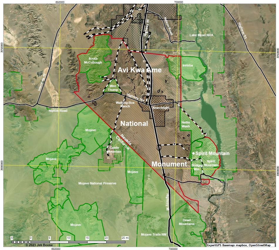
Note: Map based on aerial photograph. North is at the top. Grid is UTM NAD27 CONUS. Roads are black (solid = paved; dashed = unpaved; width implies quality). Conservation lands (various shades of green) based on NPS and BLM data.
Happy hiking! All distances, elevations, and other facts are approximate.
![]() ; Last updated 231008
; Last updated 231008
| Avi Kwa Ame | Hiking Around Las Vegas | Glossary | Copyright, Conditions, Disclaimer | Home |