birdandhike.com logo
Home | Birding | Favorites | Portal Area | Area Map
Birding South Fork of Cave Creek Map
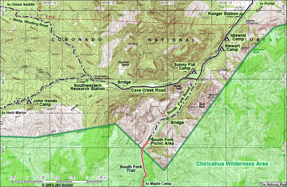
Birding Around Las Vegas, Favorite Places Far Away
South Fork of Cave Creek Map
Note: Roads are black (solid = paved; dashed = unpaved). Trails and routes are red (solid = main; dashed = adjacent or alternate). Map based on USGS 15 minute topo map. North is at the top. Grid is NAD83 Lat/Long. Wilderness Areas (boundaries solid green, fill dark green) based on BLM data. National Forest Areas (boundaries dashed brown, fill light green) based on USFS data. Download GPS data: GPX or KML.

Note: All distances, elevations, and other facts are approximate.
copyright; Last updated 130502

tags: birdwatching, birds, portal, southeastern arizona, idlewild campground, stewart campground, sunny flat campground, south fork, maple camp, cave creek, southwestern research station, jonh hands, herb martyr, chiricahua wilderness area
Portal Area Birding Birding Around Las Vegas Glossary Copyright, Conditions, Disclaimer Home
Google Ads