Birding Around Las Vegas, Urban Las Vegas Valley
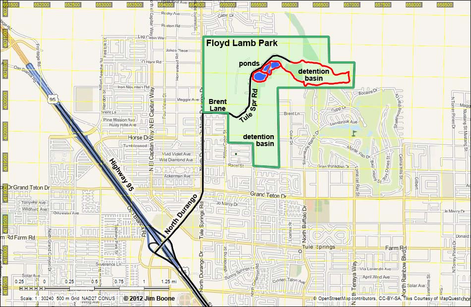
Note: Roads are black (solid = paved; dashed = unpaved). Trails and routes are red (solid = main; dashed = adjacent or alternate). Map based on OpenStreetMap. North is at the top. UTM Grid is NAD27 CONUS. Park boundary (green) based on aerial photos.
| Floyd Lamb Park | Birding Around Las Vegas | Southern Nevada Birds | Copyright, Conditions, Disclaimer | Home |