Hiking Around Las Vegas, Basin and Range National Monument
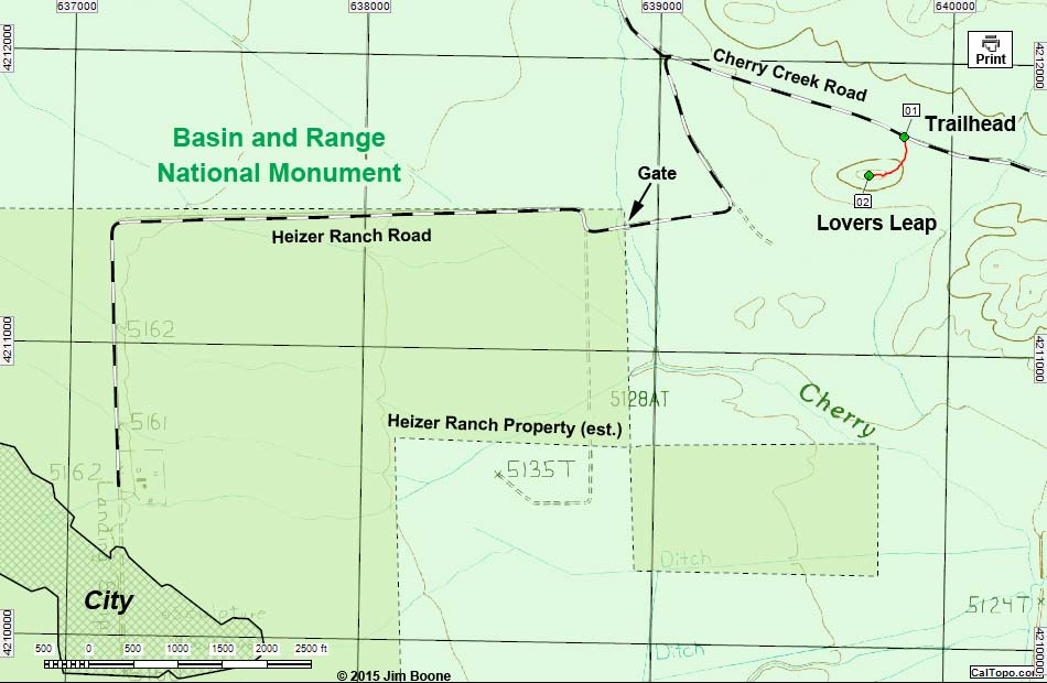
Note: Roads are black (solid = paved; dashed = unpaved). Trails and routes are red (solid = main; dashed = adjacent or alternate). Map based on USGS 7.5-minute topo map, which may have red grid lines and various numbers. North is at the top. Grid is UTM NAD27 CONUS. National Monuments (boundaries solid green, fill light green) based on BLM data. Private land (crosshatch gray) based on aerial photos. Heizer Ranch Property (boundaries dashed brown, fill dark green) estimated from Lincoln County tax records. Download waypoint coordinates from route description page.
Happy Hiking! All distances, elevations, and other facts are approximate.
![]() ; Last updated 150808
; Last updated 150808
| Lovers Leap | Hiking Around Las Vegas | Glossary | Copyright, Conditions, Disclaimer | Home |