Hiking Around Las Vegas, Death Valley National Park, Death Valley Wilderness Area
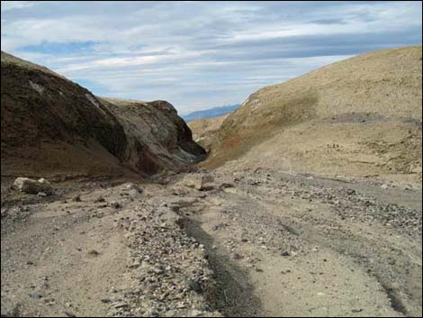
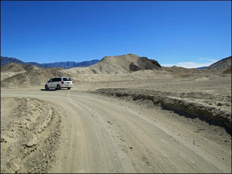 20 Mule Team Road, approaching 20 Mule Team Trailhead (view SE) |
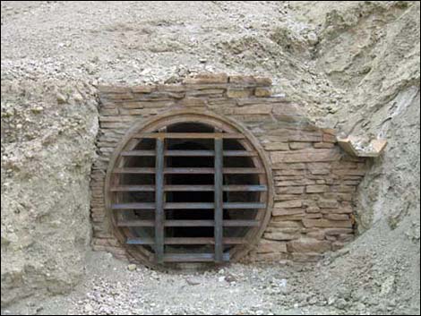
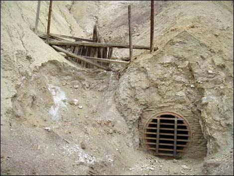
Overview Corkscrew Canyon provides a fairly easy 5-1/2 mile, round-trip hike into a geologically and historically interesting canyon. From 20 Mule Team Road, the route runs off-trail up Corkscrew Canyon Wash through an unexpected narrows and into an borax mining area where historic mine workings dot the yellow mudhill bluffs. Farther along, the route turns up Corkscrew Canyon, proper, on an old road, passes a "No Trespassing" sign (your conscience is your guide), and taking a side canyon to avoid an abandoned mine site, the canyon narrows and twists, but never gets too deep, until hikers reach a natural bridge near the top of the canyon. An abandoned mine site, in an adjacent canyon, harbors historic buildings and gated mine entrances, but this is private property. This is one of those hikes with few landmarks where following a GPS is particularly useful. Link to map. |
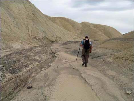
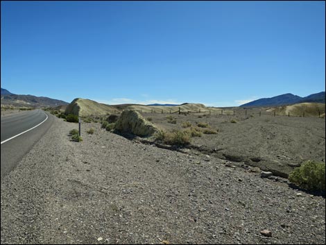
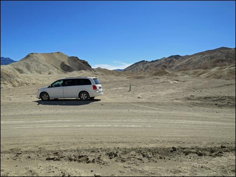 20 Mule Team Trailhead (view SE) |
Watch Out Other than the standard warnings about hiking in the desert, ... hiking in this area is fairly safe in dry weather, but the narrow canyon is subject to flash flooding. Stay away from historic buildings and mines as they were abandoned in the 1950s and could collapse at any time, plus they might be private property. Without many landmarks, a GPS is particularly useful on this hike. While hiking, please respect the land and the other people out there, and try to Leave No Trace of your passage. This hike is in a wild and remote area, so be sure to bring the 10 Essentials. Getting to the Trailhead This hike is located in Death Valley National Park, about 2-1/2 hours northwest of Las Vegas. From the Furnace Creek visitor center, drive east on Highway 190 (towards Las Vegas) for 5.9 miles to Twenty Mule Team Road, which normally is passable in passenger vehicles. |
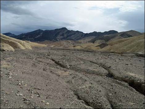
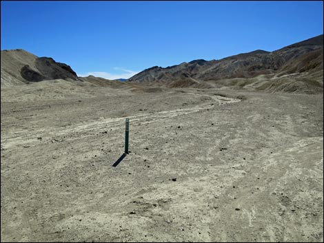 Route starts up this canyon (view SE) |
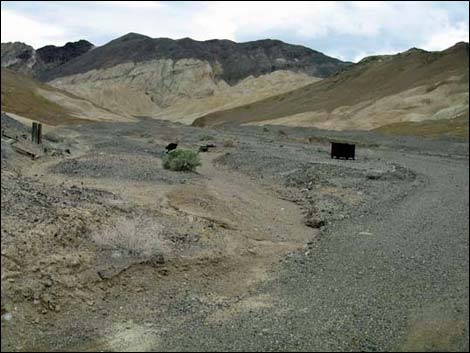
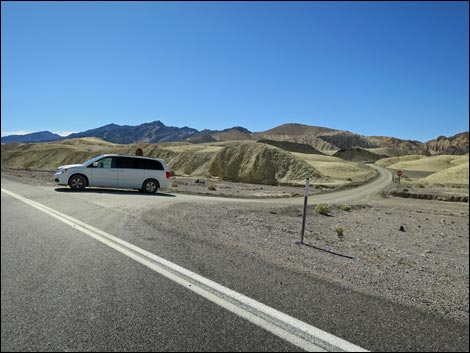
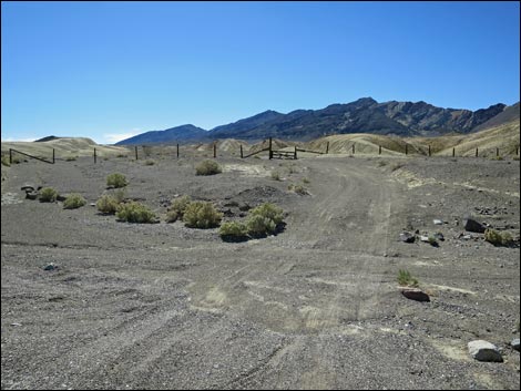
Drive up the one-way Twenty Mule Team Road for 2.1 miles. As the road descends a steep hill, stop in the wide spot at the bottom of the hill where the road turns hard to the left. Park here; this is the 20 Mule Team Trailhead (Table 1, Waypoint 01). When Twenty Mule Team Road is closed, continue along Highway 190 to the exit from Twenty Mule Team Road and walk "backwards" on the one-way road for 0.6 miles to the 20 Mule Team Trailhead (Wpt 01). See photos below. Alternatively, continue up Highway 190 for 300 yards past the exit from Twenty Mule Team Road to the mouth of a broad wash on the right. Park here; this is the Hwy 190 Wash Trailhead (Wpt 01A). See photos below. A third trailhead alternative is to drive a total of 8.7 miles from Furnace Creek visitor center to yet another broad wash on the right, this wash marked by fencing across the wash. Park here; this is the Hwy 190 Old Road Trailhead (Wpt 01B). See photos below. |
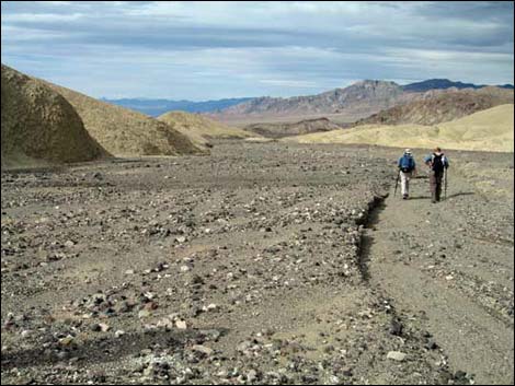
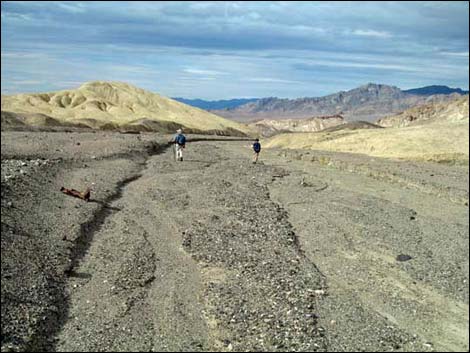
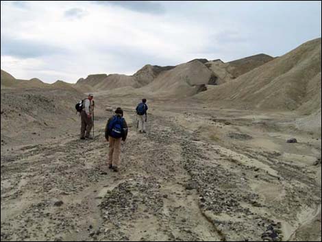 Hikers departing 20 Mule Team Trailhead (view SE) |
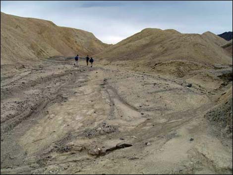
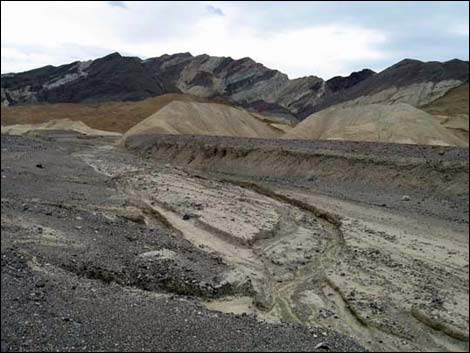
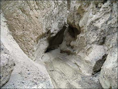
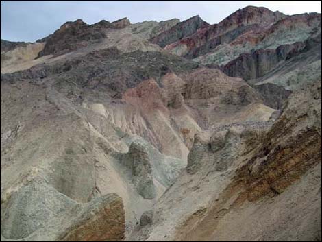
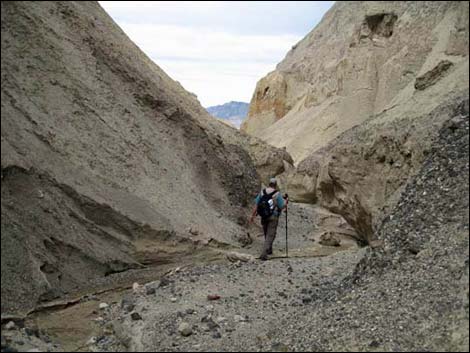
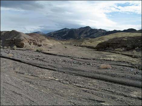
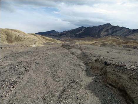
The Hike From the 20 Mule Team Trailhead (Wpt 01), the route runs southeast up the broad wash. The wash winds a bit, but it is wide and open, making for easy walking and grand, open views. The land here is eroded mud deposits in various shades of mustard with a bit more red in places that formed in the bottom of some ancient lake. The soils are unfit for most vegetation and this area is almost devoid of vegetation, with only a few scattered Desert Holly bushes (Desert-Holly Saltbush) here and there. Starting about 0.6 miles out, hikers will notice signs of historic borax mining activity in the area, including adits and stonework. By the old mine with stacked up rocks, which perhaps are abandoned low-grade ore, there is a closed vertical shaft just around the corner. Then, at about 0.8 miles out, the wash unexpectedly enters a shallow narrows area. Exiting the narrows upstream (Wpt. 02), hikers will notice that the wash and the narrows are a side-wash of the main Corkscrew Wash. Here, water flowing down Corkscrew Wash has broken through a mud-ridge dam to flow down Twenty Mule Team Canyon rather than down the natural watercourse: Corkscrew Wash. |
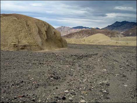
 Hiker in wash among yellow mudhills (view SE) |
When descending the route, hikers need to recall this spot (Wpt. 02) as it would be easy to walk by the slot in the ridge and just follow the main wash downstream, thereby missing the left turn towards the trailhead. Hikers who make this mistake will emerge onto Highway 190 at the Hwy 190 Wash Trailhead (Wpt. 01A). [transcript from voice recorder: this side wash would be hard to find without coordinates] Continuing up Corkscrew Wash, hikers might notice a pile of stones with numbers and letters carved into the surface (similar to those seen in other parts of the National Park). I don't understand the code, but surely this is a mining claim marker. Shortly thereafter, hikers pass another adit in an odd little black hill in the middle of the wash. Walking up the main wash, hikers will pass a hill on the right (Peak 1790) and quickly arrive at an old dirt road (Wpt. 03). This road comes from the highway at Hwy 190 Old Road Trailhead (Wpt. 01B), and from here it runs up Corkscrew Canyon to the old mine site. |
 The wash runs among yellow mudhills (view SE) |
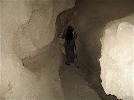
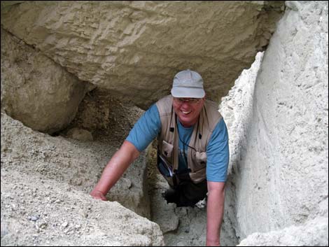
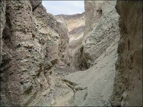
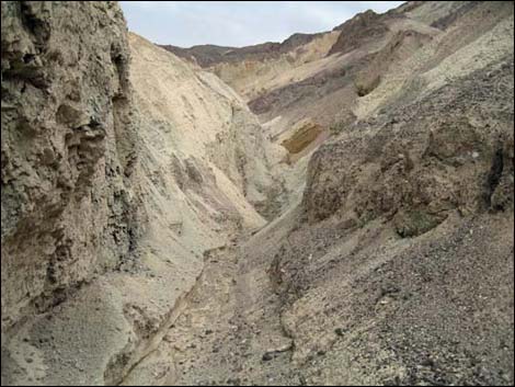
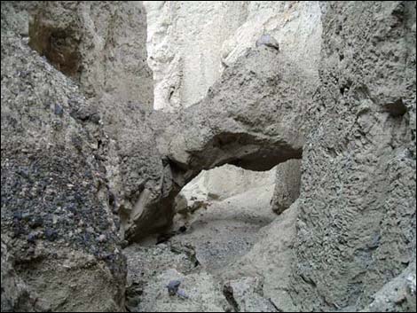
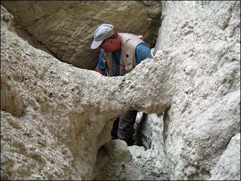
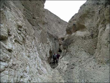
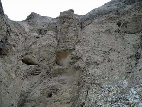
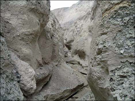
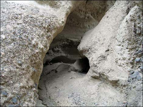
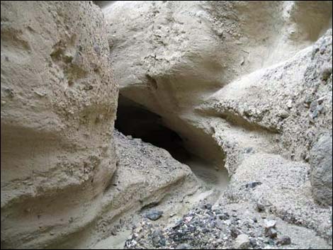
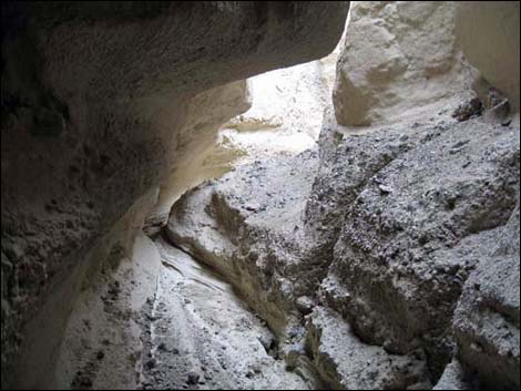
Turning right to follow the old road into Corkscrew Canyon, the wash narrows a bit. At about 1.9 miles out, the route passes a pipe gate. Historically, there have been no signs at this gate, implying that vehicles must stay out, but not pedestrians. Now, however, there is a "No Trespassing" sign on the gate. Passing the gate, the canyon continues to narrow. At 2.1 miles out, the main canyon bends right at a point where a narrow side canyon forks to the left. The entrance to the side canyon is marked with an odd pillar of stone (Wpt 05). Here, the route turns left into the side canyon to avoid entering the Corkscrew Mine area. Turning into the side canyon, hikers quickly encounter a narrow, twisting canyon with overhanging walls, boulders to wind under and around, and plenty of tight places. Even though this is a side canyon, surely this is what give the area the name Corkscrew. At about 0.5 miles up the side canyon, hikers encounter Corkscrew Natural Bridge (Wpt. 07). The bridge isn't huge, but it is a real natural bridge. Continuing beyond the bridge, the canyon continues to wind about, eventually opening a bit near the top of the canyon as it starts to climb into the Black Mountains. |
 Hikers in the wash (view SE) |
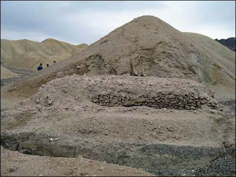 Old borax mine site (view SE) |
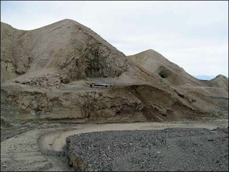 Old borax mine site above the wash (view SE) |
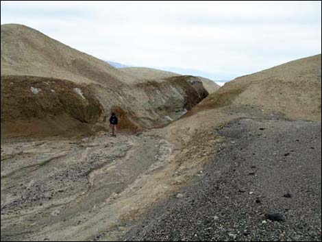 Looking back, hiker exiting the unexpected narrows (view NW) |
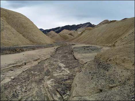
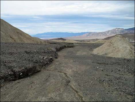
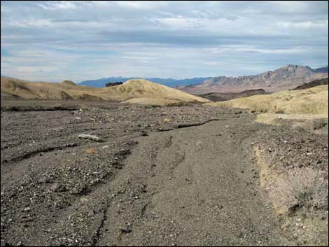
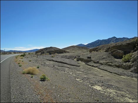
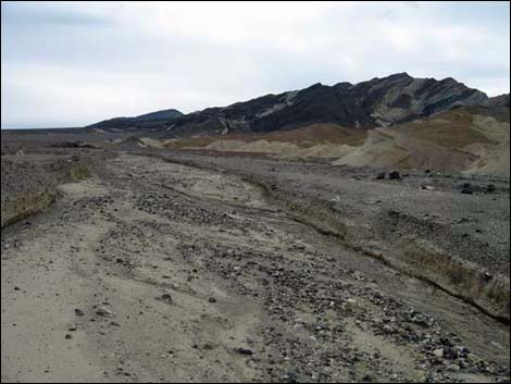 Corkscrew Wash (view SE) |
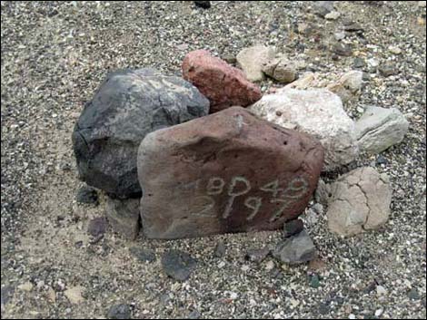 Marked stones |
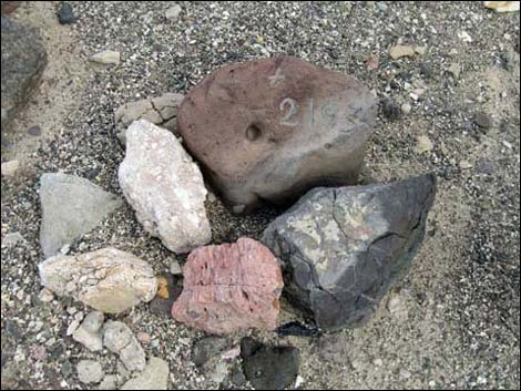 Marked stones Marked stones |
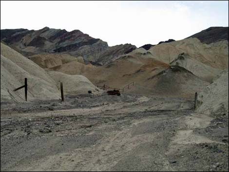
 Approaching Corkscrew Canyon (view SE) |
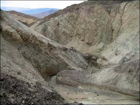
 Entrance into Corkscrew Canyon with mining debris (view S) |
 Mining debris (view E) |
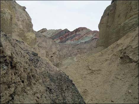
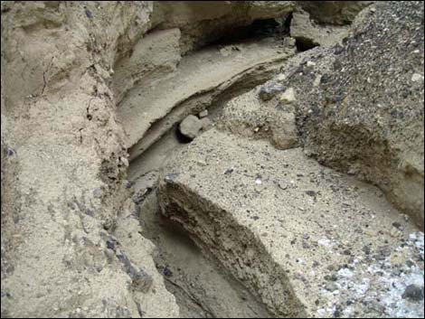
 Colorful muds and gravels in Corkscrew Canyon (view S) |
 Approaching the unsigned pipe gate (view S) |
 Approaching Corkscrew Canyon side canyon (view S) |
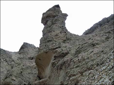
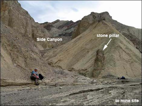 Entrance to side canyon marked with odd stone pillar (view S) |
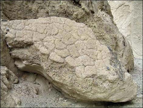 "Fossilized" mud crack from some ancient lake bed |
 Colorful rock bands above yellow mud hills (view S) |
 |
 |
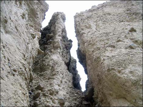
 Hiker squeezing through narrow slot |
 Hiker crawling under boulder pile |
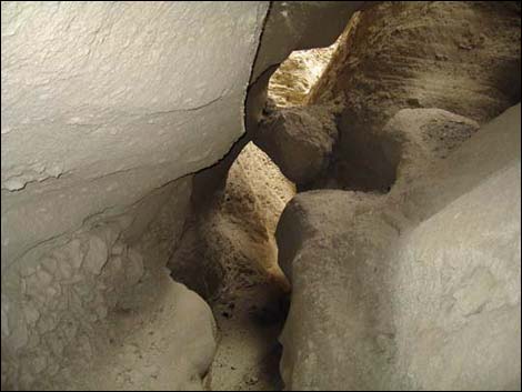
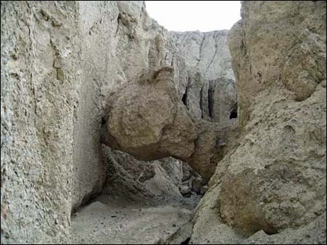 Corkscrew Natural Bridge (view S) |
 High in the side canyon (view S) |
 High in the side canyon (view S) |
 Colorful cliff in the Artist's Palate area (view S) |
Hiking back down Corkscrew Canyon
 Corkscrew Natural Bridge (view N) |
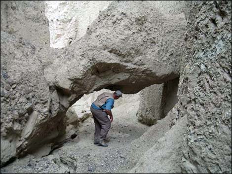 Hiker ducking under Corkscrew Natural Bridge (view S) |
 Too many natural bridges to count them all! |
 Hikers in the narrow side canyon (view N) |
 |
 |
 |
 |
 |
 |
 |
 |
 Narrow slot |
 Hiker approaching exit from side canyon (view N) |
 Approaching exit from Corkscrew Canyon (view N) |
 Passing the marked stones (view NW) |
 Don't miss the unexpected slot (view NW) |
 Alternative ending: continuing down Corkscrew Wash (view N) |
 Alternative ending: continuing down Corkscrew Wash (view N) |
 Alternative ending: continuing down Corkscrew Wash (view N) |
 Alternative ending: continuing down Corkscrew Wash (view N) |
 More to come ... |
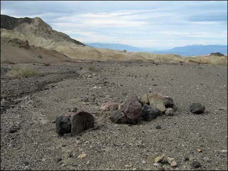
Hiking in from Hwy 190 Wash Trailhead. The mouth of the wash is guarded by low conglomerate cliffs, and mud hills can be seen beyond the cliffs. The Black Mountains (Artist's Palate area) loom in the background.
 Hwy 190, approaching Hwy 190 Wash Trailhead (view SE) |
 Hwy 190 Wash Trailhead (view SE from edge of Hwy 190) |
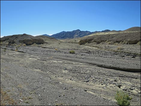
 Corkscrew Wash (view S) |
 Route runs up Corkscrew Wash (view S) |
 Route runs up Corkscrew Wash (view S) |
More to come ... |
Twenty Mule Team Road Exit Trailhead
 Consider parking here when 20 Mule Team Rd is closed (view SE) |
More to come ... |
Hwy 190 Old Road Trailhead
 Hwy 190, approaching Hwy 190 Old Road Trailhead (view SE) |
 Hwy 190, approaching Hwy 190 Old Road Trailhead (view SE) |
 Hwy 190 Old Road Trailhead (view S from Hwy 190) |
More to come ... |
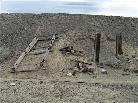
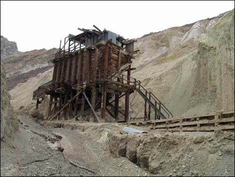
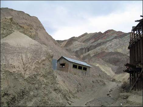
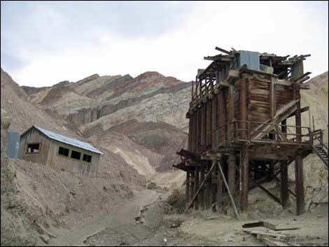
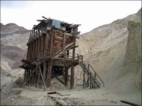
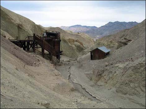
Corkscrew Mine Site I didn't know at the time, but I may have be trespassing here. Enjoy the photos, but please respect private property rights. Chain-link fencing now encloses the ore hopper.
 |
 |
 |
 |
 |
 |
 |
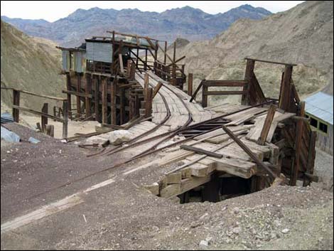 |
Table 2. Hiking Coordinates and Distances based on GPS Data (NAD27; UTM Zone 11S). Download hiking GPS waypoints (gpx) file.
| Wpt. | Location | UTM Easting | UTM Northing | Elevation (ft) | Point-to-Point Distance (mi) | Cumulative Distance (mi) | Verified |
|---|---|---|---|---|---|---|---|
| 01 | Twenty Mule Team Rd Trailhead | 520373 | 4027335 | 1,141 | 0.00 | 0.00 | GPS |
| 01A | Hwy 190 Wash Trailhead | 520950 | 4027722 | 1,202 | . | . | GPS |
| 01B | Hwy 190 Old Road Trailhead | 522031 | 4026746 | 1,385 | . | . | GPS |
| 02 | Fork in the Wash (top of narrows) | 521211 | 4026423 | 1,388 | 0.89 | 0.89 | GPS |
| 03 | Wash at Old Road | 521573 | 4025696 | 1,492 | 0.51 | 1.40 | GPS |
| 04 | Gate | 521306 | 4024971 | 1,653 | 0.50 | 1.90 | GPS |
| 05 | Entrance to Narrow Side Canyon | 521260 | 4024626 | 1,754 | 0.30 | 2.20 | GPS |
| 06 | Crawl-Under Narrows | 521323 | 4024388 | 1,909 | 0.45 | 2.65 | GPS |
| 07 | Natural Bridge | 521329 | 4024370 | 1,925 | 0.01 | 2.66 | GPS |
| 08 | Old Mill Site | 521190 | 4024477 | 1,831 | . | . | GPS |
| 01 | Twenty Mule Team Rd Trailhead | 520373 | 4027335 | 1,141 | 2.66 | 5.32 | GPS |
Happy Hiking! All distances, elevations, and other facts are approximate.
![]() ; Last updated 240324
; Last updated 240324
| Death Valley | Hiking Around Las Vegas | Glossary | Copyright, Conditions, Disclaimer | Home |