Hiking Around Las Vegas, Death Valley National Park
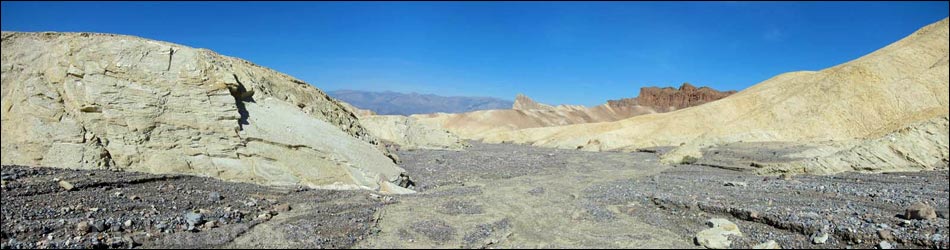
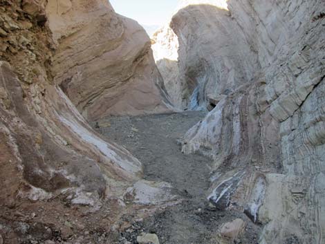
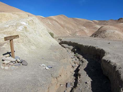
 Start of Gower Gulch Slot (view SE from Zabriskie parking lot) |
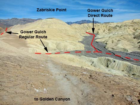
Overview The Gower Gulch Direct Route is an alternate start into the Gower Gulch area. The direct start begin at the upstream end of Gower Gulch, descends a short, but narrow slot that requires 4th-class scrambling techniques to pass a pour-over, and then continues down Gower Gulch to connect with the regular Gower Gulch route at the intersection with the trail to Golden Canyon. There is an alternate start to bypass the pour-over. Link to map. |
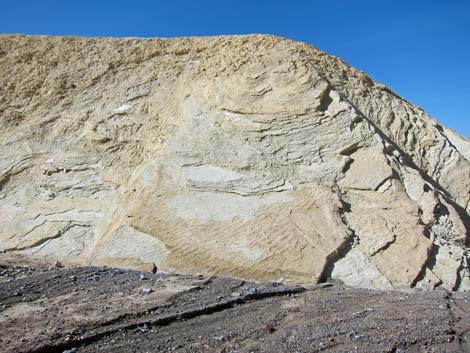
 Top end, Gower Gulch Slot (view SE from above) |
Watch Out Other than the standard warnings about hiking in the desert, ...except for the 4th-class pour-over, this hike is fairly safe, but stay out of the canyon (and off the mudhills) if it is raining or threatens to rain because of possible flash floods. The 12-ft pour-over inside the Gower Gulch Slot is a dicey downclimb because the rock is water-polished, slick, and damp, plus it is covered with dust and gravel, so there is greater than usual risk if slipping with no good handholds. While hiking, please respect the land and the other people out there, and try to Leave No Trace of your passage. Also, this leads to a fairly long hike, so be sure to bring the 10 Essentials. |
 Gower Gulch Slot (view SW from above) |
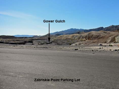
Getting to the Trailhead This hike is located along Highway 190 in Death Valley National Park, about 2-1/2 hours northwest of Las Vegas. From town, drive out to Death Valley, pay the entrance fee, and then drive to the Zabriskie Point Trailhead, depending on which end of the trail you want to start the hike. Park here; this is the trailhead. |
 Gower Gulch Slot (view SW from above) |
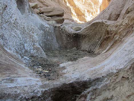
The Hike From the edge of the Zabriskie Point parking lot (Wpt. 16), the route runs southeast parallel to the highway (hard left from the paved trail to Zabriskie Point). Down in Furnace Creek Wash (Wpt. 17), water flowing down the wash is blocked by the paved parking area and is funneled west through a narrow slot into Gower Gulch. Hiking into the slot, the first few yards are immediately narrow and sinuous, but the canyon walls are low. Just ahead, the walls become tall, but the wash widens. After only a few yards, the floor of the wash falls away at a 6-ft pour-over, and then shortly ahead it again falls away at a 15- to 20-ft pour-over. This tall pour-over is potentially dangerous because of smooth, dirty stone with few and rounded hand-holds. The final pour-over is only about 3-ft high. |
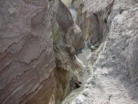
 Entering Gower Gulch slot (view W; downstream) |
Continuing downstream, the canyon walls fall back, and a side canyon comes in from the north (Wpt. 18). This side canyon can be used to access Gower Gulch without downclimbing the pour-overs. Continuing down the wash, the route runs round the south side of Zabriskie Point and bends to the northwest, arriving shortly at a major side wash entering from the north. This is where the regular Gower Gulch Trail enters Gower Gulch Wash at a junction marked with a trail sign (Wpt. 12). For hikers who want to bypass the pour-overs, an alternative route is to start up the paved Zabriskie Point Trail, but quickly turn left (Wpt. 18) and hike down the first side canyon to the left and drop into Gower Gulch (Wpt. 19), which can be seen below. |
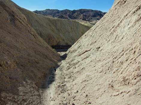
 Gower Gulch Slot (view W) |
 Gower Gulch Slot (view W) |
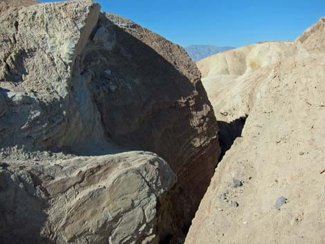
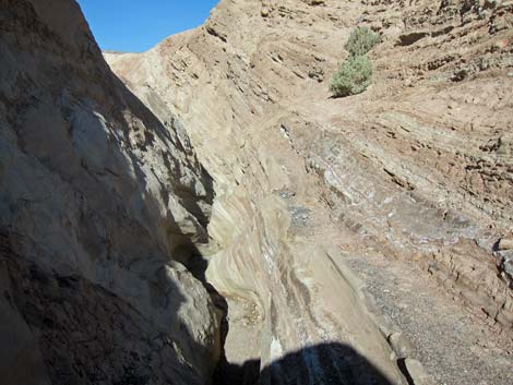
 Approaching pour-over in Gower Gulch Slot (view W) |
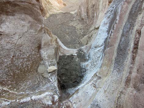 Pour-over in Gower Gulch Slot (view down) |
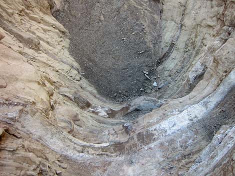 Pour-over in Gower Gulch Slot (view down) |
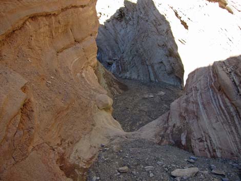
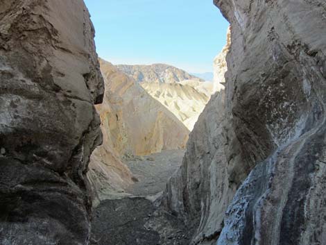 End of Gower Gulch Slot (view SW) |
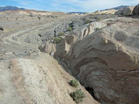
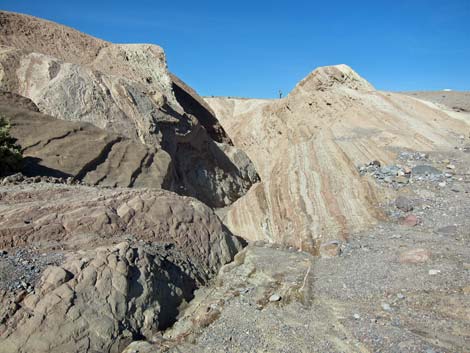
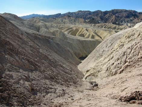
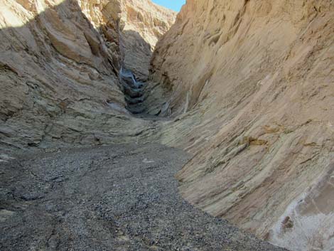
 Gower Gulch Canyon (view SW) |
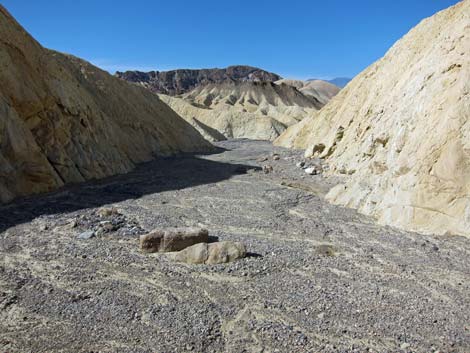 Gower Gulch Canyon (view SW) |
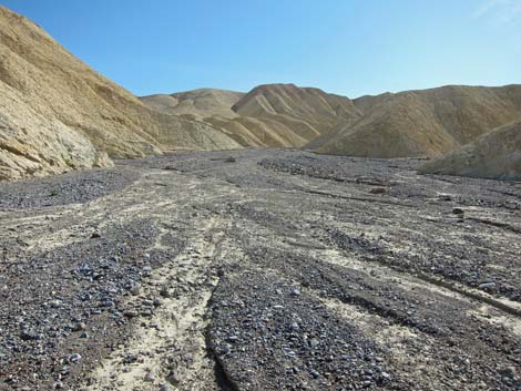
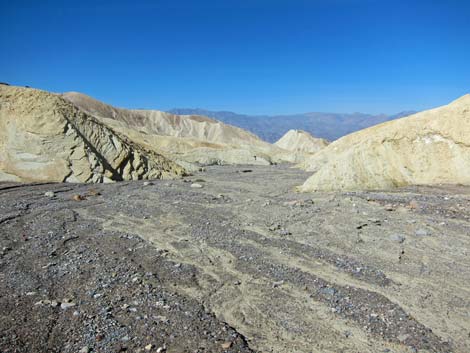 Gower Gulch Wash (view NW) |
 Ripple marks in stone along Gower Gulch Wash (view W) |
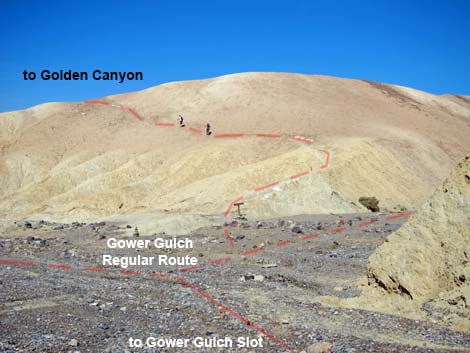 Approaching Gower Gulch Regular Route (view NW) |
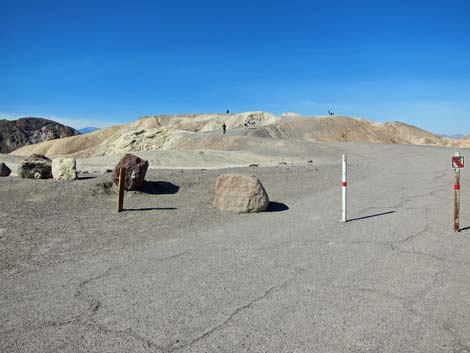
 Sign at trail junction (view N up Regular GG Route) |
Alternate Start. This route starts from the paved Zabriskie Point Trail
 Start of alternate route: paved Zabriskie Point Trail |
 Side Canyon (view S from near pavement) |
 Descending the side canyon (view S) |
 Approaching Gower Gulch (view S) |
Hiking Upstream in Gower Gulch into the Gower Gulch Slot
 Overlook of Gower Gulch trail junction (view SE) |
Trail junction sign (view N; not the route!) |
 Gower Gulch (view SE) |
 Approaching Gower Gulch slot (view NE) |
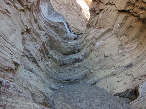 12-ft pour-over (view NE) |
 Peering over the final step atop the pour-over (view NE) |
Table 1. Hiking Coordinates Based on GPS Data (NAD27, UTM Zone 11S). Download Hiking GPS Waypoints (*.gpx) file.
| Wpt. | Location | UTM Easting | UTM Northing | Elevation (ft) | Point-to-Point Distance (mi) | Cumulative Distance (mi) | Verified |
|---|---|---|---|---|---|---|---|
| 16 | Edge of Pavement | 517128 | 4030424 | 652.90 | 0.00 | 0.00 | GPS |
| 17 | Top of Gower Gulch Slot | 517166 | 4030375 | 649.30 | 0.06 | 0.06 | GPS |
| 18 | Bottom of Gower Gulch Slot | 517049 | 4030331 | 568.10 | 0.09 | 0.15 | GPS |
| 19 | Zabriskie Point Trail | 517019 | 4030424 | 647.80 | 0.00 | . | GPS |
| 12 | Gower Gulch Wash, Edge | 516600 | 4030309 | 501.90 | 0.33 | 0.48 | GPS |
Happy Hiking! All distances, elevations, and other facts are approximate.
![]() ; Last updated 240324
; Last updated 240324
| Death Valley | Hiking Around Las Vegas | Glossary | Copyright, Conditions, Disclaimer | Home |