Hiking Around Las Vegas, Death Valley National Park
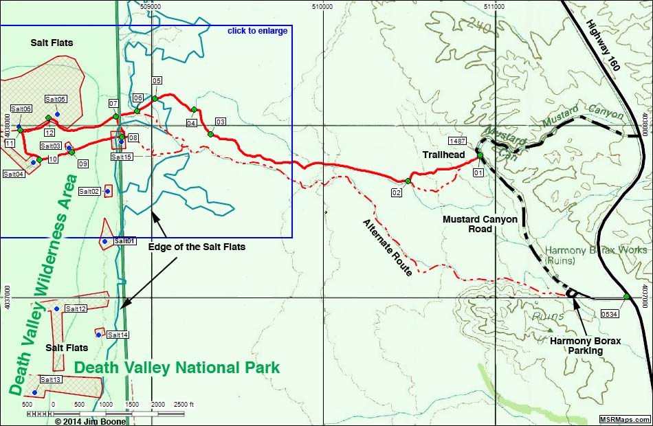
Note: Roads are black (solid = paved; dashed = unpaved). Trails and routes are red (solid = main; dashed = adjacent or alternate). Map based on USGS 7.5-minute topo map, which may have red grid lines and various numbers. North is at the top. Grid is UTM NAD27 CONUS. Wilderness Areas (boundaries solid green, fill light green) based on NPS data. National Park Areas (boundaries dashed green, fill light green) based on NPS data. Blue dots mark major historic salt works. Crosshatch (red) indicate approximate boundaries of salt works areas (based on aerial photos) that hikers probably should stay out of, especially when the salt is wet.
Happy Hiking! All distances, elevations, and other facts are approximate.
![]() ; Last updated 140111
; Last updated 140111
| Harmony Salt Flats | Hiking Around Death Valley | Glossary | Copyright, Conditions, Disclaimer | Home |