Hiking Around Las Vegas, Death Valley National Park, Death Valley Wilderness Area
 |
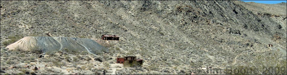
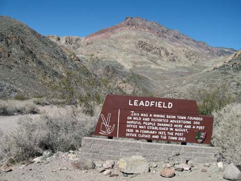
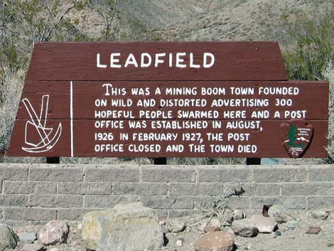
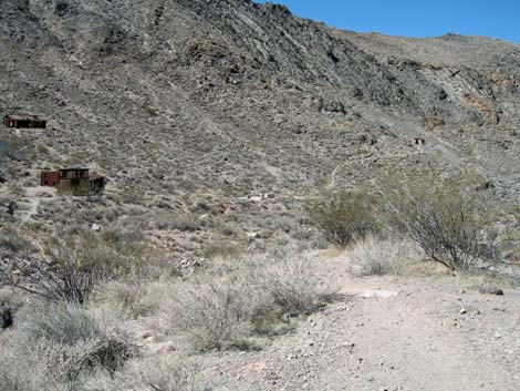
Overview Leadfield was a lead and copper mining town located in Titus Canyon, Death Valley National Park, California. The town boomed with some 1700 lots and 300 residents in early 1926, but the lead quickly played out, and the town died in 1927. Scattered mines, dumps, tunnels, and prospect holes remain, as do the remains of wood and tin buildings, a dugout, and the cement foundations of the mill. The ghost town is located along the 27-mile, one-way only, Titus Canyon Road. Link to Google Map. |
 |
Watch Out Other than the standard warnings about hiking in the desert, ... this area is fairly safe, including the buildings. However, although holes in the ground are always interesting, they are never safe to enter. Titus Canyon Road is long and rough, and it requires, at the least, a high clearance vehicle. |
 |
Getting to the Trailhead Leadfield is located in Death Valley National Park, about 3.5 hours northwest of Las Vegas. Don't even think about driving this 27-mile, one-way dirt road in a sedan. From Las Vegas, drive out to Death Valley. From the Furnace Creek Visitor Center (Table 1, Site 0712), drive north on Highway 190 to Beatty Cutoff (Site 0742). Turn right and follow signs towards Beatty. Stay to the right at Hell's Gate (Site 0769) and drive east and out of the National Park. From the boundary, drive east 2.7 miles to Titus Canyon Road (Site 1064). |
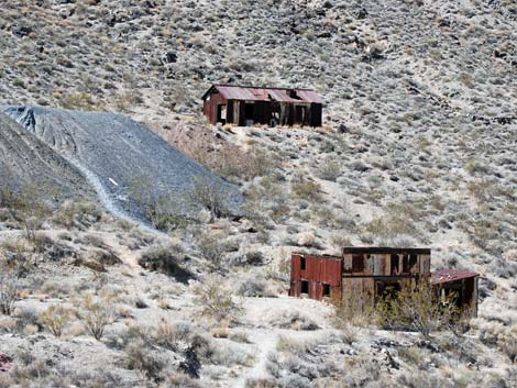
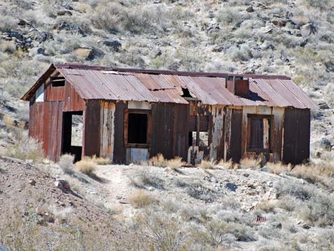 Tin building in Leadfield |
From the pavement, turn left (north) onto Titus Canyon Road, which runs west and re-enters the park about 1.9 miles out. The road winds over the Grapevine Mountains, then drops into Titus Canyon. At about 15.3 miles out, the road reaches Leadfield (Site 1065). Parking and a sign are on the right, and trails into the old town site are on the left. A free information handout describing highlights of the trip can be picked up at the Furnace Creek Visitor Center. |
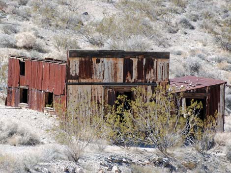 Tin building (store) in Leadfield |
Miners began filing claims for lead and copper deposits in the Leadfield area in 1905, but major mining efforts didn't begin until 1926. In February 1926, Charles C. Julian, a flamboyant California promoter, became president of the town's leading mining company, the Western Lead Mines. In April 1926, the town was laid out with 1,749 lots, and Julian's promotions brought in a total of about 300 people. The financial downfall of Charles Julian and the playing out of lead in one of the main mines, led the town to disband in August 1926. The area is scattered with mines, dumps, tunnels and prospect holes, and there are remains of wood and tin buildings, a dugout and cement foundations of the mill. |
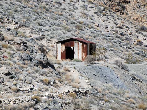 Mine building |
After visiting Leadfield, continue down the canyon (the road is one-way only). At 17.9 miles out, the road passes Klare Spring (Site 1066). Stop to see the verdant vegetation and petroglyphs. At about 23.8 miles out, the road emerges from tight narrows and spills out onto the desert bajada. The parking area beyond the gate (Site 0760), which has a restroom, marks the end of the one-way road. Beyond the parking area, the road is rough and narrow, but a two-way road. At 26.4 miles out, the Titus Canyon Road ends at the paved Scotty's Castle Road (Site 0761). |
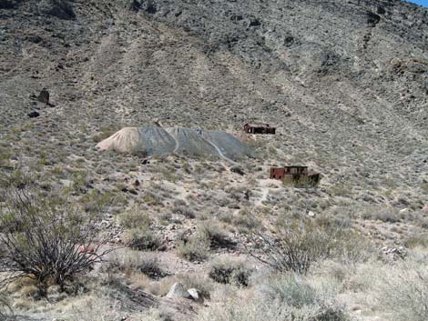 Spoils pile and tin buildings in Leadfield |
 Old trail to mine and building in Leadfield |
Table 1. Highway Coordinates Based on GPS Data (NAD27; UTM Zone 11S). Download Highway GPS Waypoints (*.gpx) file.
| Site # | Location | Latitude (N) | Longitude (W) | Easting | Northing | Elevation (ft) | Verified |
| 0712 | Furnace Creek Visitor Center | 36.46159 | 116.86574 | 512030 | 4034954 | -186 | Yes |
| 0742 | Hwy 190 at Beatty Cutoff | 36.58805 | 116.94240 | 505153 | 4048974 | -190 | Yes-2 |
| 0760 | Titus Canyon Lower Parking | 36.82199 | 117.17321 | 484552 | 4074937 | 917 | Yes |
| 0761 | Scotty's Castle Rd at Titus Canyon Rd | 36.78771 | 117.19063 | 482991 | 4071137 | 169 | Yes-2 |
| 0769 | Daylight Pass Rd at Beatty Cutoff (Hell's Gate) | 36.72392 | 116.97718 | 502038 | 4064044 | 2,289 | Yes |
| 1064 | Hwy 374 at Tutus Canyon Rd | 36.85918 | 116.84512 | 513806 | 4079060 | 3,405 | GPS |
| 1065 | Titus Canyon Rd at Leadfield | 36.84842 | 117.05852 | 494782 | 4077856 | 3,993 | GPS |
| 1066 | Titus Rd at Klare Spring | 36.84098 | 117.09005 | 491971 | 4077033 | 3,094 | GPS |
Happy Hiking! All distances, elevations, and other facts are approximate.
![]() ; Last updated 240324
; Last updated 240324
| Death Valley | Hiking Around Las Vegas | Glossary | Copyright, Conditions, Disclaimer | Home |