Hiking Around Las Vegas, Death Valley National Park
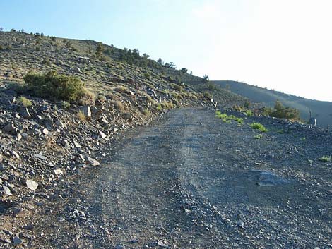
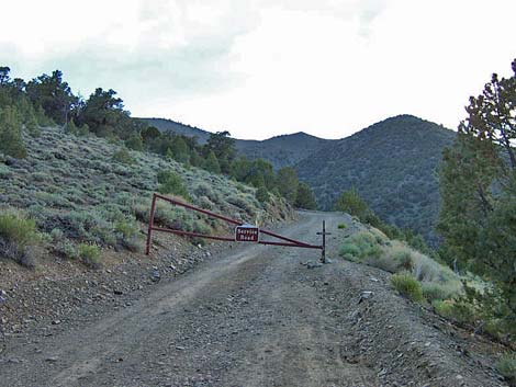 Gate on Rogers Peak Road (view west) |
Overview This fairly strenuous, 2.75-mile hike starts at Mahogany Flat Campground and runs up the Rogers Peak Road, a steep service road (12% grade) for the communications equipment atop the mountain. The road zigzags up the north sides of the peak to near the top, then cuts along the west side, and finally sweeps back around to the summit. This windswept route offers superb views into Death Valley and Panamint Valley while climbing the peak, then amazing 360-degree views from the summit. Returning on the Telescope Peak Trail would make a nice loop for the return trip. This route runs up a cherry stem into the Death Valley Wilderness Area. The service road and summit buildings are outside the wilderness area, but if hikers step off the road, they will be in the Wilderness Area. Link to map or elevation profile. |
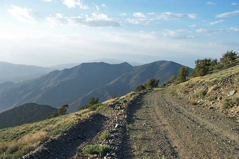
 Death Valley (view northeast from along the road) |
Watch Out Other than the standard warnings about hiking in the desert, ...this is a steep, but pretty safe road when it is clear of snow. Stay off the ridges and the summit if lightning threatens. Snow accumulates on the ridges, so winter ascents might require ice axes and crampons. Beware of altitude sickness, as the peak is some 10,000 feet higher than the surrounding desert valleys. There is no water at the campground, trailhead, or on the trail. Get water at Wildrose Campground. While hiking, please respect the land and the other people out there, and try to Leave No Trace of your passage. Also, this is a fairly easy hike, so just bring what you need of the 10 Essentials. |
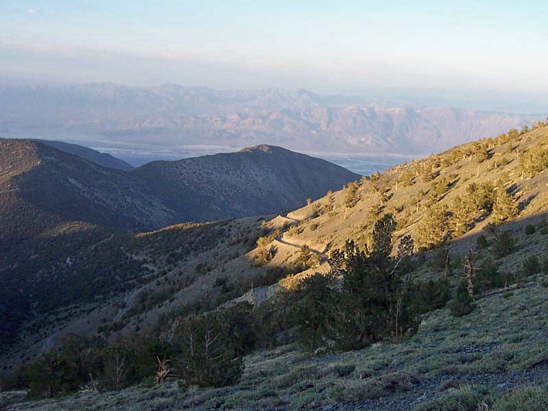 Death Valley (view northeast) |
Getting to the Trailhead This hike is located in Death Valley National Park, about 4 hours northwest of Las Vegas. From town, drive out to Death Valley, then continue on westbound Highway 190, past Stovepipe Wells to Emigrant Canyon Road. Turn left onto Emigrant Canyon Road and drive up into the mountains, eventually arriving at the Telescope Peak Trailhead. Park here; this is the trailhead. The last 0.7 miles to Mahogany Flat Campground might require a 4WD vehicle or a hike. |
 |
The Hike From the trailhead parking area (Table 2, Waypoint 1), the route runs west and up the dirt road, passing a gate just beyond the Telescope Peak trailhead. The first 0.11 miles (Wpt. 2) seemed extra steep to me, but after that, the grade settles in at a fairly constant 12% grade (which is to say, pretty steep). Almost immediately, the road leaves the trees and offers great views to the north where you can see the Charcoal Kilns in the bottom of the canyon and Wildrose Peak in the distance. The beginning of the road is the steepest part, and although it stays steep, it seems to get progressively less steep the higher you get. |
 Wildrose Peak (view north) |
Continuing on, the trail angles up across the sagebrush-covered slope for 0.82 miles to a switchback at the edge of a wash (Wpt. 3). From there it runs up and east for 0.44 miles to a second switchback (Wpt. 4) on the ridge above the campground. You can see down to the campground and off into Death Valley. The road then turns back west and runs for 0.86 miles to the crest of the northwest ridge (Wpt. 5). From there, with great views down into Panamint Valley and Wildrose Campground, the road turns south and runs for 0.34 miles to the crest of the southwest ridge (Wpt. 6) where you can look down on Arcane Meadow and south to Telescope Peak. The grade then eases up and you have a gentle stroll for the final 0.2 miles to the summit (Wpt. 7). |
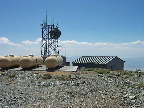 Communication facilities on the summit |
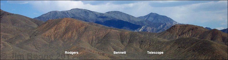
On the summit, there are buildings, communications towers, solar panels, and propane tanks, so it isn't a true wilderness experience, but the views a grand. You can see down into Death Valley (Furnace Creek and Badwater), east into Nevada, south to Bennett and Telescope peaks, west to Panamint Valley and the Sierra Mountains, and north to Wildrose Peak and the vastness of the desert beyond. Along the route, watch for Panamint Chipmunks, Sagebrush Lizards, Rock Wrens, Clark's Nutcrackers, and Red Crossbills. Return to the trailhead by following the dirt road back down, or make a loop by hiking south to the Telescope Peak trail at Arcane Meadow, and following the trail back down. For more summit views, see the Rogers Peak Trail description. |
Table 2. Hiking Coordinates Based on GPS Data (NAD27, UTM Zone 11S). Download Hiking GPS Waypoints (*.gpx) file.
| Wpt. | Location | Easting | Northing | Elevation (ft) | Point-to-Point Distance | Cumulative Distance | Verified |
|---|---|---|---|---|---|---|---|
| 01 | Mahogany Flat Trailhead | 493943 | 4009255 | 8,133 | 0.00 | 0.00 | GPS |
| 02 | Top of the steep part | 493819 | 4009100 | 8,171 | 0.11 | 0.11 | GPS |
| 03 | Switchback at the edge of wash | 492880 | 4008464 | 8,801 | 0.70 | 0.81 | GPS |
| 04 | Second switchback | 493537 | 4008416 | 8,907 | 0.44 | 1.25 | GPS |
| 05 | Gully | 492675 | 4008113 | 9,376 | . | . | GPS |
| 06 | Crest of northwest ridge | 492338 | 4008286 | 9,584 | 0.86 | 2.11 | GPS |
| 07 | Crest of southwest ridge | 492209 | 4007794 | 9,836 | 0.34 | 2.45 | GPS |
| 08 | Rogers summit | 492398 | 4007923 | 9,945 | 0.20 | 2.65 | GPS |
Happy Hiking! All distances, elevations, and other facts are approximate.
![]() ; Last updated 240324
; Last updated 240324
| Death Valley | Hiking Around Las Vegas | Glossary | Copyright, Conditions, Disclaimer | Home |