Hiking Around Las Vegas, Grand Canyon National Park
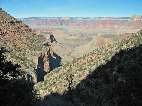
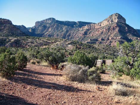
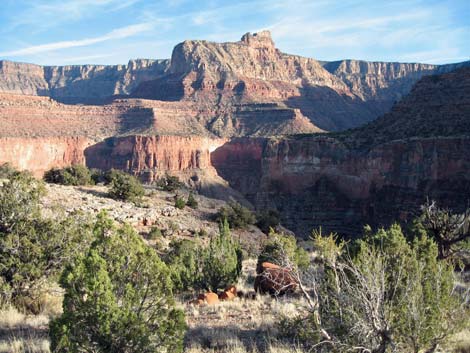
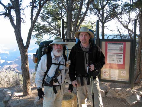 Grandview Trailhead (view NE) |
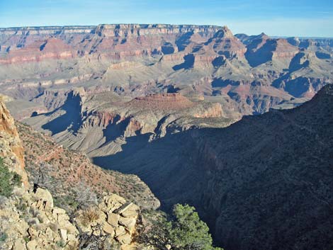
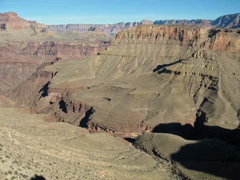
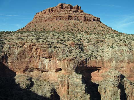
Overview This 3-mile trail starts at Grandview Overlook (7,400) and runs down to copper mines and a camping area on the top of Horseshoe Mesa (4,900 ft; atop the Redwall Limestone). The trail is quite exposed in places, especially near the top, and those with a fear of heights might want to hike elsewhere. Much of the trail is steep, and long sections are rocky. This isn't the easiest trail into the canyon, but the views from the upper portions are spectacular, and the views from down in the canyon quickly give perspective to the immensity of the place. Trails from the mining district run out to the Cave of the Domes and run down into Hance Canyon, the Tonto Trail, and Cottonwood Canyon. |
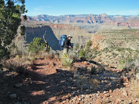
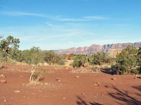
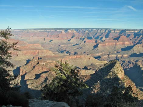 Grandview Trailhead (view N) |
Horseshoe Mesa has backpacker campsites and outhouses, but no water. Water is available from springs on both sides of the mesa below the Redwall. Page Spring (Miner Spring) is an hour or so from Horseshoe Mesa campsites via the steep, extremely exposed Page Spring Trail down the east side, and Cottonwood Spring is about 45 minutes below Horseshoe Mesa via the steep, exposed Cottonwood Canyon Trail down the west side. Page Spring is considered easier to get to, but neither is a good source of water for campers on the mesa. Link to trail map or map of Horseshoe Mesa. |
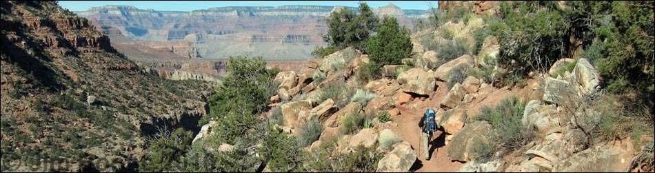
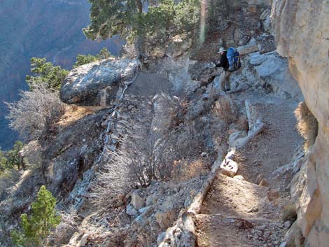
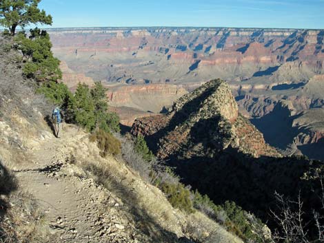
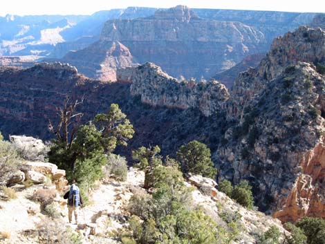
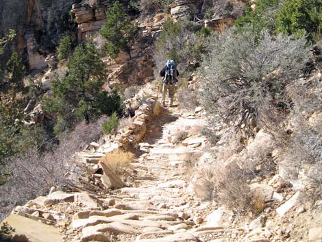
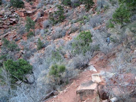
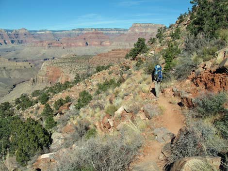
 Starting down the trail (view NW from just below the overlook) |
Watch Out Other than the standard warnings about hiking in the desert, ...this trail runs along steep hillsides with precipitous drop-offs, and while not a dangerous trail when dry, falls from many places would be fatal. This trail would be treacherous during winter if snow or ice were present. While hiking, please respect the land and the other people out there, and try to Leave No Trace of your passage. Also, this is a long hike, so be sure to bring the 10 Essentials. |
 Steep, narrow trail through the limestone (view E) |
Getting to the Trailhead This hike is located on the South Rim of the Grand Canyon, about 5 hours southeast of Las Vegas. From Las Vegas, drive out to the South Rim of Grand Canyon National Park. From the South Rim Visitor Center (Table 1, Site 811), drive east on South Entrance Road (Hwy 180) to Highway 64 (Site 951), the road to Desert View. Turn left towards Desert View and drive east for about 12 miles to the Grandview Point turnoff (Site 952). Turn left onto the Grandview Point access road and drive north to the parking area at the end of the road (Site 953). Park here; this is the trailhead. If you plan to hike out another trail, consider parking near the exit trailhead and taking the taxi to Grandview. |
 Steep, narrow switchbacks through the limestone (view W) |
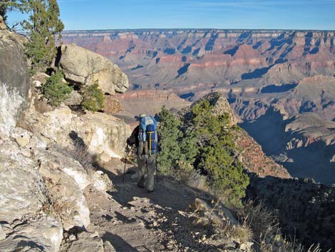
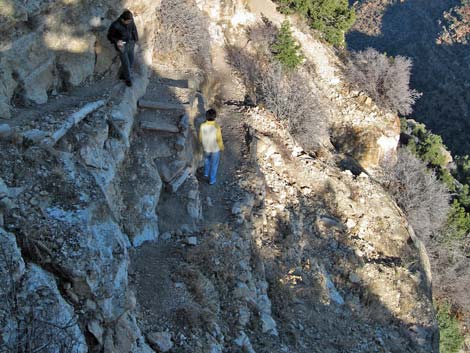
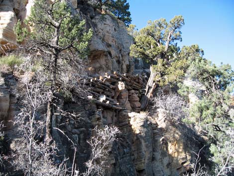
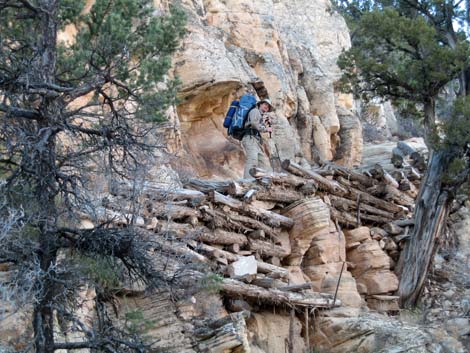
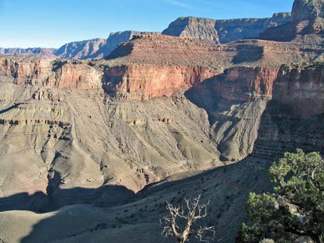
The Hike From the trailhead (Table 2, Waypoint 1), which is located on the northeast edge of the scenic overlook and is marked with a large trailhead sign, the trail cuts down and under the viewpoint. The trail runs over the edge of the rim and begins switchbacking quickly and steeply through the Kaibab Limestone and Toroweap Formation as it descends an amazing north-facing cliff. The trail is narrow, and the cliffs are precipitous through here, but the scenery is spectacular. Some parts of the trail are on cliffs that are so steep that a trail had to be built up using logs and log stairs to span the gaps between ledges. Looking down, you can look out over the top of Horseshoe Mesa and see down into the bottom of Cottonwood Canyon. This historic trail was built by copper miners in the 1890s to access the mines on Horseshoe Mesa. The historic nature shows: OSHA would not have approved, and the Park Service would never construct a new trail like this today. The Park Service does, however, maintain the trail, but they do it as an historic route staying as close to the original construction as possible (which means a narrow, precipitous trail without handrails or any other safety features). Many places along the upper trail are too narrow for two people to pass safely. |
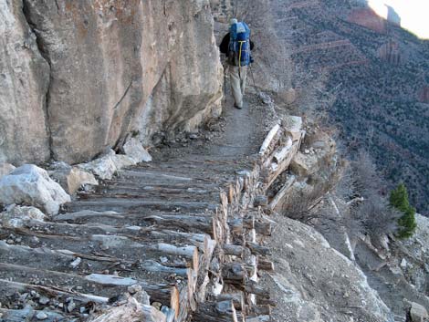 Trail built of logs on limestone cliffs (view W) |
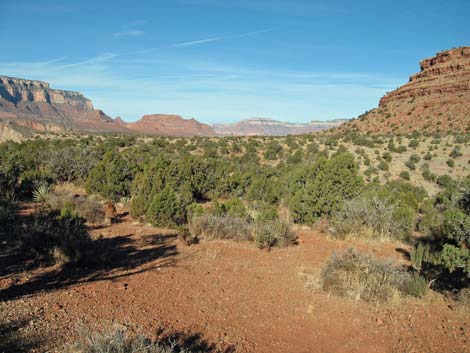
This part of the trail runs through the Upper Sonoran (Pinyon-Juniper Woodland) life zone where Two-needle Pinyon Pine and Utah Juniper dominate the vegetation community. In addition, there is a nice stand of Douglas Fir. This species is unusual this far south, but seems to survive on the cool, north-facing slopes near the rim. The understory is mostly open, but includes Gambel Oak, Serviceberry, Mormon Tea, Banana Yucca, Fremont's Mahonia, Bunchgrasses, and a very spiny rosebush of some sort. There are a few fossils along the trail too. At the base of the Toroweap Formation, the trail runs across some amazing log stairs just before reaching a gap at the top of the Coconino sandstone (Wpt. 2). Here, the trail turns and runs north along the west side of a ridge, a section you can see from far above. This bit of trail is nearly level and runs below a narrow band of cliffs at the top of the Coconino. Along here, Creeping Barberry, Mountain Mahogany, bunchgrasses, and Old-man Pricklypear adorn the trail. |
 Very steep and narrow trail (view down) |
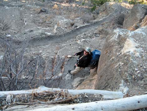
After running level for several minutes, the trail rounds a corner on a point with grand views out across the canyon (Wpt. 3). For a short dayhike, the flat rocks off the point make a great place for a picnic lunch and photos. From the corner, the trail turns and runs east for a few minutes before starting down a steep, rocky gully into the Coconino. For people who get stuck on the trail in the dark, there is a marginal (illegal) campsite (Wpt 4) a few minutes down the gully, and just below there, there is another grand, but airy viewpoint on the edge of the cliffs. Below the viewpoint, the cobblestone trail switchbacks steeply down a gully through the Coconino. In places, the trail is built up using pipes and drill bits to hold the cobblestones in place. The trail gets to a gap in the ridge at the bottom of the Coconino (Wpt. 5) where you can look east and down into the Hance Creek drainage, which runs along the east side of Horseshoe Mesa. There is another poor (illegal) campsite here, but it would suffice for hikers caught out in the dark. |
 Easier trail (view NW) |
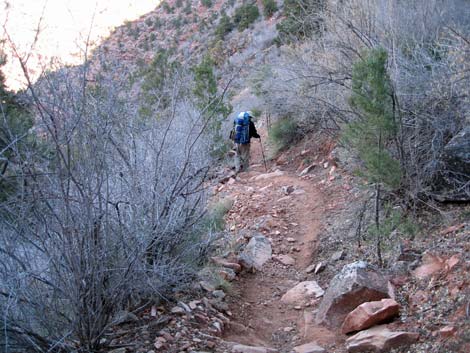
From the gap in the ridge (Wpt. 5), the trail drops steeply into the top of the Supai Formation and runs out to a corner with an outcrop of sandstone where the USGS placed a benchmark in 1904 at an elevation of 6,190 feet. After that, a bit of nearly level trail runs across the top of a steep, forested slope to out near a rockslide. The trail then begins switchbacking steeply down the forested slope through the upper Supai. The trail is steep cobblestones with plenty of loose sand and gravel, making for difficult footing much of the way. At least the trail is shady with many Two-needle Pinyon Pine, Ash trees with round sumaras, and a few Utah Juniper. Skunkbush, Mormon Tea, and bunchgrasses are also common on the slope. Below the forested slope, the trail begins to traverse and descend the middle Supai. Through most of the middle Supai, the trail is not as steep as higher up, but there is one steep section where the trail drops down the rocky side of gully. Much of the trail through the middle Supai is on a dirt tread with rocks, rather than a rock trail with rocks as was the case higher up. |
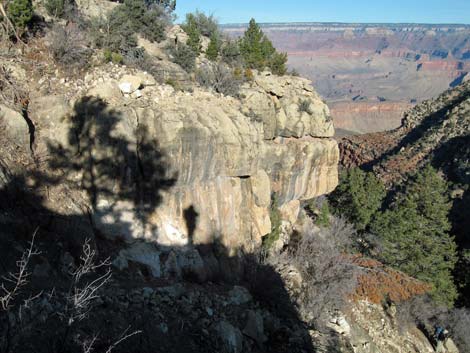 Shadow of a hiker on stone wall (view NW) |
The trail eventually runs out into the lower Supai where the trail remains moderate, but with more rocks and washouts to work across and around, and the going is hard with a full pack and water. The vegetation remains dominated by Two-needle Pinyon Pine with a few Utah Juniper, but more desert-like species begin to appear. Cliffrose becomes common, as does a Ceanothus-looking shrub and perhaps Ashy Silktassel. The trail eventually passes the end of the Supai cliffs and starts across more gentle terrain as it approaches Horseshoe Mesa. The trail runs out onto to a little ridge overlooking Cottonwood Canyon (Wpt. 7), then wraps around the toe of the ridge to the east and passes the first of the mine shafts (actually a shallow adit) (Wpt. 8); other mining activity can be seen just below the trail. The trail continues down and eastward across the toe of the ridge for a minute or two to an unmarked trail junction (Wpt. 9) at the edge of the cliffs on the southeast edge of Horseshoe Mesa. The Grandview Trail turns to the left (north), while the Page Spring Trail turns right (south) and starts down towards Page Spring and Hance Canyon. |
 Looking back up at trail built of logs through the cliffs (view W) |
Running north, the trail passes below some mine tailings and arrives at a sign with an arrow pointing towards Page Spring (Wpt. 10). This apparently is the old trail junction and is not a good way to go; perhaps the trail crew will move the sign back up the trail. Continuing north, the trail descends towards the flats of Horseshoe Mesa. At the bottom of the slope, the Cottonwood Creek Trail (Wpt 11) forks off to the left and runs west down a ravine. The junction is marked with a sign. A few yards beyond the trail junction, the trail arrives at the ruins of an old stone building (Wpt 12). This building served as the cookhouse for the copper mining operation, but all that remains are the walls, chimney, an old cooking pot, some stove pipes, and a few bits of junk. Please help protect this historical structure by not damaging or removing the things that remain. The old cookhouse marks the end of the Grandview Trail. The old stone building also marks the start of the trail to the small-group campsites, which are to the east of the stone building. The trail junction is marked only by a sign marked “Toilets” and an arrow pointing east. |
 Looking down to the trail ahead (view NE) |
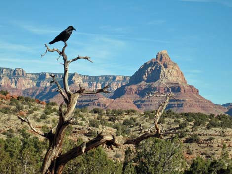
The three, official-small-group campsites are located about 2 minutes out the “Toilet” trail. Two sites sit along the north side of the trail, and a third (Wpt. 13) sits off the end of the trail. The outhouse (Wpt. 14) is located south of the trail between the second and third campsites. There are nice, but unofficial and illegal, campsites scattered all over the area; but in the spirit of Leave No Trace, we should all try to use the official campsites. The campsites seem to be infested with well-trained and well-fed Cactus Mice, a type of deer mouse). The little buggers are aggressive and persistent, but they don't seem to know how to climb trees to get into packs. Campers are advised to hang food and packs in the Utah Juniper trees at the campsites. Common Ravens were also about, but they seemed to be scavenging for food rather than tearing up packs. The official large-group campsite is located several minutes beyond the stone building. Continuing north on the main trail past the stone building, the trail junction to the large-group campsites (Wpt. 15) is unmarked, but forks off to the right and bends to the east under the hill that sits atop Horseshoe Mesa. |
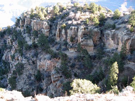
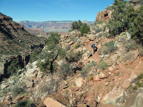
 Trail runs down an airy ridge (view NE) |
A couple of minutes out, the campsite is a large, cleared area with some nice rocks for a kitchen (Wpt. 16). The large-group outhouses are located about 4 minutes farther to the east (Wpt. 17), out near the edge of the mesa. Two minutes beyond the outhouses, there is an unofficial (illegal) large-group campsite. As was the case at the top of the trail, the top of Horseshoe Mesa is also in the Upper Sonoran (Pinyon-Juniper Woodland) life zone, but here the vegetation community is much more desert-like. The vegetation is dominated by a low-growing and sparse forest of Utah Juniper. In addition, there are a few Two-needle Pinyon Pines, a few species of shrubs (e.g., Nevada Jointfir, Mormon Tea, Cliffrose), several species of cactus (e.g., Old-man Pricklypear, Engelmann's Pricklypear, Cottontop Cactus, and Strawberry Hedgehog Cactus), some Stipa-type bunchgrasses, and Utah Agave. There is also a short-stemmed yucca that looks like Banana Yucca, but it seems to have small fruits. Return to the trailhead by retracing your footprints back to Grandview Overlook. |
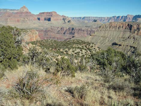
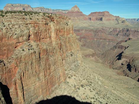
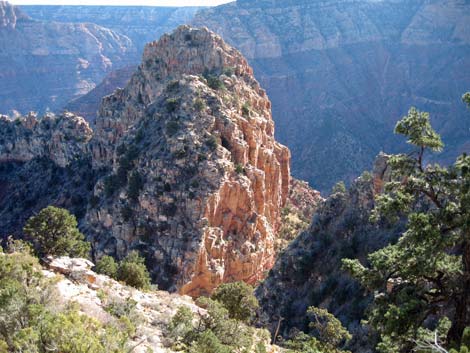 Grand scenery (view NE) |
 Looking down to the trail ahead (view NE) |
 The grand scenery keeps changing (view NE) |
 Cobblestone trail through the Coconino (view E) |
 Trail built up with logs along cliffs (view SW) |
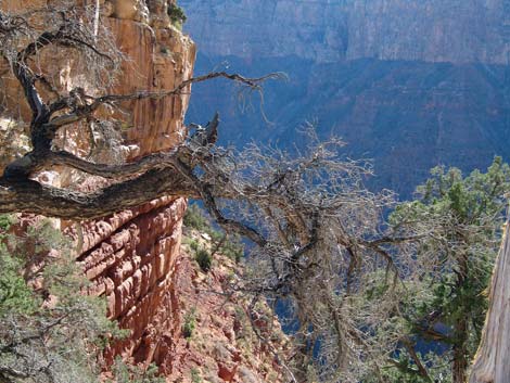 Natural art along the trail (view E) |
 Trail in the Upper Supai (view E) |
 Grand scenery (view N) |
 Trail in the Upper Supai (view NE) |
 Grand scenery (view SW towards Grandview Point) |
 Trail in the Lower Supai (view N) |
 Trail in the Lower Supai (view N) |
 Trail approaching elevation of Horseshoe Mesa (view N) |
 Trail approaching elevation of Horseshoe Mesa (view N) |
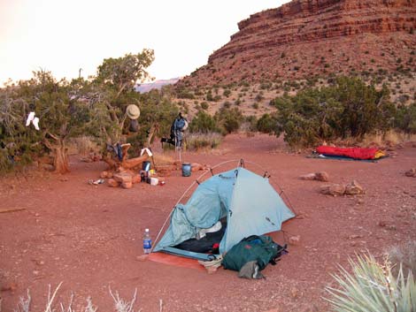
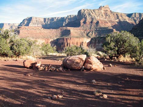
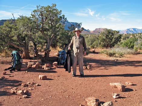 Hiker at camp on Horseshoe Mesa (view N) |
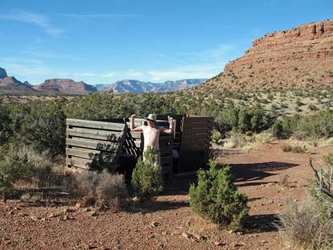 Small-group outhouses (view W) |
 amp on Horseshoe Mesa (view N) |
 Camp on Horseshoe Mesa (view S towards Grandview Point) |
 Third small-group campsite (view NW) |
 Outhouse on Horseshoe Mesa (view S towards Grandview Point) |
 Large-group campsite (view E) |
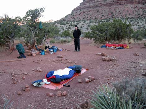
 Morning at Leave-No-Trace campsite (view NW) |
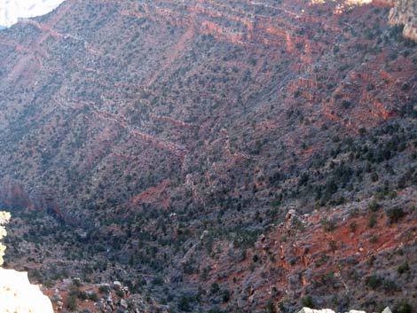
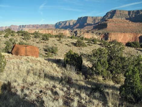
 Grand scenery off the edge of Horseshoe Mesa (view NE) |
 Grand scenery off the edge of Horseshoe Mesa (view NE) |
 Grand scenery off the edge of Horseshoe Mesa (view E) |
 Grand scenery off the edge of Horseshoe Mesa (view N) |
 Caved-in mine opening |
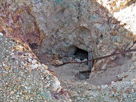 Scary mine opening with ore-car track and broken timbers (view NW) |
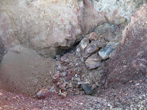
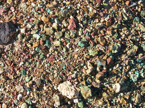
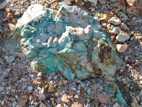 The blue-green material in the soil is copper ore |
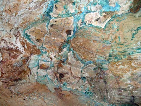 The blue-green material in the soil is copper ore |
 Fragment of copper ore outside the mine |
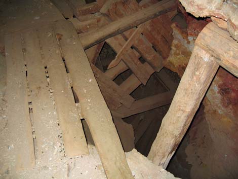 Rotting wooden timbers inside the mine |
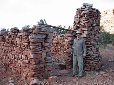 Outside stone cookhouse (view NW) |
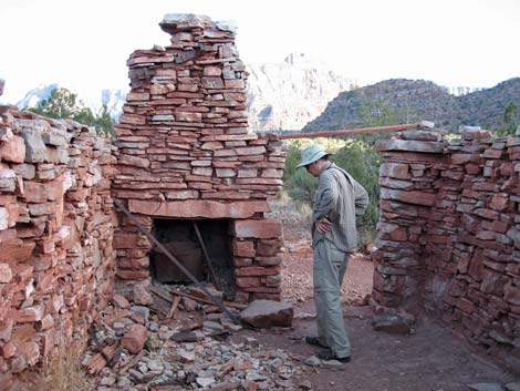 Inside stone cookhouse (view E) |
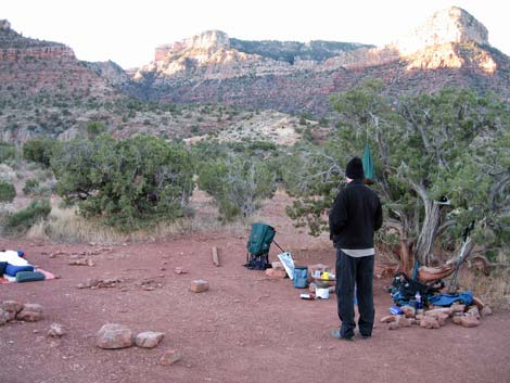
 Morning on Horseshoe Mesa (view E) |
 Morning on Horseshoe Mesa (view NE) |
 Morning on Horseshoe Mesa (view N) |
 Common Raven hoping for food scraps (view NE) |
Table 1. Highway Coordinates (NAD27, UTM Zone 12S). NOTE: This is UTM Zone 12. Download Highway GPS Waypoints (*.gpx) file.
| Site # | Location | Latitude (°N) | Longitude (°W) | UTM Easting | UTM Northing | Elevation (feet) | Verified |
|---|---|---|---|---|---|---|---|
| 811 | Visitor Center, Canyon View Information Plaza | 36.0590 | 112.1085 | 400166 | 3990857 | 7,092 | Yes |
| 951 | Highway 180 at Highway 64 | 36.0519 | 112.1049 | 400477 | 3990072 | 7,104 | Yes |
| 952 | Highway 64 at Grandview Access Road | 35.9895 | 111.9920 | 410581 | 3983037 | 7,489 | Yes |
| 953 | Grandview Point parking area | 35.9979 | 111.9870 | 411039 | 3983967 | 7,418 | Yes |
Table 2. Hiking Coordinates (Waypoints; NAD27; UTM Zone 12S). Download Hiking GPS Waypoints (*.gpx) file.
| Wpt. | Location | Time* | Easting | Northing | Elevation (ft) | Point-to-Point Distance | Cumulative Distance |
|---|---|---|---|---|---|---|---|
| 01 | Grandview Trailhead | 0819 | 411047 | 3984027 | 7,418 | 0.00 | 0.00 |
| 02 | Top of the Coconino | 0853 | 411216 | 3984177 | 6,803 | 0.57 | 0.57 |
| 03 | Corner on point in Coconino | 0859 | 411249 | 3984359 | 6,735 | 0.13 | 0.70 |
| 04 | Campsite (marginal) | 0907-0942 | 411332 | 3984281 | 6,703 | 0.08 | 0.78 |
| 05 | Base of Coconino (camp) | 1001 | 411504 | 3984239 | 6,278 | 0.31 | 1.09 |
| 06 | Campsite in open | 1207 | 412028 | 3985949 | 5,140 | 1.58 | 2.67 |
| 07 | Campsite on ridge | 1213 | 412042 | 3986128 | 5,019 | 0.12 | 2.79 |
| 08 | Mine shaft (adit) | 1215 | 412093 | 3986147 | 5,026 | 0.04 | 2.83 |
| 09 | Page Spring Trail (no sign) | 1218 | 412148 | 3986111 | 5,005 | 0.05 | 2.88 |
| 10 | Trail junction (sign) | 1221 | 412138 | 3986213 | 4,925 | 0.08 | 2.96 |
| 11 | Cottonwood Creek Trail junction | 1225 | 412141 | 3986420 | 4,880 | 0.13 | 3.09 |
| 12 | Stone building | 1227 | 412122 | 3986440 | 4,865 | 0.02 | 3.11 |
| 13 | Campground (3rd site) | 1230 | 412277 | 3986409 | 4,894 | 0.11 | 3.22 |
| 14 | Toilets (40 yards from Site #3) | . | 412245 | 3986382 | 4,890 | . | . |
| 12 | Stone building | . | 412122 | 3986440 | 4,865 | 0.00 | 0.00 |
| 15 | Trail to group sites | . | 412123 | 3986542 | 4,928 | 0.06 | 0.06 |
| 16 | First group campsite | . | 412196 | 3986714 | 4,918 | 0.12 | 0.18 |
| 17 | Group toilets | . | 412404 | 3986872 | 4,921 | 0.18 | 0.36 |
| 18 | Second group campsite | . | 412370 | 3986935 | 4,923 | 0.05 | 0.41 |
*Times are for carrying an 8-day backpack with an extra gallon of water for the dry camp on Horseshoe Mesa. Times for day hikers and those with light packs would be much shorter.
Happy Hiking! All distances, elevations, and other facts are approximate.
![]() ; Last updated 240326
; Last updated 240326
| Hiking the Grand Canyon | Hiking Around Las Vegas | Glossary | Copyright, Conditions, Disclaimer | Home |