Hiking Around Las Vegas, Grand Canyon National Park
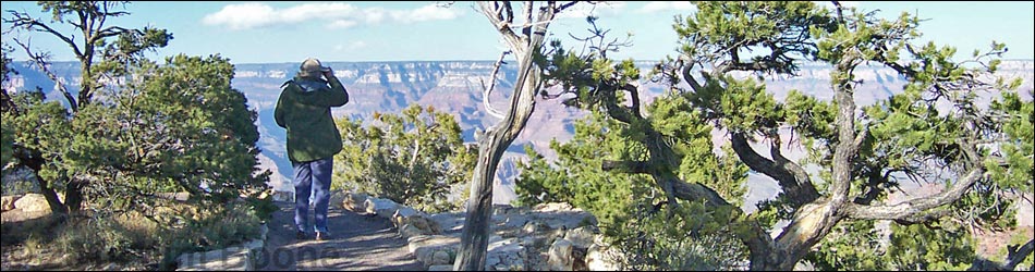
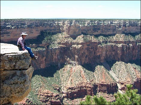
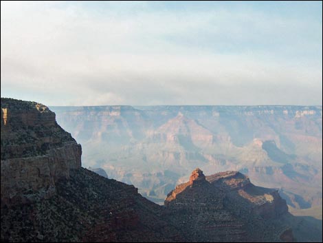
 Between Maricopa Point and Trailview Overlook |
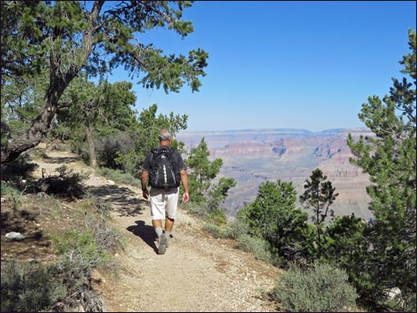
Overview For anyone who wants easy grandeur, the Rim Trail is the place to go. This trail runs within a few feet of the lip of the South Rim from Yaki Point to Hermits Rest, and most of the 13.4-mile trail is nearly level. Hikers can walk any portion of the trail by riding a shuttle bus to a viewpoint, hiking to another viewpoint, and then riding the shuttle bus back home (except no shuttle bus on Hermit Road during winter). A good hike on summer evenings is to ride the shuttle bus to Maricopa Point, watch the sunset, and then walk back to the Bright Angel Lodge for dinner. For hikers with out-of-town visitors, this is a good place to take them on an easy -- but extraordinary -- hike. For detailed photos of the trail, from east to west, see Yaki Point to Yavapai Point, Yavapai Point to Bright Angel Point, Bright Angel to Maricopa Point, Maricopa Point to Mohave Point, Mohave Point to Monument Creek Vista, Monument Creek Vista to Hermits Rest. Link to maps. |
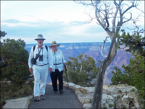
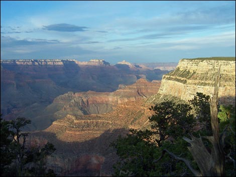
 Edge of the canyon |
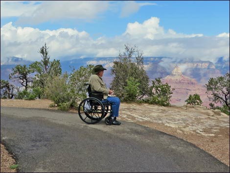
From South Kaibab Trailhead to the Village Route Transfer (Hermit Rest Road) bus stop, the trail is paved and suitable for wheelchairs and other assistive devices. From Village Route Transfer to Trailview Overlook, the trail is paved, but most is steep and there are two sets of stone stairs that make this section unsuitable for wheelchairs. From Trailview Overlook to a bit past Powell Point, the trail is paved and fine for wheelchairs. From a bit past Powell Point to Monument Creek Vista, the trail is dirt (except when passing the named points) and narrow with some parts running very close to the rim. Beyond Monument Creek Vista, the trail is wide, paved, and generally stays away from the rim. There are some nice views just before and at Hermits Rest. |
 |
Watch Out Other than the standard warnings about hiking in the desert, ...this hike is safe, but there are many places where hikers could stumble off the rim and into the canyon if not paying attention. Just west of the Bright Angel Lodge, the trail is fairly steep with two sets of stairs, so even though it is paved, it is not suitable for a wheelchair or for someone who shouldn't hike steep trails. The elevation at the South Rim is surprisingly high, about 7,000 feet, so take it easy until acclimated to the elevation. While hiking, please respect the land and the other people out there, and please try to Leave No Trace of your passage. Also, this is a fairly easy hike with several pit stops along the way, so just bring what you need of the 10 Essentials. |
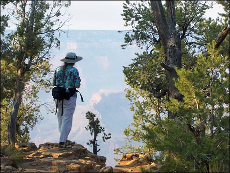
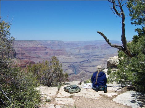 Lunch with a view of the Colorado River |
Getting to the Trailhead This hike is located on the South Rim of the Grand Canyon, about 5.5 hours southeast of Las Vegas. From Las Vegas, drive out to the South Rim of Grand Canyon National Park. From the Canyon View Information Plaza, which includes the Visitor Center (Table 1, Site 0811), walk, ride the shuttle bus, or drive to any of the viewpoints between Yaki Point (Site 0817) and Hermits Rest (Site 0816). The Rim Trail can be started at the east end (Yaki Point), west end (Hermits Rest), or at any shuttle bus stop on the rim between those two points. It is a short walk from Mather Campground (and most other South Rim lodging) to the Rim Trail, so campers can leave their vehicle in the campground and walk to the Rim Trail or to a bus stop. |
 |
The Hike The Rim Trail officially runs from South Kaibab Trailhead to Hermits Rest, but hikers can start at Yaki Point and follow a use-trail along the rim to South Kaibab Trailhead, adding about 0.45 miles to the total length; plus, hikers can wander from Hermits Rest to Hermits Rest Trailhead, adding another 0.21 miles (technically adding 0.42 miles round-trip). Yaki Point to Yavapai Point - Photos From Yaki Point (Table 2, Wpt. 01), a dirt use-trail leaves from the last parking stall in the paved parking area and runs south along the rim for 0.45 miles to the South Kaibab Trailhead parking area. The use-trail starts running along the rim, but eventually it gets pinched between the road and the rim, and it is easier to walk for a short distance on the paved road. When the paved road curves to the southeast and away from the rim (Wpt. 02), the route follows a use-trail southwest across a flat area to the South Kaibab Trailhead (Wpt. 03). |
 |
Crossing the flat area, but angling towards the rim to avoid the mule corrals, the route comes out of the woods at a small parking area between the corrals and the trailhead sign (which is to the right on the rim). From the trailhead sign, the route follows a short dirt road to the South Kaibab Trailhead parking area (Wpt. 03). From just beyond last parking stall at the South Kaibab Trailhead, the paved trail runs for 0.95 miles to Pipe Creek Vista. The trail runs south along the rim of the canyon through a two-needle pinyon pine forest, eventually emerging onto the main highway at the east end of Pipe Creek Vista. The trail continues westward on the sidewalk past the vista parking spaces to the Pipe Creek Vista shuttle bus stop (Wpt. 04). From the Pipe Creek Vista bus stop (Wpt. 04), the paved trail runs west along the rim for 1.3 miles to Mather Point. The trail departs the highway and heads northwest and back into the pinyon-pine woods. The trail then runs through an old burn area that is starting to grow back, especially the gamble oak and cliffrose. This is a good place to look for elk, and there are some nice views over the rim before the trail runs back into the unburned woods. |
 Overlook into Bright Angel Canyon |
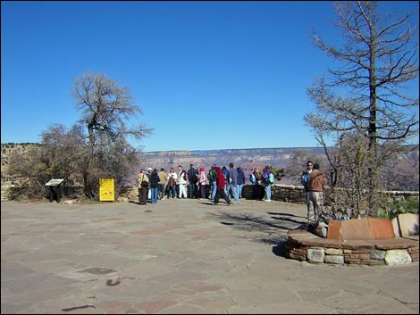
At about 0.8 miles from Pipe Creek Vista, the Rim Trail passes a junction with the Grand Canyon Visitor Center Greenway Trail. This side trail runs through woods to the back of the Visitor Center, making this the long way to get there, but a way to get from the visitor center to the South Kaibab Trailhead on a bicycle. Continuing, the trail runs through the woods and more-or-less along the rim northwest towards Mather Point. Just before getting there, the Rim Trail is intersected by several paved trail that run between the Visitor Center, the bus stop, and Mather Point (Wpt. 05). Mather Point is a great place to visit: it is one of the most-visited viewpoints and one of the classic South Rim scenes. The views are spectacular, and there are several rock outcrops where you can get out into the canyon. Some of the overlooks have railings, but not all of them, so be careful if you venture off the trail. The Canyon View Information Plaza is located across the road from Mather Point, so if you are inclined to visit the Visitor Center or the restrooms, it is a short (0.15 miles) walk southwest from Mather Point. |
 The edge (view N into Bright Angel Canyon) |
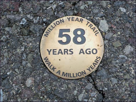
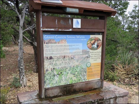
From Mather Point (Wpt. 05), the paved trail runs west through a ponderosa pine forest near the rim for 0.67 miles to Yavapai Point (Wpt. 06). There are some great views along this section, including one spot with a view down to the Colorado River. In some places, the new Rim Trail runs parallel to the old Rim Trail. The new trail is wider, and the grades are gentler, but the old trail runs closer to the rim. The trail eventually arrives at the Yavapai Geology Museum (Wpt. 06). The museum has interesting indoor geology displays, outdoor displays that name the features in the canyon, and restrooms. The Park Service hosts a web cam that looks north across the canyon from here. Yavapai Point to Bright Angel Point - Photos From Yavapai Point (Wpt. 06), the paved trail runs southwest along the rim, quickly passing a water-bottle refilling station. This part of the Rim Trail, from Yavapai Point to Verkamp's Visitor Center is also called the Trail of Time, although associated exhibits run from here all the way to Maricopa Point. |
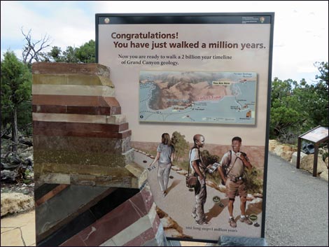 |
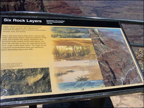
From Time 0 at Yavapai Point to Time 4,560 million-years-ago near Maricopa Point, the Trail of Time has information signs and geologic exhibits scattered along the Rim Trail. As hikers head west, the ages of the rocks on display get older, and medallions on the pavement mark off the time. The main information signs are at Time Zero and at Time One Million Years. Along this timeline, each long step (1 meter = about 3 feet) is about 1 million years. Continuing, the Rim Trail provides great views as the trail runs through a beautiful forest of tall ponderosa pines and shorter pinyon pines that provide plenty of shade but don't obstruct the view too much. As before, in some places, the new Rim Trail runs parallel to the old Rim Trail. |
 Back porch of the Bright Angel Lodge (view N) |
Eventually the Rim Trail arrives at a junction with the Park Headquarters Trail (Wpt. 07). From here, the paved Park Headquarters Trail runs southeast to the Evening Program Amphitheater, the Shrine of the Ages, and the NPS Headquarters buildings. The Park Headquarters Trail is also the short way back to Mather Campground and the grocery store from the Rim Trail. From Park Headquarters Junction (Wpt. 07), the paved Rim Trail runs west along the rim for 0.95 miles to the Bright Angel Lodge. The first part of this section is a very pleasant piece of trail that runs through a ponderosa pine and pinyon pine forest on the edge of the canyon. As before, in some places old Rim Trail runs closer to the rim. The trail eventually reaches Verkamp's Visitor Center and the start of the Grand Canyon Village (South Rim urban complex). The Rim Trail passes the historic El Tovar Hotel that was mostly built during the late 1800s, passes some newer lodges, and finally arrives at the Bright Angel Lodge (Wpt. 08). The historic structures are interesting, and the semi-urban environment provides flush toilets, up-scale coffee, and ice cream cones. |
 |
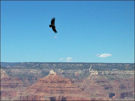
To a biologist, however, the California Condors who roost below the Bright Angel Lodge during summer are the real attraction in this area. There is nothing quite like sitting on the back porch of the Bright Angel, dangling your feet over the rim, eating ice cream, and watching condors fly by. However, also watch the Rock Squirrels who will fight you for your snacks. Being an urban area, there are many ways to continue west from the Bright Angel, but staying along the rim as much as possible is the more interesting route. Bright Angel to Maricopa Point - Photos From the Bright Angel Lodge (Wpt. 08), the paved trail runs west along the rim. Just west of the Bright Angel Lodge, the trail passes the Lookout Studio (good views of Condors from the back porch) and the Kolb Art Studio, which, with the traveling art exhibits, always is an interesting place to visit. |
 California Condor at Bright Angel Lodge (view N) |
In front of Kolb Art Studio, the trail forks. Currently (Fall 2014), signs suggest talking the left fork, which takes hikers up into a parking lot to bypass construction around the studio. However, staying right and carefully passing the construction rewards hikers with nice views of the Canyon and the Bright Angel Trail rather than parked cars. The two forks converge at the east edge of the Bright Angel Trailhead complex, which includes shade structures, water-bottle filling station, the historic circular stone mule corral, several signs, and of course, the start of the Bright Angel Trail, which is the most popular route for hikers who want to descend below the rim of the Canyon. Continuing through the Bright Angel Trailhead complex, the Rim Trail runs west and descend a bit of hill into the Village Route Transfer bus stop (Wpt. 09). |
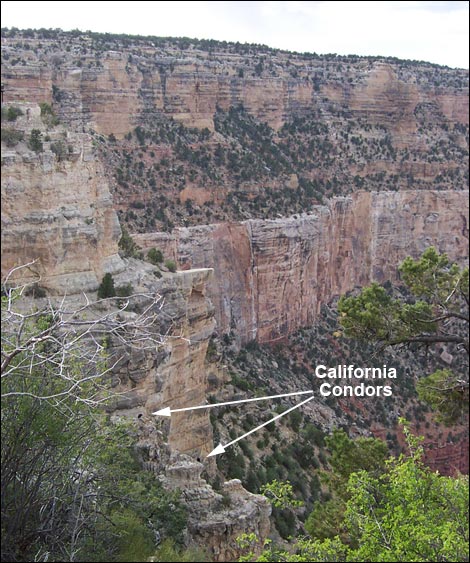 California Condors on ledges below Bright Angel Lodge |
From the Village Route Transfer bus stop (Wpt. 09), the paved trail runs west along the rim. This section of the trail starts at a great overlook (behind the bus stop) down the Bright Angel Canyon. This canyon was formed by the Bright Angel Fault, and hikers will notice that the cliffs on the left (west) side of the canyon are about 200 feet higher than those on the right (east) side. The difference is due to the fault, which uplifted the land to the west relative to the land to the east, and yes, the trail climbs up there. Leaving the bus stop, the trail drops down a set of stone stairs that block travel by wheelchairs and make things difficult for less-sheer-footed walkers. This is just a well because the trail ahead becomes quite steep in places and there are more stone stairs ahead. For people who just want to go a short way up the trail, walk in the street for several yards, then cut back through the trees to the paved trail. Shortly after leaving the bus stop, hikers can stop for a rest and sit in the Bright Angel Fault (Wpt. 10), which is just past the low-point along the trail. While relaxing, consider what would happen if the earth quaked while you were sitting there. Beyond the Bright Angel Fault, the trail turns north and starts climbing through Kaibab limestone cliffs that are cloaked in a pinyon-juniper forest. Through this section, parts of the Kaibab limestone are exposed, and hikers can see many fossils in the rocks. Take a minute to walk off the trail onto the flat bedrock on either side of the trail to see fossilized brachiopods (clam-like creatures), corals, and sponges set in a matrix of gray limestone rock. The Park Rangers do a nice Nature Talk here and explain the geologic history of the area. |
 |
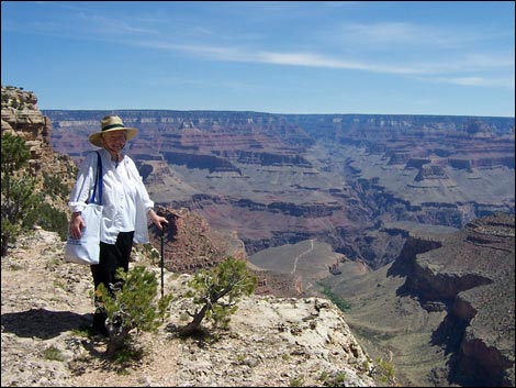
The trail climbs stone stairs and steep sections, eventually arriving at Trailview Overlook (Wpt. 11), which is a great place to safely walk out a spur trail onto rocky outcrops on the edge of the canyon and look straight down onto the Bright Angel Trail. Climbing the "few" steps back to the Rim Trail, consider the plight of the people and mules you saw struggling to climb out of the canyon on the Bright Angel Trail! From Trailview Overlook (Wpt. 11), the paved trail runs north along the rim for 0.7 miles to Maricopa Point (Wpt. 12). This section of the trail is nearly level and very pleasant. In some ways, the views from this section, and from the point, are the most spectacular on the entire trail. I especially like the view where the paved trail seems to run out over the rim of the Canyon. A spur trail runs 200 yards out onto Maricopa Point, proper. |
 Powell Point spur (view N towards Powell Monument) |
Maricopa Point to Mohave Point - Photos From Maricopa Point (Wpt. 12), the paved trail runs west along the rim for 0.5 miles to Powell Point (Wpt. 13). Just west of Maricopa Point, the trail passes the site of the Orphan Mine. Originally opened as a copper mine in 1906, they eventually mined high-grade uranium here before the site was abandoned leaving radioactive mine tailings along the rim. The area is now fenced off and closed to the public as the NPS works to rehabilitate the area. Passing the mine site, the Rim Trail runs north to Powell Point (Wpt. 13). Out at Powell Point, which is on a narrow neck of rock that juts for 0.1 miles out into the canyon, a monument honors John Wesley Powell. In 1869, Major Powell (1834 to 1902) led a small group of men on the first expedition down the Colorado River. They ran the river for 3 months, never knowing what laid in wait for them around the next corner. Major Powell wrote a 400-page book about the adventure. He excerpted the best parts of the story in a short book, The Cañons of the Colorado, which sells for about $6; it's a great adventure story that can be read in a couple of hours. |
 On the edge (view SW from near Mohave Point) |
From Powell Point (Wpt. 13), the Rim Trail runs west along the rim. Initially, the trail follows the road, but then turns away from the road and shortly the paved trail ends and hikers must continue on a rocky trail following a wooden fenceline. As in other places, there are some great views of the canyon from here. Continuing west into the Hopi Point (Wpt. 14) area, the trail spills out onto the paved roadway, but the bus stop and viewpoint are close and obvious. Hopi Point is considered to be the best place on the West Rim for watching the sunset. There are grand views of the Colorado River and the canyon from the point, and there are restrooms in the parking area. From Hopi Point (Wpt. 14), the dirt Rim Trail runs south along the rim. A few minutes west of Hopi Point, the trail passes the Hopi Point shuttle bus stop, but then continues onward staying close between the rim and the road. The Hopi Wall, below the trail, is quite steep and provides spectacular views off the edge of the trail into the Canyon. As elsewhere along the Rim Trail, there are grand views of the river and the inner canyon. |
 |
The trail bends around the head of Salt Creek Canyon and eventually turns northwest to Mohave Point (Wpt. 15). Mohave Point has great views into the Canyon and like Hopi Point, is considered one of the better places to watch the sunset. Mohave Point to Monument Creek Vista - Photos From Mohave Point (Wpt. 15), the dirt trail runs south along the rim. This is a great piece of trail with grand views to the west down into Monument Canyon and out across the Grand Canyon. The trail runs along the lip of The Abyss and feels quite airy in places, as the cliffs below the trail are some 3,000 feet high. Parts of this trail run along the edge of the road, and the trail goes onto the pavement at overlook parking areas, so keep an eye out for traffic coming up from behind. |
 One of many information signs along the trail |
There are picnic benches along the trail where hikers can sit and rest along the edge, and there is one spot where the trail takes a little switchback over the edge to cross a gully and climb stone stairs back onto the rim. Eventually, the trail arrives at The Abyss Overlook (Wpt. 16), which after walking along the quite rim feels quite crowded, but rightfully so as this is a great bus stop for getting out and looking over the edge. From The Abyss Overlook (Wpt. 16), the dirt trail continues southwest along the rim. Along the lip of The Abyss, the trail gets pinched between the road and the rim. The trail feels quite airy in places and even drops below the rim to get away from the road. In my opinion, the dirt trail from Mohave Point to this area is the best part of the Rim Trail for hiking: the crowed are thin, the views grand, much of the trail is airy, and the dirt trail is easier on tired feet. Unfortunately, all of this ends when the trail arrives at Monument Creek Vista (Wpt. 17). |
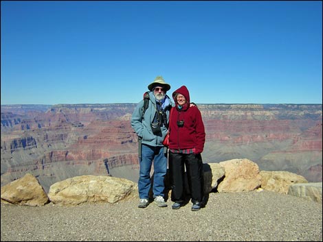 A cold day at Powell Point |
Monument Creek Vista to Hermits Rest - Photos From Monument Creek Vista (Wpt. 17), the now paved trail continues northwest along the rim as the Greenway Trail. The trail starts out near the lip of the Abyss, but stays back in the trees with few nice views out over the Grand Canyon. There are, however, several places where short spur trails run out to overlooks. The road eventually curves away from the trail, and then the trail curves away from the rim to drop through a moderate drainage. At the bottom of the drainage, there are some nice ponderosa pines, a rare species out in this pinyon-juniper forest. The trail eventually climbs out of the drainage and hits the Hermit Road again. This time, however, the trail runs along the paved shoulder of the road, following it all the way out to Pima Point (Wpt. 18). |
 Forest fire on the North Rim |
Pima Point is another great place to watch the sunset. From Pima Point, visitors can look down to the Tonto Platform and see the site of the old Hermit Camp, a tourist camp that the Santa Fe Railroad operated during the early 1900s. From the viewpoint, sometimes hikers can be seen on the Tonto Trail far below. From Pima Point (Wpt. 18), the Rim Trail follows the pavement around the loop, then leaves the roadway at a signed trail junction and continues southwest as the broad, paved Greenway Trail. Fortunately, there are some nice views into the Canyon along this section, and they get better farther out, although much of the view is now into Hermit Canyon rather than the Grand Canyon, proper. The trail runs along the rim until getting pinched off by the road just before arriving at Hermits Rest (Wpt. 19), the official end of the Rim Trail. |
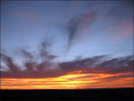 Sunset from one of the points |
From the Hermits Rest shuttle bus stop (Wpt. 19), the paved trail continues west a few yards to Hermits Rest, proper (the building, restrooms, and snack bar). Beyond the Hermits Rest buildings, a dirt use-trail runs west for 0.21 miles to the Hermits Rest Trailhead (Wpt. 20), which is out on the end of the point. There are many pinyon pine trees in this area that block the view, so Hermits Rest Trailhead isn't the best area for viewing the Canyon, but it is fun to come out to the end, look down the trail into the canyon, and wonder what it would be like to just keep going down the Hermit Trail. When ready, wander back to the main Hermits Rest building. Back at Hermits Rest, kick back, relax on the porch, enjoy a cold soda or a hot chocolate (depending on the weather), and gaze out over Hermit Canyon. In 1914, Mary Jane Coulter designed the Hermits Rest building using rough-hewn limestone blocks and boulders so that the structures would blend with the scenery. Ms. Coulter designed these and the other buildings along the South Rim that tend to blend into the background, all of which are interesting and worth investigating. When ready to head out, hop on a shuttle bus and ride it back to your trailhead. |
Table 1. Highway Coordinates (NAD27, UTM Zone 12S). NOTE: This is UTM Zone 12. Download Highway GPS Waypoints (*.gpx) file.
| Site # | Location | Latitude (°N) | Longitude (°W) | UTM Easting | UTM Northing | Elevation (feet) | Verified |
|---|---|---|---|---|---|---|---|
| 0811 | Canyon View Information Plaza | 36.05897 | 112.10848 | 400166 | 3990857 | 7,092 | Yes |
| 0816 | Hermits Rest building | 36.06222 | 112.21033 | 390996 | 3991326 | 6,656 | Yes |
| 0817 | Yaki Point Rim Trail trailhead | 36.05837 | 112.08281 | 402477 | 3990765 | 7,253 | Yes |
Table 2. Hiking Coordinates (NAD27, UTM Zone 12S). Note: This is UTM Zone 12. Download Hiking GPS Waypoints (*.gpx) file.
| Wpt. | Location | UTM Easting | UTM Northing | Elevation (ft) | Point-to-Point Distance (mi) | Cumulative Distance (mi) | Verified |
|---|---|---|---|---|---|---|---|
| 01 | Yaki Point trailhead | 402477 | 3990756 | 7,253 | 0.00 | 00.00 | GPS |
| 02 | Leave paved road | 402565 | 3990303 | 7,238 | 0.31 | 00.31 | GPS |
| 03 | South Kaibab Trailhead | 402450 | 3990137 | 7,200 | 0.14 | 00.45 | GPS |
| 04 | Pipe Creek Overlook | 401480 | 3989639 | 7,091 | 0.95 | 01.40 | GPS |
| 05 | Mather Point | 400268 | 3991127 | 7,082 | 1.40 | 02.80 | GPS |
| 06 | Yavapai Point | 399434 | 3991647 | 7,033 | 0.67 | 03.47 | GPS |
| 07 | Park Headquarters Junction | 398650 | 3990786 | 6,947 | 0.85 | 04.32 | GPS |
| 08 | Bright Angel Lodge | 397321 | 3990705 | 6,858 | 0.95 | 05.27 | GPS |
| 09 | Village Route Transfer | 396971 | 3990694 | 6,819 | 0.25 | 05.52 | GPS |
| 10 | Fault | 396784 | 3990712 | 6,836 | 0.13 | 05.65 | GPS |
| 11 | Trailview Overlook | 396761 | 3991233 | 6,981 | 0.36 | 06.01 | GPS |
| 12 | Maricopa Point | 396646 | 3992169 | 7,007 | 0.72 | 06.73 | GPS |
| 13 | Powell Point | 396313 | 3992392 | 7,240 | 0.46 | 07.19 | GPS |
| 14 | Hopi Point | 396070 | 3992600 | 7,065 | 0.26 | 07.45 | GPS |
| 15 | Mohave Point | 395072 | 3992315 | 6,678 | 0.93 | 08.38 | GPS |
| 16 | Abyss Overlook | 394776 | 3990816 | 6,583 | 1.09 | 09.47 | GPS |
| 17 | Monument Creek Vista | 393557 | 3991107 | 6,509 | 0.95 | 10.42 | GPS |
| 18 | Pima Point | 391983 | 3992341 | 6,461 | 1.80 | 12.22 | GPS |
| 19 | Hermit Rest | 391070 | 3991355 | 6,677 | 0.99 | 13.21 | GPS |
| 20 | Hermit Rest Trailhead Parking | 390880 | 3991147 | 6,646 | 0.21 | 13.42 | GPS |
Happy Hiking! All distances, elevations, and other facts are approximate.
![]() ; Last updated 240326
; Last updated 240326
| Hiking the Grand Canyon | Hiking Around Las Vegas | Glossary | Copyright, Conditions, Disclaimer | Home |