Hiking Around Las Vegas, Grand Canyon National Park
Overview | Hermits Rest | Abyss | Hopi Point | Bright Angel | Yaki Point
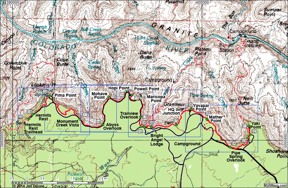
Note: Roads are black (solid = paved; dashed = unpaved). Trails and routes are red (solid = main; dashed = adjacent or alternate). Map based on USGS 15-minute topo map, which may have red grid lines and various numbers. North is at the top. Grid is UTM NAD27 CONUS. Download waypoint coordinates from route description page.
Happy Hiking! All distances, elevations, and other facts are approximate.
![]() ; Last updated 140928
; Last updated 140928
| Rim Trail Hike | Hiking Around Grand Canyon | Glossary | Copyright, Conditions, Disclaimer | Home |