Hance Canyon to Cottonwood Canyon
Hiking Around Las Vegas, Grand Canyon National Park
Overview | Next Segment West | Next Segment East
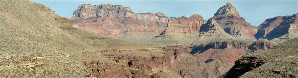
 Hance Creek (view S) |
Overview I've organized my description of the Tonto East Trail into two parts: (1) an overview of the entire trail, trailheads, and other general information, and (2) individual canyon-to-canyon segments. From Hance Canyon, it is about 5.0 miles and 3 hours to Cottonwood Canyon. This segment of the trail runs out the west side of Hance Canyon, loops around both arms of Horseshoe Mesa, and then runs up into Cottonwood Canyon. The trail is fairly slow getting out of Hance (many rocky spots), but the views above and below the trail are truly spectacular; the rest of the trail is fast and easy. Hance Canyon is in Backcountry Use Zone BE9 (camping at-large), and Cottonwood Canyon is in Zone BG9 (camping at-large); the wash between the two arms of Horseshoe Mesa separates the two zones. Link to map of this segment. |
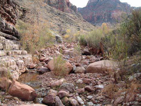
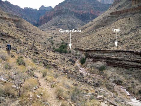
 Camp area along Hance Creek (view S) |
Watch Out Other than the standard warnings about hiking in the desert, ...this is a fairly safe hike, but there are several places along Hance Canyon to fall into the abyss. Be sure to read the Watch Out section on the Tonto East Overview page, which discusses things such as cell phones and signal mirrors. While hiking, please respect the land and the other people out there, and please try to Leave No Trace of your passage. Getting to the Trailhead Trailhead information is presented on the Tonto East Overview page. |
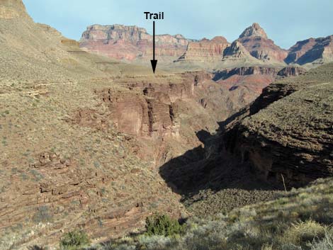
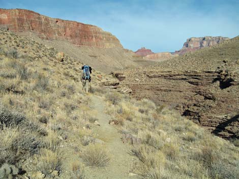 Trail in back of Hance Canyon (view N) |
The Hike 3. Hance Canyon to Cottonwood Canyon -- 5.0 miles and 3 hours From the creek crossing in Hance Canyon (Table 3, Waypoint 012; 0924 hrs), the trail runs onto the west bank heading north, passes a trail junction to the Hance Creek Camp area, and angles up and across the hillside. The trail crosses a rocky gully to get above the first band of cliffs (0928), then runs out on the contour atop the Tapeats Sandstone cliffs. A rocky bit of trail navigates behind some big bushes and past a seep in a shallow side canyon (0939), and shortly arrives at the unmarked junction with the Page Spring Trail (Wpt. 014; 0940), which angles up and away from the edge of the Hance Canyon gorge en route to the top of Horseshoe Mesa. |
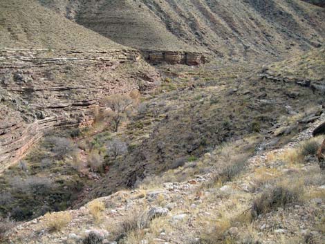
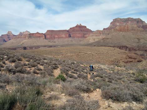
 Hance Canyon (view from S side of Page Spring Canyon) |
Continuing along the edge of the Hance Canyon gorge, the Tonto East Trail runs out to a point at the edge of Page Spring Canyon (Wpt. 015). There is a grand view and space for one tent on the edge of the cliffs. The trail circles around the point, runs up to cross Page Creek (0954) on the slickrock (watch for Bighorn Sheep), and continues north on the contour. From Page Creek out to the point, the trail generally runs on the contour, but it is rocky and slow going because the sidehill is steep and rocky. In contrast to the other side of the canyon, the edge of the Tapeats here is close under the Redwall. The trail continues north on the contour to a point (Wpt. 016; 1016) with a campsite on the edge of the cliffs. There are grand views, a good spot for one tent, and acceptable spots for more tents. |
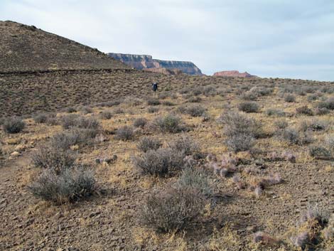 Flats at northwest end of Hance Canyon (view W) |
From the point, the trail continues north and turns into (1021) and out of (1036) a major side canyon with two horns. Beyond the side canyon, the slope of the hillside lessens, and the trail is easier to walk on. As the hillside turns to flats, the trail turns away from the edge of the gorge (Wpt. 017; 1056) and runs up a hillside at a moderate grade (good trail but a bit rocky) to the top of the ridge (1100), then follows the ridgeline west at a gentler grade. The trail crosses a ridge with marginal campsites (Wpt. 018; 1103) and exits the Hance Canyon drainage system. |
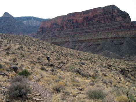
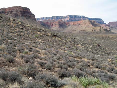 Hillside off northeast tip of Horseshoe Mesa (view W) |
A few minutes later, the easy trail crosses another flat ridge with nice campsites and plenty of room for a Boy Scout troop (Wpt. 019; 1107). The trail continues west, crosses a large gully (1112), and runs up onto a ridge with a marginal campsite (Wpt. 020; 1119). From that ridge, the trail runs downhill towards the wash that comes down between the two arms of Horseshoe Mesa. The trail runs low, then cuts up along the east side of the wash for farther than it seems it should before crossing the wash (Wpt. 021; 1139). Maybe it seems so far because the trail had been easy, but then got rocky along the last bit as it worked around and under a grove of big, old Catclaw Acacia trees along the wash. |
 Approaching the wash between the arms of Horseshoe Mesa. Trail-of-the-Caves Trail comes down the ravine above the hiker (view SW) |
From the wash crossing (Wpt. 021; 1139), the trail runs west to the junction with the Trail-of-the-Caves Trail (Wpt. 022; 1141) that comes down the inside of the west arm of Horseshoe Mesa. The junction is unsigned, but it is marked by a very large cairn with an old drill bit sticking out the top. From the junction, the trail runs back down the hillside for a short way before turning west and running at a slight downgrade to a broad ridge at the turn into Cottonwood Canyon (Wpt. 023; 1154). There are very marginal campsites and lots of Pricklypear Cactus on the ridge. |
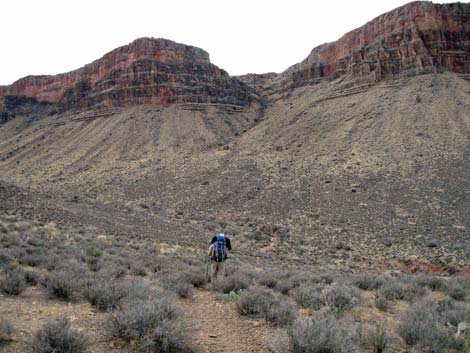
 Hillside below the west tip of Horseshoe Mesa (view NW) |
The trail continues to descend gently across the hillside as it passes the west tip of Horseshoe Mesa and runs down towards the edge of the Cottonwood Canyon gorge (1223). The trail runs along the edge of the gorge briefly, then passes the first of several (2-3) use-trails (Wpt. 024, 025; 1225) that descend the hillside to campsites along Cottonwood Creek. The main trail continues on the contour atop the cliffs and crosses the creek (Wpt. 026; 1232) at a short pour-over in the Tapeats Sandstone. Campsites can be found above and below the creek crossing. There are some nice, sunny campsites above the crossing on the east side of the creek, and there are some shady campsites down the creek under the Tapeats Sandstone cliffs and Cottonwood Trees. (Wpt 027). |
 Turn into Cottonwood Canyon (view SW) |
 Cottonwood Canyon (view S) |
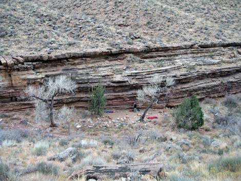 Camp in Cottonwood Canyon during winter (view NW) |
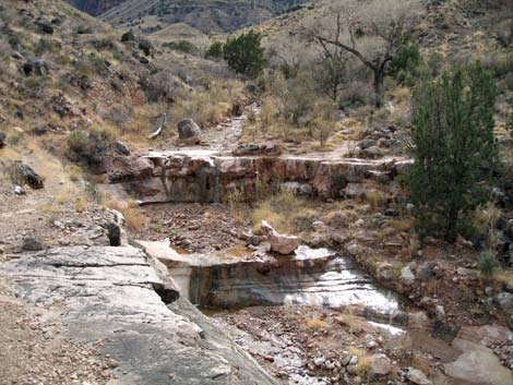 Pour-over at the Cottonwood Canyon crossing (view S) |
Table 3. Hiking Coordinates Based on GPS Data (NAD27; UTM Zone 12). Download Entire Route Hiking GPS Waypoints (*.gpx) file.
| Wpt. | Location | Easting | Northing | Elevation | Point-to-Point Time (min) | Cumulative Time (min) | Point-to-Point Distance (mi) | Cumulative Distance (mi) | Total Tonto Distance (mi) |
|---|---|---|---|---|---|---|---|---|---|
| 12 | Hance Creek crossing | 413601 | 3986081 | 3,651 | 0:00 | 0:00 | 0.00 | 0.00 | 6.97 |
| 13 | Hance Creek campground | 413574 | 3986182 | 3,658 | 0:00 | 0:00 | 0.03 | 0.00 | 7.00 |
| 14 | Page Spring Trail | 413183 | 3986519 | 3,756 | 0:16 | 0:16 | 0.74 | 0.74 | 7.74 |
| 15 | Turn into Page Spring Canyon | 413108 | 3986812 | 3,765 | 0:13 | 0:29 | 0.27 | 1.01 | 8.01 |
| 16 | Point with campsite | 413002 | 3987456 | 3,739 | 0:26 | 0:55 | 0.84 | 1.85 | 8.85 |
| 17 | Leaving Hance gorge | 413300 | 3988508 | 3,874 | 0:40 | 1:35 | 1.31 | 3.16 | 10.16 |
| 18 | Crossing ridge out of Hance | 413068 | 3988664 | 3,968 | 0:07 | 1:43 | 0.22 | 3.38 | 10.38 |
| 19 | Campsite (big) | 412905 | 3988738 | 3,959 | 0:03 | 1:46 | 0.12 | 3.50 | 10.50 |
| 20 | Campsite (marginal) | 412417 | 3988684 | 3,926 | 0:12 | 1:59 | 0.42 | 3.92 | 10.92 |
| 21 | Wash between horns of Horseshoe | 412028 | 3988249 | 3,868 | 0:19 | 2:18 | 0.98 | 4.90 | 11.90 |
| 22 | Trail of the Caves Trail junction | 411976 | 3988254 | 3,912 | 0:02 | 2:20 | 0.04 | 4.94 | 11.94 |
| 23 | Turning into Cottonwood Canyon | 411637 | 3988785 | 3,863 | 0:13 | 2:34 | 0.61 | 5.55 | 12.55 |
| 24 | Trail junction to campsites | 410989 | 3987779 | 3,691 | 0:29 | 3:03 | 1.17 | 6.72 | 13.72 |
| 25 | Trail junction to campsites | 410983 | 3987714 | 3,708 | 0:05 | 3:08 | 0.10 | 6.82 | 13.82 |
| 26 | Cottonwood Creek crossing | 410990 | 3987642 | 3,694 | 0:02 | 3:11 | 0.05 | 6.87 | 13.87 |
| 27 | Campsite (big) | 410951 | 3987754 | 3,638 | 0:00 | 3:11 | 0.10 | 6.97 | 13.97 |
Happy Hiking! All distances, elevations, and other facts are approximate.
Total Tonto Distance (mi) starts at the mouth of Red Canyon.
![]() ; Last updated 240326
; Last updated 240326
| Hiking Around Grand Canyon | Hiking Around Las Vegas | Glossary | Copyright, Conditions, Disclaimer | Home |