Cottonwood Canyon to Grapevine Canyon
Hiking Around Las Vegas, Grand Canyon National Park
Overview | Next Segment West | Next Segment East
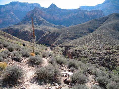
 Trail crossing in Cottonwood Canyon (view N) |
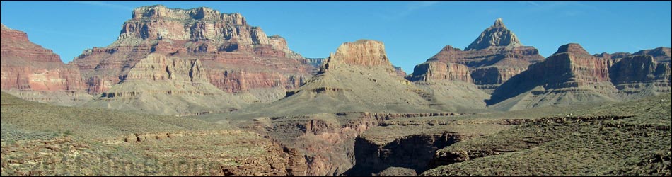
Overview I've organized my description of the Tonto East Trail into two parts: (1) an overview of the entire trail, trailheads, and other general information, and (2) individual canyon-to-canyon segments. From Cottonwood Canyon, it is about 5.8 miles and 3 hours to Grapevine Canyon. This segment of the trail runs out the west side of Cottonwood Canyon, loops around a major ridge coming down from Grandview Point, and then runs up into Grapevine Canyon, passing a spring along the way. The trail is fairly fast and easy, and the views above and below the trail and out into the Inner Gorge are spectacular. Cottonwood Canyon is in Zone BG9 (camping at-large), and Grapevine Canyon is in Zone BH9 (camping at-large). Link to map of this segment. |
 Upper Cottonwood Canyon (view N) |
Watch Out Other than the standard warnings about hiking in the desert, ... this is a fairly safe trail. However, the dirt trail at the turn into Grapevine Canyon is a narrow, out sloping, and quite airy. There is also a precipitous section above Grapevine Canyon where an overhanging rock might try to catch your backpack. Be sure to read the Watch Out section on the Tonto East Overview page, which discusses things such as cell phones and signal mirrors. While hiking, please respect the land and the other people out there, and please try to Leave No Trace of your passage. |
 Lower Cottonwood Canyon (view N) |
Getting to the Trailhead Trailhead information is presented on the Tonto East Overview page. This segment of the Tonto East Trail can be accessed from the east via the Grandview Point Trail and the Cottonwood Trail. From the west, this segment can be accessed from the South Kaibab Trail and the Tonto East Trail. |
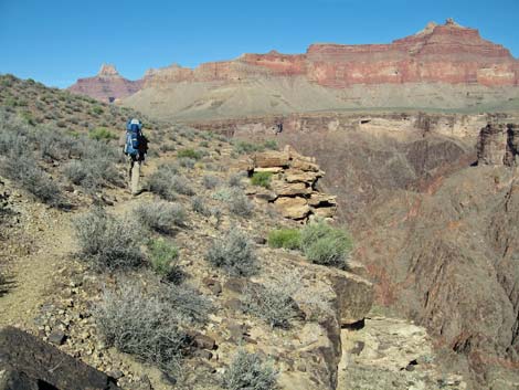 Hiker on point between Cottonwood and Grapevine canyons; edge of the Inner Gorge (view NW) |
The Hike 4. Cottonwood Canyon to Grapevine Canyon -- 5.8 miles and 3 hours From the creek crossing in Cottonwood Canyon (Table 4, Waypoint 26; 0917 hrs), the trail crosses on the slickrock atop the Tapeats Sandstone, then runs upstream about 10 yards before turning and heading northwest on the contour. The trail runs north above the big junipers and runs out along the top of the Tapeats. The bottom of Cottonwood Canyon is a pretty place where Cottonwood and Juniper trees provide shade against Tapeats Sandstone Cliffs. The sounds of the clear water running down the creek soften the silence. Shrubs along the creek include rabbitbrush and squaw waterweed, and salt grass grows thick in some places. |
 Nervous hiker on sloping trail at turn into Grapevine Canyon (view S) |
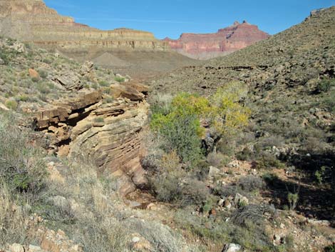
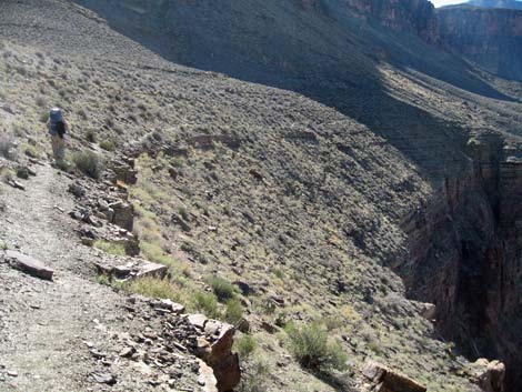
After getting out of the back of the canyon (0930 hrs), the shrubs are mostly blackbrush, Nevada Jointfir (a type of Mormon tea), agave, Anderson desert-thorn, and catclaw acacia. Cactus include hedgehog cactus, a pricklypear species that grows in chains, cottontop cactus, and pancake pricklypear. Keep an eye out for beavertail and fishhook cactus too. On the point where the trail turns into the first major side canyon (0939 hrs), there are some marginal campsites. In the back of the side canyon, water trickles across the slickrock at the crossing (Wpt. 28; 0953 hrs). Watch for birds and bighorn sheep around the water. In the early summer, flowers on the Virgin River Encelia bushes add bright yellow to the red and gray landscape, and in the fall, rabbitbrush does the same. To here, the trail runs mostly along the contour, a little in and out, a little up and down, but mostly easy trail on the contour. |
 Lower Grapevine Canyon (View S) |
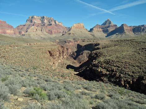
Where the trail turns out of the side canyon (1011), there are a couple of adequate campsites on the ridge. The trail runs north along the top of the Tapeats, mostly on the contour, then turns out of Cottonwood Canyon at a point on the edge of the Inner Gorge (Wpt. 29; 1022 hrs). There are great views into the Inner Gorge, but the Colorado River can't be seen from here. Just past the turn, you can look down and see a little bit of river. No campsites here. A few minutes beyond the turn, a large cairn (Wpt. 30; 1035 hrs) marks the start of a trail that is supposed to run down to the river. The route looks very improbable, but there is a campsite here that is barely adequate for one tent. |
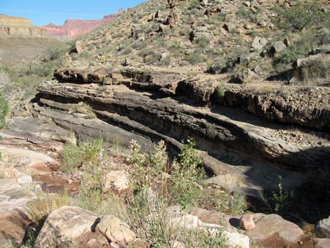
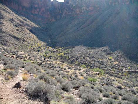 Side canyon with spring |
The Tonto East Trail continues west, turning into (1040 hrs) and crossing the back of the side canyon (1045 hrs). As is usual, the trail in the side canyon is rocky with some up-and-downs, but the hiking is easy. The trail exits the side canyon on a saddle (Wpt 31; 1050 hrs) covered with Blackbrush, a little bit of Mormon Tea, Mojave Yucca, and some Pricklypear and Beavertail cactus. There are no campsites. The trail winds around another little side canyon to a slight ridge (Wpt. 32; 1055 hrs) with a flat area and marginal spaces for 3 tents. A few minutes farther, the trail turns south into Grapevine Canyon (Wpt. 33; 1058 hrs) on a point with a marginal tent site by the trail and what looks like several nice sites on flat rocks out on the point. |
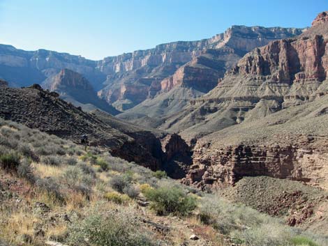
 Upper Grapevine Canyon (view S) |
From the turn (Wpt. 33; 1058 hrs), the trail runs south on the contour, but on a narrow, down-sloping dirt trail with a tremendous drop off into the bottom of Grapevine Canyon. It isn't particularly dangerous when dry, but it could treacherous when wet or muddy. It only takes a few minutes to pass this section, but pay attention here and be careful not to step off the trail. After a few minutes (1108 hrs), the trail runs over a little saddle, and there is no more exposure. The trail then traverses a rocky hillside with lots of little up-and-downs, in-and-outs, and rocks in the trail. That is followed (1115 hrs) by gentle side hills and easy trail, in and out of little side canyons, and across gentle side hills (1131 hrs). The trail is easy overall, but parts are rocky, and there is a narrow and precipitous section with an overhanging rock that catches on big packs. |
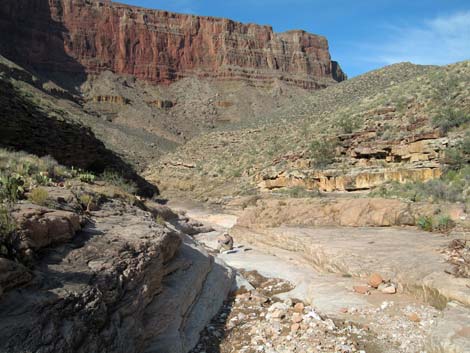
 Tonto Trail crossing into Grapevine Canyon (view S) |
The trail eventually winds into a large side canyon with a spring (Wpt. 34; 1140). Water flows across the trail, and there are lots of Single-leaf Ash Trees, and a few Redbud and Utah Juniper Trees. Shrubs are dense, and include Narrow-leaf Cattail, Arrowweed, Squawbush, Four-wing Saltbush, Catclaw Acacia, and Matchweed. Between the shrubs, there is some saltgrass. Because of the thick vegetation, it is hard to find the trail heading south from the spring, but it goes steeply up the hillside, running just below a large Juniper. The trail climbs onto a ridge and turns into another side canyon. Crossing the back of the side canyon (1153), the trail is narrow with quite a drop-off. It then crosses another small side canyon atop a pour-over (1205 hrs) and comes out with nice views into the east (main) and west arms of Grapevine Canyon (1207 hrs). |
 Hiker getting water below trail crossing in Grapevine Canyon (view N) |
The trail then runs down into the wash in the bottom of Grapevine Canyon (Wpt 35; 1217 hrs). The trail crosses the wash atop white slickrock by a large Utah Juniper Tree. There is a campsite under the Juniper at the crossing and couple of tent sites along the wash just above the crossing. Water is present. The sides of the wash in the bottom of the canyon (especially upstream) are well vegetated with desert species from the hillsides, plus Redbud, Catclaw Acacia, Single-leaf Ash, Arrowweed, Squawbush, Apache Plume, Salt cedar, Squaw Waterweed, and a couple species of yellow-blooming aster. |
Table 4. Hiking Coordinates Based on GPS Data (NAD27; UTM Zone 12). Download Entire Route Hiking GPS Waypoints (*.gpx) file.
| Wpt. | Location | Easting | Northing | Elevation | Point-to-Point Time (min) | Cumulative Time (min) | Point-to-Point Distance (mi) | Cumulative Distance (mi) | Total Tonto Distance (mi)* |
|---|---|---|---|---|---|---|---|---|---|
| 26 | Cottonwood Creek crossing | 410990 | 3987642 | 3,694 | 0:00 | 0:00 | 0.00 | 0.00 | 13.87 |
| 27 | Campsite (big) | 410951 | 3987754 | 3,638 | 0:00 | 0:00 | 0.00 | 0.00 | 13.97 |
| 28 | Canyon with water | 410245 | 3988318 | 3,732 | 0:38 | 0:38 | 1.00 | 1.00 | 14.97 |
| 29 | Turning out of Cottonwood Cyn | 411006 | 3989282 | 3,764 | 0:26 | 1:05 | 1.07 | 2.07 | 16.04 |
| 30 | Large cairn with a trail | 410737 | 3989625 | 3,760 | 0:12 | 1:18 | 0.35 | 2.42 | 16.39 |
| 31 | Saddle, no campsites | 410294 | 3989766 | 3,791 | 0:15 | 1:34 | 0.44 | 2.86 | 16.83 |
| 32 | Flat area with marginal campsites | 410097 | 3989782 | 3,788 | 0:04 | 1:38 | 0.17 | 3.03 | 17.00 |
| 33 | Turning into Grapevine Canyon | 409960 | 3989834 | 3,781 | 0:03 | 1:41 | 0.12 | 3.15 | 17.12 |
| 34 | Side canyon with a spring | 408762 | 3988922 | 3,588 | 0:44 | 2:26 | 1.42 | 4.57 | 18.54 |
| 35 | Grapevine Wash crossing | 407987 | 3988245 | 3,500 | 0:34 | 3:00 | 1.22 | 5.79 | 19.76 |
Happy Hiking! All distances, elevations, and other facts are approximate.
![]() ; Last updated 240326
; Last updated 240326
| Hiking Around Grand Canyon | Hiking Around Las Vegas | Glossary | Copyright, Conditions, Disclaimer | Home |