South Kaibab Trail (Tipoff) to Pipe Canyon
Hiking Around Las Vegas, Grand Canyon National Park
Overview | Next Segment West | Next Segment East
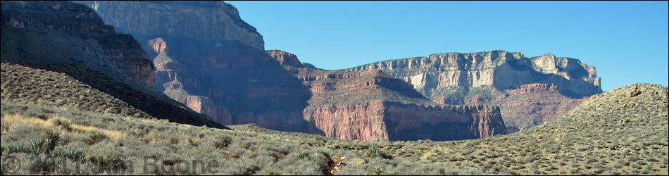
 South Kaibab Trail at the edge of the world (The Tipoff; view NW) |
Overview I've organized my description of the Tonto East Trail into two parts: (1) an overview of the entire trail, trailheads, and other general information, and (2) individual canyon-to-canyon segments. From The Tipoff, it is about 2.5 miles and 1.3 hours to the creek crossing in Pipe Canyon. This segment of the trail runs southwest from The Tipoff, curves around O'Neal Butte, passes Burro Spring, and ends at the creek in Pipe Canyon. Views above and below the trail are spectacular. Camping is not permitted along this segment of the Tonto Trail. Link to map of this segment. |
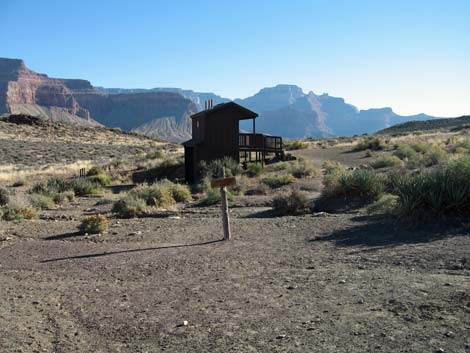 Tipoff outhouses (view E) |
Watch Out Other than the standard warnings about hiking in the desert, ...this segment is fairly safe, but be sure to read the Watch Out section on the Tonto East Overview page, which discusses things such as cell phones and signal mirrors. While hiking, please respect the land and the other people out there, and please try to Leave No Trace of your passage. |
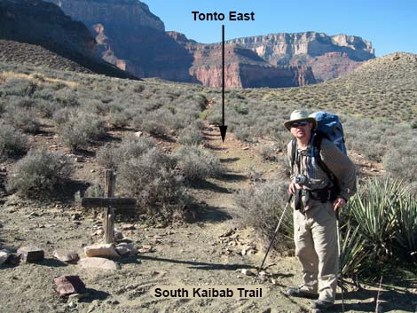 Tonto East Trail at the South Kaibab Trail (view W) |
Getting to the Trailhead Trailhead information is presented on the Tonto East Overview page. The east end of this segment of the Tonto East Trail can be accessed from the South Kaibab Trail. The other end can only be accessed from other segments of the Tonto East Trail. |
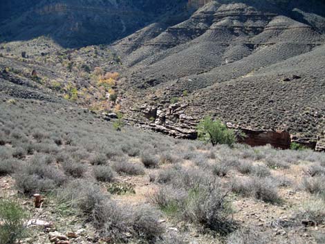
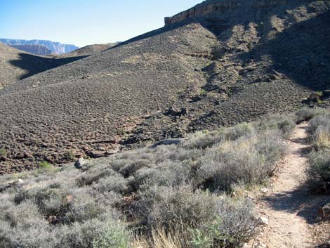 Looking back at trail along sidehills (view E) |
The Hike 9. South Kaibab Trail (The Tipoff) to Pipe Canyon -- 2.5 miles and 1.3 hours From the junction of the Tonto and South Kaibab trails (Wpt. 75; 0922 hrs), the Tonto Trail follows the South Kaibab Trail to the south (uphill) for about one minute to the signed "Tonto Trail - West" trail junction (Wpt. 76; 0923 hrs). From the trail junction, the trail runs southwest and up a shallow gully onto a low saddle (Wpt. 77; 0928 hrs) behind a knob. From the saddle, you can look west and see the Plateau Point Trail, which is on the other side of the Bright Angel Trail. The trail crosses over the saddle, then runs down the gully on the other side before turning more to the south and starting out across the steep hillside on the contour. |
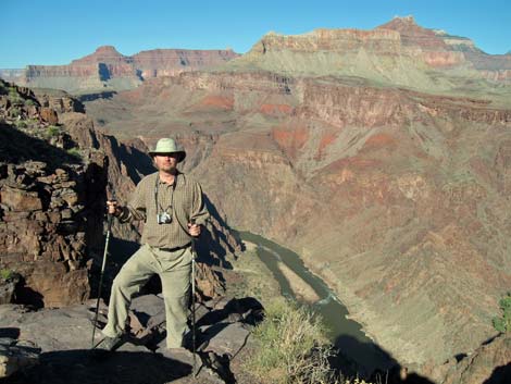
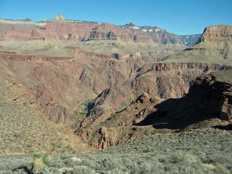 Phantom Ranch (view N) |
The trail winds around the back of a side canyon, passing above some enormous boulders and crossing the wash (Wpt. 78; 0939) heading slightly downhill across the wash. The trail then runs out onto gentle sideslopes (0945 hrs) where there are great views down into Phantom Ranch; some of the ranch buildings are visible. The trail contours up onto a low saddle (0953 hrs), then cuts straight down the other side into ravines. |
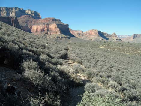 Trail across north-facing hillsides with a Blackbrush (view W) |
The trail contours up onto another low saddle (Wpt. 79; 1002 hrs), then begins to drop at a fair grade into Pipe Canyon. To this little saddle, the hiking has been delightful easy on the sideslopes. The vegetation on the north-facing slopes up to this point had been almost a monoculture of Blackbrush. Beyond the saddle, the trail traverses south-facing slopes where the vegetation becomes thick and diverse with desert-hardy species. The trail eventually regains the contour and crosses hillsides into the Burro Spring side canyon. The trail crosses the outflow (Wpt. 80; 1018 hrs) below the spring. The stream crossing is choked with Bulrush and a few Maidenhair Ferns, and there are several Cottonwood Trees, Two-needle Pinyon Pines, Single-leaf Ash, and large Serviceberry bushes in the area. |
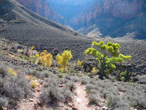 Burro Spring area (view S) |
From the Burro Spring crossing, the trail climbs over a ridge onto sideslopes and more-or-less contours around into the back of Pipe Canyon and the creek crossing (Wpt. 81; 1031 hrs). There are nice spots at the creek crossing to rest, but there is no camping here because this is a no-camping zone. There are many Cottonwood, true Willow, Single-leaf Ash trees at the crossing, plus lots of squaw waterweed and other tall composite shrubs, for shade, and nice sunny rocks to sit and relax on colder days. There is a bit of Bulrush (Scirpus) along the wash too. |
 Upper Pipe Canyon and trail crossing (view S) |
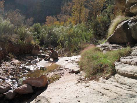 Hiker at Pipe Canyon crossing (view S) |
Table 9. Hiking Coordinates Based on GPS Data (NAD27; UTM Zone 12). Download Entire Route Hiking GPS Waypoints (*.gpx) file.
| Wpt. | Location | Easting | Northing | Elevation | Point-to-Point Time (min) | Cumulative Time (min) | Point-to-Point Distance (mi) | Cumulative Distance (mi) | Total Tonto Distance (mi)* |
|---|---|---|---|---|---|---|---|---|---|
| 75 | South Kaibab Trail junction | 402030 | 3449312 | 4,013 | 0:00 | 0:00 | 0.00 | 0.00 | 35.50 |
| 76 | Sign: "Tonto Trail - West" | 402032 | 3994278 | 4,011 | 0:00 | 0:00 | 0.03 | 0.00 | 35.53 |
| 77 | Little saddle behind a knob | 401902 | 3994190 | 4,028 | 0:03 | 0:03 | 0.10 | 0.13 | 35.63 |
| 78 | Crossing a side canyon | 401482 | 3993808 | 3,926 | 0:11 | 0:15 | 0.46 | 0.59 | 36.09 |
| 79 | Crossing a low saddle | 400874 | 3993486 | 3,915 | 0:22 | 0:37 | 0.71 | 1.30 | 36.80 |
| 80 | Crossing Burro Creek | 400919 | 3992800 | 3,717 | 0:31 | 1:08 | 0.77 | 2.07 | 37.57 |
| 81 | Crossing Pipe Wash | 400762 | 3992384 | 3,646 | 0:13 | 1:21 | 0.40 | 2.47 | 37.97 |
Happy Hiking! All distances, elevations, and other facts are approximate.
![]() ; Last updated 240326
; Last updated 240326
| Hiking Around Grand Canyon | Hiking Around Las Vegas | Glossary | Copyright, Conditions, Disclaimer | Home |