Hiking Around Las Vegas, Grand Canyon National Park
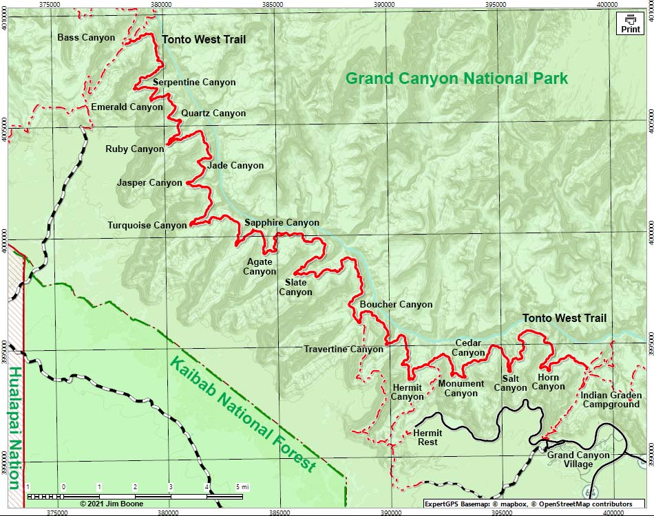
Note: Map based on shaded relief OpenStreetMap. North is at the top. Grid is UTM NAD27 CONUS. Roads are black (solid = paved; dashed = unpaved; width implies quality). Trails and routes are red (solid = main; dashed = adjacent or alternate). Washes, streams, and lakes are blue (solid = permanent; dashed = intermittent). National Park areas (boundaries dashed green, fill light green) based on NPS data. National Forest areas (boundaries dashed brown, fill light green) based on USFS data. Tribal Lands (boundaries solid red, fill crosshatch red) based on USGS data. Download waypoint coordinates from route description page. From the South Rim, the Tonto West Trail is accessed only by the Bright Angel, Hermit, and Bass trailheads.
Happy Hiking! All distances, elevations, and other facts are approximate.
![]() ; Last updated 210906
; Last updated 210906
| Tonto Trail -- Overview | Hiking Around Grand Canyon | Glossary | Copyright, Conditions, Disclaimer | Home |