Agate Canyon to Sapphire Canyon
Hiking Around Las Vegas, Grand Canyon National Park
Overview| Previous Segment | Next Segment
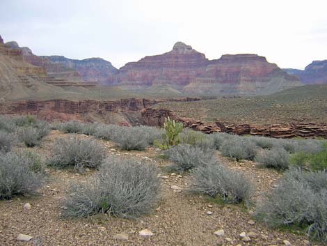
 Agate Wash (view SE) |
Overview This description of the Tonto West Trail is divided into two parts: (1) an overview of the entire trail, trailheads, and other general information, and (2) individual canyon-to-canyon segments. From the wash in Agate Canyon, it is about 1.8 miles and 1 hour to the wash in Sapphire Canyon. Seasonal water is available in Sapphire Wash. This segment of the trail runs out of Agate Canyon, loops around Pollux Temple, and runs back into Sapphire Canyon. The trail is always faint, and hikers should expect to spend some time off route and looking for the trail. This segment of the trail is in Backcountry Use Zone BO9 (at-large camping). Link to map of this segment. |
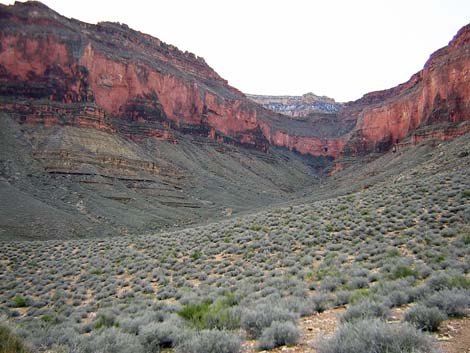 Agate Canyon (view S) |
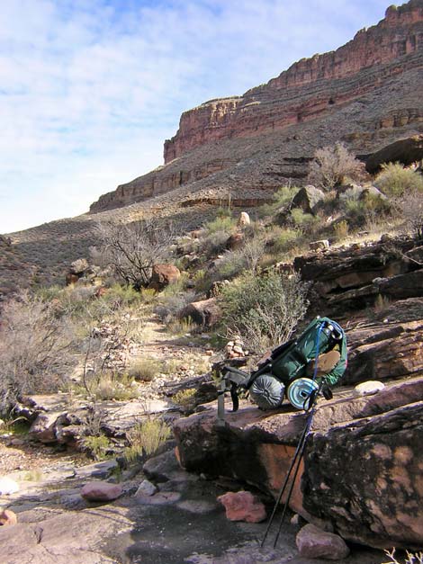
Watch Out Other than the standard warnings about hiking in the desert, ...be sure to read the Watch Out section on the Tonto West Overview page, which discusses things such as cell phones and signal mirrors. While hiking, please respect the land and the other people out there, and please try to Leave No Trace of your passage. Getting to the Trailhead Trailhead information is presented on the Tonto West Overview page. |
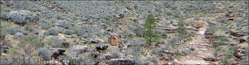
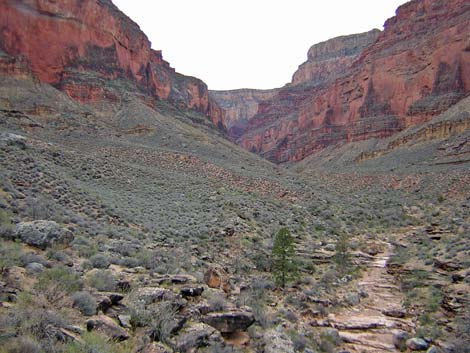
 North Rim from the end of Agate Canyon (view NE) |
The Hike 12. Agate Canyon to Sapphire Canyon -- 1.8 miles and 1 hour From the wash crossing in Agate Canyon (Table 12, Waypoint 070), the trail immediately cuts up a rocky gully for about 50 vertical feet to a catclaw acacia, climbs the 20-ft dirt bank on the right, and gets back on flats about 100 vertical-feet above Agate Wash. Watch for the bighorn skull at the base of the gully and another in the wash. |
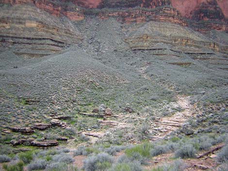
 Sapphire Canyon (view SW) |
Above the gully, the trail runs north along the contour to the base of another gully (Wpt 071) where it again cuts up the gully rather than continuing on the contour. The trail then generally climbs at a gentle grade and winds around several little gullies as it runs out to the point overlooking the river at the northwest corner of Agate Canyon (Wpt 072). The walking here generally is easy, and the trail is easy to follow. From the point overlooking the river (Wpt. 072), it is a brief walk on an easy trail to the northeast corner of Sapphire Canyon (Wpt. 073). As is usual for the Tonto Trail, there are nice campsites on the bluffs overlooking the river. However, on this section, the trail runs higher across the hillside than is usual, and the trail never really runs out to the edge of the cliffs overlooking the river. |
 Sapphire Canyon, edge of wash (view E) |
At the turn into Sapphire Canyon (Wpt. 073), which is on a broad, cactus-covered saddle, the trail becomes quite obscure. Watch carefully for the small cairns. After you get on the trail into Sapphire, the trail remains fairly obscure and rocky, but it is well cairned. In general, the trail starts high on the hillside and drops at a fair grade towards the back of the canyon. When starting into Sapphire Canyon, take note of a problem area across the canyon (trail out of Sapphire to the west) (Wpt. 076). Look across Sapphire Canyon and locate the only large side canyon on the west side of Sapphire. On the north edge of the side canyon, there is a low, white sandstone cliff with a cave and a pile of rubble (it looks like a mine with a tailings pile). The trail cuts up across the hillside, touching the lower edge of the rubble pile as it goes. Keep this in mind when you get there, as the turn in the trail is not entirely obvious and off-route cairns may lead you astray, staying low on the contour and following the old trail. |
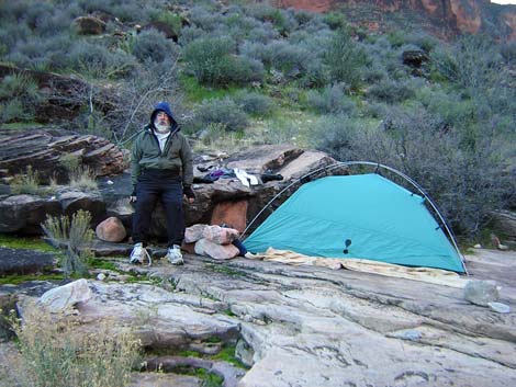 Campsite in Sapphire Canyon (view SE) |
The trail runs into the back of Sapphire Canyon, generally staying on the contour while trending downhill, but it stays above the streambed until steeply cutting down the bank into the wash and crossing Sapphire wash atop a pour-over at the edge of the Tapeats Sandstone (Wpt. 074). The trail crosses just above two pine trees that seem out of place. If the creek isn't flowing, water might be found in potholes below the trail. There are a few small campsites here. Some are just off the trail on the southeast side of the wash crossing, and the flat rocks at the edge of the pour-over make suitable campsites. |
Table 12. Hiking Coordinates Based on GPS Data (NAD27; UTM Zone 12). Download Entire Route Waypoint (gpx) file.
| Wpt. | Location | Time | Easting | Northing | Elevation (ft) | Verified |
|---|---|---|---|---|---|---|
| 070 | Agate Wash (43) | 1526 | 384408 | 3999196 | 3,120 | GPS |
| 071 | Trail cuts up gully (44) | 1548 | 384394 | 3999509 | 3,180 | GPS |
| 072 | Turn out of Agate drainage, campsite (45) | 1600 | 384321 | 4000142 | 3,273 | GPS |
| 073 | Turn into Sapphire drainage (46) | 1605 | 383953 | 4000257 | 3,245 | GPS |
| 074 | Sapphire Wash (47) | 1630 | 383113 | 3999594 | 3,044 | GPS |
| 076 | Cave with rubble pile (48.5) | -- | 383281 | 4000102 | 3,132 | GPS |
Happy Hiking! All distances, elevations, and other facts are approximate.
![]() ; Last updated 240326
; Last updated 240326
| Hiking Around Grand Canyon | Hiking Around Las Vegas | Glossary | Copyright, Conditions, Disclaimer | Home |