Turquoise Canyon to Jasper Canyon
Hiking Around Las Vegas, Grand Canyon National Park
Overview | Previous Segment | Next Segment
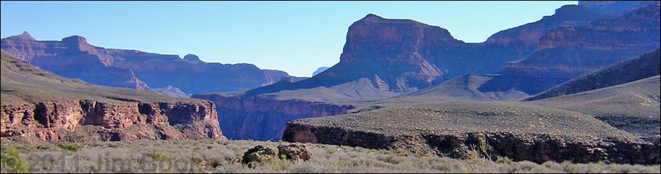
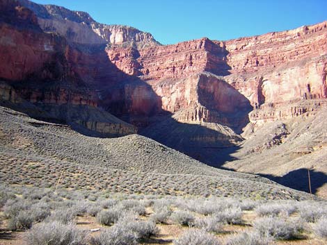
 Turquoise Canyon; trail runs atop cliffs (view SW) |
Overview This description of the Tonto West Trail is divided into two parts: (1) an overview of the entire trail, trailheads, and other general information, and (2) individual canyon-to-canyon segments. From the wash in Turquoise Canyon, it is about 2.4 miles and 1.5 hours to the wash in Jasper Canyon. Water is available from springs in Turquoise Canyon; expect no water in Jasper. This segment of the trail runs out of Turquoise Canyon, runs west along the Inner Gorge across the Shaler Plateau, and then runs back into Jasper Canyon. The trail is always faint, but it is almost entirely good and easy-to-follow the entire way. The "almost entirely" is the kicker; expect to spend some time off route and looking for the trail. Turquoise Canyon is in Backcountry Use Zone BO9 (at-large camping), and Jasper Canyon is in Zone BP9 (at-large camping). Link to map of this segment. |
 Turquoise Canyon (view SW) |
Watch Out Other than the standard warnings about hiking in the desert, ...be sure to read the Watch Out section on the Tonto West Overview page, which discusses things such as cell phones and signal mirrors. While hiking, please respect the land and the other people out there, and please try to Leave No Trace of your passage. Getting to the Trailhead Trailhead information is presented on the Tonto West Overview page. |
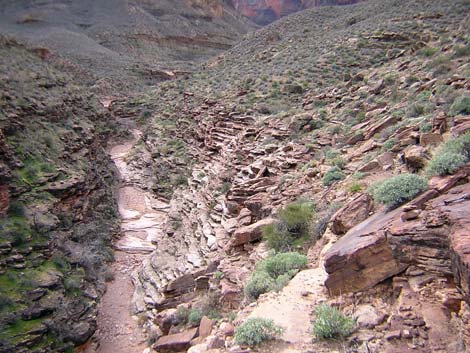
 Faint trail on Shaler Plateau (view N) |
The Hike 14. Turquoise Canyon to Jasper Canyon -- 2.4 miles and 1.5 hours The trail west from Turquoise Wash appears to start out running high, but from the flat camping area west of the crossing (Table 14, Waypoint 082), the trail drops onto slabs and ledges and runs along the steep, cliffy hillside right on the edge of the gorge. The narrow, rocky, precipitous trail is relatively well cairned and easy-to-follow. The trail passes two side canyons on the contour, and about 30 minutes out, passes a side gully (Wpt. 083). Coming out of the gully, the trail abruptly turns west and starts up the rocky hillside. The trail cuts up and through a little band of cliffs before crossing into the next little gully. The trail is well cairned, but an obvious off-route trail continues on the contour until it fades out into the hillside. |
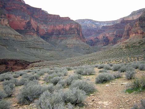
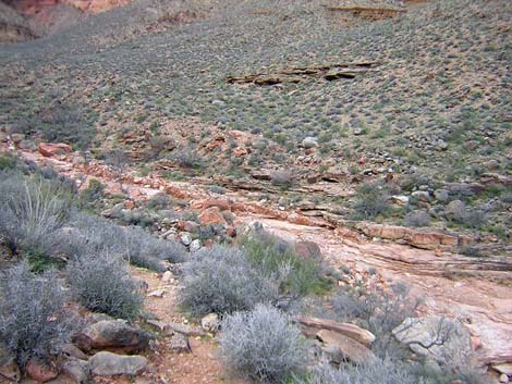
 Jasper Canyon from Shaler Plateau (view NW) |
The trail crosses the next gully above the band of cliffs (Wpt. 084), then continues up and across the hillside to a broad saddle with campsites (Wpt. 085) that marks the exit from the Turquoise drainage system. From the saddle (Wpt. 085), a faint, but easy-to-follow trail runs north across flats and a rocky hillside to another broad saddle with campsites (Wpt. 086) at the turn into Jasper Canyon. |
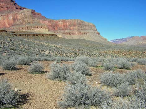
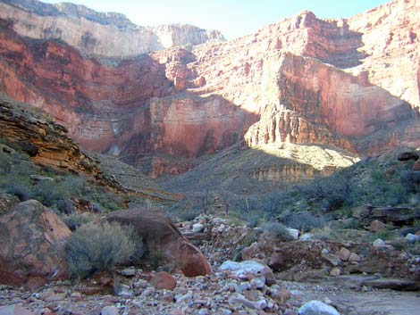
 Jasper Wash (view NW) |
The faint trail, which almost entirely good and easy to follow, runs across gentle slopes about halfway back into Jasper Canyon. The "almost entirely" is the kicker. I lost the trail several times on the way west, but it was fine on the way east. There are some useful landmarks on this section. About 10 minutes past the broad saddle (Wpt. 086), the trail crosses a shallow gully right below an unusually large boulder. The trail then runs out across gentle slopes for about 5 minutes to a tall, triangular finger of rock with a white tip (white from bird droppings). There is some multiple trailing near the triangular rock, but the main trail passes about 5 yards north of the triangular rock. From there, the trail runs west and cuts straight down the steep hillside (3 minutes) into a boulder-filled gully. |
 Jasper Wash (view W) |
The trail works through the gully, crossing below the largest boulder and above the pour-over, and cuts out on the contour. The trail crosses a rocky hillside (4 more minutes), and then crosses another gully just above the largest boulder and the pour-over. The narrow trail then descends across a rocky hillside (15 minutes) to Jasper Wash (Wpt. 087). I missed the trail going west, but it was mostly well cairned and easy to follow on the way east. The trail crosses Jasper Wash about 300 m east of (below) where the USGS topo shows the crossing. Jasper Canyon is wide and open at the crossing (Wpt. 087) because it is far out from the Redwall. As in other places, the trail crosses the wash on slickrock, but the rock layers here are angled down and don't form pour-overs. Hiking east, note that you can see the triangular rock from the crossing, so you have a landmark for getting started. |
Table 14. Hiking Coordinates Based on GPS Data (NAD27; UTM Zone 12). Download Entire Route Waypoint (gpx) file.
| Wpt. | Location | Time | Easting | Northing | Elevation (ft) | Verified |
|---|---|---|---|---|---|---|
| 082 | Turquoise Wash (53) | 1012 | 381067 | 4000436 | 2,978 | GPS |
| 083 | Easy gully (54) | 1043 | 381846 | 4001246 | 3,054 | GPS |
| 084 | Crossing gully (55) | 1050 | 381956 | 4001371 | 3,128 | GPS |
| 085 | Exit Turquoise (56) | 1056 | 382089 | 4001594 | 3,187 | GPS |
| 086 | Turning into Jasper (57) | 1109 | 382024 | 4002155 | 3,231 | GPS |
| 087 | Jasper Wash (58) | 1146 | 381193 | 4002455 | 3,148 | GPS |
Happy Hiking! All distances, elevations, and other facts are approximate.
![]() ; Last updated 240326
; Last updated 240326
| Hiking Around Grand Canyon | Hiking Around Las Vegas | Glossary | Copyright, Conditions, Disclaimer | Home |