Quartz Canyon to Emerald Canyon
Hiking Around Las Vegas, Grand Canyon National Park
Overview | Previous Segment | Next Segment
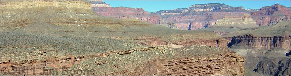
 Quartz Canyon (view SW) |
Overview This description of the Tonto West Trail is divided into two parts: (1) an overview of the entire trail, trailheads, and other general information, and (2) individual canyon-to-canyon segments. From the wash in Quartz Canyon, it is about 1.9 miles and 1.25 hours to the wash in Emerald Canyon. Water is not available on this segment. This segment runs northeast out of Quartz Canyon, crosses a ridge below the south toe of Havasupai Point, then runs north below the point, crosses a ridge below the north toe of Havasupai Point, and runs west into the south and north horns of Emerald Canyon. The trail is always faint, but it is fairly easy to follow. The trail between the two horns of Emerald Canyon is a bit airy. This segment of trail is in Backcountry Use Zone BP9 (at-large camping). Link to map of this segment. |
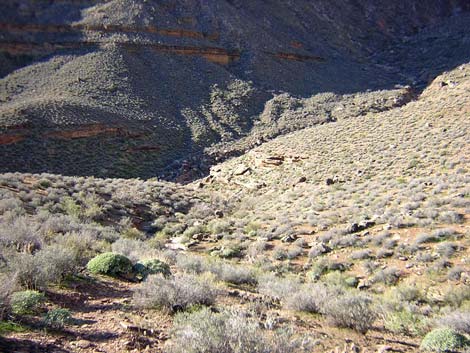
 Trail between Quartz and Emerald canyons (view N) |
Watch Out Other than the standard warnings about hiking in the desert, ...be sure to read the Watch Out section on the Tonto West Overview page, which discusses things such as cell phones and signal mirrors. While hiking, please respect the land and the other people out there, and please try to Leave No Trace of your passage. Getting to the Trailhead Trailhead information is presented on the Tonto West Overview page. |
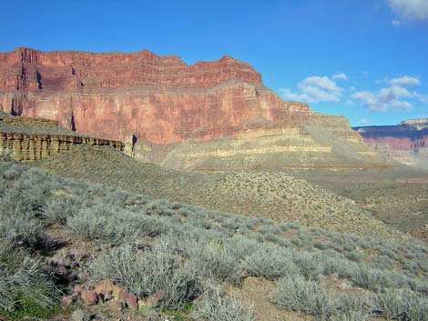
 North Rim behind Emerald Canyon and the Inner Gorge (view NE) |
The Hike 18. Quartz Canyon to Emerald Canyon -- 1.9 miles and 1.25 hours From the wash crossing in Quartz Canyon (Table 18, Waypoint 099), the trail west climbs steeply out of the gorge just upstream from some large boulders. After 1 minute, the trail gets above the cliffs, turns, and runs above the cliffs following the contour out of the canyon. After another 3 minutes, the trail turns into the first side canyon and runs up the gully toward a large natural cairn (funny, square, layered boulder about 2-3 feet on a side). The trail then leaves the contour, runs up the hillside for a short way on a fairly steep trail to a broad saddle (Wpt. 100). From there, the grade eases as the trail runs out to a ridge (Wpt. 101) and turns out of the Quartz Canyon drainage. |
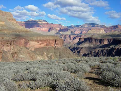
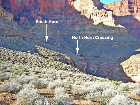 Emerald Canyon (view W) |
From the ridge (Wpt. 101), the trail runs northwest for about 10 minutes to a saddle (Wpt. 102) with a marginal campsite behind a rocky knob. Coming off this saddle, the trail switchbacks steeply down the hillside to get below two bands of cliffs, then contours out under the lower cliffs. The trail then cuts across a rocky gully and a hillside until breaking out onto gentle slopes as it contours up onto the next saddle (Wpt. 103) and turns into the Emerald drainage system. The trail across here is well cairned and easy-to-follow, and there are good campsites with grand views on the saddle (Wpt. 103). |
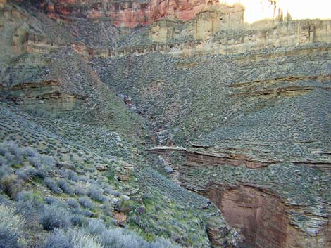 Emerald Canyon, north horn (view W) |
The trail into Emerald starts out fast and easy. The trail runs across a gentle sidehill into a rocky side canyon, which the trail passes below an enormous boulder. From there to the back of Emerald, the trail runs in a series of gentle contours across hillsides linking steep rocky gullies. Towards the back of the canyon, the trail becomes steep and narrow as it cuts up and down around rocks and bushes above precipitous cliffs on a steep, rocky hillside. The trail eventually drops steeply into the south horn of Emerald Canyon (Wpt. 104) (the main canyon, but Emerald looks like it has two horns), which is crossed behind an enormous limestone boulder just above the pour-over atop the Tapeats. There are no campsites and no water here. |
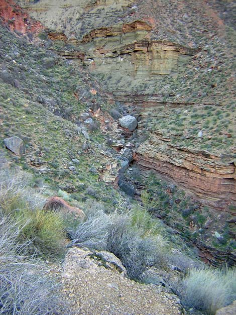 Limestone boulder at east horn crossing (view SW) |
The trail continues north from the enormous limestone boulder to cross a steep, precipitous, green shale hillside. Part of this trail was built up long ago using rocks and logs, but it is falling away now. The trail seems safe, but it adds excitement to this precipitous bit of trail. The trail continues north for a couple of minutes into the north horn of Emerald Canyon (Wpt. 105), which is crossed on a nice, secure feeling stretch of slickrock above a pour-over in the Tapeats Sandstone. A pothole below the trail near the edge of the abyss holds water during winter, and other than the slickrock, there are no campsites here. |
Table 18. Hiking Coordinates Based on GPS Data (NAD27; UTM Zone 12). Download Entire Route Waypoint (gpx) file.
| Wpt. | Location | Time | Easting | Northing | Elevation (ft) | Verified |
|---|---|---|---|---|---|---|
| 099 | Quartz Wash (70) | 0835 | 380178 | 4005396 | 3,252 | GPS |
| 100 | Top of steep hillside (71) | 0847 | 380362 | 4005568 | 3,351 | GPS |
| 101 | Exit Quartz drainage (72) | 0855 | 380543 | 4005867 | 3,423 | GPS |
| 102 | Saddle by rocky knob (73) | 0905 | 380367 | 4006047 | 3,414 | GPS |
| 103 | Top of ridge (74) | 0916 | 380245 | 4006452 | 3,400 | GPS |
| 104 | Emerald Wash, south (boulder) horn (75) | 0942 | 379368 | 4006140 | 3,163 | GPS |
| 105 | Emerald Wash, north (slickrock) horn (76) | 0946 | 379381 | 4006257 | 3,209 | GPS |
Happy Hiking! All distances, elevations, and other facts are approximate.
![]() ; Last updated 240326
; Last updated 240326
| Hiking Around Grand Canyon | Hiking Around Las Vegas | Glossary | Copyright, Conditions, Disclaimer | Home |