Serpentine Canyon to Bass Canyon
Hiking Around Las Vegas, Grand Canyon National Park
Overview | Previous Segment
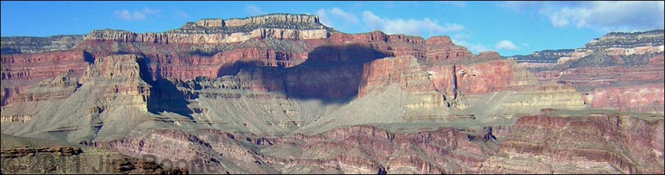
 Serpentine Canyon (view NE) |
Overview This description of the Tonto West Trail is divided into two parts: (1) an overview of the entire trail, trailheads, and other general information, and (2) individual canyon-to-canyon segments, of which this page is one. From the wash in Serpentine Canyon, it is about 4.4 miles and 1.75 hours to the Tonto-Bass Canyon trail junction (near the wash in Bass Canyon). Seasonal water is available in Serpentine and Bass canyons. This segment runs east out of Serpentine Canyon, turns north, and runs along the Inner Gorge to the Grand Scenic Divide, then turns west and runs back into Bass Canyon. The Grand Scenic Divide is a ridge that blocks views up and down the canyon. The trail is always faint, but it is fairly easy to follow. The east side of the Grand Scenic Divide is in Backcountry Use Zone BP9 (at-large camping), and the west side is in BQ9 (at-large camping). Link to map of this segment. |
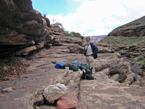
 Trail into Serpentine Canyon (view SW) |
Watch Out Other than the standard warnings about hiking in the desert, ...be sure to read the Watch Out section on the Tonto West Overview page, which discusses things such as cell phones and signal mirrors. While hiking, please respect the land and the other people out there, and please try to Leave No Trace of your passage. Getting to the Trailhead Trailhead information is presented on the Tonto West Overview page. The Hike 20. Serpentine Canyon to Bass Canyon -- 4.4 miles and 1.75 hours From atop the slickrock pour-over at Serpentine Wash (Table 20, Waypoint 107), the trail runs northwest on the contour for about 8 minutes into the back of the first major side canyon. The trail then climbs steeply up a rocky hillside for quite a ways, but there is a good trail all the way into the next broad, rocky side canyon. In fact, the trail is fairly good and easy to follow across all of the side canyons and gullies on the way out to the point overlooking the river (Wpt. 108) where the trail leaves the Serpentine drainage system. There are campsites on the saddle where the trail crosses the ridge. From the point (Wpt. 108), an indistinct trail cuts steeply down the hillside from the east edge of the campsites and crosses the first little gully just below a 4-inch-thick band of rock. The start is marked with cairns, and it leaves by two yuccas growing so close together that they touch (I missed the trail here going west and stayed too high). |
 Campsite on saddle (view N) |
The trail runs north, crossing a major side canyon just above an enormous boulder, and then climbs a cliffy section on a good, easy-to-follow trail to the next saddle with campsites (Wpt. 109). The trail continues north, passing a windy promontory with a campsite on the edge of the cliffs and a grand view of the river (Wpt. 110). The trail continues north and crosses the Grand Scenic Divide (Wpt. 111), a ridge that blocks views through the canyon from this point east and this point west. The trail crosses the Grand Scenic Divide (Wpt. 111) and turns west into Bass Canyon. For about two-thirds of the way back into the canyon, the trail runs across hillsides gently descending along the contour. About 15 minutes out, the trail drops steeply down a hillside to the bottom of a side canyon. From there, however, the trail moderates as it drops across the rocky hillside into the bottom of Bass Canyon and the Bass Canyon Trail junction (Wpt. 112). |
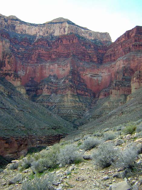
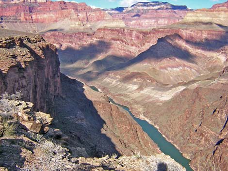 North Bass Amphitheater and Colorado River (view N from trail) |
Marginal campsites are available on the Bass Trail just below the junction. Seasonal water is available in the wash at a pour-over about 20 minutes down the Bass Trail (and more campsites). The river is about 1 hour down the Bass Trail. The junction with the Bass Trail marks the official end of the Tonto West Trail. The Bass Trail runs up the canyon to the rim and down to the Colorado River, and other trails continue west along the Tonto Platform. If you are like me, you might hike down to the river, rest for the night, and then turn around and walk back across the Tonto. |
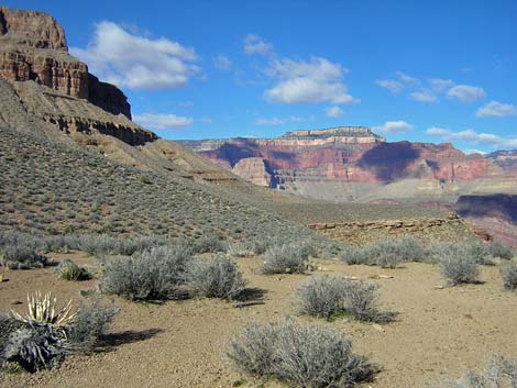
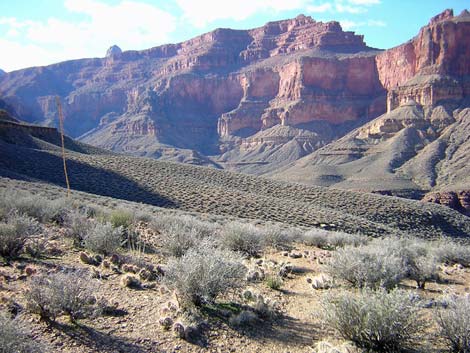 Bass Canyon from Grand Scenic Divide (view W) |
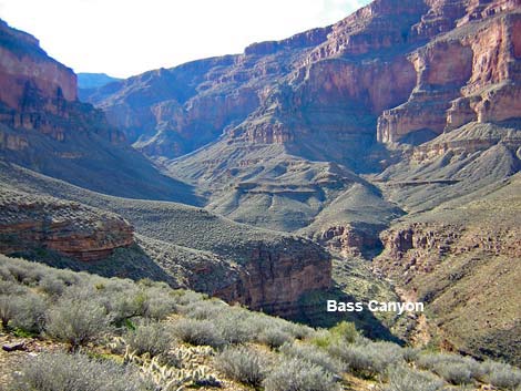 Tonto Trail overlooking Bass Canyon (view SW) |
Table 20. Hiking Coordinates Based on GPS Data (NAD27; UTM Zone 12). Download Entire Route Waypoint (gpx) file.
| Wpt. | Location | Time | Easting | Northing | Elevation (ft) | Verified |
|---|---|---|---|---|---|---|
| 107 | Serpentine (78) | 1030 | 378618 | 4006642 | 3,051 | GPS |
| 108 | Exit Serpentine drainage (79) | 1155-1337 | 379977 | 4007715 | 3,408 | GPS |
| 109 | Saddle with nice camps (90) | 1208 | 379787 | 4008103 | 3,464 | GPS |
| 110 | Windy promontory (80) | 1220 | 379729 | 4008629 | 3,426 | GPS |
| 111 | Grand Scenic Divide (81) | 1233 | 379518 | 4009187 | 3,471 | GPS |
| 112 | Tonto-Bass trail junction (82) | 1330 | 378341 | 4008721 | 3,189 | GPS |
Happy Hiking! All distances, elevations, and other facts are approximate.
![]() ; Last updated 240326
; Last updated 240326
| Hiking Around Grand Canyon | Hiking Around Las Vegas | Glossary | Copyright, Conditions, Disclaimer | Home |