Hiking Around Las Vegas, Gold Butte National Monument
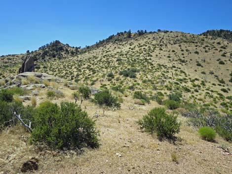
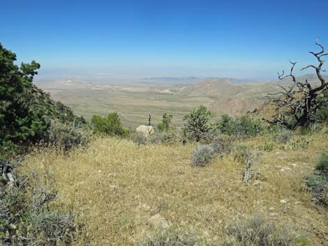
 Billy Goat Peak trailhead parking (view S) |
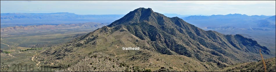
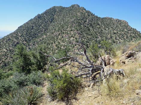
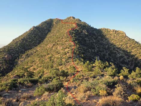
Overview Billy Goat Peak (5,701 ft) is a tough hike to a minor peak in the middle of some of the wildest country in southern Nevada. Why bother to go so far to climb a minor peak? Spectacular views. Enough said. The route runs south through a 2005 burn area of Mojave Desert Scrub to contour around a forested knob (Pinyon-Juniper Woodland life zone) and drop into a saddle on the north side of Billy Goat Peak. From the saddle, hikers need to make a choice: (1) continue straight up the North Ridge until forced into the North Face, or (2) traverse into the North Face and head up the steep slope. Everyone will want to descend via the North Face. Don't let this short hike fool you; it is only 1.2 miles to the peak, but the last half-mile is tough. Link to hiking map or elevation profile. Photos of North Ridge route, North Face route, descending the North Face. |
 |
Watch Out Other than the standard warnings about hiking in the desert, ...this is a tough hike in a wild and remote place. The route is steep, rocky, brushy, and requires a bit of Class III or IV scrambling depending on how you go, so be careful out in this remote area because even a twisted ankle could be a serious problem with help so far away. The access road is a maintained two-track and has a rough patch in the middle; with a 2WD vehicle, consider parking near Whitney Pass Road and walking. This is a wild and remote area without services of any kind (no restrooms, no water, no gas, no food). Bring what you need to survive. Be prepared and be self-reliant. Someone will find you eventually if you stay on a main road, but be prepared to survive alone for a day or two. Cell phones work from the summit. While hiking, please respect the land and the other people out there, and try to Leave No Trace of your passage. Also, this is a remote hike, so be sure to bring the 10 Essentials. |
 |
Getting to the Trailhead Billy Goat Peak is located out in Gold Butte National Monument at the northeast end of Lake Mead, about 2.5 hours northeast of Las Vegas in a wild, remote, and scenic area south of Mesquite. From town, drive out to Gold Butte National Monument. From the end of the pavement at Whitney Pocket, continue south 100 yards on the unpaved Gold Butte Road to Whitney Pass Road on the left. Turn onto Whitney Pass Road and drive east into the mountains. Atop Whitney Pass, with grand views east out over northern Arizona, continue east 0.4 miles to Billy Goat Peak Road, on the right. Turn onto Billy Goat Peak Road and drive south 0.36 miles to the end of the road. Park here; this is the trailhead. The end of the road has limited parking, with little more than enough room to turn around one full-sized pickup. Just before the end of the road, it forks. Some drivers might want to stay left on the easier grade and park on the outside of the curve where there is room to park 2-3 vehicles on fairly level ground. |
 |
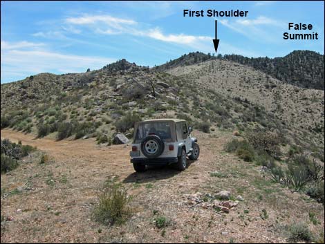
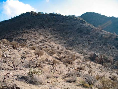
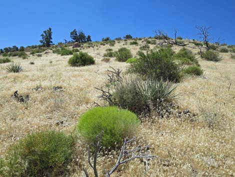
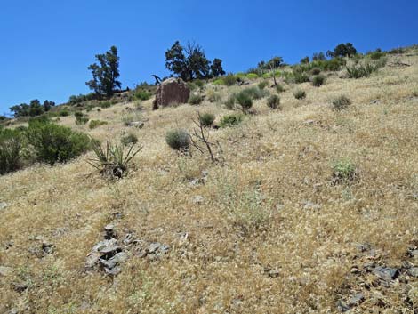
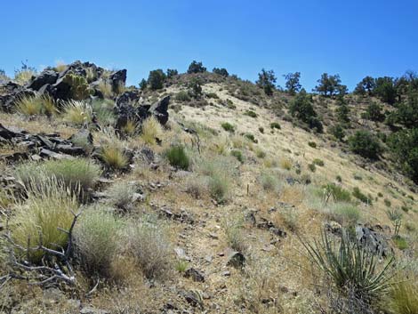
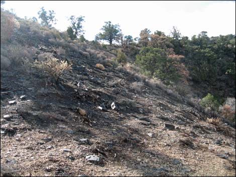
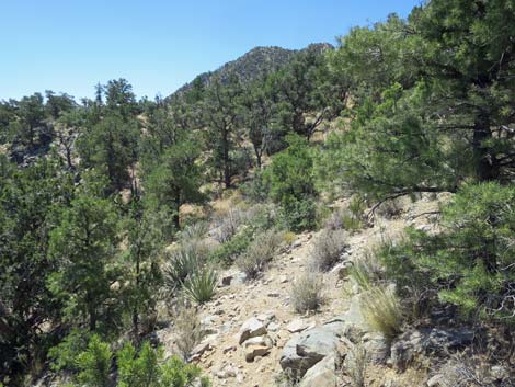
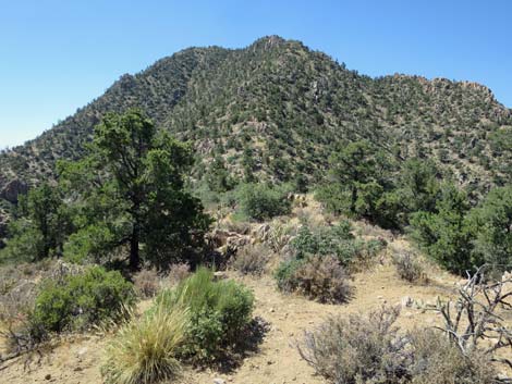
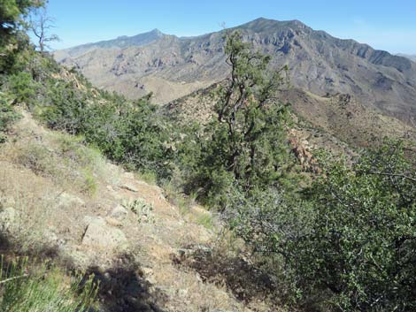
The Hike From the trailhead (Table 1, Wpt. 01) atop the ridgeline at the end of the road, the route runs south on the west-facing slope to avoid rock piles that line the crest of the ridge. There is no trail, barely a use-trail in places, but the area burned in July 2006 (230 acres) and the returning shrubby vegetation is still sparse, so walking between the rocks and the shrubs is fairly easy. This area is in the uppermost Mojave Desert Scrub Life Zone, but most of the shrubs and trees are gone. Some species are growing back after the fire, and Stansbury Cliffrose, Narrowleaf Goldenbush, and Buckhorn Cholla are returning, but it will never be the same. Unfortunately, the landscape is covered with the invasive Red Brome Grass that carried the 2006 fire. For hikers, the first goal is to climb onto the east shoulder of the knob that, in this view, falsely appears to be the summit. After following along the initial ridgeline, the route dips into a shallow saddle, and from there a good route is to head straight up the slope aiming for the left-most of the Singleleaf Pinyon Pines ahead on the skyline. |
 Route crosses first shoulder of knob (view S; January 2008) |
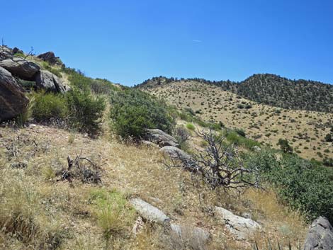
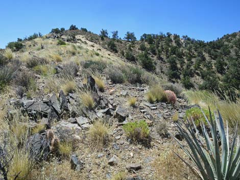
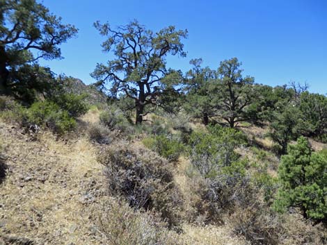
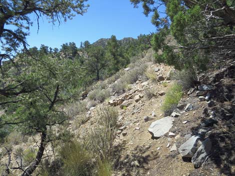
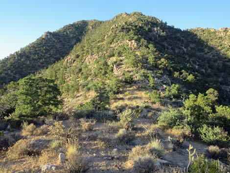
The pines are on the next ridgeline, which is followed up until an animal trail (Bighorn Sheep and Mule Deer here) is found crossing the slope into the next set of pine trees on the higher ridgeline (Wpt. 02), which is the east shoulder of the false-summit knob. As the route climbs onto the first shoulder, it crosses out of the burn area and into a Pinyon-Juniper Woodland, evidenced by lots of Singleleaf Pinyon Pine and a few Utah Juniper. Most of the shrubs in this area are Blackbrush, but Cliffrose, Shrub Live Oak, Utah Agave, and Banana Yucca are common, and there is a fair bit of cactus, including Buckhorn Cholla, Mojave Kingcup Cactus, Barrel Cactus, Grizzlybear Pricklypear Cactus, and even Pancake Pricklypear. From the first shoulder (Wpt. 02), the route contours southwest across the hillside on an animal trail aiming to pass below and east of the false-summit knob. In this area, an historical barbed-wire fence lies below the trail. |
 |
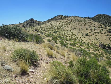
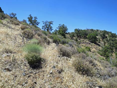
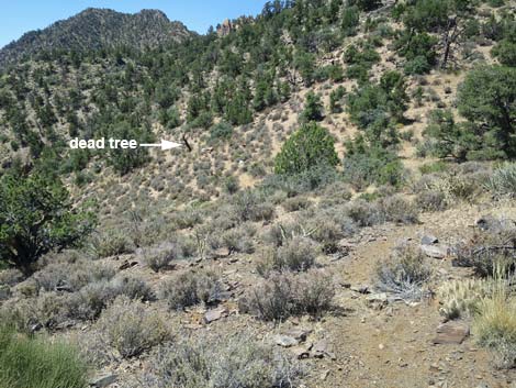
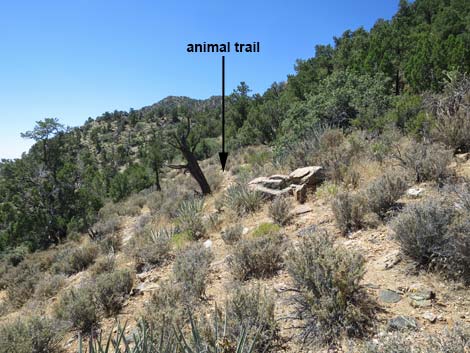
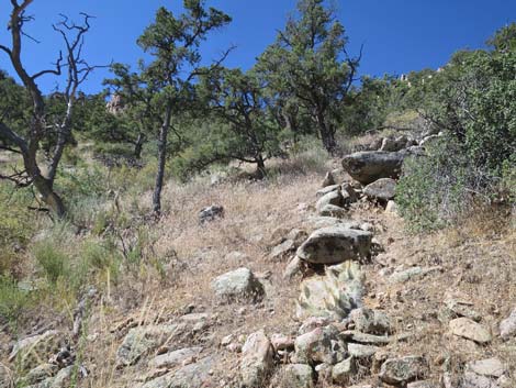
Trails are quite useful in this brushy, rocky terrain, but animal trails tend to appear and disappear, often for no apparent reason. Here, a useful animal trail begins adjacent to a dead pinyon pine (Wpt. 03) on the open slope below the barbed-wire fence. After traversing along the ridgeline, but becomes useful leave a good animal trail, step over the fence, and hike directly to the dead tree. From the dead tree (Wpt. 03), the animal trail can be followed south across the hillside and below an upright, oblong boulder on the next ridgeline. This unusual rock makes a good landmark when returning down the mountain. The route climbs onto a slightly higher second shoulder on the ridge (Wpt. 04) beyond the oblong boulder. This second shoulder provides the first good view of the main saddle and the route to the summit. From the second shoulder, the route contours around to the main ridgeline and follows it south and down into the deep saddle (Wpt. 05) between the false-summit knob and Billy Goat Peak, proper. |
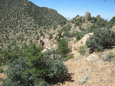
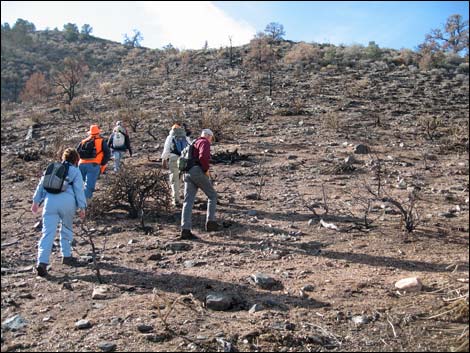 Hikers on trail after the wildfire (view S; January 2008) |
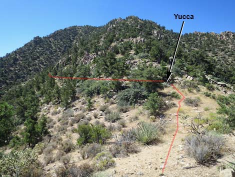
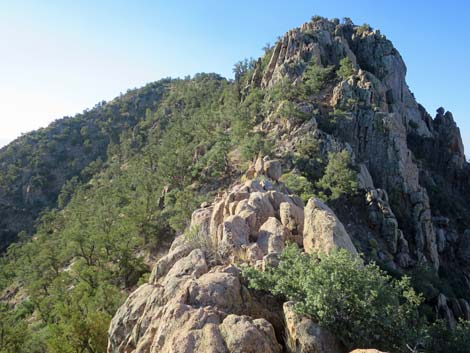
From the big saddle, there are two basic routes to the summit: (1) straight up the North Ridge until forced into the North Face, or (2) traverse onto the North Face and head all the way up the steep slope. Neither route is particularly nice, and when about 3/4ths of the way up, either will make you wonder why anyone in their right mind would want to climb this peak. North Ridge Route The obvious route is to continue south following the North Ridge to the summit, but hikers are eventually forced onto the North Face to bypass the summit cliffs. The ridgeline, for as far as it can be followed, is a maze of rocky outcrops and thick brush, forcing hikers back and forth, even backing down, as they search for a route forward. Trying to regain the ridgeline, and repeatedly being forced back onto the steep side-slopes becomes tiring and dangerous. |
 |
High on the ridgeline, hikers are funneled onto a narrow coxcomb of rounded, eroding boulders with 30- to 50-ft drop-offs on both sides. Not wanting to back down, hikers are pushed into delicate Class IV maneuvers on decomposing rock to continue uphill. Either just before or just after the coxcomb, hikers are finally forced onto the North Face for a last time. Now avoiding all cliffs, the route climbs to the Summit Ridge (Wpt. 06) where it joins the North Face route. Because this is a north-facing slope, the soil moisture is high, and the brush is thick. Much of the brush is Shrub Live Oak, which has stiff branches and is tough to get through, but there is also a fair bit of Desert Gooseberry with its nasty little spines. There is, however, less cactus on this colder side of the mountain. |
 |
North Face Route To avoid the perils of the North Ridge (brush, cliffs, Class IV maneuvers, and the Gooseberry), hikers might rather traverse out onto the North Face to make their way up. Certainly, this is a better way to come down. From the main saddle (Wpt. 05), it is useful to walk forward a few yards to a large Banana Yucca growing between two, low pinyon pines. Stepping between the pines, a fairly open route traverses out onto the North Face following along below a band of low cliffs. Passing beyond the band of cliffs, the route contours around the back of a wide, steep-sided gully, to emerge out onto the North Face, proper. From there, it is a steep hike up the face winding between trees and shrub patches, sometimes climbing through downed pine tree branches, all the while trying not to slip on the loose soils. Avoiding rocky cliffs all the way up, the route eventually pops onto the Summit Ridge (Wpt. 06) and joins with the North Ridge route. |
 |
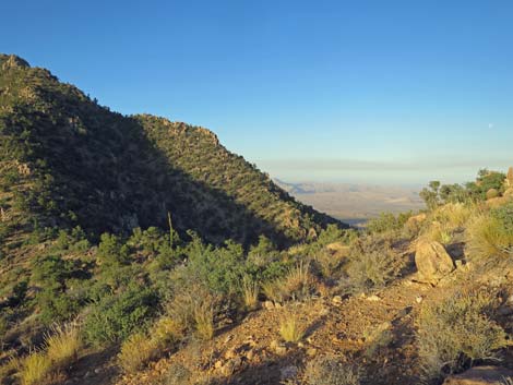
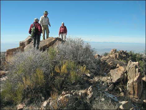
On the summit ridge (Wpt. 06), and with the summit at hand, the route runs a few yards towards the summit, traverses onto the west-facing slope, regains the summit ridge, and arrives at the peak (Wpt. 07). Regardless of how one gets there, gaining the summit of this seldom-visited peak rewards hikers with some of the most spectacular views in all of southern Nevada. To the north is Virgin Peak, to the east are the Grand Wash Cliffs in Arizona, to the south are mountains in Arizona beyond Gold Butte (not to mention Gold Butte Peak, Tramp Ridge, Lime Ridge, and adjoining peaks and ridges), and to the west are Lake Mead and mountain ranges extending as far as the Spring Mountains. When ready, return to the trailhead by following your footprints back down the mountain, or at least back to the Summit Ridge (Wpt. 06), but from there it might be worth trying to find an easier way. Heading east from the summit and then down the Northeast Ridge is not a good route. |
 Approaching the first shoulder (view SW; July 2019) |
 Approaching the first shoulder (view SW; January 2008) |
 Arriving at the first shoulder (view S) |
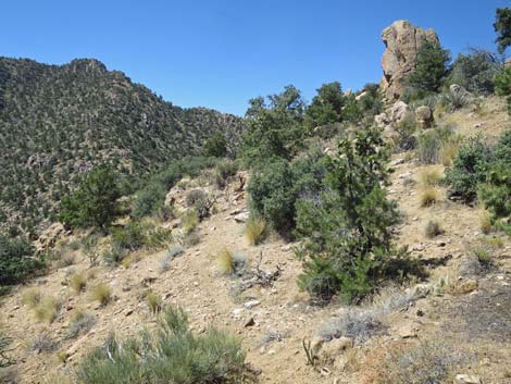
 In the shade of a tree, the summit comes into view (view S) |
 Animal trail traverses the side of the ridge (view W) |
 A dead tree marks the start of a useful animal trail (view SW) |
 A useful animal trail starts after this dead tree (view SW) |
 Traversing steep hillsides on animal trail (view SW) |
 Traversing rocky hillsides on animal trail (view SW) |
 On a shoulder, the oblong boulder comes into view (view SW) |
 The animal trail traverses towards the oblong boulder (view SW) |
 The animal trail traverses towards the oblong boulder (view SW) |
 The animal trail traverses below the oblong boulder (view SW) |
 The animal trail continues onto the next ridgeline (view SW) |
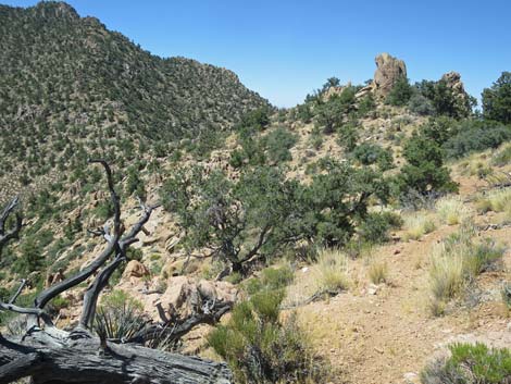
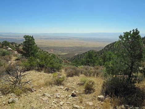
 Nice morning view towards Lake Mead (view SW) |
 The animal trail fades, but the route runs down the ridge (view S) |
 Approaching the main saddle (view S) |
 Arriving at the main saddle (view S) |
 At the main saddle, grand views across southern Nevada (view W) |
 At the main saddle, grand views across northern Arizona (view E) |
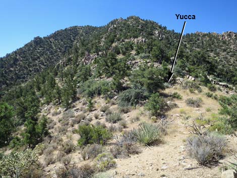 Just past the saddle, the routes diverge at the Yucca (view S) |
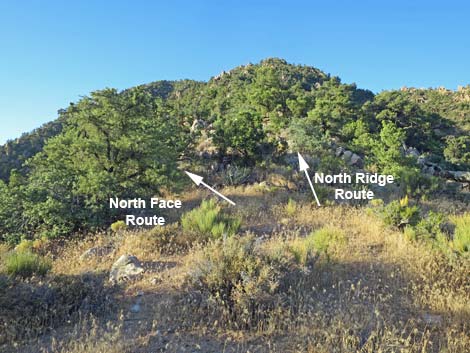 At the Yucca, the North Face and North Ridge routes split (view S) |
 North Face route traverses left off the ridge (view S) Link to Details |
 North Face: steep, but fairly open slope (view S) Link to Details |
 North Ridge route climbs the ridgeline (view S) Link to Details |
 North Ridge: lots of cliffs and brush (view S) Link to Details |
 Summit views --link to additional photos |
 The descent -- link to additional photos |
Table 1. Hiking Coordinates Based on GPS Data (NAD27; UTM Zone 11S). Download Hiking GPS Waypoints (*.gpx) file.
| Wpt. | Location | UTM Easting | UTM Northing | Elevation (ft) | Point-to-Point Distance (mi) | Cumulative Distance (mi) |
|---|---|---|---|---|---|---|
| 01 | Trailhead | 762710 | 4046073 | 4,644 | 0.00 | 0.00 |
| 02 | First Shoulder | 762847 | 4045628 | 5,023 | 0.33 | 0.33 |
| 03 | Dead Tree | 762775 | 4045525 | 5,116 | 0.10 | 0.43 |
| 04 | Second Shoulder | 762767 | 4045347 | 5,202 | 0.12 | 0.55 |
| 05 | Main Saddle | 762734 | 4045097 | 5,085 | 0.19 | 0.74 |
| 06 | Saddle Below Summit | 762867 | 4044616 | 5,687 | 0.45 | 1.19 |
| 07 | Billy Goat Peak Summit | 762907 | 4044594 | 5,718 | 0.03 | 1.22 |
| 01 | Trailhead | 762710 | 4046073 | 4,644 | 1.22 | 2.44 |
Note: All distances, elevations, and other facts are approximate.
![]() ; Last updated 240325
; Last updated 240325
| Hiking Around Gold Butte | Hiking Around Las Vegas | Glossary | Copyright, Conditions, Disclaimer | Home |