Hiking Around Las Vegas, Gold Butte National Monument
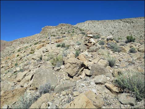
 Bitter Ridge Trailhead parking and route outline (view NW) |
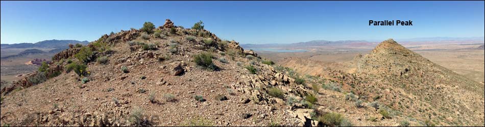
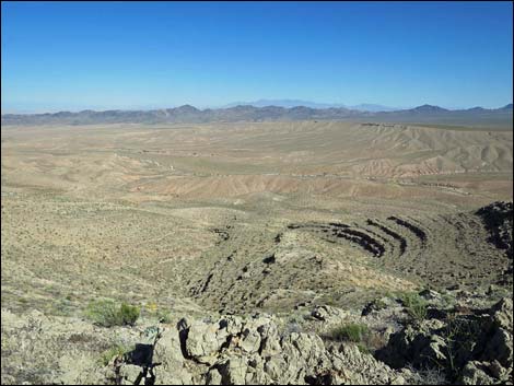
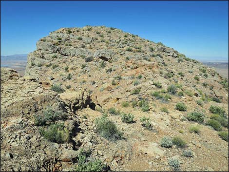
Overview Bitter Ridge is a striking, isolated limestone ridge located on the desert flats west of Whitney Pocket and overlooking the Overton Arm of Lake Mead. From afar and from up close, the ridge is striking. The ridge looks long, and the highpoint at Parallel Peak looks high, but the hike is surprisingly short at only 2 miles round-trip. The hike starts from the highpoint on Black Butte Road and climbs a steeply onto Bitter Ridge. From there, the hiking is relatively easy as the route runs southwest following the narrow ridgeline. At most of a mile out, hikers will swear that they have arrived on the summit (after all, it is high and is complete with a huge summit cairn), but careful examination proves the summit is a bit farther west. While it is nice to bag the true summit, the views are no better than those from the false summit. So stop or go, it matters little: hikers can see peaks in Nevada, Arizona, and Utah, and maybe California, from both summits. Link to hiking map. See also Summit Views or Descent from the Peak. |
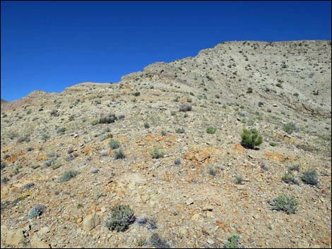
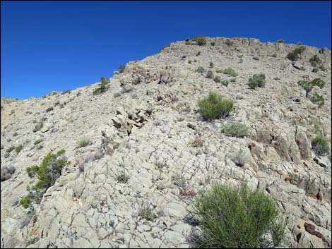
 The route onto the ridgeline (view NW from the trailhead) The route onto the ridgeline (view NW from the trailhead) |
Watch Out Other than the standard warnings about hiking in the desert, ... this is a fairly safe route. Trekking poles might be nice for getting from the trailhead to the crest of the ridge (steep slopes and scree), but they could be left on the ground at that point. There are places along the route and on the summit with precipitous edges, so pay extra attention to your footing in those areas. This is a wild and remote area without services of any kind (no restrooms, no water, no gas, no food). Bring what you need to survive. Be prepared and be self-reliant. Someone will find you eventually if you stay on a main road, but be prepared to survive alone for a day or two. Cell phones only work along parts of the paved road. While hiking, please respect the land and the other people out there, and try to Leave No Trace of your passage. Also, even though this hike is short, the area is remote, so be sure to bring the 10 Essentials. |
 An old road passes a mining cairn with a 4x4 wooden post (view NW) |
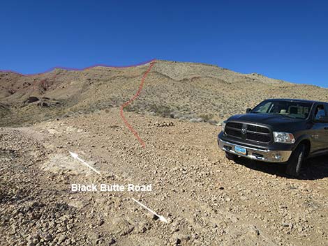
Getting to the Trailhead Bitter Ridge is located out in Gold Butte National Monument at the northeast end of Lake Mead, about 2.5 hours northeast of Las Vegas in a wild, remote, and scenic area. From town, drive out to Gold Butte National Monument. From Whitney Pocket, turn around and drive back north for 1.4 miles to Black Butte Road, an unmarked dirt road to the west. This is just past a large sandstone crag with campsites around the base. Turn left and drive west on Black Butte Road. Black Butte Road stays left at a fork, passes through the Falling Man Trailhead area, crosses washes and runs up over low ridges until dropping into Sand Wash, 3.5 miles from the pavement. From Sand Wash, the road climbs and climbs, steeply at times. When the road rolls over and begins to drop steeply into the canyon below on the left, turn right into an unvegetated area. Park here; this is the trailhead. |
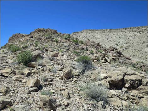
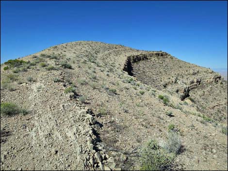
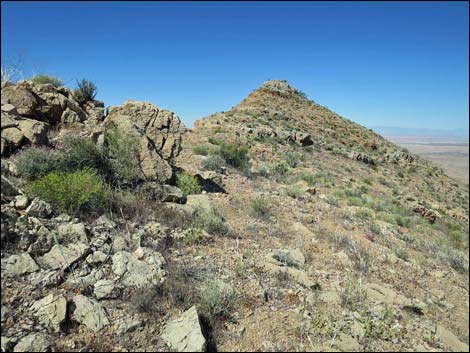
 Mining cairns on rocky side-ridge (view NW) |
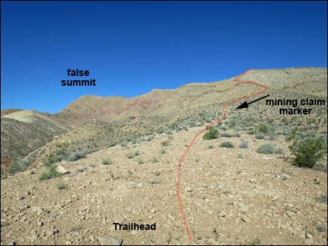
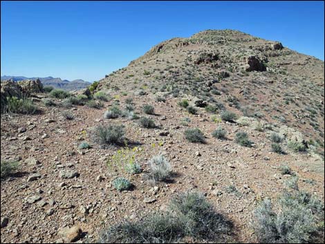
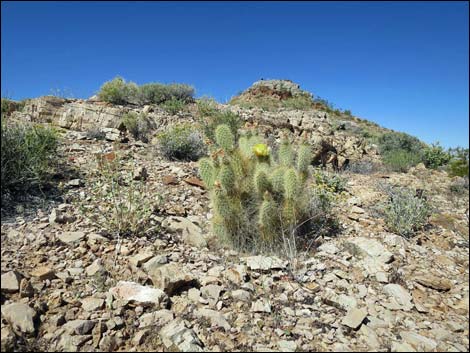
The Hike From the trailhead (Table 1, Waypoint 01), the route runs up a faint, unused side-road that heads west-northwest to an historic mining claim marker some 140 yards out (Wpt. 02). Beyond the claim, the old road become more and more faint, eventually ending below a low band of cliffs capped by three more mining claim cairns (Wpt. 03). Whatever the miners saw here, it must have been good to require three cairns, but there are no prospects in the area. Continuing up the rocky ridge, some parts are steep and rocky, other parts are just steep, and the rest are rocky. The hillside is interspersed with good places to stop and enjoy the scenery to the south, and in season there are plenty of places to stop and smell the Las Vegas Bearpoppy flowers. Eventually, just below reaching the crest of the ridge, the route becomes steep and scree covered. Bighorn sheep make beds here, so they must feel safe in these surroundings, but use extra care climbing the last few yards onto the crest of Bitter Ridge (Wpt. 04). |
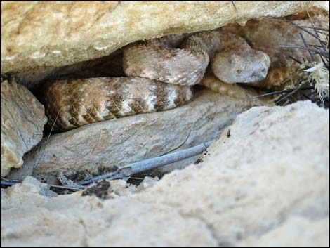 Keep an eye out for my slithery friend |
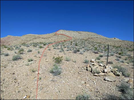
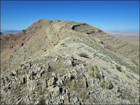
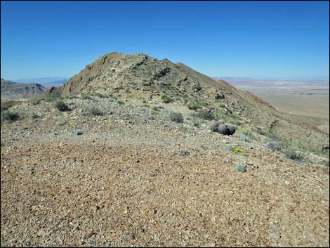
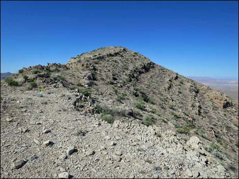
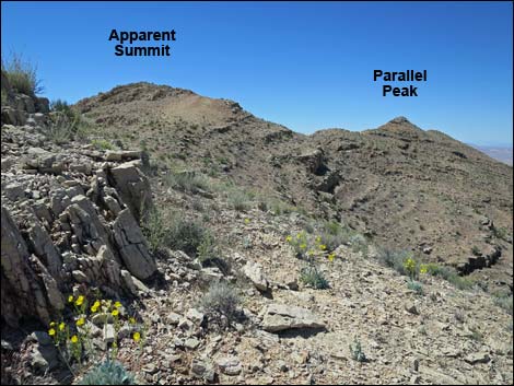
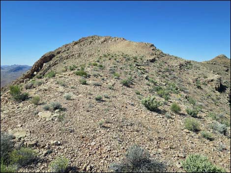
After climbing the steep and rocky ridge, the crest of Bitter Ridge (Wpt. 04) feels broad, flat, smooth, and safe with grand views in all directions. Continuing, the route turns southwest to climb gently along the crest. There are a few knobs along the ridge (e.g., Wpt. 05) where the most efficient hikers could contour around the side and avoid the gain and loss of elevation, but they are so slight that staying atop the crest is easy enough. Hiking along the crest, the highpoint -- straight up the ridge -- is plain to see and obvious from everywhere, but this is just another knob on the ridge (a false summit). Hard as it is to believe from looking at it, departing the ridge (Wpt. 06) and contouring around the north side of the knob until returning to the crest of the ridge (Wpt. 08) is more efficient. |
 Rocky side-ridge |
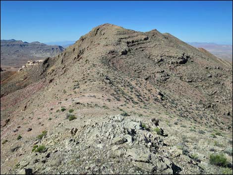
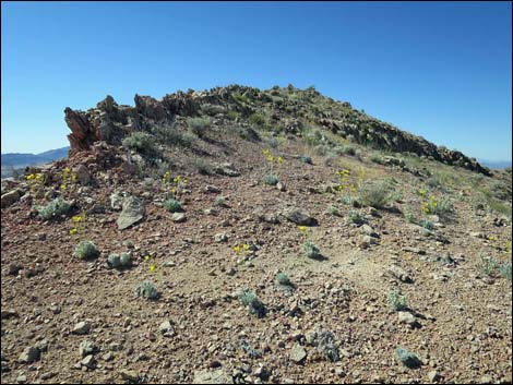
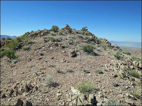
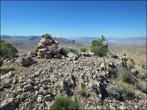
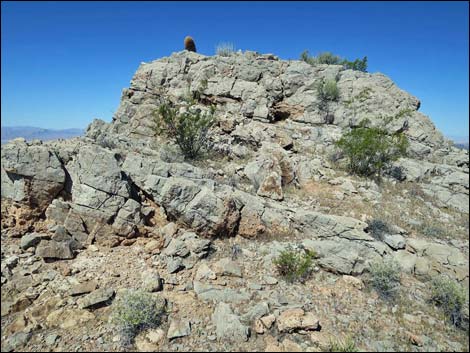
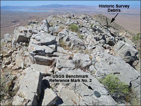
For those more interested in scenery, however, continue up the ridge to the false summit (Wpt. 07). There is a huge summit cairn and another off to the side to the southeast (an historic mining cairn?), but no summit register. Views from the false summit are grand, and in fact every bit as good as those from the true summit. Departing off the northwest side of the false summit, the route drops steeply among rocks and continues out the rocky ridgeline to the west. After dropping through a saddle (Wpt. 08) and connecting with the bypass route (note the sheep trails), the route resumes climbing towards the true summit. Using game trails and clambering among the rocks, the route finally climbs onto Parallel Peak (Wpt. 09). The summit is adorned with two USGS Reference Marks, placed in 1951, indicating the name of the peak (Parallel) and the direction (using arrows) to the USGS Benchmark, which seems to be gone. The summit also has historic wooden slats and guy-wires that were used during the original surveys of southern Nevada. Please don't clean up this historic junk. |
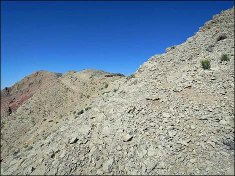
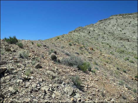 Approaching the crest of the ridge (view NW) |
For a peak with an elevation of only 3,236 feet, the Summit Views are surprisingly grand:
When ready, descend to the trailhead (photos) over the same route, or if climbing the peak via the false summit, consider contouring around the north side of the false summit. When approaching the jump-off point to start down off the side of the ridge, vehicles at the trailhead are visible below, making it easy to find the correct ridge to descend. |
 Easy terrain approaching the crest of the ridge (view NW) |
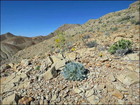 Las Vegas Bearpoppy (view W across slope towards summit) |
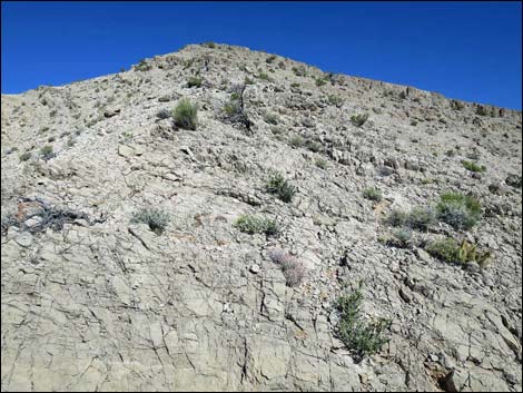 Rocky terrain approaching the crest of the ridge (view NW) |
 Steep side-slopes (view SW towards the summit) |
 Rocky push to the crest (view NW) |
 Rocks and scree just below the crest, poles useful here (view SW) |
 Atop Bitter Ridge (view SW towards the summit) |
 Atop Bitter Ridge (view N towards Mormon Mountains) |
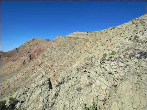
 Gentle ridgeline (view SW) |
 Gentle ridgeline (view SW) |
 Gentle ridgeline (view SW) |
 Gentle ridgeline (view SW) |
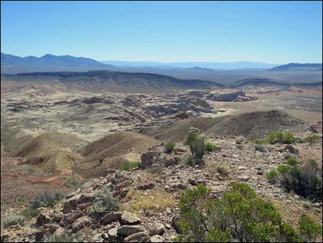
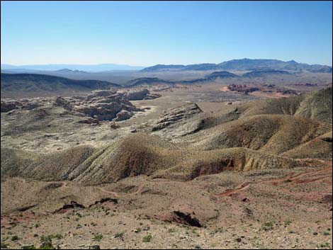 Grand scenery afar to the south across Gold Butte |
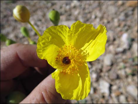 Grand up-close (many Las Vegas Bearpoppy plants on the ridge) |
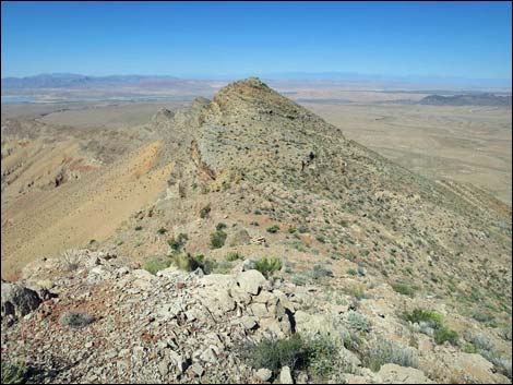
 Rolling ridgeline approaching what appears to be the summit |
 Bypassing a high spot on the rolling ridge (view SW) |
 Gentle ridgeline (view SW) |
 A "field" for flowering Las Vegas Bearpoppy plants on the ridge) |
 Arriving at what appears to be the summit (view SW) |
 "Summit" cairn (view SW) |
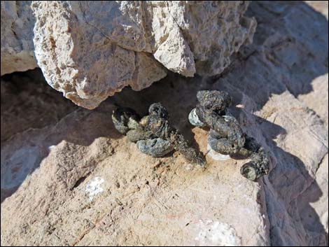 Curious scat on summit cairn (long-tailed weasel or spotted skunk?) |
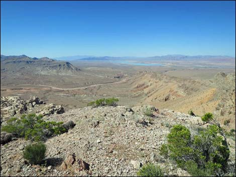 Summit view (view SW towards Lake Mead) |
 Summit view (view SE towards Grand Canyon) |
 Summit view (view W) -- oops, is that one higher? |
 Rocky knob along ridgeline (view W) Rocky knob along ridgeline (view W) |
 True summit comes back into view (view W) |
 Western Pricklypear Cactus in bloom (view W to summit) |
 Approaching true summit (view W) |
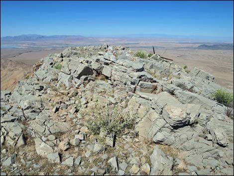 Summit, Parallel Peak (view W) |
 Summit, Parallel Peak (view W) |
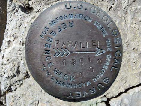 USGS Benchmark, Reference Mark No. 2, Parallel Peak |
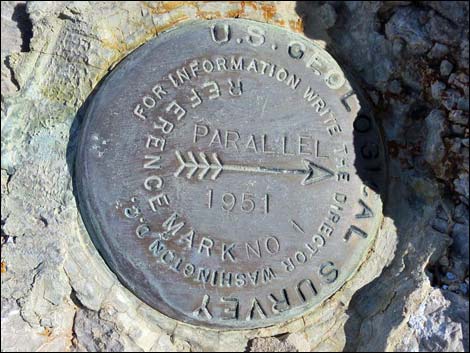 USGS Benchmark, Reference Mark No. 1, Parallel Peak |
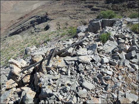 Historic survey debris (wooden slats and guy-wires) on the summit |
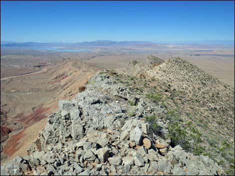 Summit (view SW along Bitter Ridge towards Lake Mead) |
Table 1. Hiking Coordinates and Distances based on GPS Data (NAD27; UTM Zone 11S). Download Hiking GPS Waypoints (gpx) file.
| Wpt. | Location | UTM Easting | UTM Northing | Elevation (ft) | Point-to-Point Distance (mi) | Cumulative Distance (mi) | Verified |
|---|---|---|---|---|---|---|---|
| 01 | Trailhead | 749967 | 4041525 | 2,555 | 0.00 | 0.00 | GPS |
| 02 | Mining Claim Cairn with Post | 749854 | 4041554 | 2,609 | 0.08 | 0.08 | GPS |
| 03 | Three Mining Claim Cairns | 749727 | 4041623 | 2,729 | 0.10 | 0.18 | GPS |
| 04 | Crest of the Ridge | 749561 | 4041671 | 2,951 | 0.14 | 0.32 | GPS |
| 05 | Knob on the Ridge | 749240 | 4041472 | 3,071 | 0.25 | 0.57 | GPS |
| 06 | Depart Ridgeline | 748986 | 4041260 | 3,168 | 0.23 | 0.80 | GPS |
| 07 | False Summit | 748933 | 4041159 | 3,225 | 0.08 | 0.88 | GPS |
| 08 | Resume Ridgeline | 748833 | 4041163 | 3,176 | 0.08 | 0.96 | GPS |
| 09 | Summit | 748702 | 4041155 | 3,236 | 0.09 | 1.05 | GPS |
| 01 | Trailhead | 749967 | 4041525 | 2,555 | 1.05 | 2.10 | GPS |
Happy Hiking! All distances, elevations, and other facts are approximate.
![]() ; Last updated 240325
; Last updated 240325
| Gold Butte | Rock Art | Hiking Around Las Vegas | Glossary | Copyright, Conditions, Disclaimer | Home |