Hiking Around Las Vegas, Gold Butte National Monument
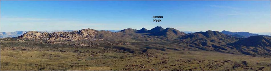
 Shark Tooth and Jumbo peaks at the head of Cedar Basin (view S) |
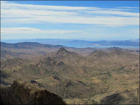
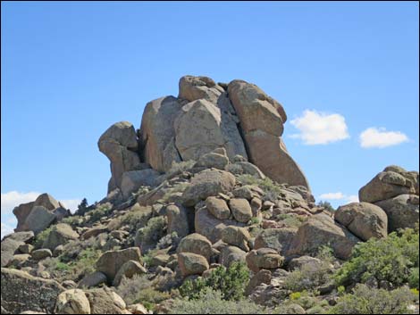
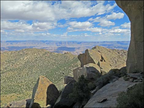
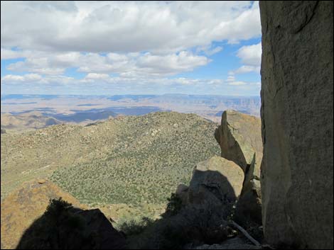
Overview Jumbo Peak, located at the south end of Gold Butte National Monument, is extremely remote, steep, and rocky, but once hikers make it to the trailhead, the route is obvious to follow: up sideslopes winding among rocky outcrops to the ridgeline, then south along the ridgeline to the summit. This, however, does not adequately describe the route, as the summit is a tower of vertical granite. Hiking to the ridgeline is well worth the effort, as views from the summit can hardly be better than those from the ridgeline, but climbing to the summit requires technical rock-climbing skills and equipment. If not interested in the technical aspects of this route, consider visiting Jumbo Ridge Highpoint, a knob on the ridge a bit north of the peak. The views are the same from both places. Views from the summit are spectacular and extend across Cedar Basin to the north, as well as southeast into the Grand Canyon and southwest to peaks in southern California. Link to map. |
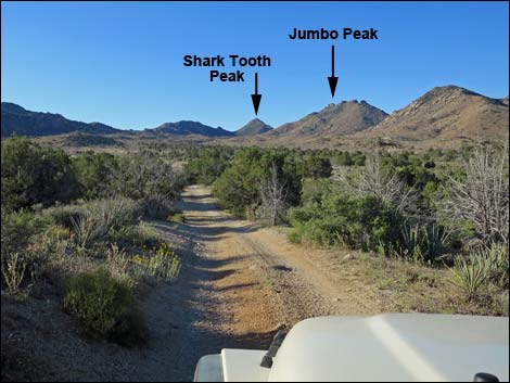
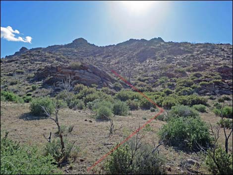
 Shark Tooth--Jumbo Peak Trailhead (view SW) |
Watch Out Other than the standard warnings about hiking in the desert, ... this is a wild and remote area without services of any kind (no restrooms, no water, no gas, no food). Bring what you need to survive. Be prepared and be self-reliant. It is a big place, but someone will eventually find you if you stay on a main road, but be prepared to survive alone for a day or two, or even longer on side roads. Consider signaling the tourist helicopters that traverse the area coming and going from the Grand Canyon. This hike is relatively safe to the granite tower, but be extra careful on rocky outcrops and on the tower where hikers could fall and help is a long way off. While out, please respect the land and the other people out there, and try to Leave No Trace of your passage. Also, this is a remote area, so be sure to bring the 10 Essentials. |
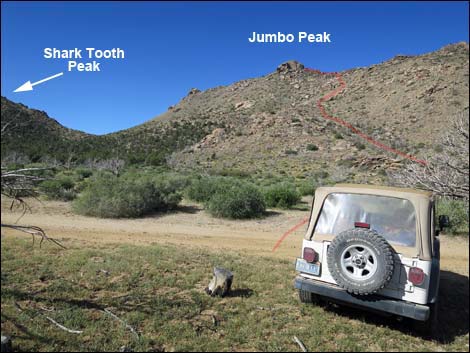
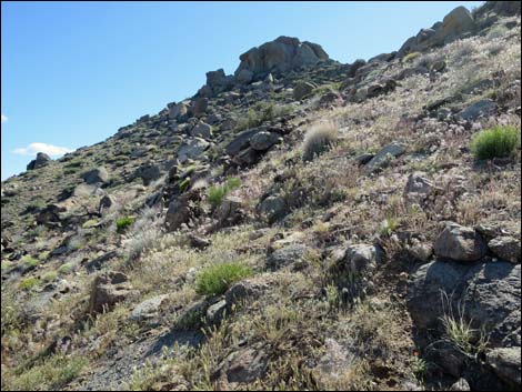
 Direct route runs up the side of the ridge (view W from trailhead) Direct route runs up the side of the ridge (view W from trailhead) |
Getting to the Trailhead Jumbo Peak is located out in Gold Butte National Monument at the northeast end of Lake Mead, about 3.5 hours northeast of Las Vegas in a wild, remote, and scenic area. From town, drive out to Gold Butte National Monument. From Whitney Pocket, continue south on the unpaved Gold Butte Road to Gold Butte Townsite. From there, Scanlon Road is the main road running southwest. Drive south on Scanlon Road for 1.9 miles to Quail Springs Wash (watch for a flash flood warning sign). Turn left and drive up Cedar Basin Road, which follows Quail Springs Wash into Cedar Basin. At 3.3 miles out, Cedar Basin Road forks at a white 55-gallon drum in a forested area, stay right on Cedar Basin Road. Passing historic corrals, Cedar Basin Road continues south into a broad canyon generally following a wash. When the road turns left out of the wash and starts up across the gentle hillside, watch for an open area among burned trees that serves as the trailhead. Don't get too far from the wash. Park here; this is the trailhead. |
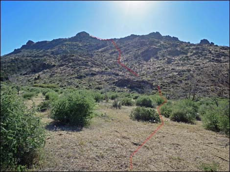
 From the wash, the route stays right of rocky outcrop (view W) |
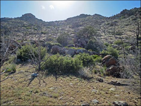
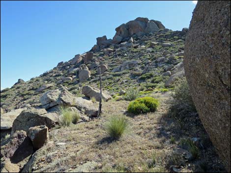
The Hike From the trailhead (Table 1, Waypoint 01), the route runs west to cross the wash (Wpt. 02) in the bottom of the valley, then continues southwest and up into a shallow side canyon, staying right of a rocky outcrop. Running up the side canyon through an area of skeleton trees that did not survive a fire, the route bends a bit left and climbs onto a flat spot (Wpt. 03) atop the ridge on the south side of the side canyon. From the flat spot, the route ahead can be seen all the way to the crest of Jumbo Ridge, aiming for the north side of the summit tower. It is useful, however, to aim for a spot (Wpt. 04) where the route to the summit and the route to Jumbo Ridge Highpoint diverge. From that spot (Wpt. 04), the route contours south a bit before turning uphill to pass just below a boulder of unusual size (Wpt. 05). Doing so, the route makes fairly efficient passage among outcrops and boulders. |
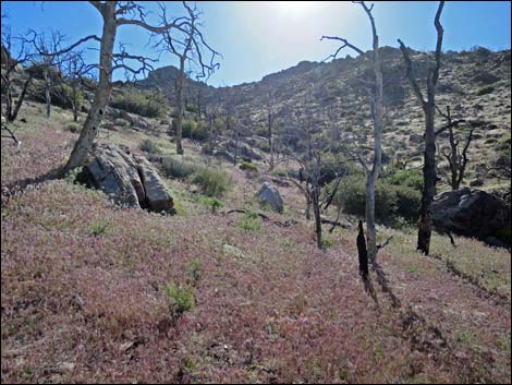 Red Brome grows dense in old burn area |
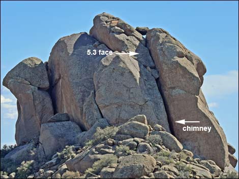
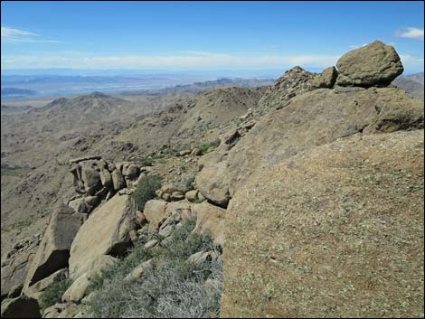
From the large boulder, the route runs west and up the side of Jumbo Ridge, aiming to crest-out on the ridge just north of the summit tower. This area is choked with boulders and shrub live oak trees, but there are fairly efficient routes through the boulder fields winding between stands of oak trees. Gaining the crest (Wpt. 06) of Jumbo Ridge, the route turns south to the base of the tower. When viewed from the north, a wide chimney is apparent a bit right of center on the north face of the tower. I've not done it, but the route ascends the chimney to a large chockstone where options diverge. Hikers can tunnel out the back of the chimney or climb the exposed Class 5.3 or 5.4, lichen-covered face, among other possibilities. Rappelling off the summit seems mandatory. If this is too much, visit the Jumbo Ridge Highpoint (see map). |
 Flat spot (view SW) |
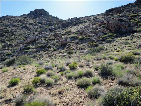 Steep sideslopes (view SW) |
 |
 |
 Crest of Jumbo Ridge (view W) |
 Crest of Jumbo Ridge (view S) |
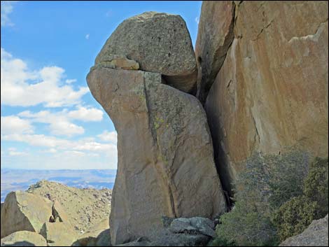
 North face of Summit Tower (view SE) |
 Base of Summit Tower (view SE) |
 Base of Summit Tower (view S) |
 Base of Summit Tower (view E) |
 Crest of Jumbo Ridge (view NW) |
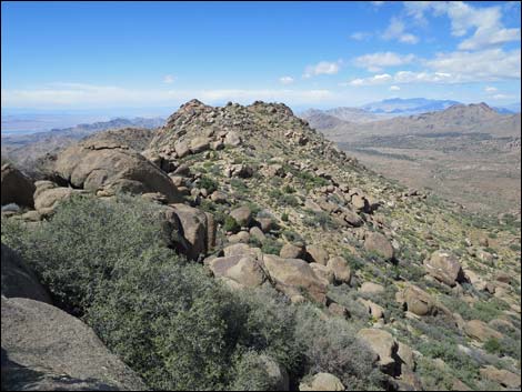 If not the tower, consider Jumbo Ridge Highpoint (view N) |
Table 1. Hiking Coordinates and Distances based on GPS Data (NAD27; UTM Zone 11S). Download hiking GPS waypoints (gpx) file.
| Wpt. | Location | UTM Easting | UTM Northing | Elevation (ft) | Point-to-Point Distance (mi) | Cumulative Distance (mi) | Verified |
|---|---|---|---|---|---|---|---|
| 01 | Jumbo Peak Trailhead | 754281 | 4010898 | 4,685 | 0.00 | 0.00 | GPS |
| 02 | Wash Crossing | 754197 | 4010889 | 4,678 | 0.05 | 0.05 | GPS |
| 03 | Flat Area Atop Ridge | 754026 | 4010739 | 4,834 | 0.18 | 0.23 | GPS |
| 04 | Routes Split | 753757 | 4010589 | 5,140 | 0.26 | 0.49 | GPS |
| 05 | Large Boulder | 753654 | 4010452 | 5,413 | 0.15 | 0.64 | Map |
| 06 | Ridgeline at Base of Tower | 753484 | 4010398 | 5,692 | 0.14 | 0.78 | Map |
| 07 | Jumbo Peak Summit | 753535 | 4010334 | 5,761 | 0.06 | 0.84 | Map |
| 01 | Jumbo Peak Trailhead | 754281 | 4010898 | 4,685 | 0.84 | 1.68 | GPS |
Happy Hiking! All distances, elevations, and other facts are approximate.
![]() ; Last updated 240325
; Last updated 240325
| Hiking Around Las Vegas | Gold Butte | Glossary | Copyright, Conditions, Disclaimer | Home |