Hiking Around Las Vegas, Gold Butte National Monument
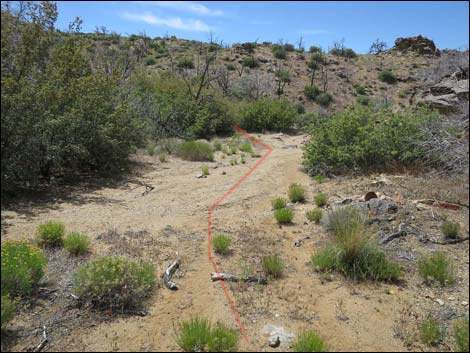
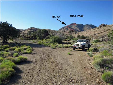 Mica Peak trailhead along Vermiculite Mine Road (view S) Mica Peak trailhead along Vermiculite Mine Road (view S) |
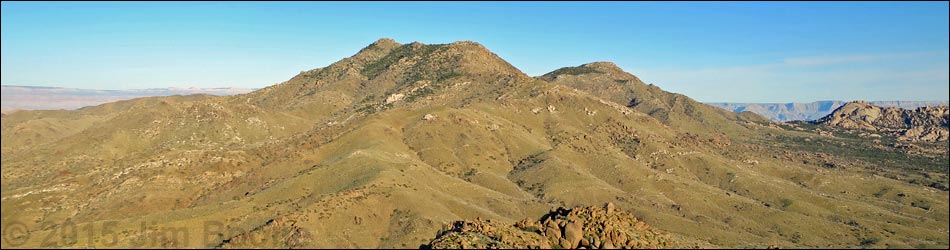
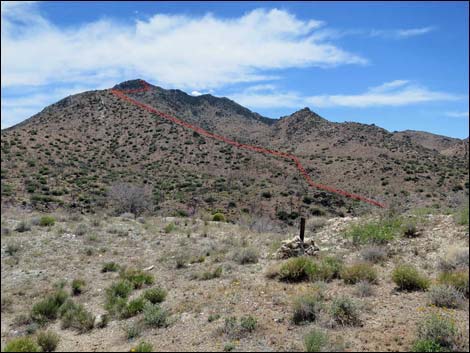
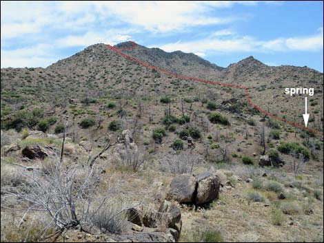
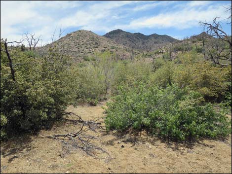
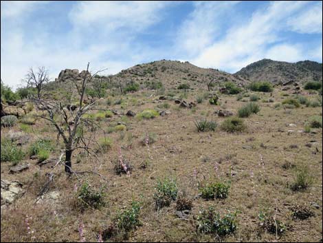
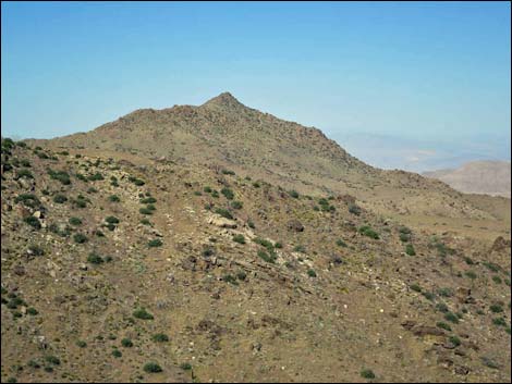
Overview Mica Peak, via the North Ridge, is a fun hike deep in the heart of Gold Butte National Monument. The route ascends the fairly steep and strenuous, but safe, North Ridge, which is followed south towards the summit. Parts of the upper ridgelines are rocky, but the craggier portions can be bypassed on one side or the other. The summit is guarded by rocky crags, but the easiest route cuts across the north face just below the crags to gain the summit from the west ridge. There is no trail, and hiking poles are recommended. The hike to the summit and back is about 4 miles. Hikers who make the summit are rewarded with what is among the best 360-degree views in southern Nevada that leaves one wanting to climb the other high peaks in the neighborhood. Link to hiking map. See also: photos of and from the summit and photos of the descent. |
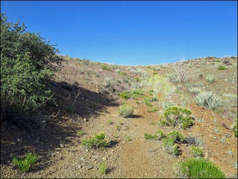
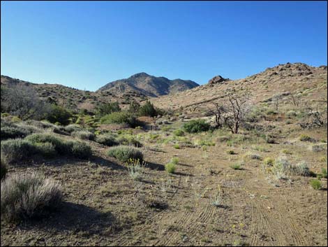 Route starts up old road towards the peak |
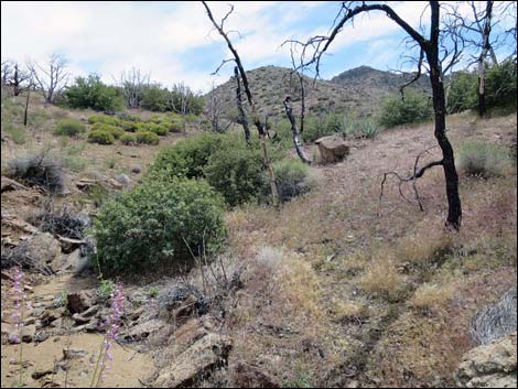
Watch Out Other than the standard warnings about hiking in the desert, ... this area is fairly safe, but watch for loose rocks on the ridgeline. The craggy areas look like prime rattlesnake habitat, so be sure to watch carefully -- especially when using boulders for handholds. The craggy sections can be bypassed, but are minimal 3rd-class, so always be extra careful when high enough to fall and get hurt -- help is a long way away. This is a wild and remote area without services of any kind (no restrooms, no water, no gas, no food). Bring what you need to survive. Be prepared and be self-reliant. Law enforcement occasionally patrols the area. Someone will find you eventually if you stay on a main road, but be prepared to survive alone for a day or two. Cell phones only work along parts of the paved road. The roads require a stout 2WD-HC vehicle, but a 4WD would be safer in this remote region. While hiking, please respect the land and the other people out there, and try to Leave No Trace of your passage. Also, this is a very remote hike, so be sure to bring the 10 Essentials. |
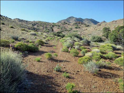 Old road runs up canyon (view S) |
Getting to the Trailhead Mica Peak is located out in Gold Butte National Monument at the northeast end of Lake Mead, about 3 hours northeast of Las Vegas in a wild, remote, and scenic area. From town, drive out to Gold Butte National Monument. From Whitney Pocket, continue south on the unpaved Gold Butte Road for about 17.9 miles to the unmarked Vermiculite Mine Road. Watch on the left for two gaps in the fence that lines the road in this area. Turn left onto Vermiculite Mine Road and drive south 1.1 miles to the mine site. Just past the mine site, a wide spot on the right serves as the trailhead parking and campsite. Park here; this is the trailhead. |
 Old road climbing across hillside towards ridgeline (view W) |
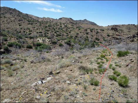
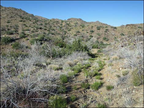
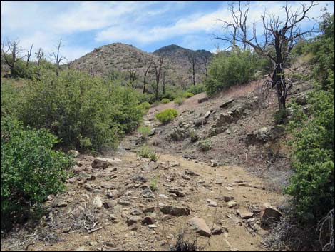
The Hike From the trailhead (Table 1, Waypoint 01), the route runs south on what turns out to be a little-used road with so many wildflowers growing in the roadway that nobody would want to drive on them. The old road starts up a canyon, but then bends right and climbs across the hillside to a ridgeline. Turning south on the ridgeline, the old road runs out to Snowflake Mine (Wpt. 02) where large pieces of mica make the ground sparkle. Passing through the mine site, the old road bends right and runs down the next hillside dropping into the sandy wash (Wpt. 03) below. The old road enters the wash a few yards upstream from a confluence of washes. The route continues the few yards down to the confluence, then turns up the other fork (Wpt. 04). In this west fork, a spring dampens the ground, and the wash is choked with saltcedar trees and shrubs. |
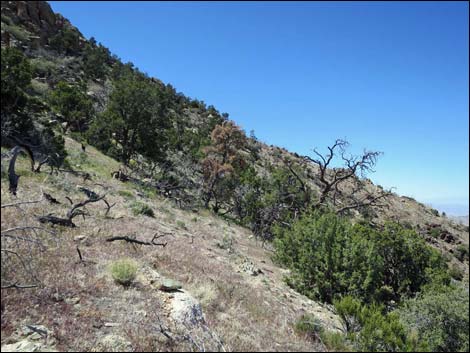
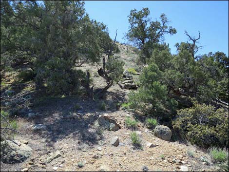
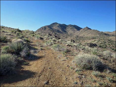 Old road runs up ridgeline (view S) |
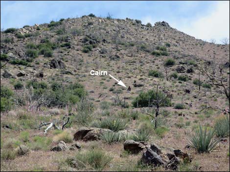
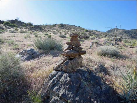
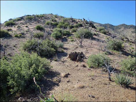
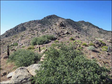
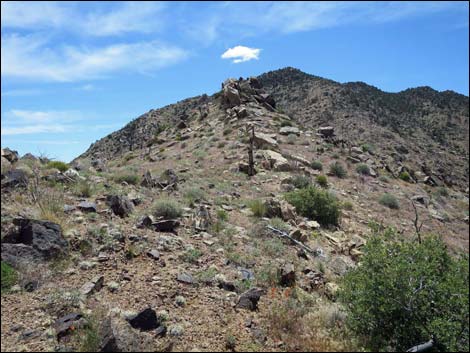
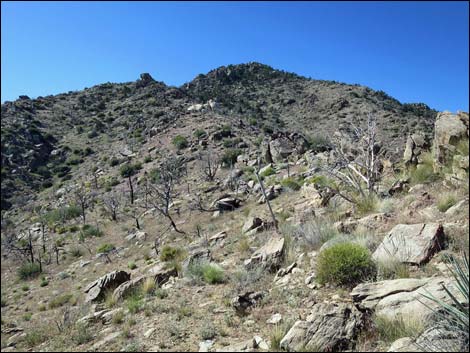
Emerging from the vegetation, the route continues up the wash. Staying to the right of the canyon bottom, the route passes a mining claim marker cairn (Wpt. 05) on a rocky ledge and continues up the canyon to the ridgeline ahead, which is the North Ridge. Turning up the North Ridge, the route passes another mining claim marker cairn (Wpt. 06) on the hillside. From there, it is advantageous to gain the ridgeline and follow it up. The ridge is steep and rocky, but all of the rocky outcrops can be passed on one side or the other. Approaching the summit (Wpt. 07), hikers face daunting cliffs, and a decision must be made: continue up the ridgeline into 4th-class cliffs or detour below the cliffs across the steep north-facing side-slopes for a 2nd-class walk-up. For the cliffs, see the alternative route page, otherwise angling across the side-slope, the walk-up route crosses the north facing slope to the next ridgeline (Wpt. 08) to the west. |
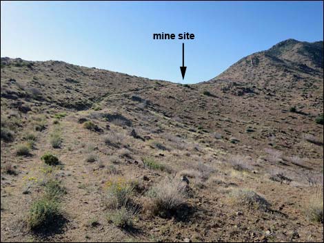 Old road continues towards Snowflake Mine site (view S) |
On the ridgeline, the route runs more-or-less straight up the slope. It is advantageous to continue straight up until reaching an enormous boulder on the skyline near the summit (Wpt. 09). From the boulder, an easy scramble leads up and left to the summit (Wpt. 10). The summit is adorned with bits and pieces of historic survey equipment (boards, broken mirror, wires, etc.) and a summit register. As is often the case for Gold Butte National Monument peaks, views from the summit are surprisingly grand, and stretch from Utah to California and include the Grand Canyon and Red Rock cliffs. For views of and from the summit, see the Summit Views page. Regardless of the route taken to the summit, hikers should use the north-face traverse for the descent (see photos of the route down). |
 Entering the mine area (view S; route follows the ridge ahead) |
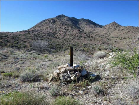 Mining claim marker cairn with 4x4 wooden post |
 Snowflake Mine (view E) |
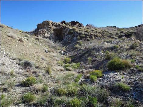
 Collapsed entrance to Snowflake Mine |
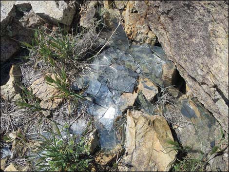
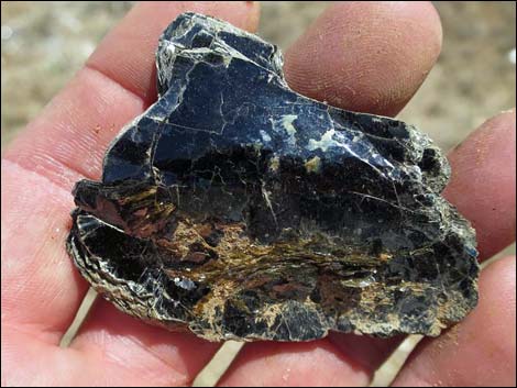 Large piece of mica |
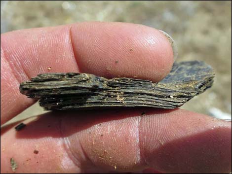 Thin layers in large piece of mica |
 Route ahead is visible from the mine site (view S) |
 Overgrown old road departs mine site towards wash (view SW) |
 Overgrown old road runs down towards wash (view W) |
 Route runs down wash a few yards to confluence (view W) |
 Route turns up wash into vegetated spring area (view S) |
 Beyond spring, route follows wash uphill (view S) |
 Route angles right towards the peak (view S) |
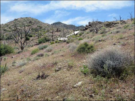 Route passes outcrop with mining cairn (view S) |
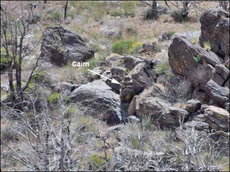 Outcrop with mining cairn (view S) |
 Route angles right climbing towards North Ridge (view SW) |
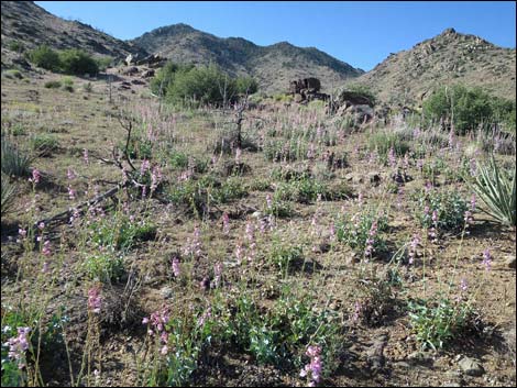 Field of blooming penstemon on North Ridge (view SW) |
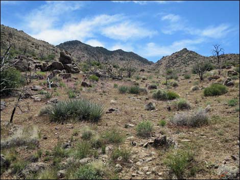
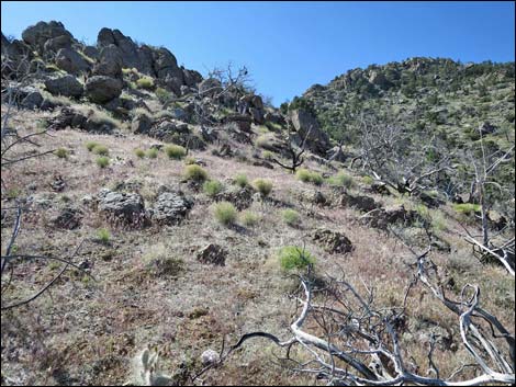
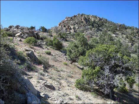
 Lower down, the North Ridge is broad (view S) |
 Route passes a second mining cairn (view S) |
 Second mining cairn (view S) |
 Route now follows more closely the spine of the North Ridge (view S) |
 Gold Butte Peak -- the view already is getting good (view W) |
 Route follows the North Ridge (view SE) |
 Route follows the North Ridge (view SE) |
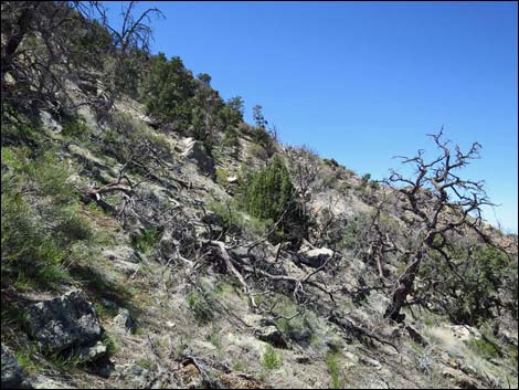
 Passing a rocky outcrop on the ridgeline (view S) |
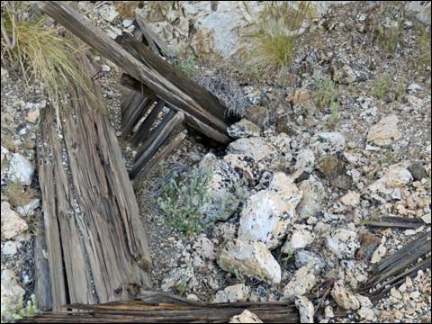
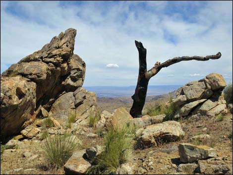 Wood and Stone: art in the wild (view E) |
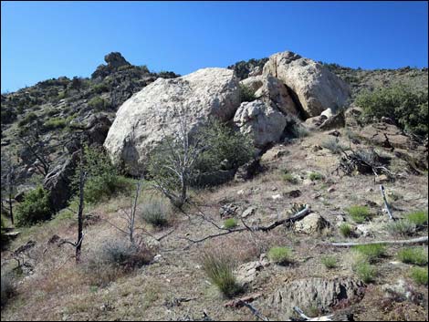 Large white boulders on the ridgeline (view S) |
 Passing to the right of white boulders on the ridgeline (view S) |
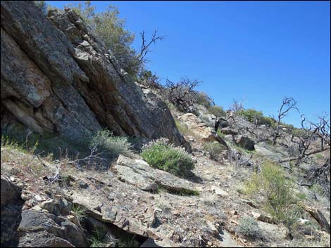
 Approaching more rocky crags (view S) |
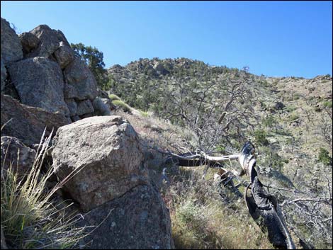 Passing to the right of rocky crag(view S) |
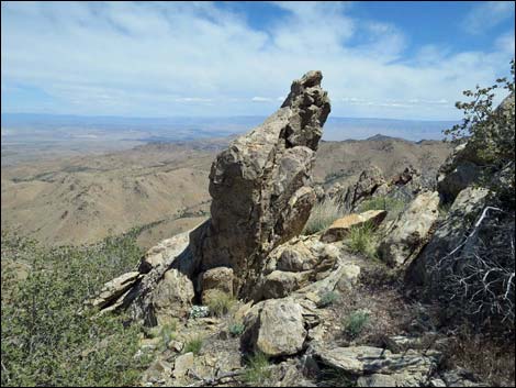 Standing Stone: more art in the wild (view NE) |
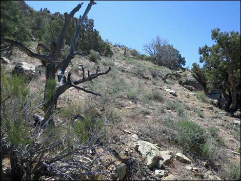
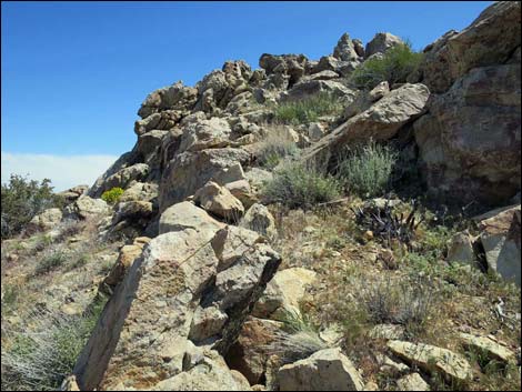
 Upper ridgeline (view S) |
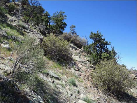
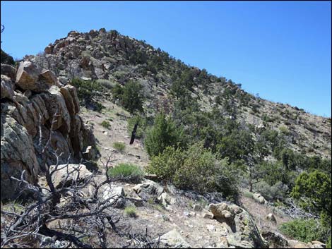 Passing rocky outcrop on upper ridgeline (view S) |
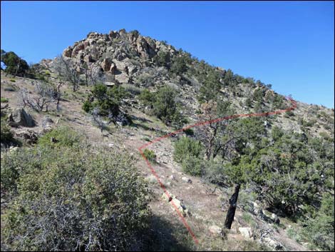 Safer route departs ridgeline to cross the north face (view SW) |
 Route starting across steep north face (view SW) |
 Route climbs across steep north face (view SW) |
 Route climbs across steep north face (view SW) |
 Beyond rocky outcrop, route turns uphill (view SW) |
 Route climbs straight up steep hillside (view S) |
 Route climbs straight up steep hillside (view S) |
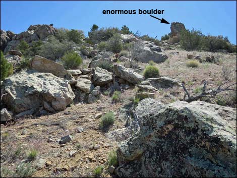 Route climbs steep hillside towards enormous boulder (view S) |
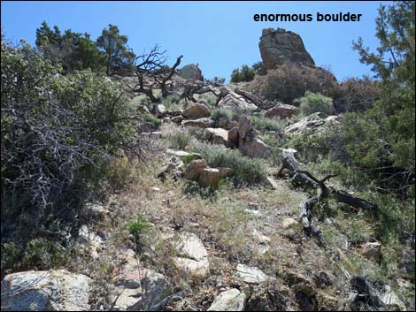 Route climbs steep hillside to enormous boulder (view S) |
 Passing left of enormous boulder (view SE) |
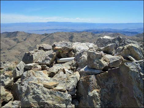 Arriving on the summit (view E) |
 Broken historic signal mirror |
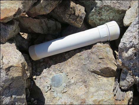 Summit register inside large PVC pipe |
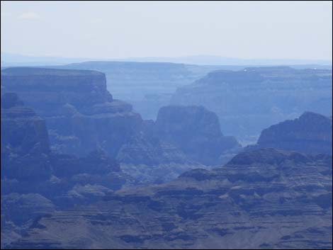 Summit (view SE into Grand Canyon; zoom) [more summit views] |
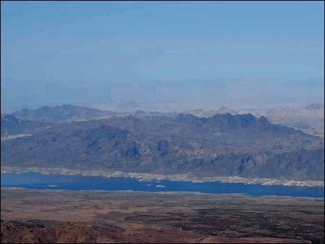 Summit (view SW across Lake Mead into Las Vegas) [more views] |
Table 1. Hiking Coordinates and Distances based on GPS Data (NAD27; UTM Zone 11S). Download Hiking GPS waypoints (gpx) file.
| Wpt. | Location | UTM Easting | UTM Northing | Elevation (ft) | Point-to-Point Distance (mi) | Cumulative Distance (mi) | Verified |
|---|---|---|---|---|---|---|---|
| 01 | Mica Peak Trailhead | 755303 | 4019149 | 4,103 | 0.00 | 0.00 | GPS |
| 02 | Old Mine Site | 755433 | 4018647 | 4,288 | 0.40 | 0.40 | GPS |
| 03 | Old Road Ends in Wash | 755321 | 4018568 | 4,192 | 0.15 | 0.55 | GPS |
| 04 | Edge of Spring Vegetation | 755288 | 4018537 | 4,187 | 0.03 | 0.58 | GPS |
| 05 | Mine Claim Cairn 1 | 755305 | 4018328 | 4,312 | 0.15 | 0.73 | GPS |
| 06 | Mine Claim Cairn 2 | 755367 | 4018131 | 4,472 | 0.16 | 0.89 | GPS |
| 07 | Depart Ridgeline | 755684 | 4017188 | 5,399 | 0.78 | 1.67 | GPS |
| 08 | Ridgeline | 755467 | 4017135 | 5,541 | 0.16 | 1.83 | GPS |
| 09 | Large Boulder | 755523 | 4017036 | 5,703 | 0.09 | 1.92 | GPS |
| 10 | Mica Peak Summit | 755544 | 4017034 | 5,738 | 0.02 | 1.94 | GPS |
| 01 | Mica Peak Trailhead | 755303 | 4019149 | 4,103 | 1.94 | 3.88 | GPS |
Happy Hiking! All distances, elevations, and other facts are approximate.
![]() ; Last updated 240325
; Last updated 240325
| Hiking Around Gold Butte | Hiking Around Las Vegas | Glossary | Copyright, Conditions, Disclaimer | Home |