Hiking Around Las Vegas, Gold Butte National Monument
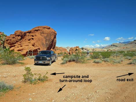 Trailhead parking (view N) |
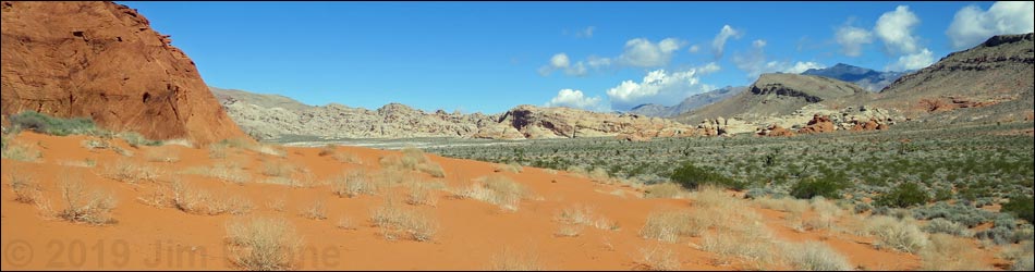
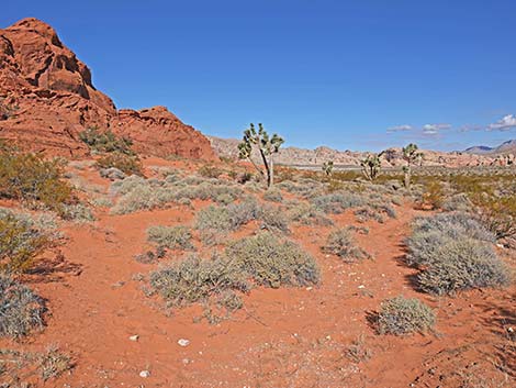
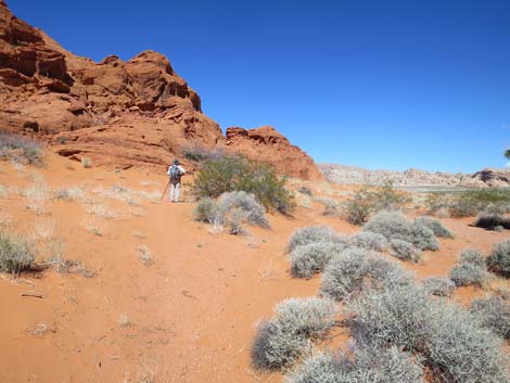
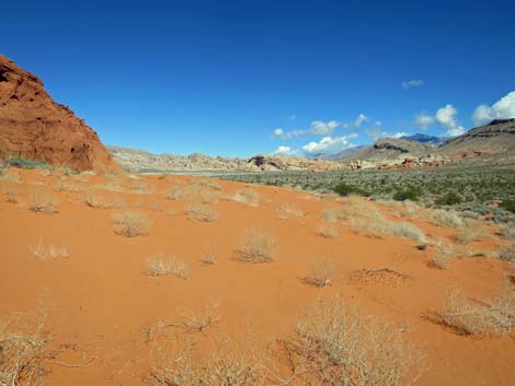
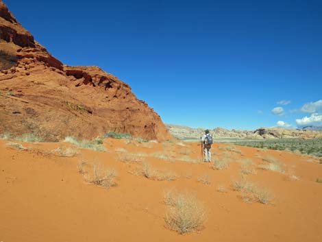
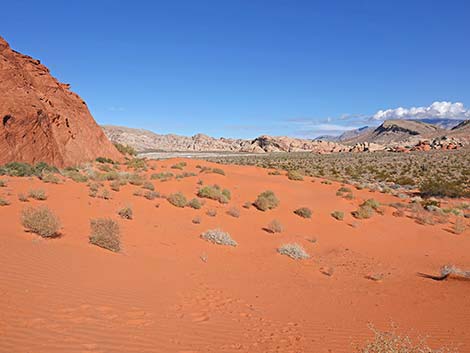
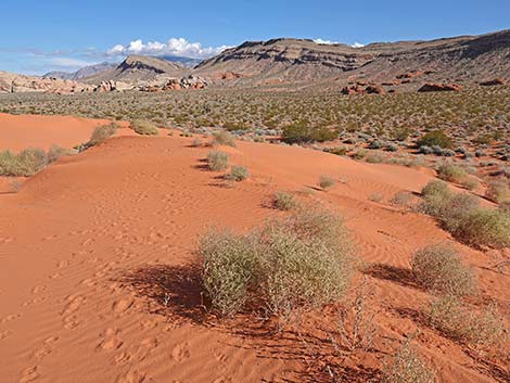
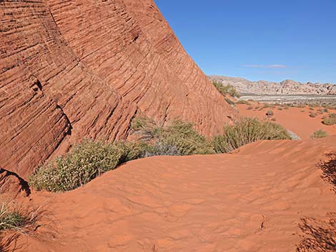
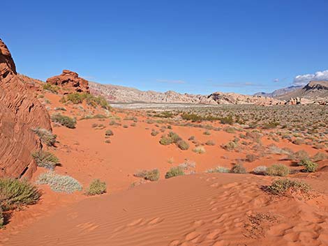
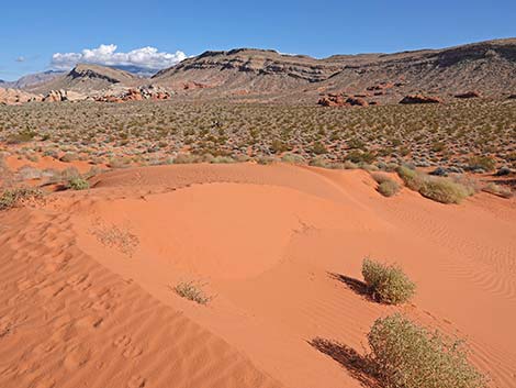
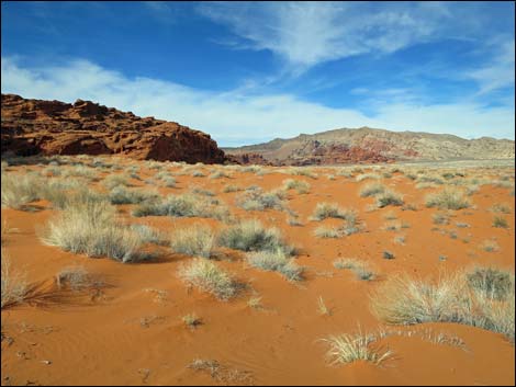
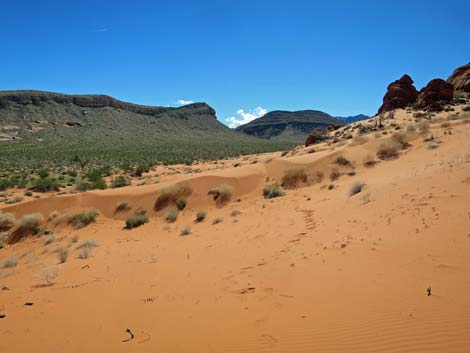
Overview The hike to the Mud Wash Dune Field is easy, nearly level, and runs only 1-1/4 miles round-trip, although in country like this, hikers are free to go as far as they like. The dune field is reached in about 300 yards, and from there it stretches northwest for another 0.6 miles. Pushed up against red sandstone crags and dotted with Joshua Trees, the red dunes appear to be moving northward, but they don't get anywhere. This is a great place to wander around in the sand, look for the homes and tracks of wild animals, look for flowers during spring, and generally revel in the unusually red-colored sand. Link to hiking map. |
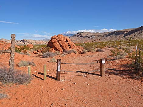 A post-and-cable fence blocks the old road (view N) |
Watch Out Other than the standard warnings about hiking in the desert, ... this is a fairly safe area without any unusual hazards. This is a wild and remote area without services of any kind (no restrooms, no water, no gas, no food). Bring what you need to survive. Be prepared and be self-reliant. Someone will find you eventually if you stay on a main road, but be prepared to survive alone for a day or two. Cell phones only work along parts of the paved road. While hiking, please respect the land and the other people out there, and try to Leave No Trace of your passage. Also, even though this hike is short, the area is remote, so be sure to bring what you need of the 10 Essentials. Cell phones don't work here. |
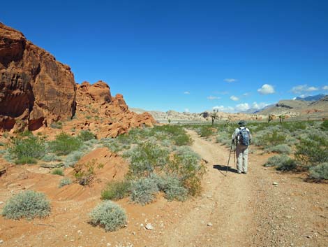
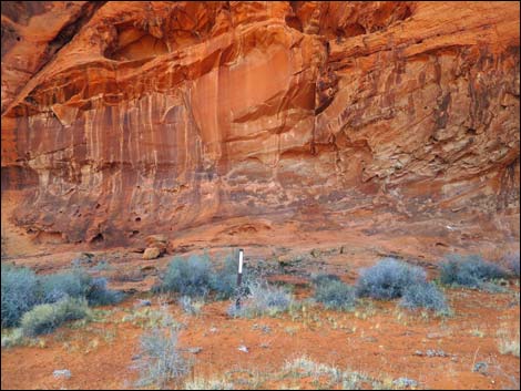
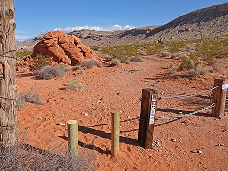 Trail starts on the old road (view N) |
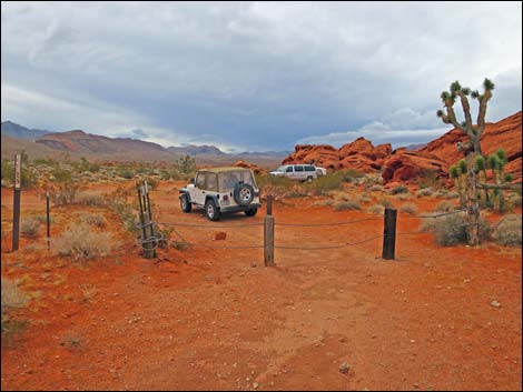
Getting to the Trailhead The Mud Wash Dune Field is located out in Gold Butte National Monument at the northeast end of Lake Mead, about 3 hours northeast of Las Vegas in a wild, remote, and scenic area. From town, drive out to Gold Butte National Monument. From Whitney Pocket, continue south on the unpaved Gold Butte Road for 3.9 miles to Mud Wash North Road. Turn right onto Mud Wash North Road and drive southwest and downstream for 3.2 miles to Mud Wash Road. Stay right onto Mud Wash Road, continuing downstream for another 0.6 miles to Mud Wash Dunes Road, which climbs the steep bank of the wash on the right. Turn right onto Mud Wash Dunes Road and drive north for 0.5 miles to the end of the road. Trailhead parking is on the right when entering the turn-about at the end of the road. |
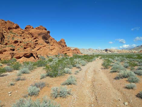
 Trail runs on old road along base of cliffs (view N) |
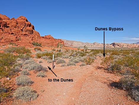
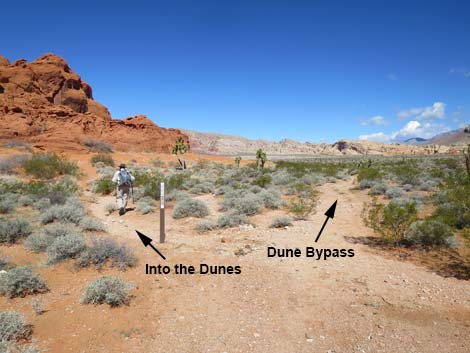
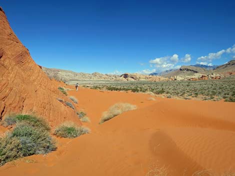
The Hike From the trailhead (Table 1, Waypoint 01), the route runs north following an old road along the base of red sandstone cliffs. The old road runs slightly down hill, but it is essentially level. About 300 yards out, the old road reaches an intersection marked with a carsonite sign. Here, a spur-trail leads into the south end of the dune field. The dune field stretches out for another 0.6 miles, and continuing, the old road runs north, bends a bit to the west, and generally follows the edge of the dune field, although farther out, some parts are obscured by the moving sand. At about 0.6 miles out, the trail forks. The natural tendency is to stay right and wander down a wash, but the trail stays left on the edge of the dune field for another 200 yards. In this area, hikers can return to the trailhead or continue around the sandstone crags to Little Finland, and loop back over the hills to the trailhead. |
 Trail runs on old road along base of cliffs (view N) |
 Approaching a fork in the trail (view N) |
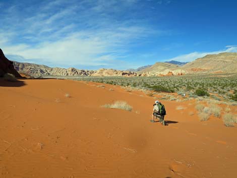
 Trail forks; hiker heading into the dune field (view N) |
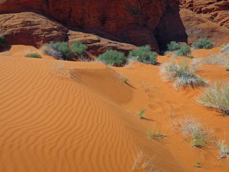
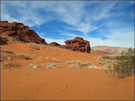
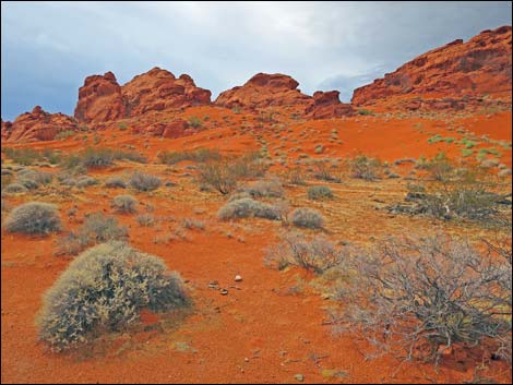
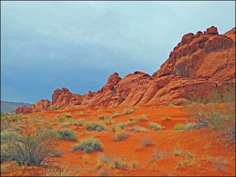
 Mud Wash Dunes (view N) |
 Hikers in dune field (view NW) |
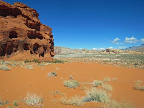
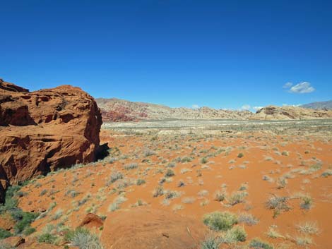
 Dunes form along the base of the cliffs (view N) |
 Dunes form along the base of the cliffs (view N) |
 Mud Wash Dunes (view N) |
 |
 |
 |
 |
 |
 |
 |
 |
 The sand drifts back and forth (view NE) |
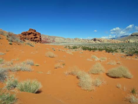
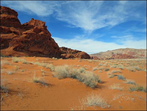
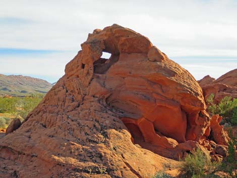
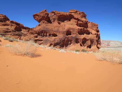 This crag marks a good place to turn around (view N) |
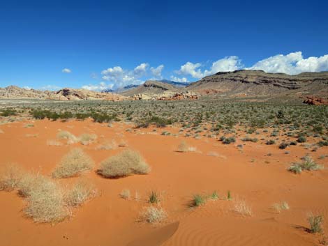
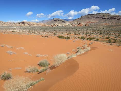
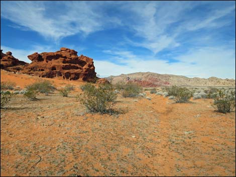
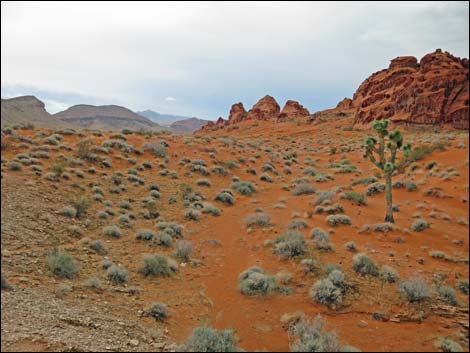
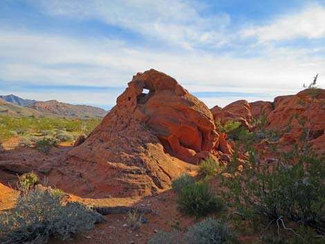
 Grand scenery beyond the dunes (view N) |
 The dunes offer a plethora of opportunities for photography |
 The dunes begin to diminish to the north (view N) |
 Sandy desert flats, but no longer a dune field (view NW) |
The Main Dirt Road Bypasses most of the Drifting Sand
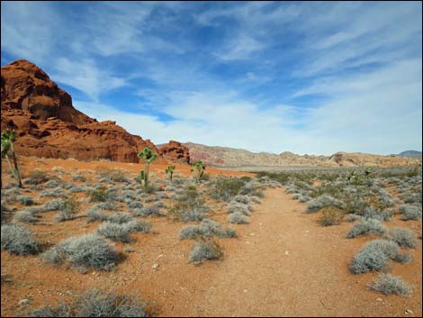 From the fork, the main trail continues north (view N) |
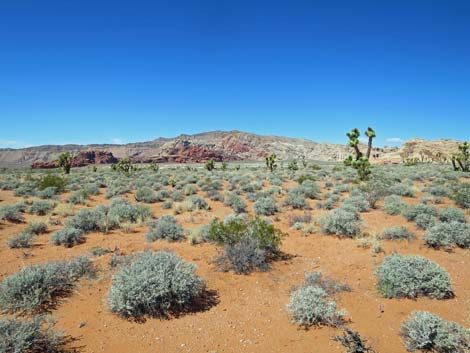
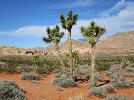 For Eastern Joshua Trees, these are unusually tall and skinny |
 The old road becomes faint (view NW) |
 Faint old road continues (view NW) |
 The main route stays left into the sand (view NW) ... |
 ... but eventually disappears into the shifting sand (view NW) |
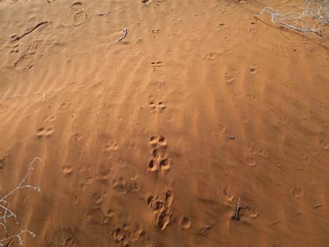
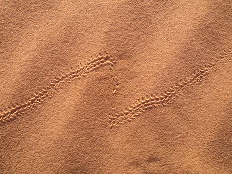
Tracks in the Sand
 Kangaroo Rat tracks |
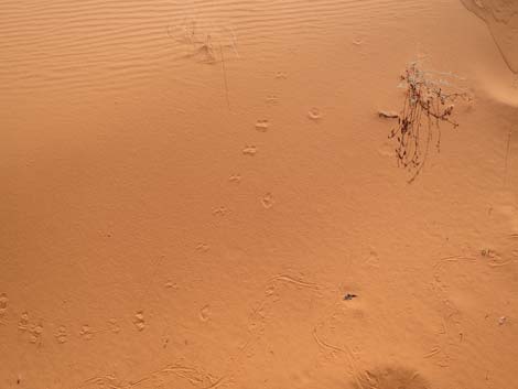 Kangaroo Rat tracks |
 Beetle tracks |
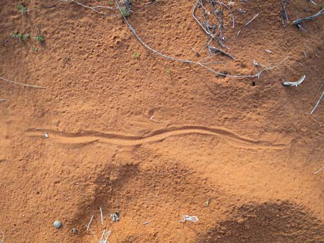 Snake track? Nope, Kangaroo Rat dragging its tail |
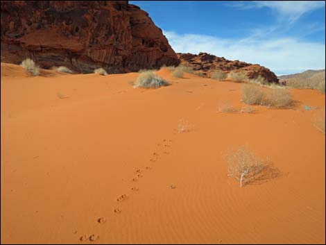 Kit Fox tracks |
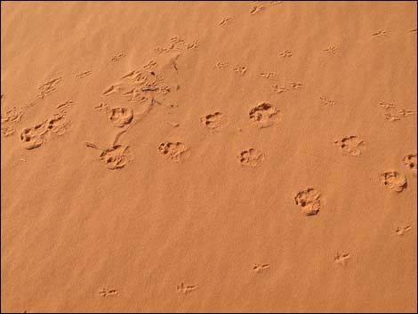 Kit Fox and bird tracks |
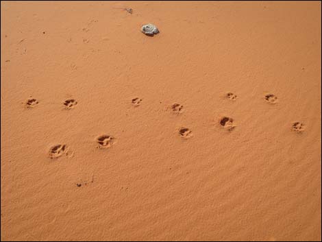 Kit Fox tracks |
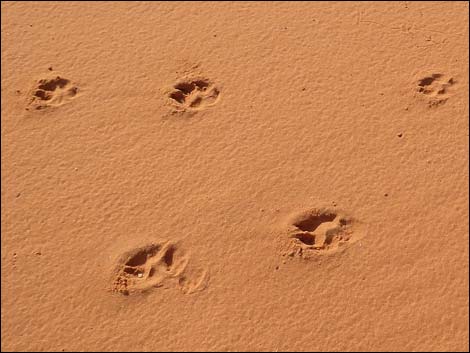 Kit Fox tracks |
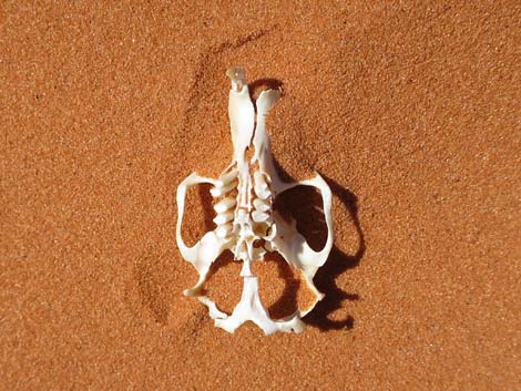 Pocket Gopher skull |
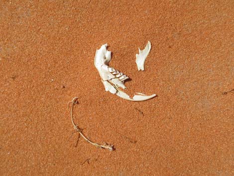 Pocket Gopher jaw |
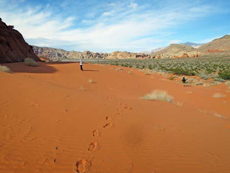 Human tracks |
 More to come ... |
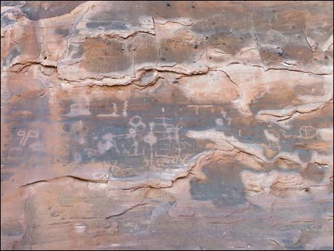
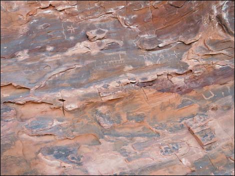
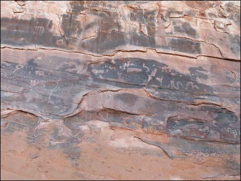
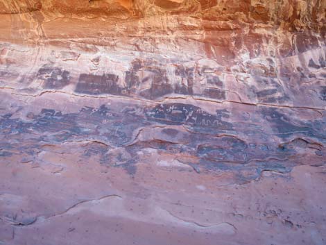
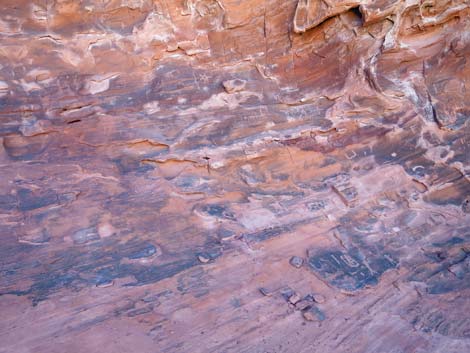
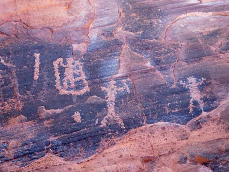
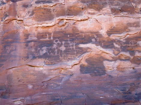
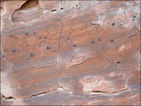
Petroglyphs along the Dunes
 Petroglyphs along the trail |
 Petroglyphs along the trail |
 Petroglyphs along the trail |
 Petroglyphs along the trail |
 |
 |
 |
 |
 Interesting concretions on vertical sandstone wall |
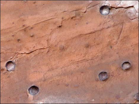 Interesting concretions on vertical sandstone wall |
Returning to the Trailhead
 |
 |
 Stormy days accentuate the red colors (view S) |
 Stormy days accentuate the red colors (view S) |
 This monster guards the return to the trailhead (view S) |
 This monster guards the return to the trailhead (view S) |
 Arriving at the Mud Wash Dunes trailhead (view S) |
More to come ... |
Table 1. Hiking Coordinates and Distances based on GPS Data (NAD27; UTM Zone 11S). Download Hiking GPS Waypoints (gpx) file.
| Wpt. | Location | UTM Easting | UTM Northing | Elevation (ft) | Point-to-Point Distance (mi) | Cumulative Distance (mi) | Verified |
|---|---|---|---|---|---|---|---|
| 01 | Mud Wash Dunes Trailhead | 751079 | 4036857 | 2,039 | 0.00 | 0.00 | GPS |
| 02 | Old Road into Dune Field | 751081 | 4037116 | 2,029 | 0.17 | 0.17 | GPS |
| 03 | Trail Junction | 750918 | 4037712 | 1,977 | 0.41 | 0.58 | GPS |
| 01 | Mud Wash Dunes Trailhead | 751079 | 4036857 | 2,039 | 0.58 | 1.16 | GPS |
Happy Hiking! All distances, elevations, and other facts are approximate.
![]() ; Last updated 240325
; Last updated 240325
| Gold Butte | Rock Art | Hiking Around Las Vegas | Glossary | Copyright, Conditions, Disclaimer | Home |