Hiking Around Las Vegas, Gold Butte National Monument
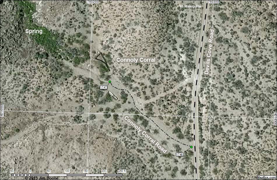
Note: Roads are black (solid = paved; dashed = unpaved; width implies quality). Map based on aerial photo (vegetation is green, dirt and rocks are brown. North is at the top. Grid is UTM NAD27 CONUS. BLM areas (white) based on BLM data. Download waypoint coordinates from route description page.
Happy Hiking! All distances, elevations, and other facts are approximate.
![]() ; Last updated 150904
; Last updated 150904
| Connoly Corral | Hiking Around Gold Butte | Glossary | Copyright, Conditions, Disclaimer | Home |