Hiking Around Las Vegas, Gold Butte National Monument
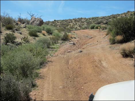
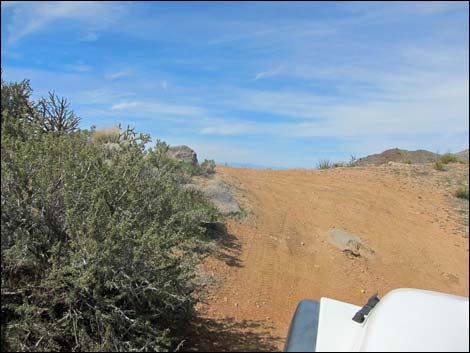
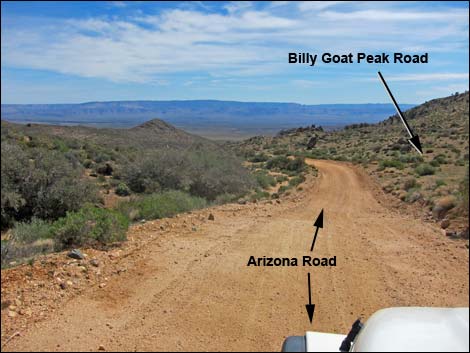 AZ Road approaching Billy Goat Peak Road (view SE) |
Overview Billy Goat Peak Road runs south from Whitney Pass Road, climbing somewhat steeply 0.36 miles to the end of the road and the Billy Goat Peak trailhead. The road normally is suitable for 2WD high-clearance vehicles, but it is steep and narrow and getting worse over time, and it gets steeper at the very end. This road provides access to the Billy Goat Peak hike and grand views west across Gold Butte National Monument and east across Grand Canyon - Parashant National Monument into northern Arizona. Link to map. |
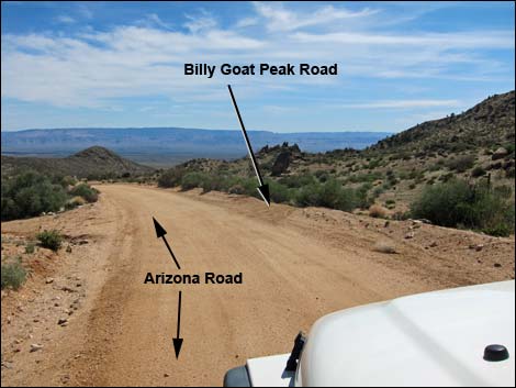 Whitney Pass Road at Billy Goat Peak Road (view SE) |
Watch Out Other than the standard warnings about driving in the desert, ... this road is narrow and fairly steep, and it should be safe, but drive slowly onto the end of the road as over-shooting the small parking area would be quite annoying. This is a wild and remote area without services of any kind (no restrooms, no water, no gas, no food). Bring what you need to survive. Be prepared and be self-reliant. Someone will find you eventually if you stay on a main road, but be prepared to survive alone for a day or two. Cell phones only work along parts of the paved road. While visiting the area, please respect the land and the other people out there, and try to Leave No Trace of your passage. Also, this is a remote area, so be sure to bring the 10 Essentials. |
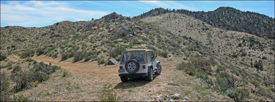
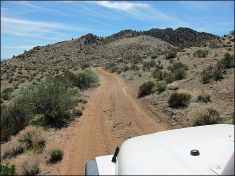
 Billy Goat Peak Road (view S) |
Getting to Billy Goat Peak Road Billy Goat Peak Road is located about 2-1/2 hours east of Las Vegas, in the wild, remote, and scenic Gold Butte National Monument south of the town of Mesquite. From Las Vegas, drive out to Gold Butte National Monument. Drive south 21 miles on the paved Gold Butte Road to Whitney Pocket at the end of the pavement. About 100 yards past the pavement, turn left onto Whitney Pass Road and drive east towards the mountains. Drive 4.3 miles to Whitney Pass (the highest point), then continue down the other side another 0.25 miles to Billy Goat Peak Road, an unsigned road on the right. |
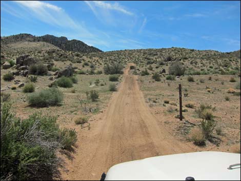
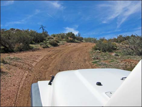
 Billy Goat Peak Road is washing out (view SE) |
The Road From Whitney Pass Road (Table 1, Site 0969), Billy Goat Peak Road runs south as it climbs towards a ridge ahead on the left. The road is a bit washed out and rocky, but not too bad. Shortly before the end of the road, the road forks. Staying left, the road runs somewhat steeply to a parking area, but then curves right to cross the sidehill and connect with the right fork (forms a loop of sorts) and continue onto another ridgeline on the right. Drive slowly onto the second ridgeline (Site 0970) as your hood will block the view of the cliff on the other side of the ridge. Parking at the end of the road is quite limited. |
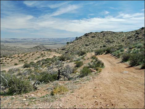
 Billy Goat Peak Road (view S) |
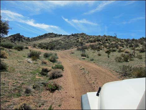 Approaching the fork in the road (view S) |
 Staying right is quite steep (view SW) |
 Arriving at the end of the steep road (view W) |
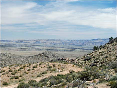 End of the road (view E into Arizona) |
 End of the road (view SE into Arizona) |
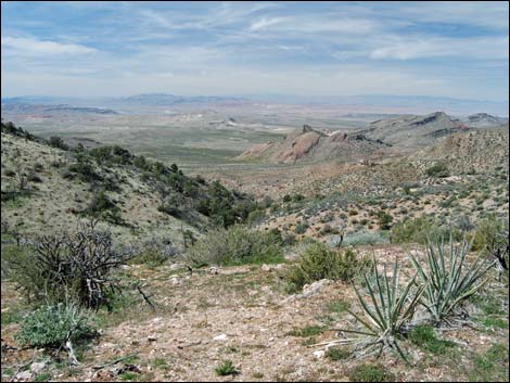
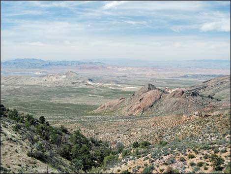 End of the road (view W into Gold Butte) |
 End of the road (view W into Gold Butte, zoom) |
Table 1. Highway Coordinates Based on GPS Data (NAD27; UTM Zone 11S). Download Highway GPS Waypoints (*.gpx) file.
| Site | Location | UTM Easting | UTM Northing | Latitude (N) | Longitude (W) | Elevation (ft) | Verified |
|---|---|---|---|---|---|---|---|
| 0480 | AZ Rd Billy Goat Peak Rd | 762700 | 4046445 | 36.52915 | 114.06596 | 4,753 | GPS |
| 0483 | Billy Goat Peak Trailhead | 762776 | 4046079 | 36.52583 | 114.06524 | 4,805 | GPS |
Happy Hiking! All distances, elevations, and other facts are approximate.
![]() ; Last updated 240326
; Last updated 240326
| Hiking Around Gold Butte | Hiking Around Las Vegas | Glossary | Copyright, Conditions, Disclaimer | Home |