Backroads Around Las Vegas, Gold Butte
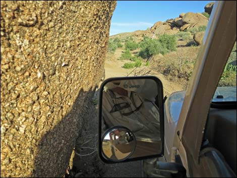
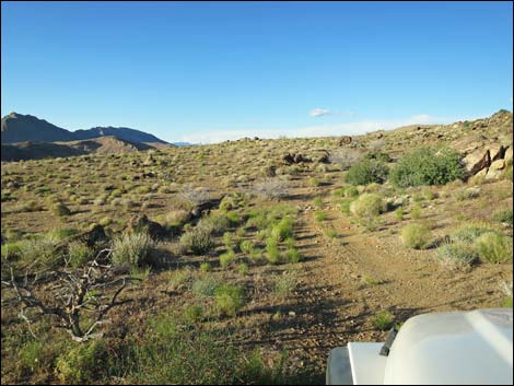
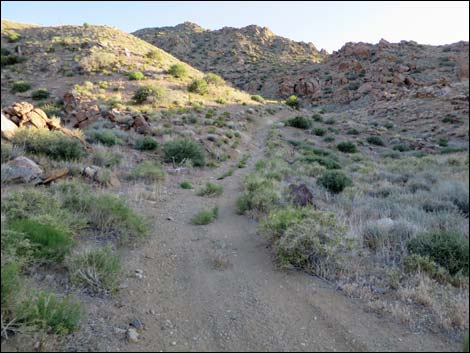
 Voight Well Road (view SE approaching Gold Butte Peak Road) |
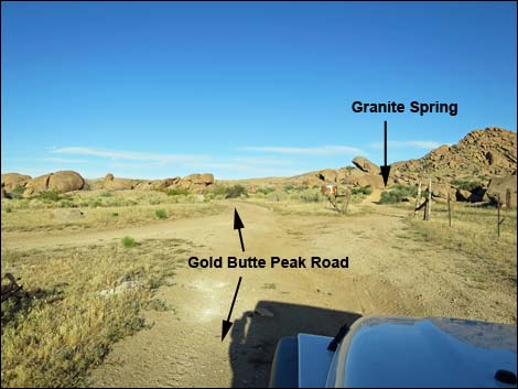
Overview Gold Butte Peak Road is a 1.8-mile-long dirt road that runs east from Voight Well, loops north around a long ridge, then turns south and runs all the way to a mine near the summit of Gold Butte Peak. The road can be thought of as consisting of three parts. Starting from Voight Well, the road runs east about 0.14 miles to a campsite that normally is accessible in a sedan. Beyond the campsite, a jeep trail runs another 0.97 miles to the base of Gold Butte Peak. Here, the real road ends, but hikers and ATVs can continue the remaining 0.71 miles to the mine site near the summit. This road provides access to Granite Spring (dry), primitive campsites, an old arrastra (like a grist mill), and the Gold Butte Peak Trail. Link to map. |
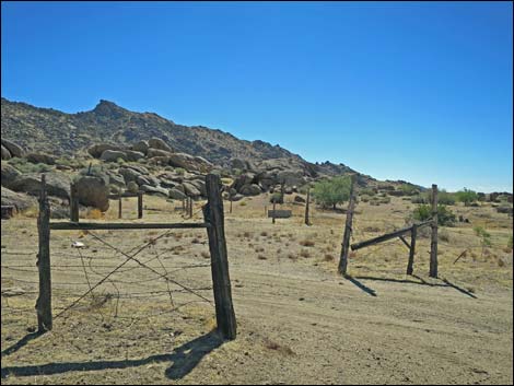
 Gold Butte Peak Road passes through an old fenceline (view SE) |
Watch Out Other than the standard warnings about hiking in the desert, ... this is a safe road to the trailhead at the base of the mountain, but beyond there, it is safer to hike. On the middle section of road, expect to receive "desert pin-striping" courtesy of the many shrubs growing over the road. Be aware that there are several old mines in the area, nails in old boards are present, and stray barbed wire presents tripping hazards. This is a wild and remote area without services of any kind (no restrooms, no water, no gas, no food). Bring what you need to survive. Be prepared and be self-reliant. Someone will find you eventually if you stay on a main road, but be prepared to survive alone for a day or two. Cell phones only work along parts of the paved road. While out, please respect the land and the other people out there, and try to Leave No Trace of your passage. Also, this is a remote area, so be sure to bring the 10 Essentials. |
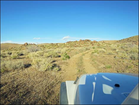
 Staying right at the split (view SE) |
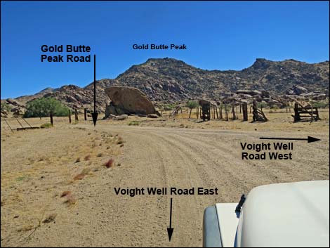
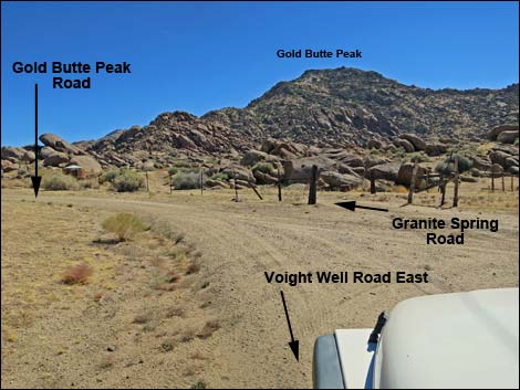
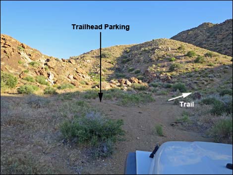
Getting to Gold Butte Peak Road Gold Butte Peak Road is located out in Gold Butte northeast of Lake Mead, about 3 hours northeast of Las Vegas in a wild, remote, and scenic area. From town, drive out to Gold Butte. Drive south on the paved Gold Butte Road to Whitney Pocket where the pavement ends. Continue south on the scenic unpaved Gold Butte Road for 19.8 miles a cattle guard that announces entry into the Gold Butte Townsite area. About 20 yards past the cattle guard, Voight Well Road forks left into the Voight Well area and proceeds south to an old corral. At the corral, Voight Well Road bends right to run west exiting the area, while Gold Butte Peak Road branches to the left. |
 Staying right at the split (view SE) |
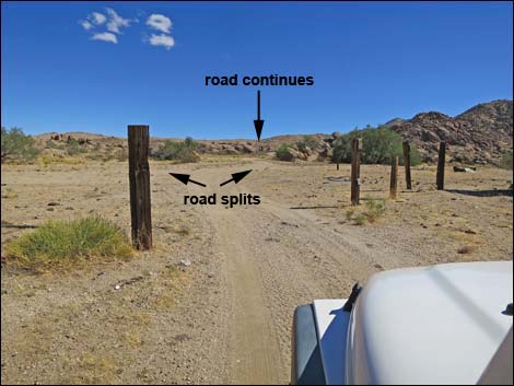
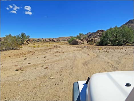
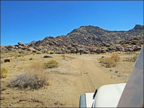
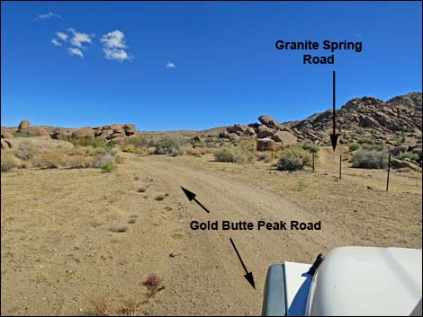
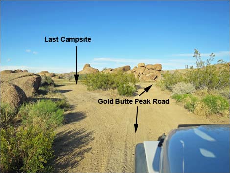
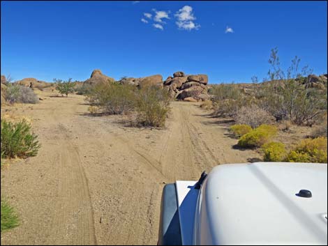
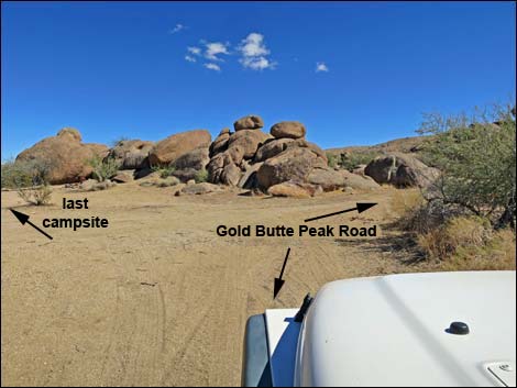
The Road From Voight Well Road at the historic corral (Table 1, Site 1698), Gold Butte Peak Road runs east to pass through a gap in an old fenceline (aligned north-south). Beyond the fenceline, the road bends a bit right, then splits equally with the forks passing to the left and right of a boulder pile that lies directly ahead. Beyond the boulder pile, the forks merge at a point where Granite Spring Road exits to the right through a gap in another fence (aligned east-west). Granite Spring Road can be seen on the other side of the fence running onto a low rise with an old water tank with a galvanized top. Staying on the left side of the Granite Spring fenceline, Gold Butte Peak Road quickly forks again, but this time the left is part of a pull-through campsite. Gold Butte Peak Road stays right, and bypassing the camp site (Site 1699), the road passes around another boulder pile. |
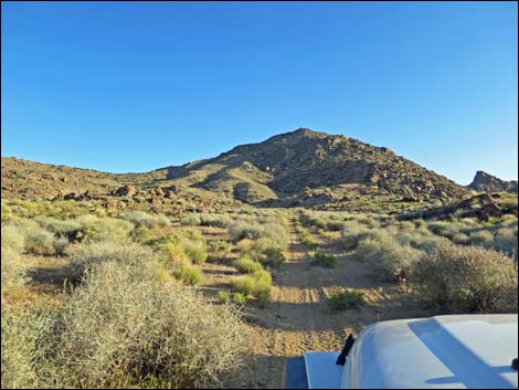
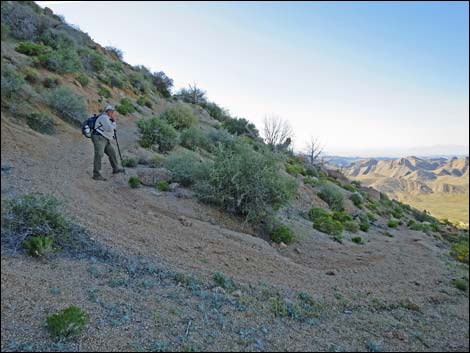
 Staying left at the split (view SE) |
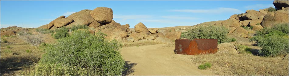
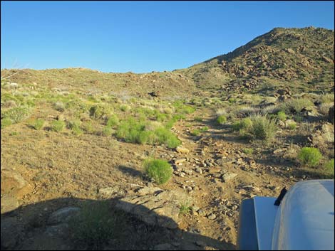
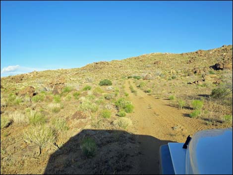
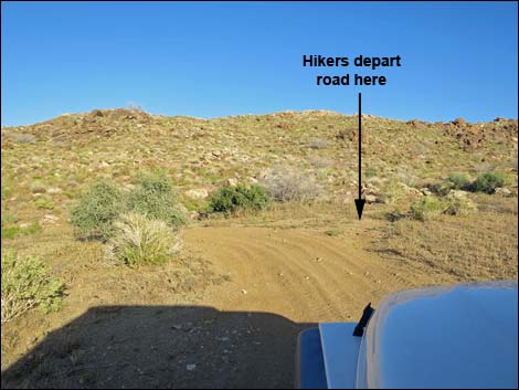
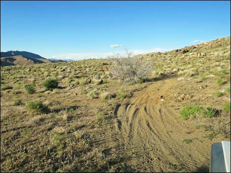
Gold Butte Peak Road quickly passes another rusting water tank (only the bottom section remains). At this point, a wide spot on the left serves at the last place to park before the road pinches through a narrow gap between large boulders. Beyond the narrow gap, Gold Butte Peak Road runs narrow as it winds between rocks and bushes. About 130 yards past the narrow gap, the road passes the historic arrastra on the right. Generally following a wash east, the road climbs gradually towards the North Ridge of Gold Butte Peak. Before getting there, the road exits the wash, making a big loop south, then climbs the hillside to the base of the ridge (Site 1700). For hikers, it is useful to depart the road here and climb over the ridge. |
 Staying left at the split (view SE) |
At the ridge, the road turns abruptly left and heads north along the base of the North Ridge. Eventually bending right around the north end of the ridge, the road turns back south along the other side of the ridge. A minor road forks left at the turn (Site 1701), but it dead-ends before too long. Continuing south, Gold Butte Peak Road eventually arrives at a turn-around at the end of the usable road (Site 1702). Beyond there, the road climbs steep and narrow to the mine site (Site 1753) near the summit, but the road is fit only for hikers and experienced ATV riders. For details of the hike up the rest of the road, see Gold Butte Peak. |
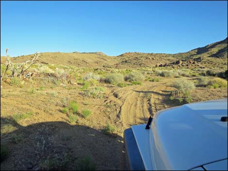
 Don't drive through fence onto Granite Spring Road (view S) |
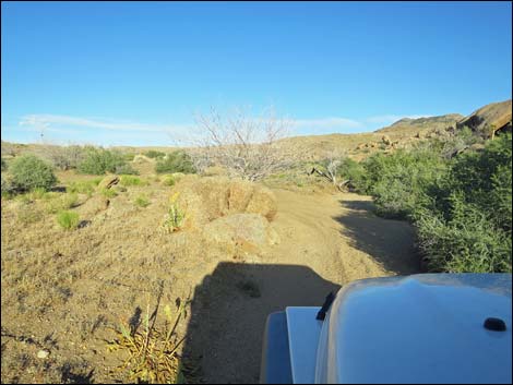
 Gold Butte Peak Road (view SE) |
 Gold Butte Peak Road at campsite loop (view E) |
 Staying right to pass campsite (view E) |
 Gold Butte Peak Road stays right past campsite loop (view E) |
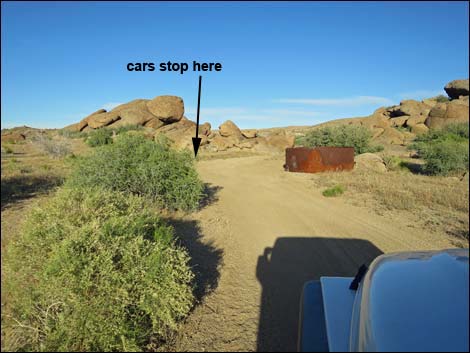 Gold Butte Peak Road at car parking (view E) |
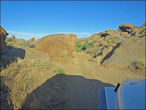 Gold Butte Peak Road approaching narrow gap (view E) |
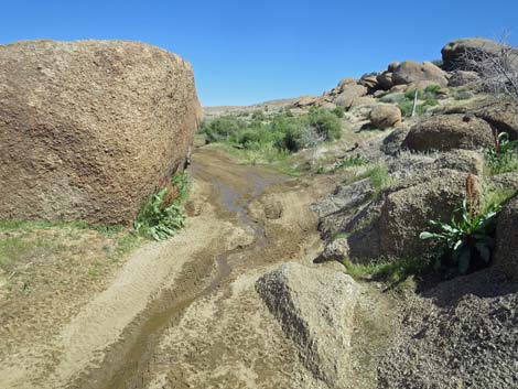 Water runs in the narrow gap after wet winters (view E) |
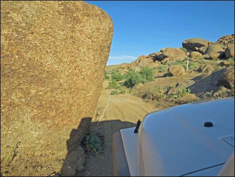 Gold Butte Peak Road at narrow gap (view E) |
 Yep, it's pretty tight! |
 Gold Butte Peak Road runs between rocks and bushes (view E) |
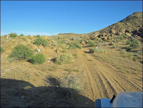 Gold Butte Peak Road runs in the open (view E) |
 Gold Butte Peak Road looping south out of the wash (view S) |
 Gold Butte Peak Road runs across rocks (view SE) |
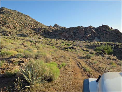
 Approaching North Ridge of Gold Butte Peak (view E) |
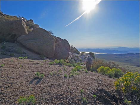
 Hikers from Voight Well depart road here (view SE; Trailhead 1) |
 Gold Butte Peak Road bends left along ridge (view N) |
 Gold Butte Peak Road runs along ridge (view N) |
 Gold Butte Peak Road runs along ridge (view N) |
 Gold Butte Peak Road turns around end of ridge (view E) |
 Gold Butte Peak Road runs back along ridge (view S) |
 Gold Butte Peak Road runs along ridge (view S) |
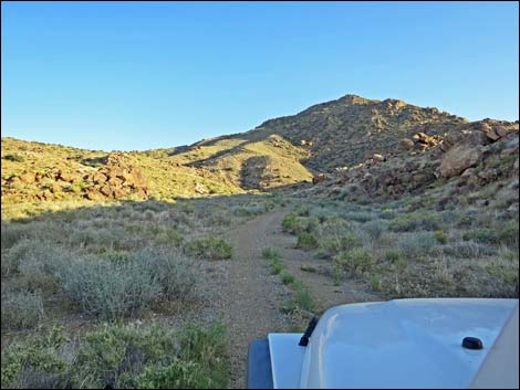
 Hikers from Voight Well return to road near here (view S) |
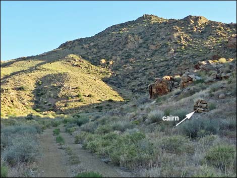
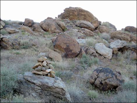 Hikers from Voight Well return to road near this cairn (view W) |
 Gold Butte Peak Road loop-about and Trailhead 2 (view S) |
 Gold Butte Peak Road continues for ATVs (view S) |
 The road runs steep and narrow (view NW) |
 Gold Butte Peak Road ends near the summit (view W) |
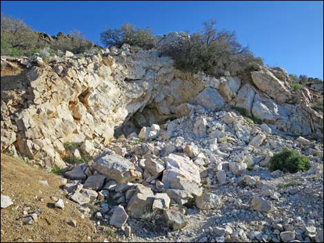 Upper mine (no mine opening; view S) |
 More to come ... |
Table 1. Highway Coordinates Based on GPS Data (NAD27; UTM Zone 11S). Download Highway GPS Waypoints (*.gpx) file.
| Wpt. | Location | Latitude (N) | Longitude (W) | Elevation (ft) | Point-to-Point Distance (mi) | Cumulative Distance (mi) | Verified |
|---|---|---|---|---|---|---|---|
| 1698 | Voight Well Area | 36.28362 | 114.19366 | 3,724 | 0.00 | 0.00 | Yes |
| 1699 | Gold Butte Peak Rd at Camp | 36.28323 | 114.19145 | 3,743 | 0.14 | 0.14 | Yes |
| 1700 | Gold Butte Peak Rd at Curve | 36.28147 | 114.18496 | 3,890 | 0.46 | 0.60 | Yes |
| 1701 | Gold Butte Peak Rd at Side Rd | 36.28254 | 114.18237 | 3,951 | 0.21 | 0.81 | Yes |
| 1702 | Gold Butte Peak Trailhead | 36.27850 | 114.18224 | 4,091 | 0.30 | 1.11 | Yes |
| 1753 | Gold Butte Peak Mine | 36.27402 | 114.18425 | 4,850 | 0.73 | 1.84 | Yes |
Happy Hiking! All distances, elevations, and other facts are approximate.
![]() ; Last updated 240326
; Last updated 240326
| Backroads Around Las Vegas | Hiking Around Las Vegas | Glossary | Copyright, Conditions, Disclaimer | Home |