Hiking Around Las Vegas, Gold Butte National Monument
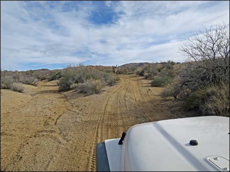
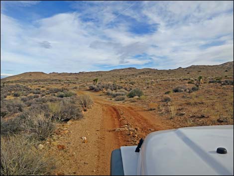
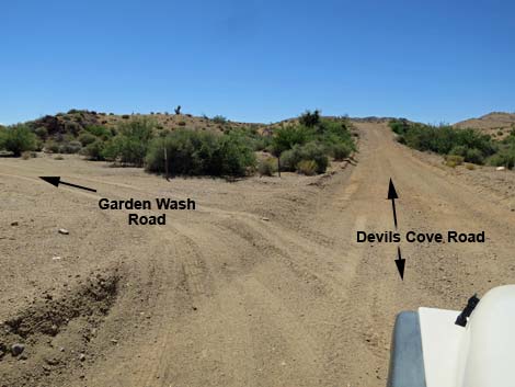 Devils Cove Road at Garden Spring Road (view SE) Devils Cove Road at Garden Spring Road (view SE) |
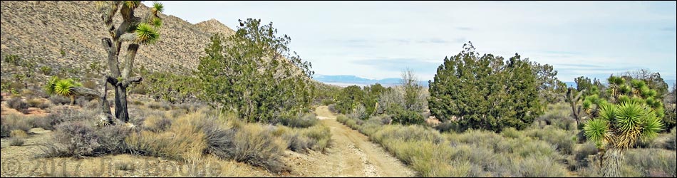
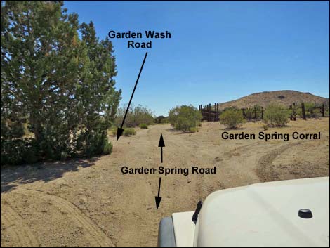
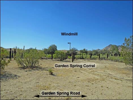
Overview Garden Spring Road is a side road off Devils Cove Road that provides 2WD-HC vehicle access to the historic Garden Spring Corral and Windmill, which is also a popular primitive camp area. Beyond the corral, Garden Wash Road runs down Garden Wash and is better suited for 4WD vehicles because of soft sand. The Fork Fire in 2005 scorched much of the area north of Garden Spring Road. Fire crews saved the corral and some of the surrounding vegetation. Trees in the area are mostly Utah Junipers and Shrub Live Oak, but include Singleleaf Pinyon Pine, Desert Willow, and Joshua Trees. Cattails grow in the wet area that is the spring. This is a nice place to camp and explore, so plan to spend a weekend exploring the historic site and surrounding natural wonders. Link to map. |
 |
Watch Out Other than the standard warnings about hiking in the desert, ... Garden Spring Road is fairly safe and without unusual hazards, but it requires a 2WD-HC vehicle to get to the corral. Beyond the corral, a 4WD vehicle is safer. This is wild and remote country without services of any kind (no restrooms, no water, no gas, no food). Bring what you need to survive. Be prepared and be self-reliant. Gold Butte National Monument is a big place and someone will find you eventually if you stay on a main road, but be prepared to survive alone for a day or two, or even longer on side roads. Cell phones don't work in this area. While visiting, please respect the land and the other people out there, and try to Leave No Trace of your passage. Also, this is a remote area, so be sure to bring the 10 Essentials. |
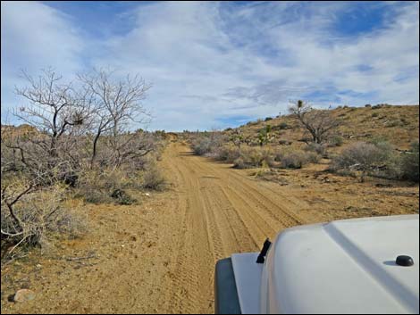
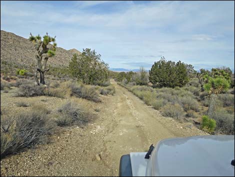
 Garden Spring Road (view E from Devils Cove Road) |
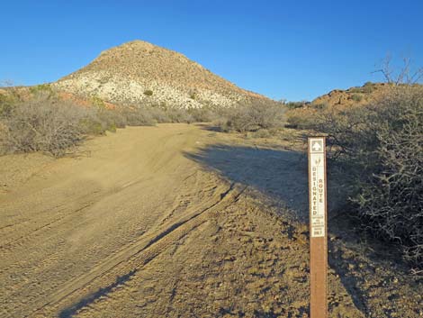
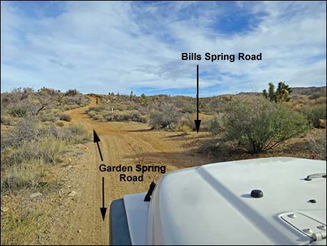
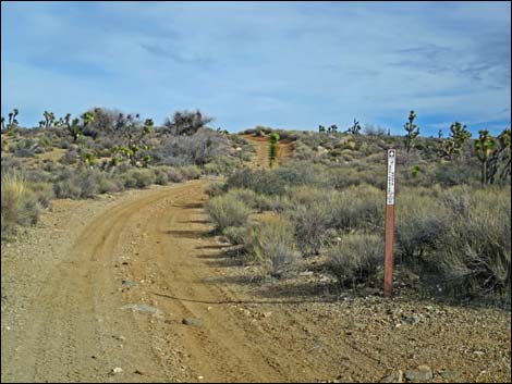
Getting to Garden Spring Road Garden Spring Road is located out in Gold Butte National Monument at the northeast end of Lake Mead, about 3 hours northeast of Las Vegas in a wild, remote, and scenic area. From town, drive out to Gold Butte National Monument. From Whitney Pocket, continue south on the unpaved Gold Butte Road to the signed Devils Cove Road. Stay left onto Devils Cove Road and continue south 1.0 miles. The relatively straight road bends left around the rocky toe of a ridge and crosses a major wash. Here, in the wash, Garden Spring Road branches left and heads up the wash. If the sand in the wash looks too soft, drivers may continue south on Devils Cove Road for another 0.2 miles to a 4-way intersection (Site 1776) with Bills Spring Road. The road left can be used to bypass the sandy wash and get back to Garden Spring Road. |
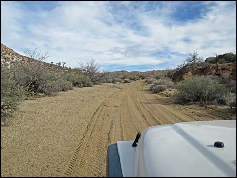
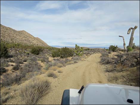
 Sandy Garden Spring Road (view E) |
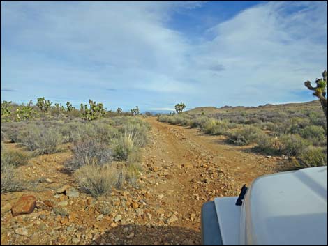
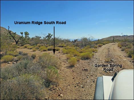
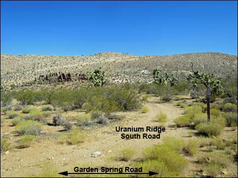
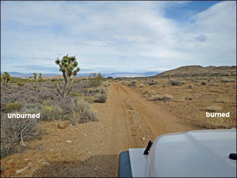
The Road From Devils Cove Road (Table 1, Site 1770), Garden Spring Road runs east and up the sandy wash through a shallow canyon. At about 0.2 miles out, a side road (Site 1777) merges from the right (this is the road that bypasses the sandy wash), and together the roads head east, climbing out of the wash rather steeply onto rolling desert flats. The road runs easterly along the base of Uranium Ridge, and at about 0.3 miles out, Garden Spring Road passes a T-intersection (Site 1447) with a minor side road to the left. This road, Uranium Ridge South Road, climbs steeply across the toe of Uranium Ridge to the crest of the ridge and ends. Shortly beyond Uranium Ridge South Road, Garden Spring Road was used as a fire line during the Tramp and Fork Fire of 2005. The results of the fire remain clearly visible after a dozen years. Some plants are growing back in the burn area on the south side of the road, but the difference from the south side of the road to the north side is striking. |
 |
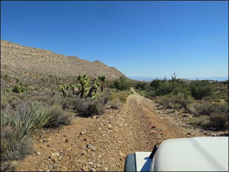
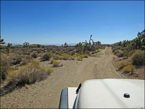
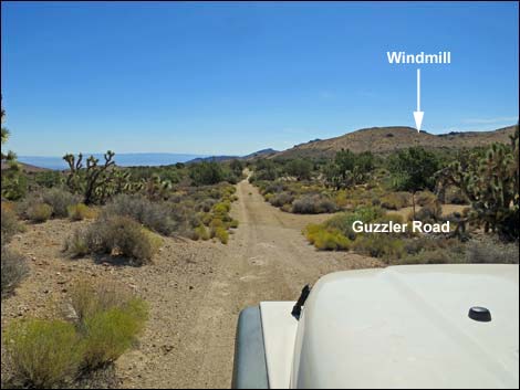
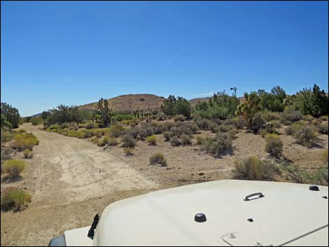
Much of the shrubbery on the unburned, north side of the road is Blackbrush, a very slow growing species that does better under wetter climate regimes than have been experienced in this area in the last 150 years; therefore, it is unlikely that Blackbrush will ever grow back here. Look for Blackbrush at higher elevations and farther north. The road exits the burn area and trends northeast along the base of Uranium Ridge. In this area, the vegetation is lush and diverse, with lots of Joshua trees, banana yucca, Utah juniper, and a few Singleleaf pinyon pines. The windmill, ahead in the distance, becomes visible in this area. The road rounds a low hill and bends right to the east. Shortly, a minor side road branches off to the right. This short road runs about 100 yards through the trees to a quail guzzler. It appears that people sometimes camp at the guzzler, but it is cruel to camp close to water because thirsty birds and other animals will be afraid to come in and drink. |
 Garden Spring Road approaching Bills Spring Road (view E) |
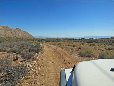
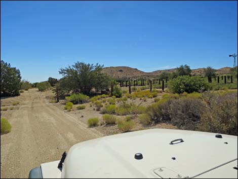
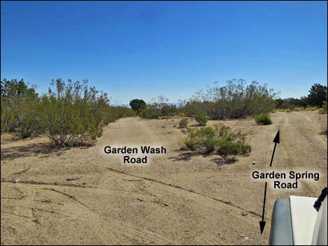
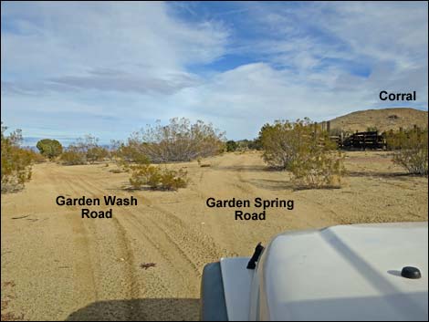
At about 0.7 miles out, Garden Spring Road enters the Garden Spring Corral area. In front of the corral (on the north side), the road forks (Site 1778). Here, Garden Wash Road angles left, while Garden Spring Road continues straight (along the corral), leading to the main campsite and another side road. At the northeast corner of the corral, Garden Spring Road forks again. Garden Spring Road continues straight a few yards east into the Garden Spring Campsite. The road right, Garden Spring South Road, runs south along the east side of the corral, then runs about 0.75 miles and ends on a low hillcrest. Maybe something was here before the fire, but there seems to be no current purpose for this road. Staying left at the first fork onto Garden Wash Road (Site 1778), this road runs northeast and descends across the landscape. Before long, the road drops into a wash. Garden Wash Road continues 4 miles and ends at an old cabin near the Azure Ridge Mine. |
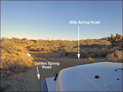 Garden Spring Road at Bills Spring Road (view E) |
 Garden Spring Road just beyond Bills Spring Road (view E) |
 Garden Spring Road climbs one fairly steep hill (view E) |
 More gentle terrain (view E) |
 Garden Spring Road at Uranium Ridge South Road (view E) |
 Uranium Ridge South Road (view N from Garden Spring Road) |
 Burn area on the right (view E) |
 Burn area on the right (view E) |
 Garden Spring Road at edge of burn area (view E) |
 Garden Spring Road beyond burn area (view NE) |
 Joshua trees and Utah juniper trees (view NE) |
 Road runs parallel to Uranium Ridge (view NE) |
 Road bends right away from Uranium Ridge (view E) |
 Approaching spur road to quail guzzler (view E) |
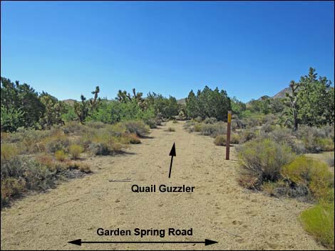 Spur road to quail guzzler (view S from Garden Spring Road) |
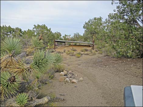 Quail Guzzler at end of spur road (view E) |
 Garden Spring Road approaching Garden Spring Corral (view E) |
 Garden Spring Road approaching Garden Spring Corral (view E) |
 Garden Spring Road approaching Garden Spring Corral (view E) |
 Fork: Garden Wash Road (left) and Garden Spring Road (straight) |
 Garden Spring Road at Garden Spring Corral (view S) |
 Garden Spring Road at Garden Wash Road (view E) |
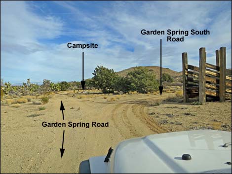 Garden Spring Road at Garden Spring South Road (view E) |
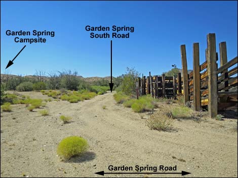 Garden Spring South Road runs along east edge of corral (view S) |
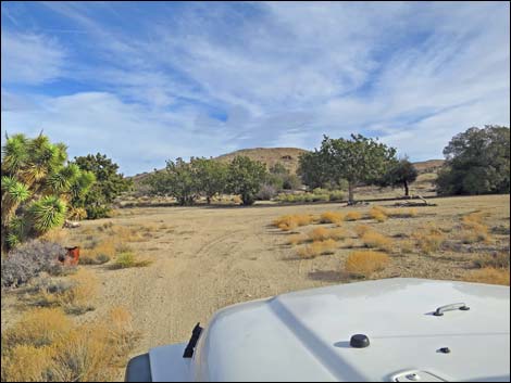 Garden Spring Road approaching the campsite (view E) |
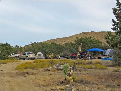 Happy campers (view E) |
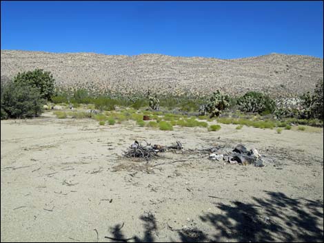 Campsite (view NW from under trees) |
 More to come ... |
Table 1. Highway Coordinates Based on GPS Data (NAD27; UTM Zone 11S). Download Highway GPS Waypoints (*.gpx) file.
| Site | Location | UTM Easting | UTM Northing | Latitude (N) | Longitude (W) | Elevation (ft) |
|---|---|---|---|---|---|---|
| 1447 | Garden Spring Road at Uranium Ridge North Road | 755702 | 4020725 | 36.29945 | 114.15250 | 3,735 |
| 1770 | Devils Cove Rd at Garden Wash Road | 755256 | 4020767 | 36.29995 | 114.15746 | 3,703 |
| 1776 | Devils Cove Road at Bills Spring Road | 755502 | 4020520 | 36.29766 | 114.15479 | 3,738 |
| 1777 | Garden Wash Road at Bills Spring Road | 755511 | 4020701 | 36.29929 | 114.15464 | 3,738 |
| 1778 | Garden Wash Road at Garden Spring Corral | 756296 | 4021009 | 36.30185 | 114.14580 | 3,719 |
Happy Hiking! All distances, elevations, and other facts are approximate.
![]() ; Last updated 240326
; Last updated 240326
| Hiking Around Gold Butte | Hiking Around Las Vegas | Glossary | Copyright, Conditions, Disclaimer | Home |