Hiking Around Las Vegas, Gold Butte National Monument
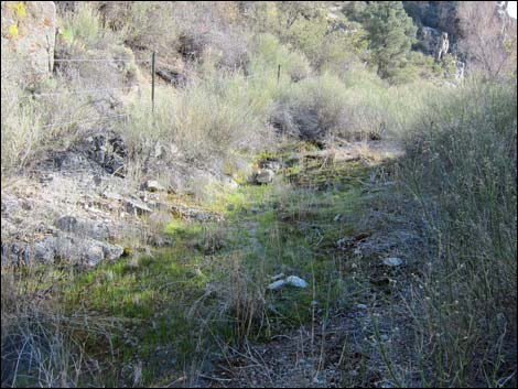
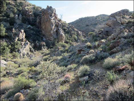
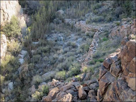
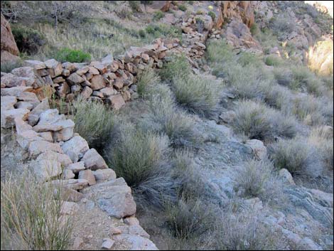
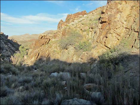
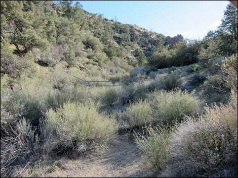 Canyon bottom with pipe-fence (view SW from trailhead) |
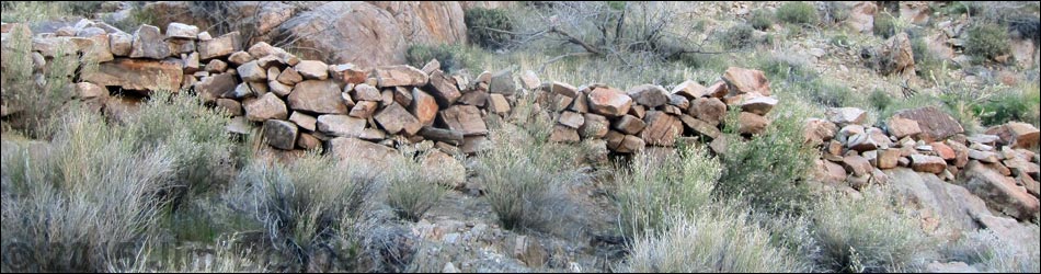
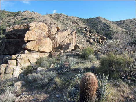
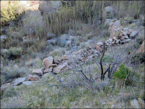
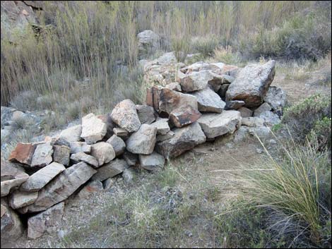
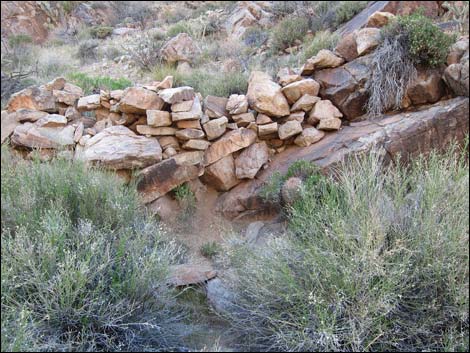
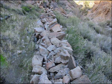
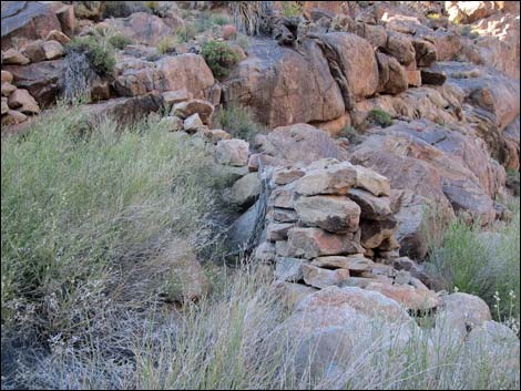
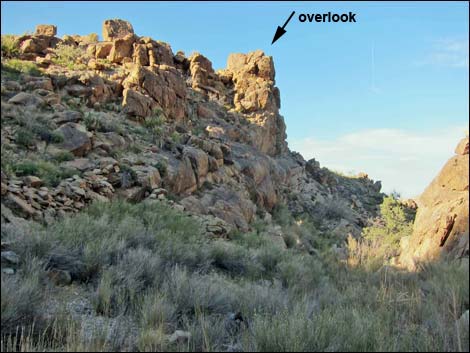
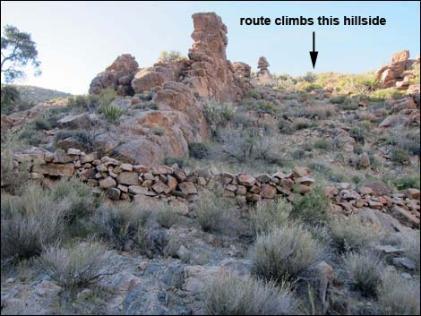
Overview Summit Spring is a fun little hike (0.5 miles round-trip) deep in the heart of Gold Butte National Monument at a spot along the interface between lower-elevation desert vegetation and the higher-elevation Pinyon-Juniper forest. The route ascends fairly steeply to an overlook, then descends even more steeply into the bottom of the canyon where water flows from the spring. At the spring, historic stone walls seem to have been designed to keep cattle out of the flowing water. Perhaps water was collected here and piped down the canyon to be used for domestic purposes by ranchers or miners. The walls were built using a sturdy double-wall construction, but time is taking its toll, and the walls are deteriorating. Please be careful and don't climb on the stone walls. Link to hiking map. |
 |
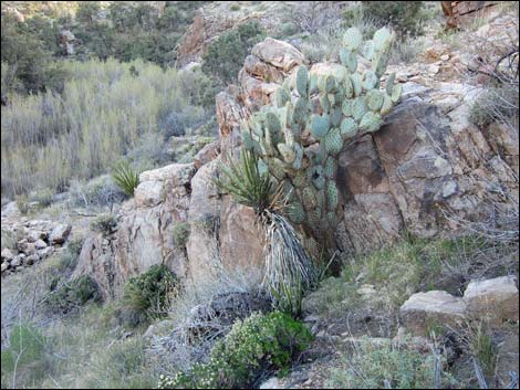
Watch Out Other than the standard warnings about hiking in the desert, ... this area is fairly safe, but watch for loose rocks on the steep parts. The craggy areas look like prime rattlesnake habitat, so be sure to watch carefully around the overlook. Always be extra careful when high enough to fall and get hurt -- help is a long way away. This is wild and remote country without services of any kind (no restrooms, no water, no gas, no food). Bring what you need to survive. Be prepared and be self-reliant. It is a big place, but someone will eventually find you if you stay on a main road, but be prepared to survive alone for a day or two, or even longer on side roads. Cell phones don't work here. While hiking, please respect the land and the other people out there, and try to Leave No Trace of your passage. Also, this is a very remote hike, so be sure to bring the 10 Essentials. |
 |
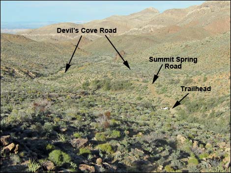
Getting to the Trailhead Summit Spring is located out in Gold Butte National Monument at the northeast end of Lake Mead, about 3 hours northeast of Las Vegas in a wild, remote, and scenic area. From town, drive out to Gold Butte National Monument. From Whitney Pocket, continue south on the unpaved Gold Butte Road for 16.5 miles to a fork. Stay left onto Devils Cove Road and continue south then east 4.3 miles to Summit Spring Road, on the right. Turn onto Summit Spring Road and drive about 300 yards southwest to a tight parking area at the end of the road. Park here; this is the trailhead. |
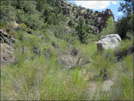
 Marshy area just inside the fence (view SW) |
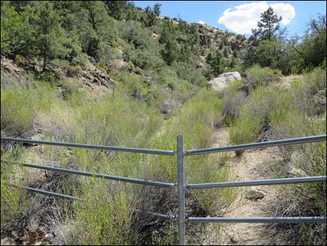
The Hike From the trailhead (Table 1, Waypoint 01), the route runs up the wash a few yards to a fence that encircles the spring area, then turns right and climbs the steep hillside outside the fence. When the hillside levels out a bit, the route arrives at a wire-fence gate (Wpt. 02) with an unusual lever mechanism for tightening the gate. Crossing into the fenced area, the route continues southwest up the hillside, staying above cliffs that drop into the canyon bottom. The route climbs onto a high point with a nice overlook (Wpt. 03) from which the spring area and stone walls can be seen far below. Continuing southwest past the overlook, the route descends steeply into the canyon bottom following a rancher's trail. Most of the historic stone walls are on the north side of the creek, and an old water tank remains in the bottom of the canyon. Retrace the route to return to the trailhead. Be sure to close the gate. |
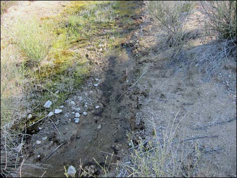 A bit of flowing water |
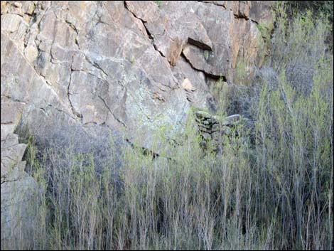
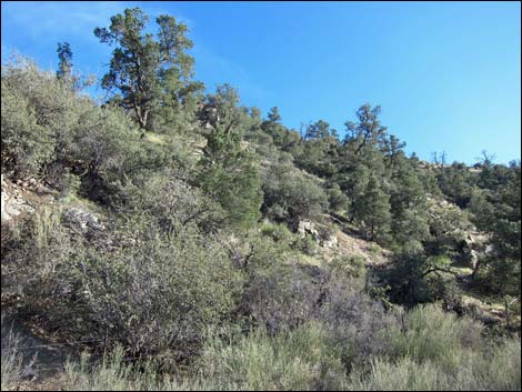 Pinyon-Juniper forest above the canyon bottom (view SW) |
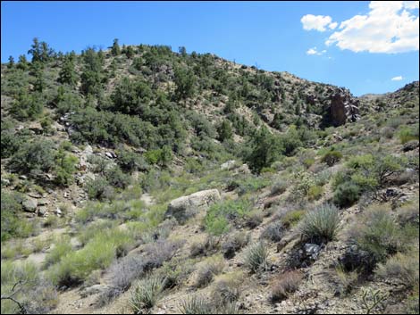 Summit Spring Canyon (view S while climbing steep hillside) |
 Summit Spring Canyon (view S while climbing steep hillside) |
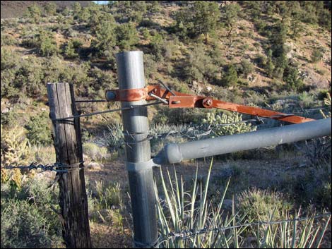 Gate (view S; enter fenced area here) |
 Approaching overlook (view S) |
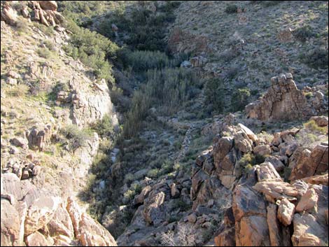 Overlook (view SW down towards spring) |
 Overlook (zoom view S down towards spring) |
 Descending steep hillside into the canyon bottom (view S) |
 Approaching the main stone wall (view S) |
 Stone wall (view S) |
 Stone wall |
 |
 |
 Stone wall |
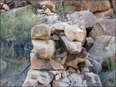 Stone wall showing double-wall construction |
 Summit Spring Canyon (view NE down canyon; notice water tank) |
 Stone wall across the canyon (view SE) |
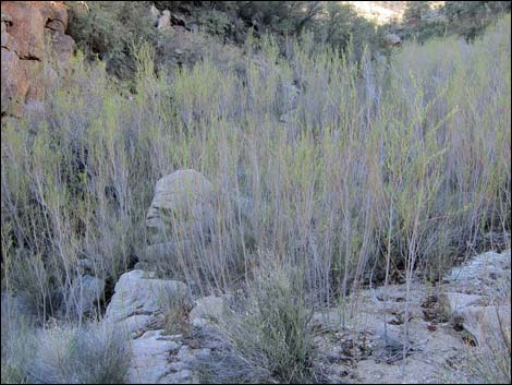 Arrowweed in the canyon |
 Summit Spring Canyon (view NE down canyon) |
 Exit route from the canyon bottom (view N) |
 Descending from near overlook (view NE) |
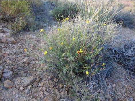 Rock Pea (aka Shrubby Deervetch) in bloom |
 more to come ... |
Table 1. Hiking Coordinates and Distances based on GPS Data (NAD27; UTM Zone 11S). Download Hiking GPS waypoints (gpx) file.
| Wpt. | Location | UTM Easting | UTM Northing | Elevation (ft) | Point-to-Point Distance (mi) | Cumulative Distance (mi) | Verified |
|---|---|---|---|---|---|---|---|
| 01 | Summit Spring Trailhead | 759071 | 4019433 | 3,818 | 0.00 | 0.00 | GPS |
| 02 | Gate | 759025 | 4019424 | 3,859 | 0.04 | 0.04 | GPS |
| 03 | Overlook | 758929 | 4019341 | 3,941 | 0.10 | 0.14 | GPS |
| 04 | Summit Spring | 758907 | 4019297 | 3,882 | 0.05 | 0.19 | GPS |
| 01 | Summit Spring Trailhead | 759071 | 4019433 | 3,818 | 0.19 | 0.38 | GPS |
Happy Hiking! All distances, elevations, and other facts are approximate.
![]() ; Last updated 240326
; Last updated 240326
| Hiking Around Gold Butte | Hiking Around Las Vegas | Glossary | Copyright, Conditions, Disclaimer | Home |