Hiking Around Las Vegas, Hiking Lake Mead NRA
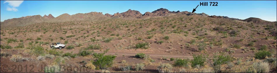
 Parking (view S from trailhead) |
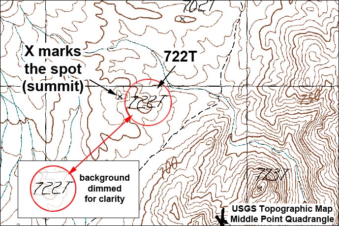
Overview Hill 722 is a short hike that runs about 0.6 miles round-trip into the Pinto Valley Wilderness Area. The route follows animal trails northwest up a gentle ridge to a low summit with grand views up and down Boathouse Cove valley and all around. The walking is easy, and the scenery is grand, making this a nice hike for people out 4-wheeling in the backcountry who need to stop and stretch their legs for a few minutes. This is not a destination hike - just a chance for some nice photos. The name of the route is taken from the summit designation on the USGS topo. The summit elevation is 722 m (2,368 ft). Link to image. Link to area map or hiking map. |
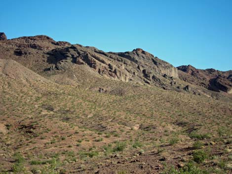
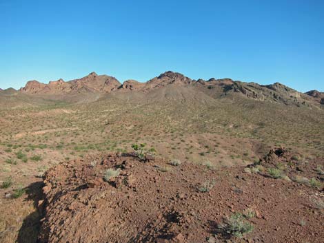
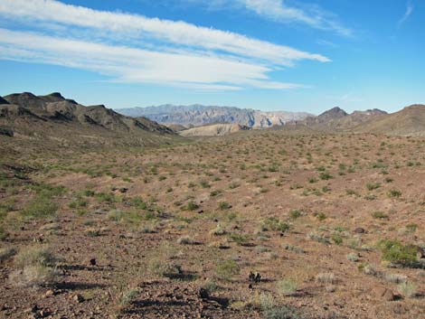
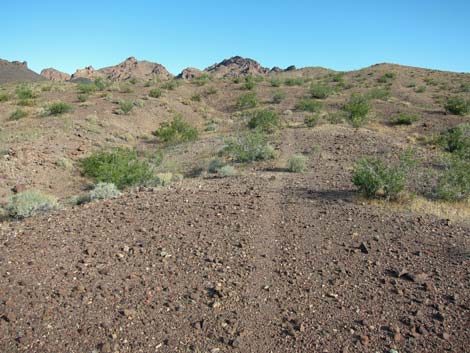 Start of the route follows animal trails (view NW) |
Watch Out Other than the standard warnings about hiking in the desert, ...this hike is pretty safe. There is nothing unusually dangerous about this route, but the region is remote, so be careful. Hikers could fall off the summit, so watch your step close to edges. A 4WD vehicle is required to reach the trailhead. While hiking, please respect the land and the other people out there, and try to Leave No Trace of your passage. This hike goes into the Pinto Valley Wilderness Area, so pay particular attention to respecting the land. This hike runs off-trail where nobody will find you, so be sure to bring the 10 Essentials. Cell phones do not work. |
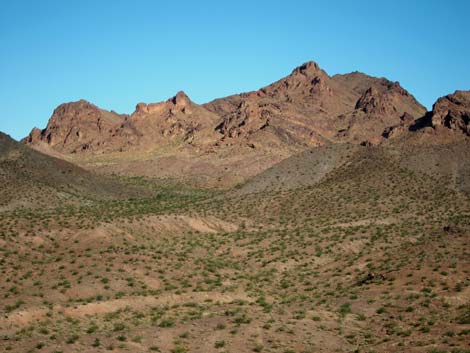
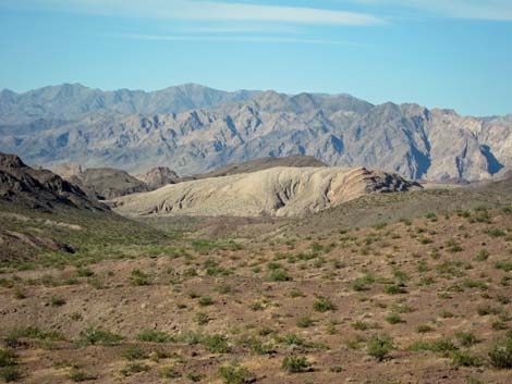
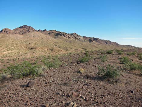 Gentle ridge near the summit (view N) |
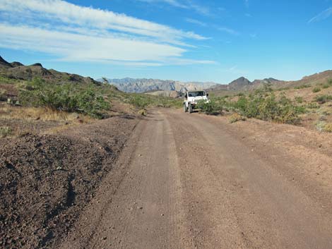
Getting to the Trailhead This hike is located in Lake Mead National Recreation Area, about 1-1/2 hours east of Las Vegas in the Northshore area. From town, drive out to Lake Mead, then drive north on Northshore Road for 30.0 miles to Boathouse Cove Road. Turn right on Boathouse Cove Road and drive south 4.7 miles to a saddle, which is 0.3 miles past the 4WD crossing of Miner's Wash. A few yards past the saddle, park at a wide spot on the right side of the road. Park here; this is the trailhead. For details and GPS waypoints, see the Boathouse Cove Road webpage. Note that 4WD is required to cross Miner's Wash. |
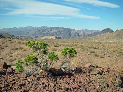 Summit with Schott's Pygmycedar (view S) |
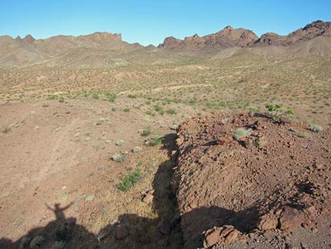
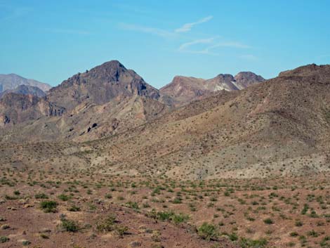
The Hike From the trailhead (Table 1, Waypoint 01), the route runs north a few yards on Boathouse Cove Road onto the saddle, then turns west and follows animal trails and runs without trails towards the low summit some 0.3 miles distant. The easiest route follows the ridgeline, which circles onto the summit (Wpt. 02) from the far side. Views from the summit a far grander than the short hike would imply. To the south, the view runs down Boathouse Cove Valley to mountains over in Arizona (Lake Mead is not visible), to the west is a ridge of the volcanic Black Mountains in the Pinto Valley Wilderness Area. To the north, the view runs up Boathouse Cove Valley, and to the east is another ridge of the volcanic Black Mountains, but this one is in the Jimbilnan Wilderness Area. |
 Summit (view NW) |
 Summit (view W) |
 Summit (view W) |
 Summit (view W) |
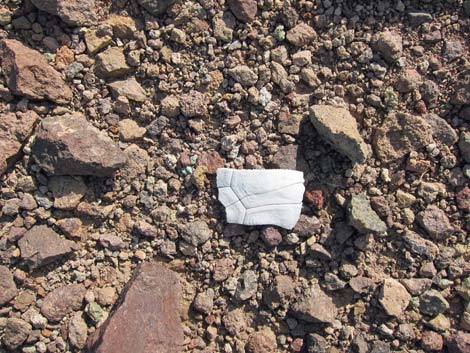 A desert tortoise spent its last day here |
 Summit (view SW) |
 Summit (view S; wide angle) |
 Summit (view S; telephoto) |
 Summit (view SW; telephoto) |
 Summit (view S; telephoto) |
Table 1. Hiking Coordinates Based on GPS Data (NAD27; UTM Zone 11S). Download Hiking GPS Waypoints (*.gpx) file.
| Wpt. | Location | UTM Easting | UTM Northing | Elevation (ft) | Point-to-Point Distance (mi) | Cumulative Distance (mi) | Verified |
|---|---|---|---|---|---|---|---|
| 01 | Trailhead | 726500 | 4010620 | 2,257 | 0.00 | 0.00 | GPS |
| 02 | Summit Hill 722 | 726375 | 4010945 | 2,368 | 0.29 | 0.29 | GPS |
| 01 | Trailhead | 726500 | 4010620 | 2,257 | 0.29 | 0.58 | GPS |
Happy Hiking! All distances, elevations, and other facts are approximate.
![]() ; Last updated 240326
; Last updated 240326
| Hiking Wilderness | Hiking Lake Mead | Hiking | Glossary | Copyright, Conditions, Disclaimer | Home |