Mountains Route, Downhill
Hiking Around Las Vegas, Lake Mead National Recreation Area
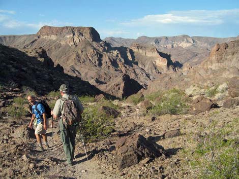
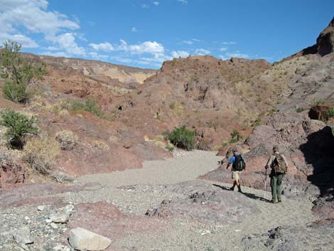
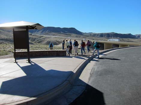 Hikers departing the t3railhead (view SW) |
Due to extreme temperatures, this area is closed during summer (usually May 15 to September 30). Link to details (PDF). Overview In addition to the Regular Route (White Rock Canyon) to Arizona Hot Spring, two other good routes lead down Hot Spring Canyon to the hot spring. The first, the Washes Route, is longer (2.8 miles) and easier, but requires down-climbing several pour-overs, including one that is 30-ft high and 4th-class. The second, the Mountains Route, is shorter (2.2 miles) and steeper, but avoids the climbing. Either way, this volcanic area is geologically interesting, and both routes lead to thigh-deep hot pools in the bottom of a deep, narrow slot canyon near the Colorado River. Using a tall ladder beyond the hot springs, hikers can continue to the Colorado River and restrooms. Arizona Hot Springs is a place to sit, relax in the warm water, and meet interesting people. Link to map or elevation profile. |
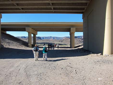 Hikers passing under Highway 93 (view SE) |
Hiking down the steep Mountains Route and hiking back up the Washes Route makes a nice partial loop. Hikers going down White Rock Canyon (the regular route) might use this as a return route. Parts of this route are quite steep, and there are a few sections requiring a bit of Class-2 scrambling, but the mountain route traverses a volcanic area with interesting rock formations, caves, and jumbled up geology. The upper and middle parts also harbor extensive stands of Brittlebush that provide a big splash of yellow in the spring. Watch Out Other than the standard warnings about hiking in the desert, ...the washes route is a fairly easy hike punctuated by three exciting pour-overs to downclimb. Most people probably would prefer a rope for the first, 30-ft downclimb. At the hot springs, be careful walking on rocks after you've picked up wet sand on the bottom of your shoes. |
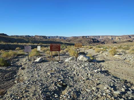 Trailhead signs (view SW) |
While hiking, please respect the land and the other people out there, and try to Leave No Trace of your passage. Also, this is a moderately long hike in a remote area, so be sure to bring the 10 Essentials. Be sure that you are physically fit and that you choose routes of the appropriate difficulty for your skills and endurance. Because of extreme summer temperatures, many hikers have required rescue in this area during recent years, putting the lives of rescue personnel at risk. Therefore, the National Park Service closes this area during summer. Getting to the Trailhead This hike is located along Highway 93, south of the Hoover Dam in Lake Mead National Recreation Area, about 45 minutes southeast of Las Vegas. From town, drive out to Lake Mead NRA, over the bridge into Arizona, and down to the White Rock Canyon Trailhead. Park here; this is the trailhead. |
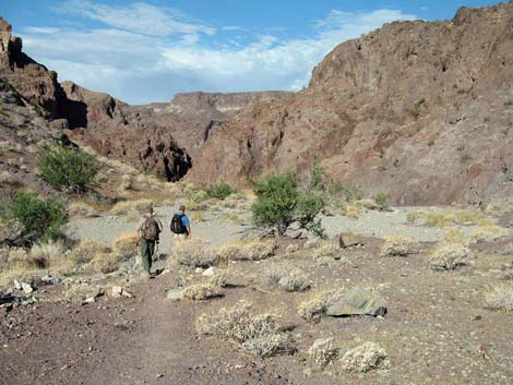
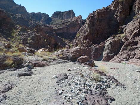
 Scene ahead: trail and old road lead to Hot Spring Canyon (view SW) |
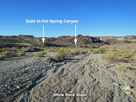
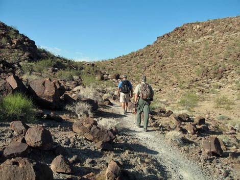
The Hike From the trailhead (Table 1, Wpt. 01), the trail runs down and right into White Rock Wash, and then down under the Highway 93 bridges. Just past the southbound bridge, trailhead signs (Wpt. 02) introduce the route. The signs give distances and directions to destinations, warn of flash floods, admonish hikers to "pack it in; pack it out," and warn of Naegleria fowleri (see above): Warning. Do not allow water to enter your nose. Naegleria fowleri, an amoeba common to thermal pools [including backyard hot tubs] may enter [your nose] causing a rare [brain] infection and death. While this is true, have you ever heard of someone dying from a brain infection they got from their hot tub? Pay attention, but keep your fears in perspective. |
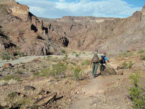
 Trail drops into a wash and joins an old road (view SW) |
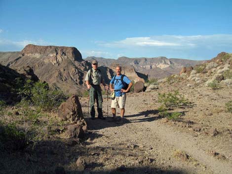
From the signs, the White Rock Canyon Route and the Hot Spring Canyon routes continue down White Rock Wash. The White Rock Canyon Route runs straight down White Rock Wash to the Colorado River, and hikers can look west, out across the close mountains, into the Black Canyon Wilderness Area in Nevada on the other side of the Colorado River. Turning around, the high mountains beyond the highway are Wilson Ridge, an ancient granite ridge that is the core of the volcano that produced the surrounding landscape, and which is protected for recreation and nature in the Mount Wilson Wilderness Area. At about 0.5 miles out, hikers can see a trail climbing the left bank (Wpt. 03) and exiting the wash to the southwest. Then, at about 0.6 miles out, adjacent to a "climb to safety" flash-flood warning sign, an old road can be seen exiting the wash to the left. Either of these routes can be used to exit White Rock Wash and hike over to Hot Spring Canyon. |
 The trail eventually climbs onto a low ridge (view SW) |
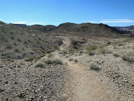
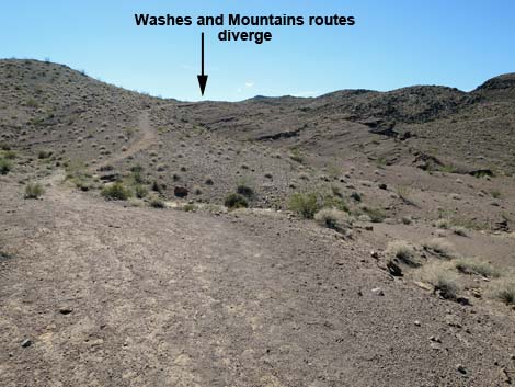
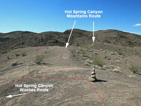
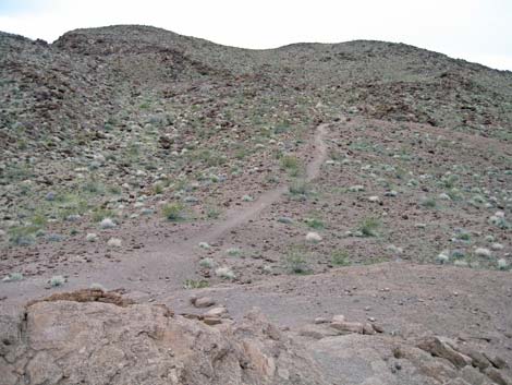
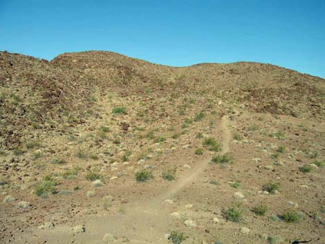
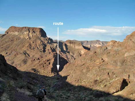
Out of the wash, the trail runs up over a low ridge, drops across a wash, climbs over a second low ridge, and drops into the next wash where it merges with the old road. Alternatively, hikers can follow the old road as it contours across the hillsides. Shortly after merging with the old road, the trail leaves the old road and runs up across a hillside onto a ridgeline (Wpt. 20), which is the highpoint along the Washes Route. At this point (Wpt. 20), the Washes Route and Mountains Route diverge. The Mountains Route turns right and heads west into the mountains, while the Washes Route turns left and heads south down into the canyon. From the highpoint (Wpt. 20), the Mountains Route runs west on slickrock atop the ridge. Because it is slickrock, the start of this trail is very faint, but looking farther to the west, the well-defined use-trail can be seen heading into a shallow canyon. When the slickrock runs out, the use-trail becomes obvious and continues on dirt heading up the shallow canyon to a saddle (Wpt. 22). |
 Trail junction: Washes and Mountains routes diverge (view W) |
From the saddle, the trail descends steeply across rocky hillsides and down rocky canyons until eventually reaching Hot Spring Canyon (Wpt. 23). In the main wash, the route continues downhill to the hot spring (Wpt. 12). About 40 minutes below the confluence, the route enters another set of narrows (Wpt. 13), the top of which is marked by a cottonwood tree and a mesquite thicket. The wash drops into a slot (10-ft easy scramble down) where the bottom of the slot has a small pool of hot water. The hot springs and hot pools are just around the corner (Wpt 12). From the hot springs, either return to the trailhead by hiking out the Mountain Route or the Washes Routes, or consider making a big loop and hiking out using the White Rock Canyon route, which requires no serious climbing and is not steep, but it is longer. From the beach, consider returning to the trailhead using the White Rock Canyon route or hike back up Hot Spring Canyon, but use the Washes Route. |
 After a low rise, the use-trail dips through a saddle (view W) |
 Atop low rise (view W) |
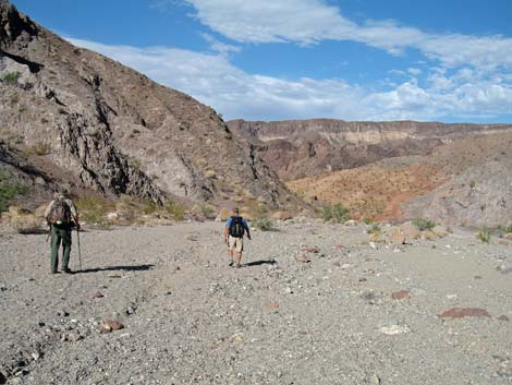
 Hikers approaching the saddle (view SW) |
 Saddle (view SW) |
 Start of steep descent (view SW) |
 Steep use-trail (view SW) |
 Steep use-trail levels out a bit (view SW) |
 Hikers approaching Hot Spring Canyon (view SW) |
 Hikers merging with Hot Spring Canyon, Washes Route (view SW) |
 Continuing down Hot Spring Canyon, Washes Route (view SW) |
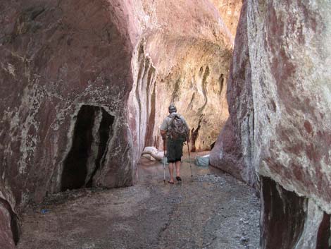
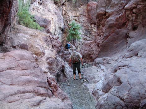
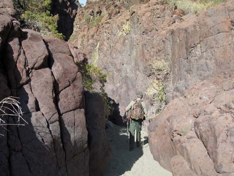 Narrow Hot Spring Canyon (view SW) |
 Wide Hot Spring Canyon (view SW) |
 Narrow Hot Spring Canyon (view SW) |
 Wide Hot Spring Canyon; nearing the hot spring (view SW) |
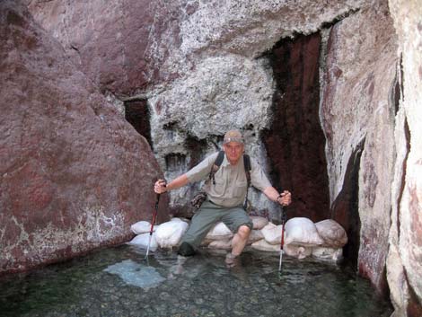 Hiker sitting on dam of upper hot pool (view W) |
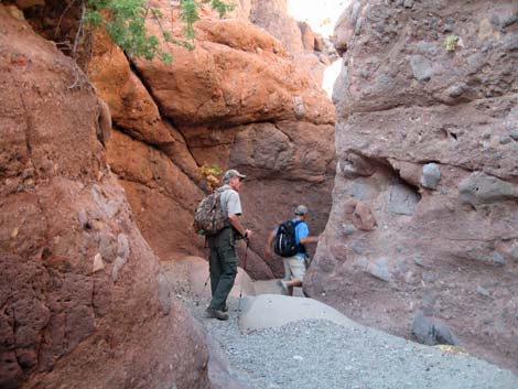
 Continuing down through the narrows (view W) |
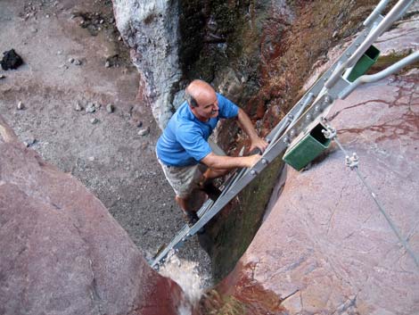 Hiker descending the metal ladder (view NW) |
 Continuing down through the narrows (view W) |
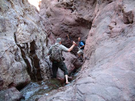 Continuing down through the narrows (view W) |
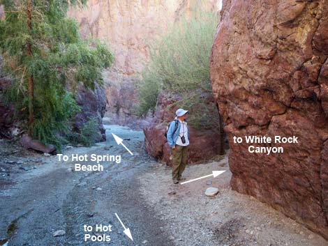 Hiker at junction with White Rock Canyon route (view SW) |
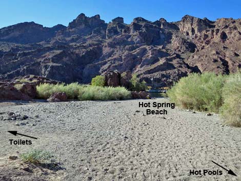 Emerging from the canyon onto Hot Spring Beach (view W) |
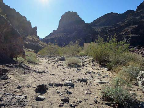 Toilets off to the left (view S) |
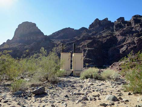 Use the toilets if you need them; keep this area sanitary (view SW) |
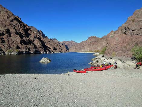 Canoes on Hot Spring Beach (view NW) |
Table 1. Hiking Coordinates and Distances based on GPS Data (NAD27; UTM Zone 11S). Download Hiking GPS Waypoints (gpx) file.
| Wpt. | Location | UTM Easting | UTM Northing | Elevation (ft) | Point-to-Point Distance (mi) | Cumulative Distance (mi) |
|---|---|---|---|---|---|---|
| 01 | White Rock Canyon Trailhead | 707677 | 3983996 | 1,536 | 0.00 | 0.00 |
| 02 | Trail Signs | 707597 | 3983812 | 1,492 | 0.15 | 0.15 |
| 03 | Hot Spring Canyon Route | 707130 | 3983517 | 1,393 | 0.36 | 0.51 |
| 20 | Crossing Ridge | 706875 | 3983095 | 1,420 | 0.34 | 0.85 |
| 22 | Saddle | 706631 | 3982933 | 1,497 | 0.23 | 1.08 |
| 23 | Mts Rt - Washes Rt Jct | 706204 | 3982315 | 1,077 | 0.52 | 1.60 |
| 12 | Arizona Hot Springs | 705211 | 3981772 | 757 | 0.89 | 2.49 |
| 11 | Hot Springs Canyon | 705061 | 3981744 | 653 | 0.18 | 2.67 |
| 24 | Hot Spring Beach | 704941 | 3981656 | 682 | 0.12 | 2.79 |
Happy Hiking! All distances, elevations, and other facts are approximate.
![]() ; Last updated 240326
; Last updated 240326
| Hiking Around Lake Mead | Hiking Around Las Vegas | Glossary | Copyright, Conditions, Disclaimer | Home |