Hiking Around Las Vegas, Lake Mead National Recreation Area
south section | north section
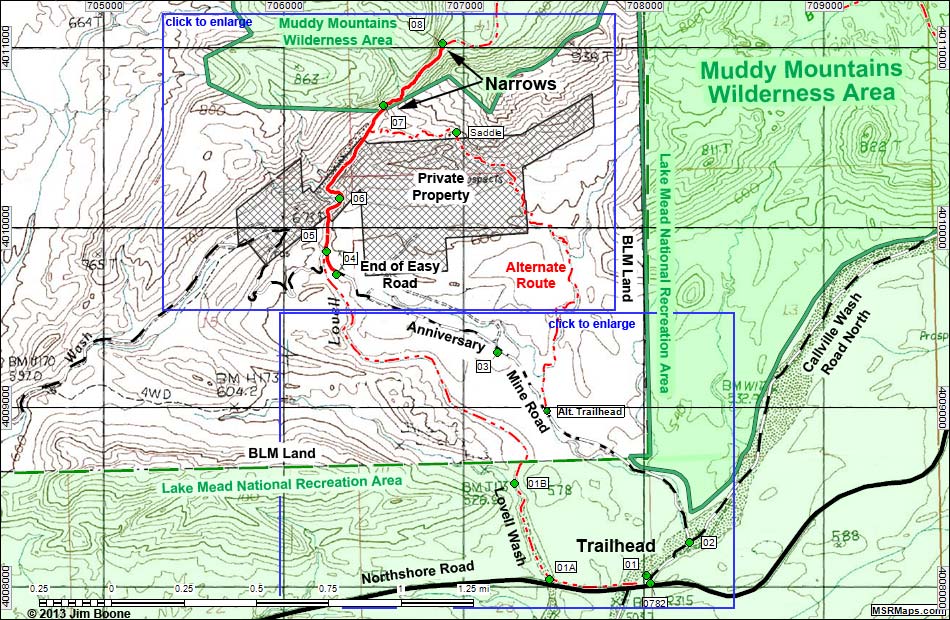
Note: Roads are black (solid = paved; dashed = unpaved). Trails and routes are red (solid = main; dashed = adjacent or alternate). Map based on USGS 7.5-minute topo map. North is at the top. Grid is UTM NAD27 CONUS. Wilderness Areas (boundaries solid green, fill dark green) based on BLM data. National Park Areas (boundaries dashed green, fill light green) based on NPS data. Private land (crosshatch gray) based on NPS data.
Happy Hiking! All distances, elevations, and other facts are approximate.
![]() ; Last updated 130308
; Last updated 130308
| Lovell Wash and Anniversary Mine Trail | Hiking Around Lake Mead | Glossary | Copyright, Conditions, Disclaimer | Home |