Hiking Around Las Vegas, Lake Mead National Recreation Area
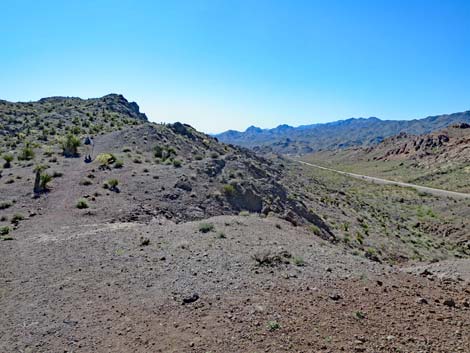
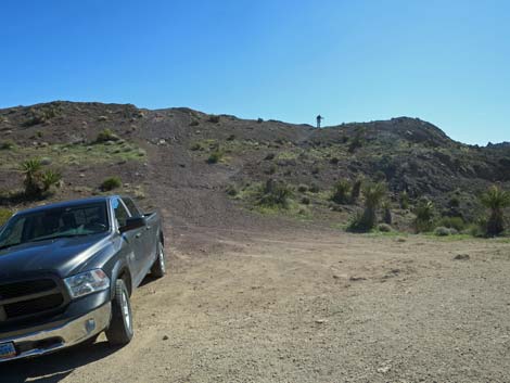 Trailhead parking; hiker atop First Ridge (view SE) |
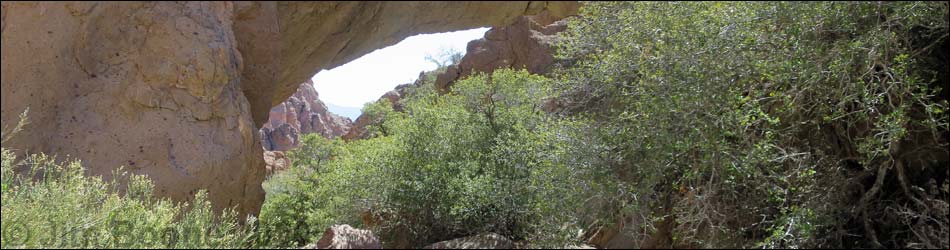
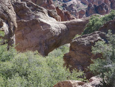
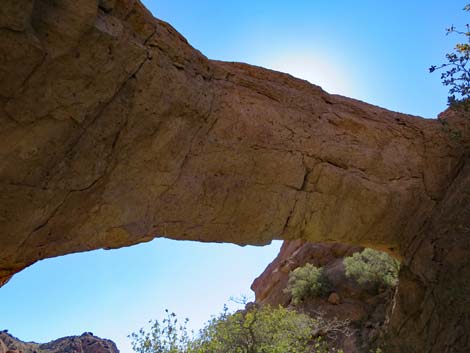
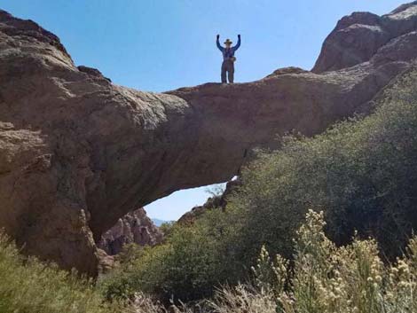
Overview Natural Bridge Canyon is a pleasant route that runs for 0.8 miles through a geologically interesting area to a spring and a natural bridge. The route starts on a use-trail (or on a short dirt road for less adventuresome drivers), crosses a couple of low ridges, drops into a wash, and runs down a shrub live oak-filled canyon to the bridge. The spring seems to provide a small amount of water, and the bridge spans the canyon. The bridge is about 25 feet long and about 10-feet thick at the center -- quite impressive. I wouldn't drive out there just to do this hike, but if I were in the Nelson area, I certainly would take this short hike to see the bridge. Link to map or elevation profile. |
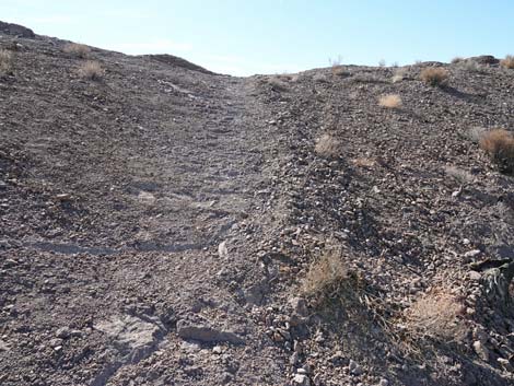
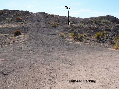 Trail angles up and away from the old road scar (view SE) |
Watch Out Other than the standard warnings about hiking in the desert, ...this hike is safe and easy, but for those of us more familiar with walking on rough (almost sticky) limestone and sandstone, the water-polished volcanic rock in the canyon is surprisingly slick. There is no need to climb anything, but be extra careful scrambling around the smooth boulders in the wash. While hiking, please respect the land and the other people out there, and try to Leave No Trace of your passage. Also, this hike is fairly short, so just bring what you need of the 10 Essentials. This hike is just outside the El Dorado Wilderness Area, so pay extra attention to respecting the land. |
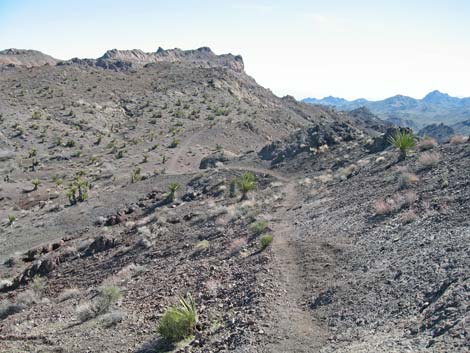
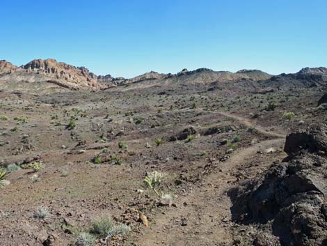
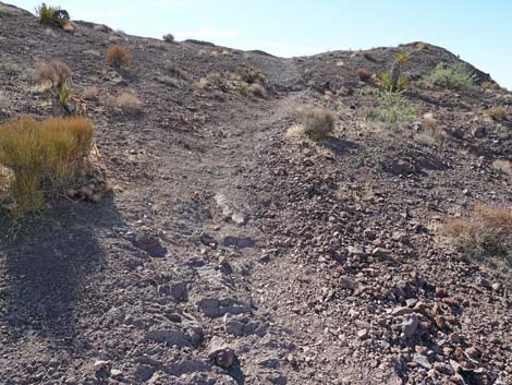 Trail runs up across First Ridge (view SE) |
Getting to the Trailhead This hike is located south of Las Vegas near the town of Nelson, just outside the Lake Mead National Recreation Area and adjacent to the El Dorado Wilderness Area. From Las Vegas, drive south on Highway I-11 towards Boulder City. Past Railroad Pass, exit right onto Highway 95 towards Searchlight and drive south for about 10 miles to Nelson Road (Highway 165) (Table 1, Site 0913). Turn left onto Nelson Road and drive east for about 9.5 miles to the trailhead turnoff (Site 0910). Watch for a "steep downhill road ahead" symbol sign, and then a narrow dirt road angling to the left and cutting up a hillside where the paved road goes into a road cut and starts down the steep hill. If you miss the turn, the road crests the hill in the roadcut and descends straight into Nelson (Site 0912). In Nelson, turn around and drive back to the top of the hill. From the first intersection (and the first curve) in Nelson, it is 1.4 miles back to the trailhead turnoff. |
 Trail runs up across First Ridge (view SE) |
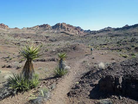
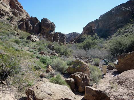
At the trailhead turnoff, either park off the pavement (Site 0910) or drive up the fairly rough road for 0.17 miles to the end of the road (Site 0911); don't try to drive up the very steep side of the ridge past the turn-around circle. Park here; this is the trailhead. The Hike From the trailhead at the end of the dirt road (Table 2, Waypoint 01), a use-trail angles up and southeast across the steep hillside to the top of the ridge (First Ridge) above the parking area. The vegetation community here is unusual; it is dominated by Mojave yucca, eastern Mojave buckwheat, and little else. The top of the ridge is a good place to stop and get orientated for the hike. From the saddle, a white, dome-shaped ridge is visible on the eastern horizon. Natural Bridge Canyon is in the canyon on the right (south) edge of the dome. To get there, the use-trail cuts south to circle around the head of a broad canyon, crosses a ridge, drops into the next wash, and follows that wash to the natural bridge. |
 Trail cresting onto First Ridge (view SE) |
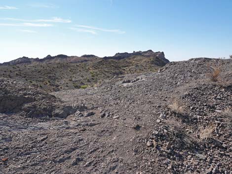
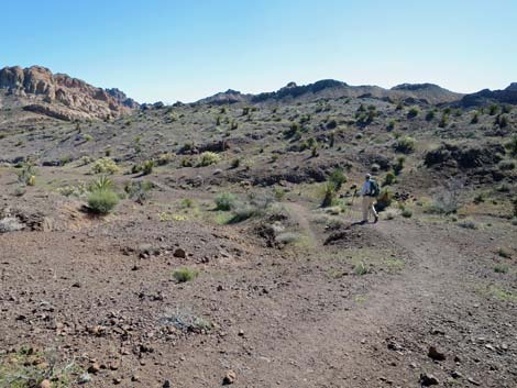
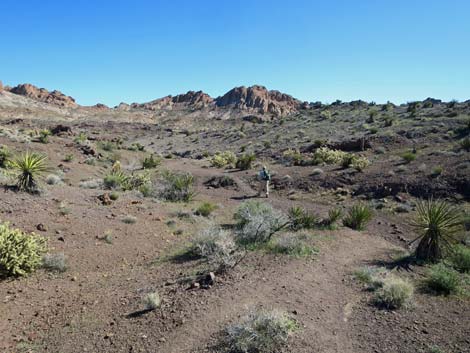
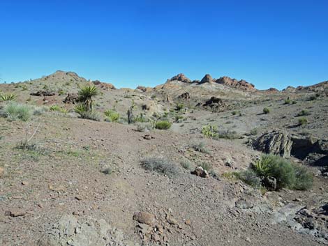
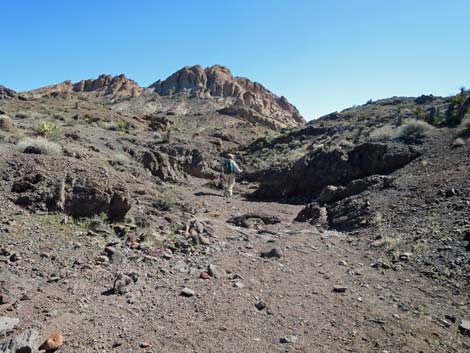
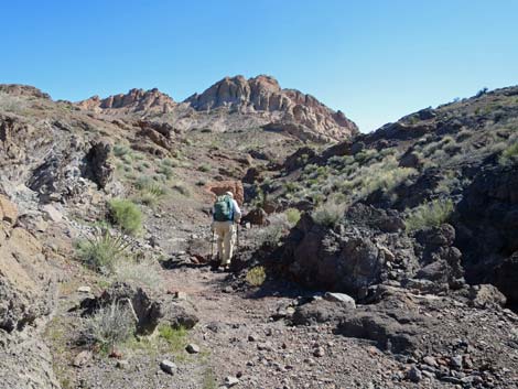
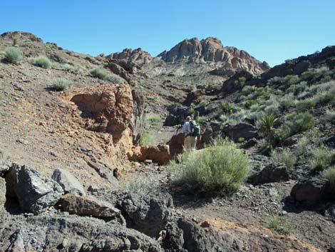
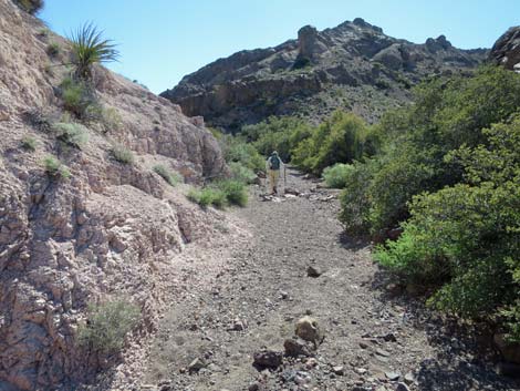
Continuing from the first ridgeline (Wpt. 02), the use-trail turns southeast and runs along the east side of the ridge to a flat area (Wpt. 03) with a view down onto the paved road and the town of Nelson. At this point, the use-trail bends to the east, crosses a wash, and cuts up the far hillside. The use-trail continues southeast for a short distance, then curves to the left and starts up towards the crest of the next ridge (Second Ridge) to the east (Wpt. 04). The trail continues over the ridge and drops into the next wash (Wpt. 05). Watch for aligned rocks or a cairn. This wash runs all the way to the natural bridge. On the ridges, the vegetation is sparse, but more diverse than at the trailhead. Along here, the shrubs include species such as creosote bush, Nevada ephedra, and indigo bush, plus some bitterbrush in gullies. There are also several species of cactus here, including teddybear cholla, buckhorn cholla, Engelmann's hedgehog cactus, and beavertail cactus. |
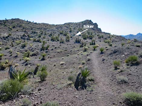
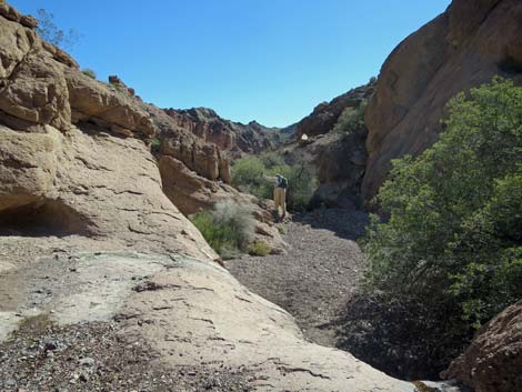
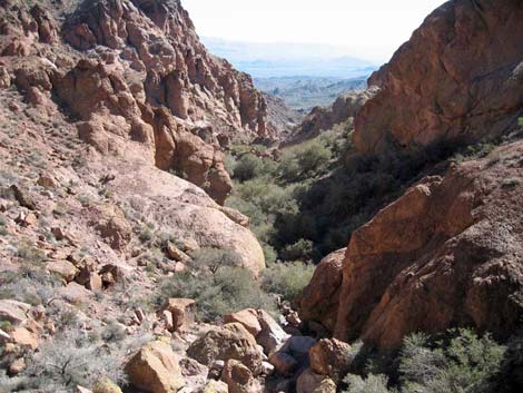
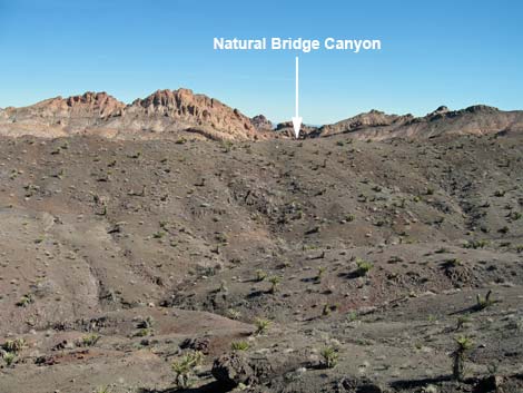 Natural Bridge Canyon in the distance (view E from First Ridge) |
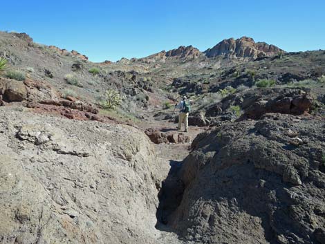
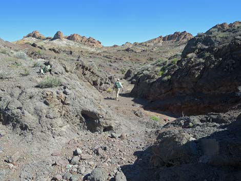
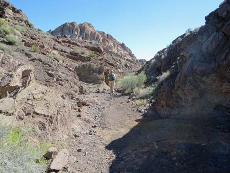
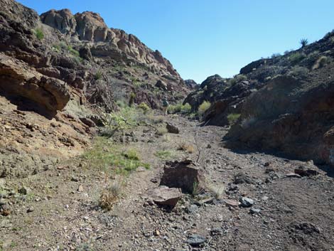
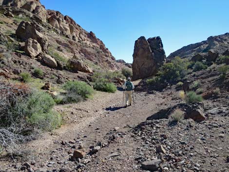
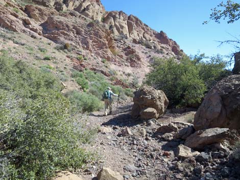
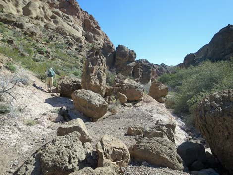
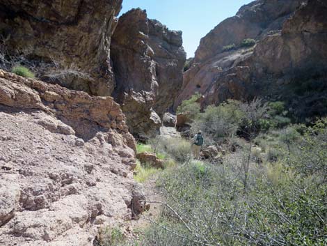
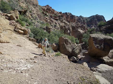
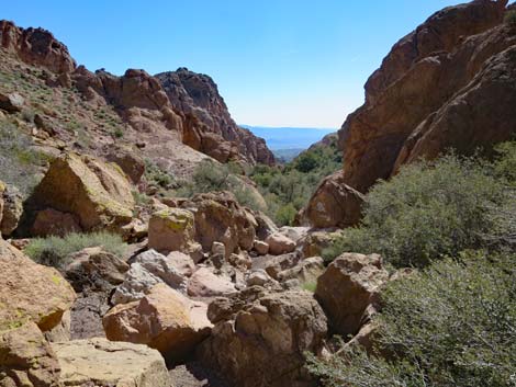
In the wash, the route turns northeast and runs downhill, occasionally on a use-trail, but generally just in the wash or on the rocks along the edge of the wash. Initially, the landscape is fairly flat and open (Wpt. 06), but it is dissected by many little wash-lets and does not provide an overall view of the area. On the way back out, I found this area to be a bit disorienting, so pay attention to the route on the way down the wash. The route continues northeast, down the wash, until it jogs to the southeast and enters a fairly straight gully cut into the bedrock. By this time, it is obvious that the route is leading down the canyon to the south of the white, dome-shaped ridge. At the end of the straight gully, the route passes an unusually large boulder on the south edge of the wash (Wpt. 07) and starts down into the canyon. The boulder has been described as an Easter Island stone statue (moai), and for hikers taking the direct route to Virlis-Fisher Arch, this is the turnoff. |
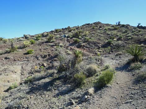
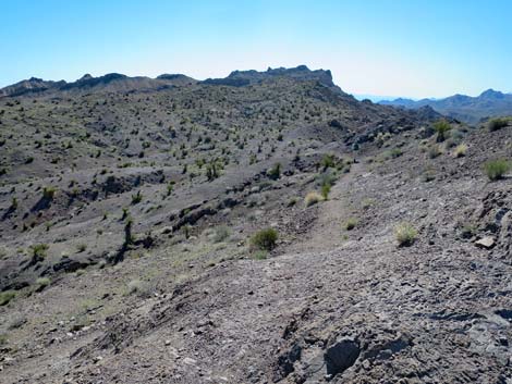 From First Ridge, trail runs south along side of the ridge (view SE) |
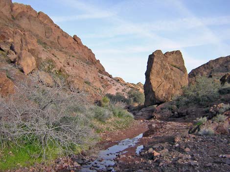
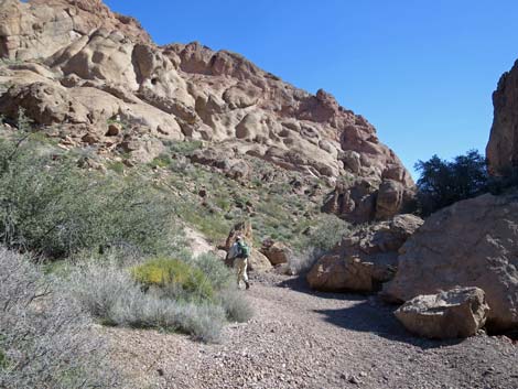
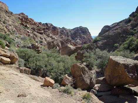
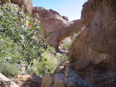
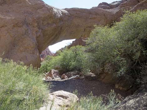
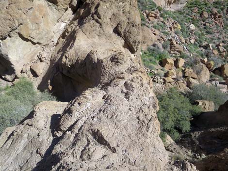
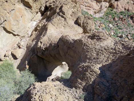
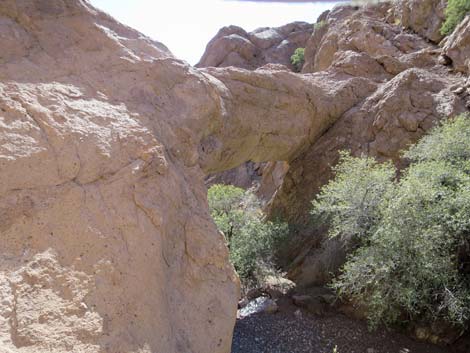
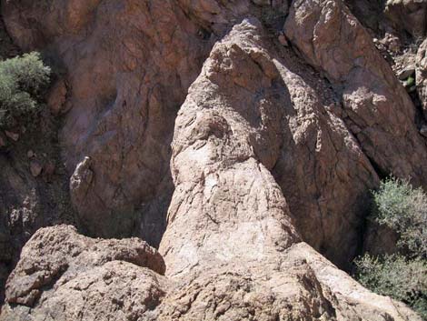
In the canyon, the route follows the wash past many shrub live oak trees to Bridge Spring (Wpt. 08), which is high on the south hillside. The canyon bottom is choked with shrub live oak, skunk bush, and other shrubs, and a use-trail cuts around the north side of thicket, bypassing the spot where water from the spring hits the bottom of the wash. Some of the rock through here has an unusual character: it looks like small, sharp edged, red stones set in a solid matrix of gray volcanic tuff. Past Bridge Spring, the route passes a pair of very large boulders (Wpt. 09) in the bottom of canyon just beyond a little pour-over. On the north hillside just a few feet beyond the boulders, hikers can look down the canyon and see the natural bridge, which is about 150-200 feet ahead. This probably is the best place to get an overview photo of the bridge. |
 The trail continues along the ridge through a saddle (view SE) |
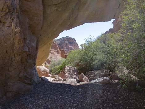
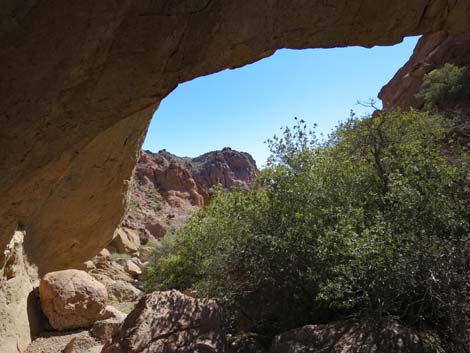
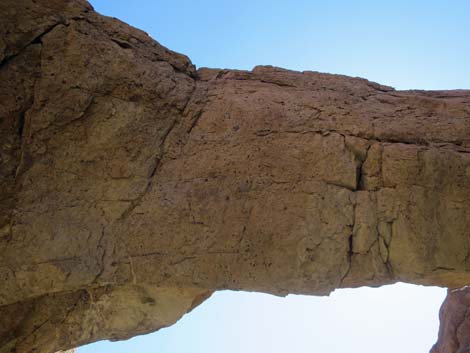
Scrambling around boulders in the bottom of the canyon, the route continues the last few yards down to Natural Bridge (Wpt. 10). The rock here is volcanic tuff: gray-brown and full of black flecks. The bridge spans the entire canyon, which is about 20-25 ft wide. The bridge is about 10-12 ft thick in the center. Around the bridge, the vegetation is dominated by shrub live oak on the sides of the wash and desert baccharis in the wash. The top of the bridge is accessible from both upstream sides. It is a bit easier to scramble up the south side of the canyon, but this side is much higher, and hikers must then scramble down onto the bridge. After contemplating the geologic and erosional forces that created such a place, and enjoying the solitude, return to the trailhead by retracing your footprints. I found myself a bit confused on the way out because of the lack of landmarks, so follow the wash and watch carefully for the stone cairns and lines of stones that mark the trail. If you get lost, just continue hiking west (towards the sunset), and you will hit the paved road. |
 Nelson Road and Nelson Town (view S) |
 Trail runs out and bends left (view SE) |
 Hiker on trail climbing towards Second Ridge (view NE) |
 Trail continues past Second Ridge (view SE) |
 The trail heads down towards the next wash (view SE) |
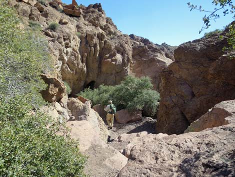
 Hiker approaching the wash (view SE) |
 Hiker starting down the wash (view E) |
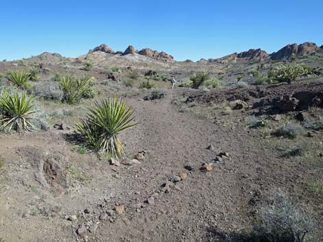 Rock alignments guide hikers in and out of the wash (view NE) |
 Trail runs along edge of wash (view NE) |
 Trail runs above the wash (view NE) |
 Trail runs in wash (view E) |
 Trail runs down wash (view E) |
 Trail runs down wash (view E) |
 Trail runs down wash (view E) |
 Interesting outcrop of red stone (view E) |
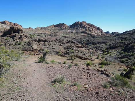
 First view down the long, straight canyon (view E) |
 Long, straight canyon (view SE) |
 Hiker approaching the Easter Island moai (view SE) |
 Easter Island moai at the head of the canyon (view SE) |
 Trail runs down the canyon (view SE) |
 Lots of Shrub Live Oak in the canyon (view SE) |
 Trail runs down the canyon (view SE) |
 Bypassing boulders on the left (view SE) |
 Hiker working through boulders in the canyon bottom (view SE) |
 Shrubs choke the canyon bottom (view SE) |
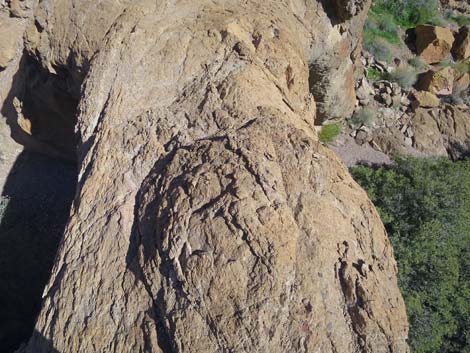
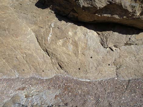 Curious bedrock with geologist sample holes (view N) |
 Geologist sample hole in the bedrock (view N) |
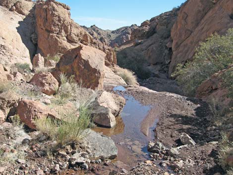 During wet times, water flows in the wash (view SE) |
 During dry times, the wash is dry (view SE) |
 Hiker on short switchback bypassing an obstacle (view SE) |
 A pair of boulders and a view of Natural Bridge (view SE) |
 Natural Bridge (view SE from the pair of boulders) |
 Hiker loses view of the arch (view SE) |
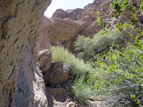
 Another brief view of Natural Bridge (view SE) |
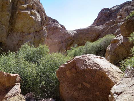 Shrubs and boulders block the wash (view SE) |
 A narrow passage along the north wash of the canyon (view SE) |
 Approaching Natural Bridge (view SE) |
 Natural Bridge (view SE) |
 Natural Bridge (view SE) |
 Under Natural Bridge (view SE) |
 Under Natural Bridge (view SE) |
 Beyond Natural Bridge (view SE) |
 Natural Bridge (view NE from above) |
 Natural Bridge (view NE from above) |
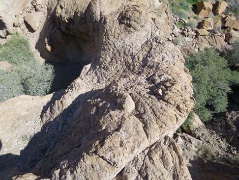 Natural Bridge (view NE from above) |
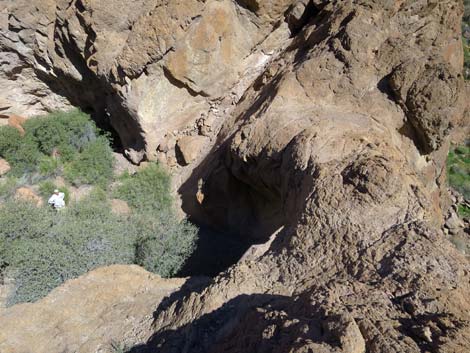 Natural Bridge (view NE from above) |
 Natural Bridge (view NE from above) |
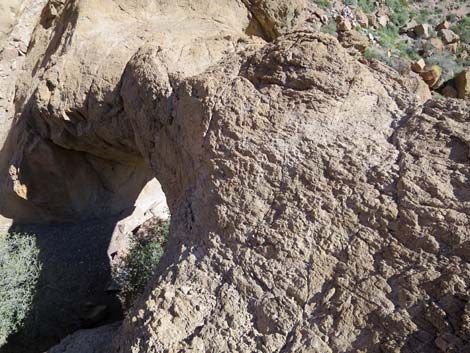
 Natural Bridge (view straight down from above) |
 Natural Bridge Canyon (view SE from atop bridge) |
 Hiker atop Natural Bridge (view SE) |
 Natural Bridge (view S from North Buttress) |
 Natural Bridge (view S from atop North Buttress) |
Table 1. Hiking Coordinates Based on GPS Data (NAD27; UTM Zone 11S). Download Hiking GPS Waypoints (*.gpx) file.
| Wpt. | Location | Easting | Northing | Elevation (ft) | Point-to-Point Distance (mi) | Cumulative Distance (mi) |
|---|---|---|---|---|---|---|
| 01 | Trailhead | 696310 | 3955737 | 3,508 | 0.00 | 0.00 |
| 02 | Ridge | 696345 | 3955719 | 3,531 | 0.03 | 0.03 |
| 03 | Trail junction | 696394 | 3955674 | 3,493 | 0.04 | 0.07 |
| 04 | Ridge | 696498 | 3955638 | 3,531 | 0.10 | 0.17 |
| 05 | Cairn in wash | 696621 | 3955602 | 3,478 | 0.09 | 0.25 |
| 06 | Open area | 696669 | 3955661 | 3,468 | 0.05 | 0.30 |
| 07 | One big boulder | 697070 | 3955738 | 3,392 | 0.11 | 0.59 |
| 08 | Spring | 697244 | 3955690 | 3,375 | 0.13 | 0.72 |
| 09 | Two big boulders | 697321 | 3955671 | 3,394 | 0.06 | 0.77 |
| 10 | Natural Bridge | 697345 | 3955650 | 3,359 | 0.03 | 0.80 |
Happy Hiking! All distances, elevations, and other facts are approximate.
![]() ; Last updated 240326
; Last updated 240326
| Hiking Around Lake Mead | Hiking Around Las Vegas | Glossary | Copyright, Conditions, Disclaimer | Home |