Hiking Around Las Vegas, Hiking Lake Mead NRA, Hiking Wilderness Areas
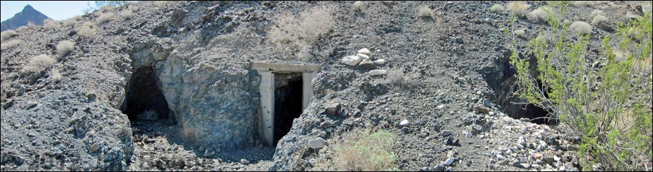
 Miner's Quarters in low knoll (view SW) |
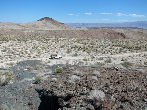
Overview This point of interest along Rockefeller Mine Road provides visitors with a site to stop, get out of the vehicle, stretch the legs, and recall a time when men, with hopes for a better life just like ours, toiled in the desert trying to dig gold, copper, and silver from these hard-rock mountains. Mining activity here probably dates from about 1910-1920, and at this site, miners converted a shallow adit to living quarters. This point of interest offers great solitude, grand scenery (Ireteba Peaks Wilderness Area lies just across the road), and the chance to visit an historic mining area. Please leave things as you find them: all items here are protected by the National Park Service. Link to route map. |
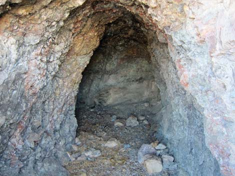
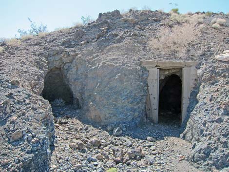 Adit (left) and Miner's Quarters (view S) |
Watch Out Other than the standard warnings about hiking in the desert, ...the area near the road is fairly safe, but there is an unmarked 8-ft-deep pit on the east side of the hill. While holes in the ground are inherently interesting, old mines are never safe -- Stay Out, Stay Alive! Remember that this area is remote, and visitors are far from help, so be careful. Access to this area requires a high-clearance vehicle. While out and about, please respect the land and the other people out there, and try to Leave No Trace of your passage. This site is near Wilderness, so pay particular attention to respecting the land. If visitors wander from the road, nobody will find you, so be sure to bring the 10 Essentials. Cell phones don't work. |
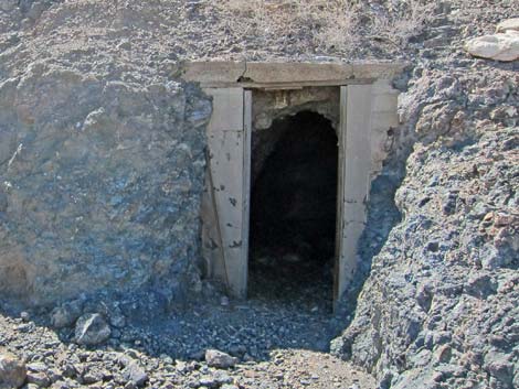 Cement door frame at Miner's Quarters (view S) |
Getting to the Site This point of interest is located in Lake Mead National Recreation Area, about 2 hours south of Las Vegas, east of Searchlight. From town, drive south on Highway 95 to Searchlight (Table 1, Site 0927). In downtown Searchlight, turn left onto Cottonwood Cove Road and drive east for 7.8 miles) to Rockefeller Mine Road (Site 1320) on the left. Drive generally northward on Rockefeller Mine Road for 10.4 miles to a small pullout on the left (southwest) side of the road (Site 1357) adjacent to a gray hill. Watch for the mine openings. Park here; this is the site. This site is 0.7 miles past the signed intersection of Rockefeller Mine Road with Camp Dupont Mine Road and Opal Mountain Road. |
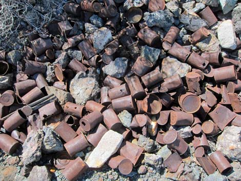 Can dump records historic cans |
The Site The low gray knoll adjacent to the road is penetrated by six prospects (3 adits, 1 prospect, 1 trench, and 1 pit). The largest adit, which is not too large or deep, was modified to living quarters by the addition of a door and perhaps widening the back. An extensive can dump, with cans dating to the 1910s or 1920s, provides evidence that this site was living quarters rather than a storage area. No other gear or equipment remains at the site. Desert Woodrats, or "packrats," have taken up residence here and for decades have armored their nest with the spines of teddybear cholla, so if people enter the adits, their shoes will be filled with cactus spines. |
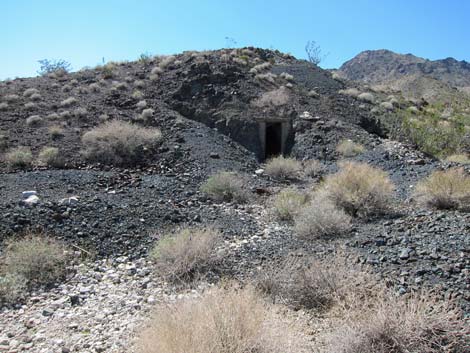
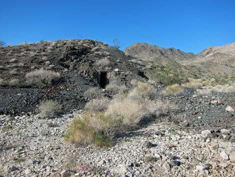 Living Quarters Knoll (view SW) |
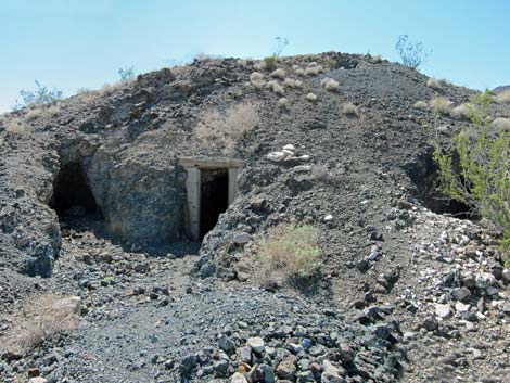 Living quarters (center) and two shallow adits |
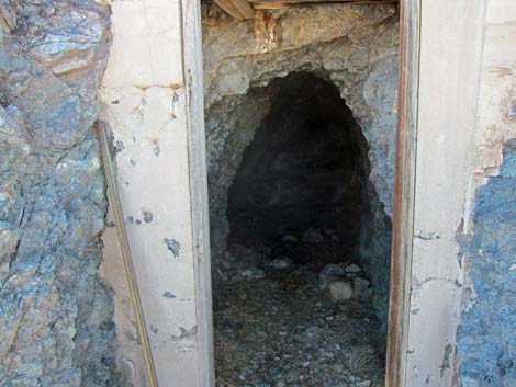 Cement door frame and roof timbers |
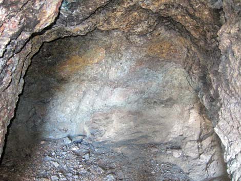
 Inside living quarters |
 Back of cramped living quarters |
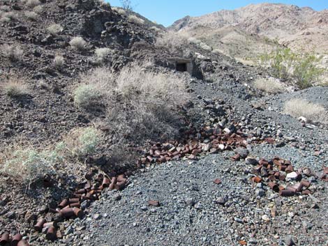 Extent of can dump |
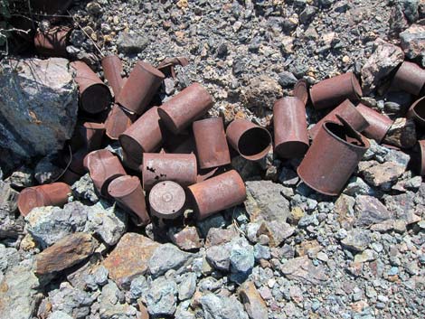 Historic cans |
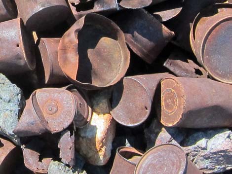 Historic cans |
 Atop Living Quarters Knoll (view NE) |
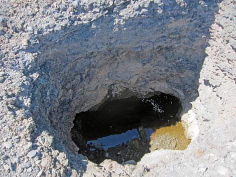 Unmarked pit on east side of Living Quarters Knoll (view SW) |
Table 1. Highway Coordinates Based on GPS Data (NAD27; UTM Zone 11S). Download Highway GPS Waypoints (*.gpx) file.
| Site | Location | UTM Easting | UTM Northing | Latitude (N) | Longitude (W) | Elevation (ft) | Verified |
|---|---|---|---|---|---|---|---|
| 0927 | Hwy 95 at Hwy 164, Searchlight | 688813 | 3926424 | 35.46519 | 114.91921 | 3,500 | Yes |
| 1320 | Cottonwood Cove Rd at Rockefeller Mine Road | 701103 | 3928204 | 35.47882 | 114.78341 | 1,982 | GPS |
| 1323 | Rockefeller Mine Road at Opal Mtn Rd | 702755 | 3937877 | 35.56564 | 114.76280 | 1,768 | GPS |
| 1357 | Rockefeller Mine Road at Miner's Quarters | 701986 | 3938594 | 35.57226 | 114.77110 | 1,924 | GPS |
Happy Hiking! All distances, elevations, and other facts are approximate.
![]() ; Last updated 240326
; Last updated 240326
| Hiking Wilderness | Hiking Lake Mead | Hiking | Glossary | Copyright, Conditions, Disclaimer | Home |