Backroads Around Las Vegas, Lake Mead National Recreation Area
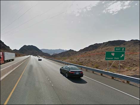 Highway 93 approaching Hoover Dam Road; Exit 2 (view E) Highway 93 approaching Hoover Dam Road; Exit 2 (view E) |
Text and numbered photos by Mark Petterson, except photos 2-4, 6-9, 11, 12, 17-19, 22, 23, 29, 30, and 32 by Tessa Griffey. Overview The Black Canyon Overlook access roads (totaling 4 miles), including Goldstrike Pass Road, Goldstrike Parallel Road, and Black Canyon Overlook Road, are rough backcountry roads that climb high into the north end of the rugged Eldorado Mountains between Boulder City and Hoover Dam. These roads offer extraordinary birds-eye views of Lake Mead, the entire Hoover Dam area, Fortification Hill, Black Canyon, and beyond. Every year, hundreds of thousands of motorists (including locals) exit at Nevada Route 172 and turn left to head for Hoover Dam, never giving a second thought about the mountains to the right (south). And each year, thousands of people hike on the popular Goldstrike Hot Springs Trail, most of them not knowing of the gorgeous vistas that lay hidden in the mountains almost literally over the top of their heads. Link to map. |
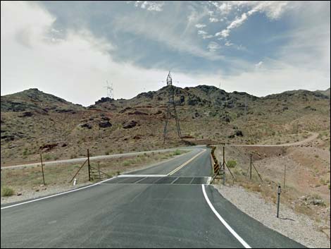
 Exiting onto Hoover Dam Road; Exit 2 (view E) |
If you stood at the north end of the Mike O'Callaghan–Pat Tillman Memorial Bridge and knew exactly where to look up into the tortured jumble of rocks to the southwest, conceivably you could see (with binoculars) Black Canyon Overlook at the end of this road. And chances are, you would exclaim incredulously: You can drive up there? A drive on these roads will lead to views that rival the nearby helicopter rides – and you can save the $69 per person! If you have a sturdy, high-clearance vehicle (4WD is strongly recommended), don't have an overwhelming fear of heights, and can train your scenic eye to "tune out" the numerous power lines and towers, these roads are definitely worth exploring. Not many people even realize that they exist. |
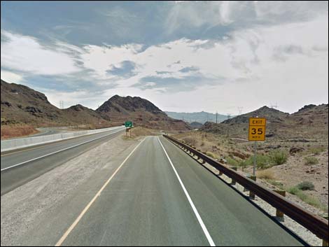
 Off-ramp at Hoover Dam Road -- Goldstrike Pass Road (view E) |
Watch Out Other than the standard warnings about hiking in the desert, ... these are not white-knuckle roads, as they are passable in 2WD-HC vehicles, but they are somewhat steep and cling to the flanks of hillsides with precipitous drop-offs. Also, there are 3 or 4 uphill, blind curves, so be careful in case someone is coming downhill. Check with NPS rangers on road conditions before driving into the backcountry. Maps of approved backcountry roads are available online and at the Alan Bible Visitor Center. Cell phones should work along most of this road. While out, please respect the land and the other people out there, and try to Leave No Trace of your passage. Also, even though this road is short, be sure to bring what you need of the 10 Essentials. |
 Goldstrike Pass Road (view S) |
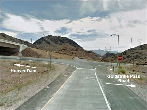
Getting to the Roadhead This road is located in Lake Mead National Recreation Area, about 40 minutes southeast of Las Vegas. From town, drive out Highway 93 towards Hoover Dam. After passing through Boulder City, exit the highway towards Hoover Dam (Exit 2). At the bottom of the off-ramp, turn right and drive south to the end of the pavement. Here, the popular Goldstrike Trailhead Road turns left to head down the canyon, while Goldstrike Pass Road turns right to head up into the hills. |
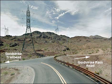 Hoover Dam Road at Goldstrike Pass Road (view S) |
The Road From the pavement (Table 1, Site 1640), Goldstrike Pass Road runs southwest and heads uphill about 0.1 miles to a fork (Site 1641) with brown signs indicating that Goldstrike Pass Road (NPS Backcountry Road 75) stays left while Goldstrike Parallel Road goes right (NPS Backcountry Road 75B). Goldstrike Parallel Road is shorter (0.6 miles long) and easier, but much less scenic and less fun than Goldstrike Pass Road. If you’re going to make the effort to do this drive, take Goldstrike Pass Road uphill; don't take the "easy way out." Save Goldstrike Parallel Road for the return trip if you wish. |
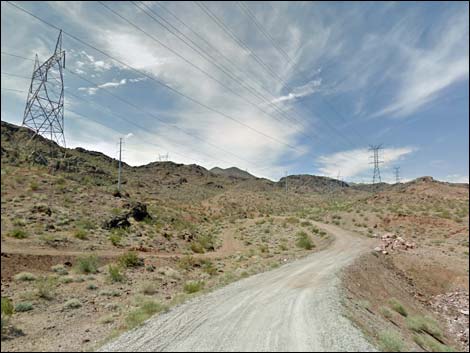 Goldstrike Pass Road (view S) |
Goldstrike Pass Road quickly climbs uphill and then to the northeast, and begins a loop around a rocky outcrop at the end of a ridge. At 0.3 miles out, the road forks. Goldstrike Pass Road stays right, while the left runs out a short way to a power tower. Now running southwest on the other side of the ridge, Goldstrike Pass Road quickly arrives at another fork (0.4 miles out). Goldstrike Pass Road again stays right, while the left runs out to another power tower. The left is more visible and seems logical (Photo 1). Do not take this road; it is quite perilous and dead-ends at a power tower (of course, I did not know this until after I had white-knuckled my way out this crazy road). Continuing on Goldstrike Pass Road, the roadway is narrow and winding, but in fairly good condition. You will be able to look down over Goldstrike Parallel Road and get your first glimpse of Lake Mead (Photos 4 and 5). The volcanic rocks along this stretch are very scenic, with many caves and alcoves (Photos 2, 3, 6, and 7). Near the intersection with Goldstrike Parallel Road, the road cut exposes colorful rocks (Photo 8). |
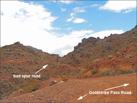 Photo 1. Goldstrike Pass Road at bad spur road; stay right Photo 1. Goldstrike Pass Road at bad spur road; stay right |
At about 1.2 miles out, Goldstrike Pass Road merges with the south end of Goldstrike Parallel Road (Site 1642), on the right. Goldstrike Pass Road continues southwest past more interesting rocks (Photo 9), then abruptly turns south and climbs steeply up a hill (visible in Photo 11). Along this stretch is a rather odd warning sign: Do not dig due to underground telephone cable; how about a sign warning you not to drive off the edge of the cliff (Photo 10)! Then the road bends to the southwest again; at 1.7 miles, there is an excellent view north down into a deep ravine with Lake Mead beyond (Photo 12). It is at this point that you can really assess how high that you have climbed already. Around this point is a stretch of fairly rocky road (Photo 13). Then the road emerges onto a ridge where you can look east across a ravine and see Black Canyon Overlook Road clinging to a hillside (Photo 14); this is where you are headed next. At 2.1 miles out, Goldstrike Pass Road reaches an intersection (Site 1643) with Black Canyon Overlook (BCO) Road (NPS Backcountry Road 75C; Photo 15). The route turns sharply left onto BCO Road. |
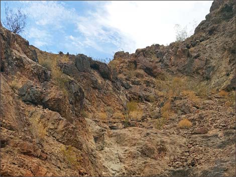 Photo 2. Rocks above Goldstrike Pass Road |
All of the land east of BCO Road is inside the Black Canyon Wilderness Area. When you reach Mile 2.4, you will encounter the worst stretch of road on the entire trip; it is visible in Photo 14 and appears to be an old rockslide area. Some fairly large rocks are embedded in the road surface, and extremely slow travel is required. You will be able to look back to the north and see the last portion of Goldstrike Pass Road with Lake Mead beyond (Photo 16). The rough stretch of road is shown in Photo 17. Past the bad section, you are rewarded with spectacular views to the north and northeast (Photos 18 and 19), and you can see BCO Road curving up and around the hillside. After this point, there are two sections of red rock in the road; after passing over a partially washed-out drainage culvert, one section is quite rough (Photo 20). The other section, where the road runs directly over the red bedrock, is not as bad as it looks (Photo 21). |
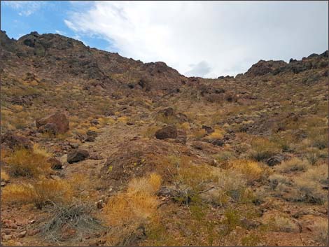 Photo 3. Hillside above Goldstrike Pass Road |
For the next 0.4 miles, there are several uphill, blind curves. At each of these curves, there are wide spots providing exceptional views to the north; you can see across Lake Mead all the way to the Muddy Mountains, over 20 miles away (Photo 22). You can also look far below and see the highway exit where you started your trip not long ago; the vehicles look like ants (Photos 23, 24, and 26). At this point, you have already climbed over 700 ft in less than 3 miles. The view looking back northwest towards the River Mountains is also superb (Photo 25). At one point, you can look down and see where U.S. 93 makes its big bend just before it reaches the O'Callaghan–Tillman Bridge, with the hulking black mass of Fortification Hill towering beyond (Photo 27). At about 2.8 miles out, BCO Road reaches what is probably its highest point, and takes a hard bend to the southeast; it looks like the road is rising to the heavens (Photo 28). Shortly thereafter, you will be treated to a beautiful view of Mt. Wilson and the Wilson Ridge to the southeast (Photo 29). |
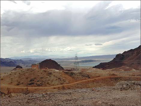 Photo 4. Casino and Goldstrike Parallel Rd, from Goldstrike Pass Rd |
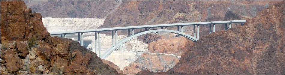
Then you will reach one of the highlights of the drive: an incredible, unobstructed view of the O'Callaghan–Tillman Bridge and a corner of Hoover Dam (Photos 30, 31, and 32). Take some time to linger here and take some photos, and tell your friends that they are not taken from a helicopter! The next 0.7 miles are fairly straight and routine, then the road makes a gradual U-turn over a saddle and turns back north. Soon it reaches the final stretch of road. The road abruptly bends right (east) and descends a quite steep and rugged stretch (Photos 33 and 44) down to the Black Canyon Overlook (Site 1644). Be careful when you reach the flat area at the overlook; as they say, "that first step is a doozy." Park your vehicle, and if you haven’t already done so, prepare to lose your breath - the view is utterly spectacular. |
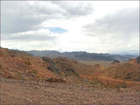 Photo 5. Looking further uphill from Photo 4 |
You may feel like an eagle on its rocky perch as you gaze down upon the spectacle spread out before you. The elevation of the overlook is 2,346 ft, so you are standing on a ledge about 900 ft higher than the O'Callaghan–Tillman Bridge. To the north, you can see Lake Mead, Sentinel Island, and the Muddy Mountains (Photo 34). To the northeast is the Hoover Dam area and Fortification Hill (Photo 35). In a quirk of fate, a rusty, rocky crag lies directly in the line of sight between the overlook and Hoover Dam; the view of the dam is completely blocked, and only the far north and south ends of the bridge are visible (Photo 38). If you were to stand on top of Hoover Dam and look southwest, this is the crag that is perfectly framed below the arch of the Bypass Bridge. Looking east, Mt. Wilson and the Wilson Ridge are the most prominent features (Photo 36). To the southeast is an awesome vista down the Black Canyon and onward to the Cerbat Mountains in the far distance (Photos 37, 39, and 40). Of course, this road description would not be complete without photos of the author and his trusty steed (Photos 41 and 42). It was difficult to depart this incredible spot, but a memorable parting shot was captured in Photo 43. |
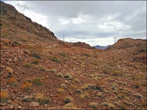 Photo 6. Continuing the climb uphill on Goldstrike Pass Road |
When you depart the overlook (Photo 44), simply return the way you came on BCO Road. When you reach Goldstrike Pass Road (Site 1643), you can make a sharp right and return the way that you came; this may be a good opportunity to make the final descent via Goldstrike Parallel Road. Alternatively, drivers can, theoretically (the author did not explore this road), turn left onto Goldstrike Pass Road and drive downhill and south 0.1 miles to North Boy Scout Canyon Road (Site 1645; NPS Backcountry Road 75D). North Boy Scout Canyon Road ends in 0.7 miles at a trailhead (Site 1646) in the upper reaches of Boy Scout Canyon. Theoretically, drivers can also continue southwest on Goldstrike Pass Road 2.6 miles to the paved Utah Street (Site 1647) on the south edge of Boulder City, and then turn right into town and eventually north to Highway 93. |
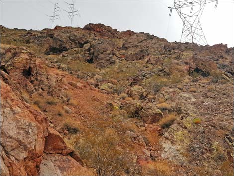 Photo 7. Colorful hillside above Goldstrike Pass Road |
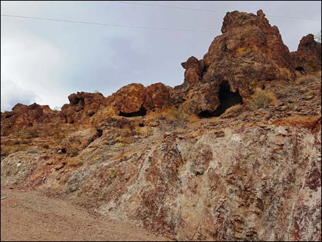 Photo 8. Road cut and rock caves along Goldstrike Pass Road |
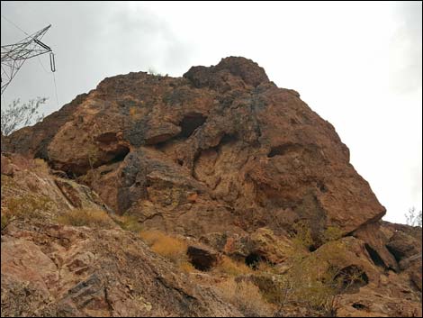 Photo 9. Rock outcrop and power tower from Goldstrike Pass Road |
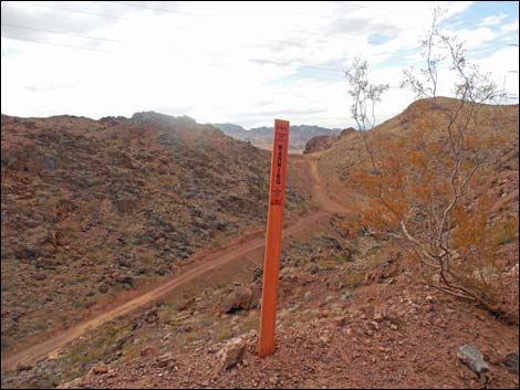 Photo 10. Warning sign at edge of cliff |
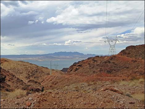 Photo 11. Looking back at steep section of Goldstrike Pass Road |
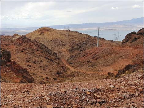 Photo 12. First deep ravine from Goldstrike Pass Road (view N) |
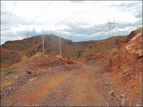 Photo 13. Rocky road along Goldstrike Pass Road |
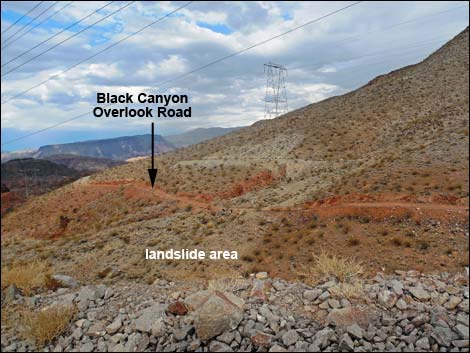 Photo 14. Goldstrike Pass Road; view NE towards beige landslide |
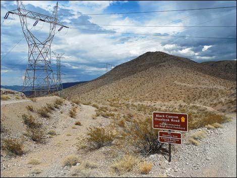 Photo 15. Beginning of Black Canyon Overlook Road |
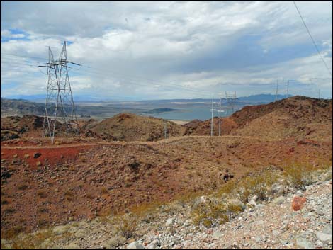 Photo 16. Looking back at Goldstrike Pass Road from BCO Road |
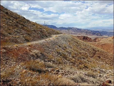 Photo 17. Looking back at the beige landslide area |
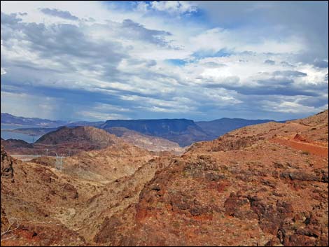 Photo 18. Fortification Hill and BCO Road at upper right (view E) |
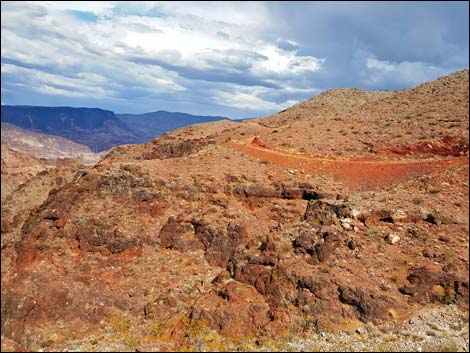 Photo 19. Looking slightly further south than Photo 17 |
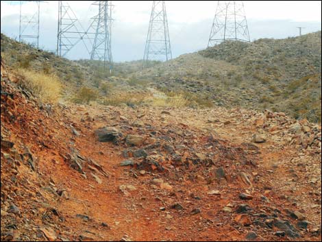 Photo 20. Rocky red section of BCO Road |
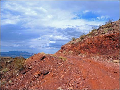 Photo 21. BCO Road on red bedrock - not as rough as it looks |
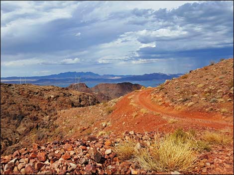 Photo 22. Looking NE from end of red bedrock section |
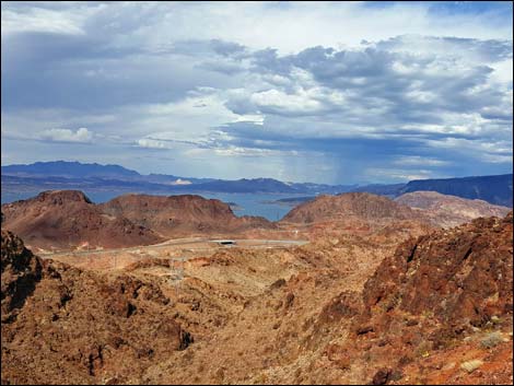 Photo 23. Highway exit and beginning of road (view NE) |
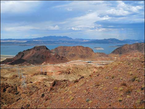 Photo 24. Closer view similar to Photo 23 |
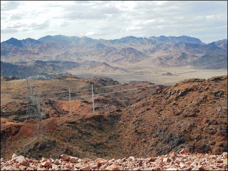 Photo 25. Looking NW towards River Mountains |
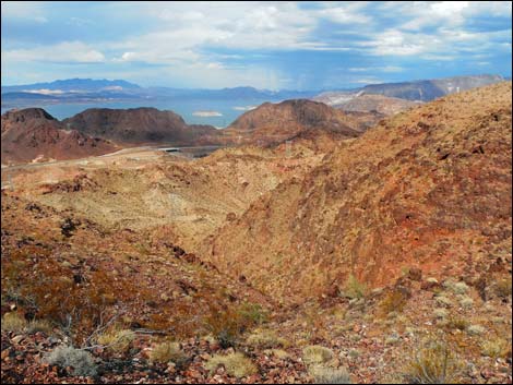 Photo 26. Similar view to 23, from high bend in BCO Road |
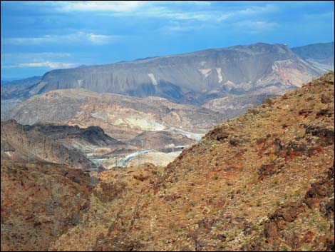 Photo 27. Big bend of U.S. 93 just before Hoover Dam Bypass Bridge |
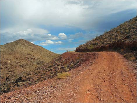 Photo 28. BCO Road ascends to the heavens and turns SE |
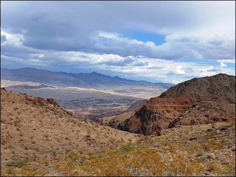 Photo 29. View SE towards Wilson Ridge |
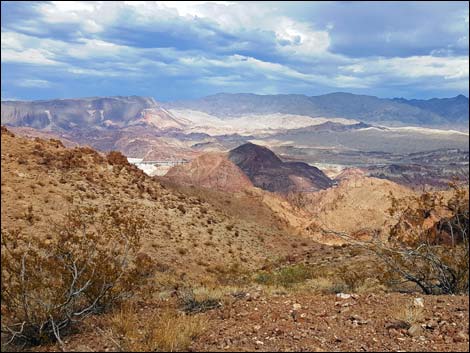 Photo 30. First view of Hoover Dam Bypass Bridge |
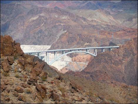 Photo 31. Zoom-in of bridge; part of Hoover Dam is visible |
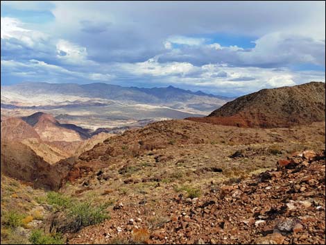 Photo 32. Wilson Ridge in the distance (view SE) |
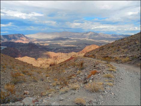 Photo 33. Last section of BCO Road running down to the overlook |
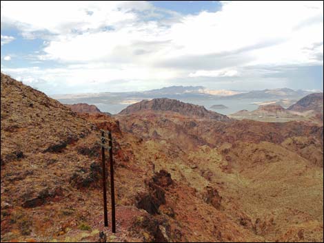 Photo 34. Overlook; view N |
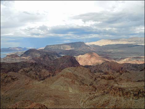 Photo 35. Overlook; view NE |
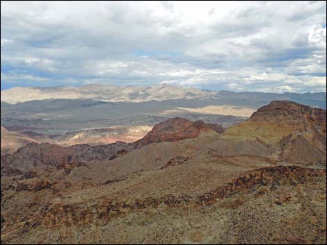 Photo 36. Overlook; view E |
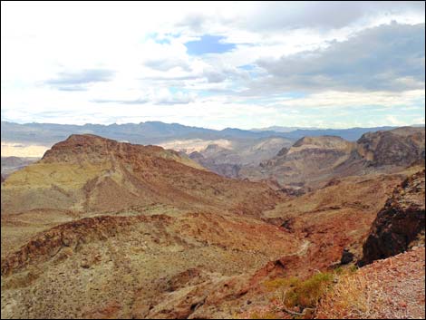 Photo 37. Overlook; view SE |
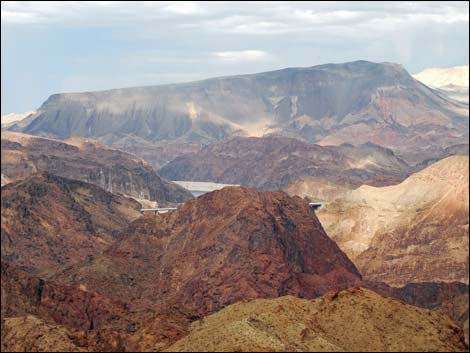 Photo 38. Overlook; view NE towards bridge and Fortification Hill |
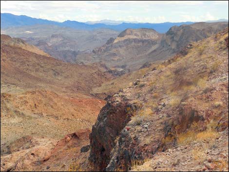 Photo 39. Overlook (view SE) |
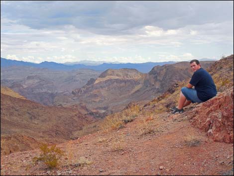 Photo 40. Overlook; Eric admiring the view (view SE) |
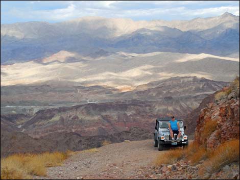 Photo 41. Overlook: Mark and Jeep; Kingman Wash Road beyond |
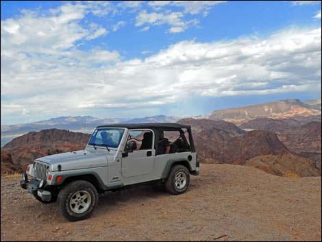 Photo 42. The Jeep perched at the overlook |
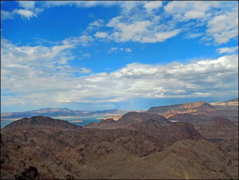 Photo 43. Overlook; view NE |
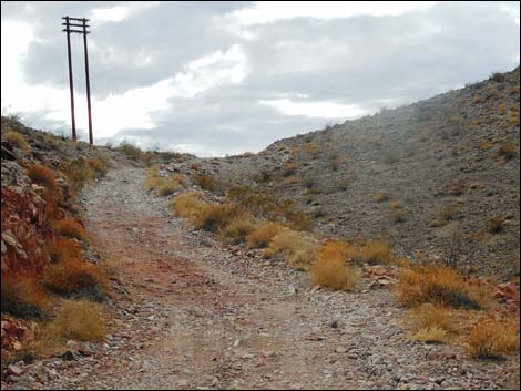 Photo 44. Departing the overlook |
Table 1. Highway Coordinates and Distances based on GPS Data (NAD27). Download Highway GPS Waypoints (gpx) file.
| Wpt. | Location | Latitude (N) | Longitude (W) | Elevation (ft) | Point-to-Point Distance (mi) | Cumulative Distance (mi) | Verified |
|---|---|---|---|---|---|---|---|
| 1640 | Goldstrike Pass Rd at Edge of Pavement | 36.00999 | 114.77311 | 1,680 | 0.00 | 0.00 | Yes |
| 1641 | Goldstrike Pass Rd at Goldstrike Parallel Rd (North) | 36.00912 | 114.77394 | 1,706 | 0.08 | 0.08 | Yes |
| 1642 | Goldstrike Pass Rd at Goldstrike Parallel Rd (South) | 36.00325 | 114.78118 | 2,024 | 1.12 | 1.20 | Yes |
| 1643 | Goldstrike Pass Rd at Black Canyon Overlook Rd | 35.99516 | 114.78703 | 2,395 | 0.92 | 2.12 | Yes |
| 1644 | Black Canyon Overlook | 35.99236 | 114.76831 | 2,346 | 1.91 | 4.03 | Yes |
| 1645 | Goldstrike Pass Rd at North Boy Scout Canyon Rd | 35.99444 | 114.78735 | 2,352 | . | . | Yes |
| 1646 | North Boy Scout Canyon Trailhead Parking | 35.98957 | 114.78122 | 2,208 | . | . | Yes |
| 1647 | Goldstrike Pass Rd at Utah Trail Rd | 35.96482 | 114.81425 | 2,418 | . | . | Yes |
Happy Hiking! All distances, elevations, and other facts are approximate.
![]() ; Last updated 240326
; Last updated 240326
| Backroads Around Lake Mead | Hiking Around Las Vegas | Glossary | Copyright, Conditions, Disclaimer | Home |