birdandhike.com logo
Home | Wilderness | Hiking | Backroads | St. Thomas Cove Road
St. Thomas Cove Road Map
Hiking Southern Nevada Wilderness Areas, Backroads 
St. Thomas Cove Road Map
Note: Roads are black (solid = paved; dashed = unpaved). Trails and routes are red (solid = main; dashed = adjacent or alternate). Map based on USGS 7.5-minute topo map. North is at the top. Grid is UTM NAD27 CONUS. National Park boundaries (dashed green) based on NPS data.

Happy Hiking! All distances, elevations, and other facts are approximate.
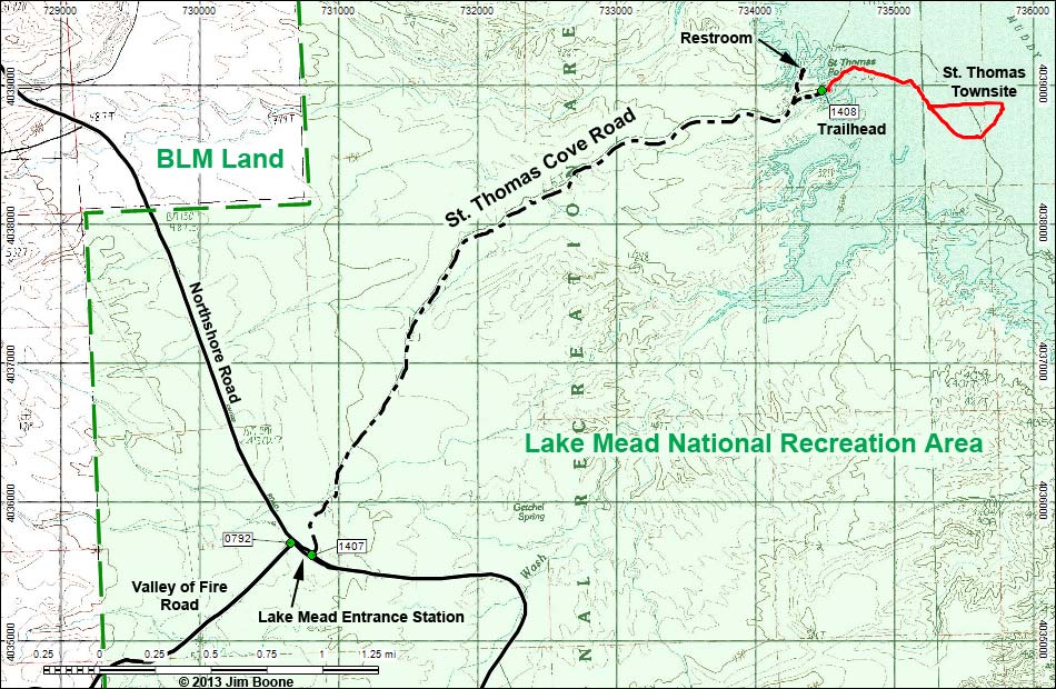
copyright; Last updated 130122

St. Thomas Cove Road Hiking the Wilderness Areas Glossary Copyright, Conditions, Disclaimer Home
Google Ads