Hiking Around Las Vegas, Lake Mead National Recreation Area
 Start of route at Kingman Wash Trailhead (view W) |
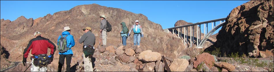
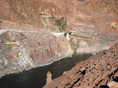
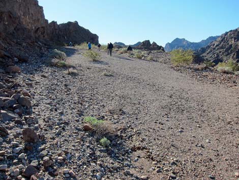
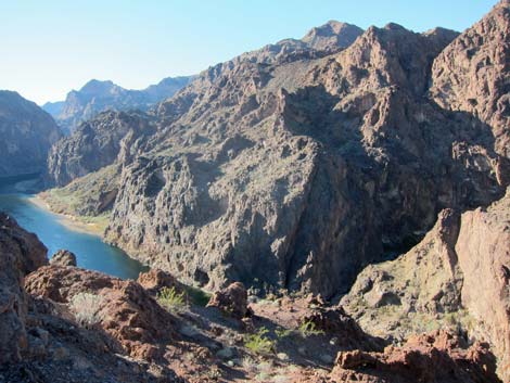
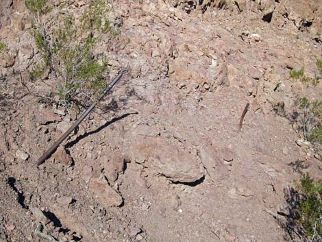
Overview Using sandy washes and old roads, this hike makes a 3.1-mile partial loop out to Sugarloaf Overlook on the edge of cliffs overlooking the Colorado River. The dam is not visible, but hikers can see most of the Highway 93 (Mike O'Callaghan–Pat Tillman Memorial) bridge over the Colorado River. The route runs through scenic and interesting canyons, but Sugarloaf Overlook is not a pristine natural area. Rather, it was used during construction of Hoover Dam in the 1930s, and the route follows roads built during construction. Historic construction debris litter the overlook area, including pieces of old equipment, pipes, cables, wooden posts, old railroad track, cement foundations, old timbers, and an unloading ramp overlooking the river. Click for photos of Sugarloaf Historic Junk. Link to map. |
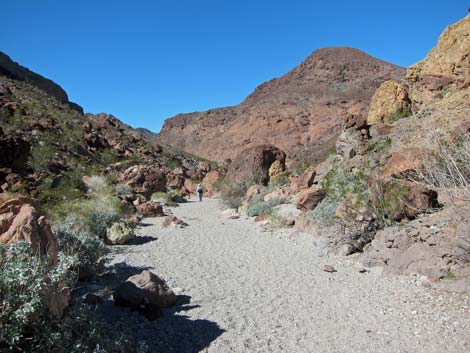
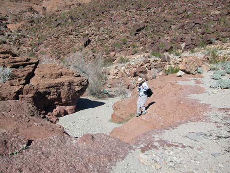
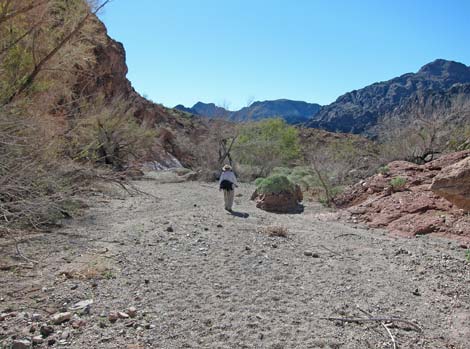
 Route descends from trailhead into canyon bottom (view S) |
Watch Out Other than the standard warnings about hiking in the desert, ...this hike is pretty safe, as there are no unusual hazards. However, out at the overlook, inattentive hikers could fall over the cliff and plummet all the way to the river -- watch the children and pets carefully. Metal debris may have sharp and rusty edges, cables and wires are a tripping hazard, and old timbers are full of slivers. While hiking, please respect the land and the other people out there, and try to Leave No Trace of your passage. This area is fairly remote, so be sure to bring what you need of the 10 Essentials. This is a National Park area, so all of the historic construction debris and old junk are protected by law: be sure to leave historic items in place for future generation to see and enjoy. |
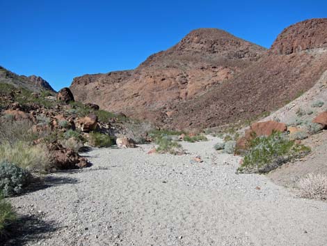
 Route descends into wash (view S) |
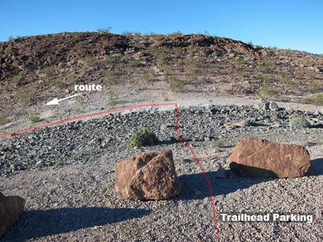
Getting to the Trailhead This hike is located in Lake Mead National Recreation Area, about 40 minutes southeast of Las Vegas. From town, drive out towards Hoover Dam, then continue south on Hwy 93 into Arizona. Leave the highway at Exit 2, turn right, and drive to the Kingman Wash Trailhead parking area. Park here; this is the trailhead. |
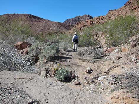
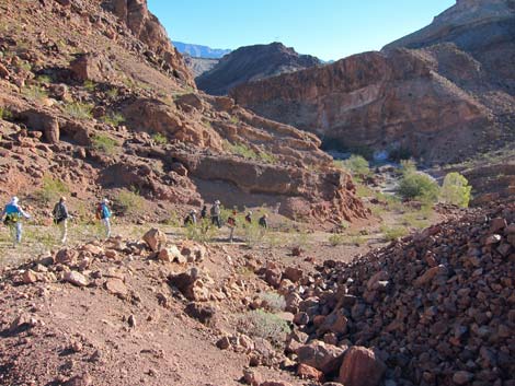
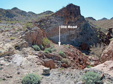 Route follows old road below culvert (view SW) |
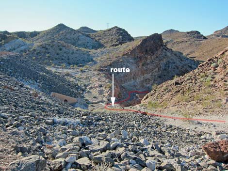
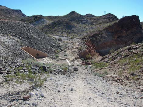
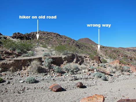
The Hike From the trailhead (Table 1, Waypoint 01), the route runs west a few steps from the parking area, then turns left (south) and runs down a gully below the parking area. The route meets a wash (Wpt. 02; just below a drainage tunnel), then turns downstream following an old road used during construction of Hoover Dam. The old road shortly disappears into the wash, but the route continues downstream as the wash curves to the right. As soon as possible, the route turns left, out of the wash, and back onto the old paved road (Wpt. 03). Note that temporary pavement set during the 1930s looks little like modern highway asphalt. Also note that there are two roads here: the route follows the paved road against the cliffs, not the dirt road that runs across a hillside towards a peaklet. |
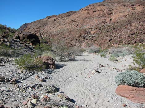
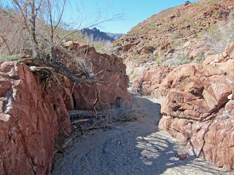
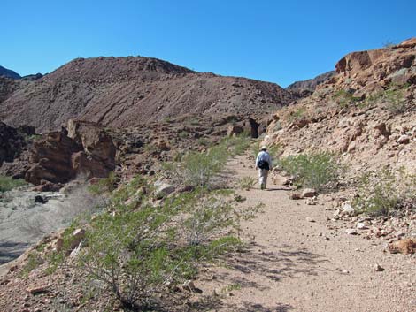
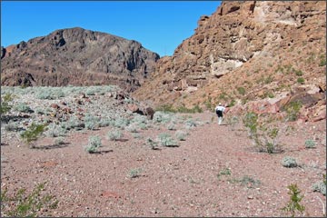
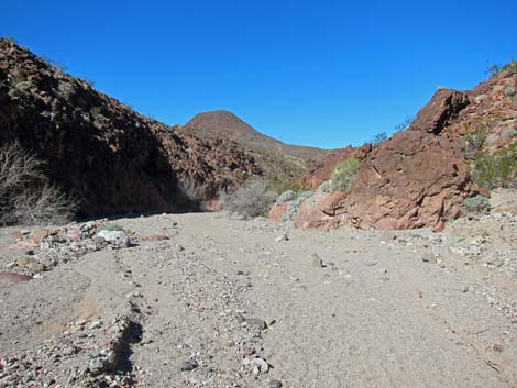 Route drops into wash (view W) |
Following the paved road over a low saddle (Wpt. 04) and steeply down the other side, the road disappears into the next wash to the west (Wpt. 05). The route continues downstream. This wash merges with a larger wash (Wpt. 06) and continues downstream over low pour-overs and through a narrow canyon. |
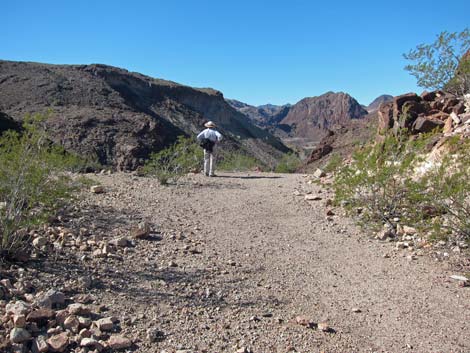
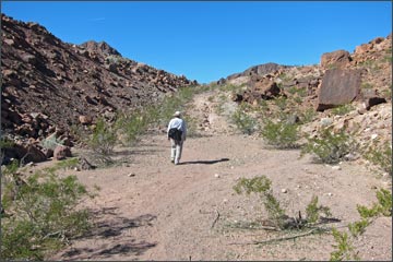
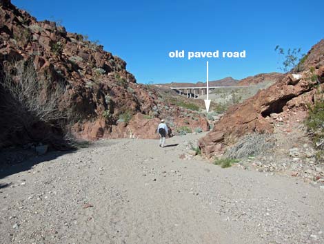 Hiker approaching old paved road (view N) |
When the canyon opens, hikers can look ahead to see the results of considerable earth-moving activity from the dam construction days. This is a dump of excess material, similar to mine tailings. A lot of these materials are from blasting, but much is river cobbles from the bottom of the canyon that needed to be removed before concrete could be poured. Shortly after emerging from the narrow canyon, the route turns out of the wash on the north side, again picking up the old paved road (Wpt. 07). The old road runs across the hillside. Climbing somewhat steeply in places, the road stays between Sugarloaf Mountain and the earthen pile. The pavement eventually ends, but the now dirt road runs up onto a large flat area (Wpt. 08). In this area, considerable amounts of dirt and rock had been moved around making flat areas for workers. |
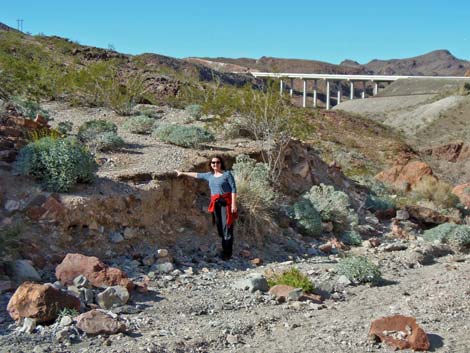 Hiker pointing out the old pavement (view N) |
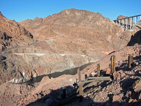
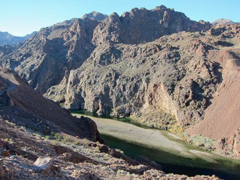
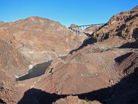
Continuing downhill to the northwest, still against the base of Sugarloaf Mountain, a view soon opens onto the overlook area. Scattered about are various types of historic junk, cement foundations, a loading dock, old bits of railroad track. All structures are gone, but historic junk litters the area. Continuing to the northwest, the route ends at the overlook (Wpt. 09): a pile of dirt and rocks with a grand view over the edge of the dirt pile down to the river and up to the bridge. Across the river are a gauging station (measures water levels), the raft and canoe launch area, and other structures associated with historic and current use of the dam. Hikers can walk a bit farther north to the upper (Wpt. 10) and lower (Wpt. 11), north-most overlook spots. Be sure to notice that cat-walks low along the water across the canyon. Although not suitable for humans after all these years, the Double-crested Cormorants find them to be a safe rookery. |
 Hiker on paved construction road |
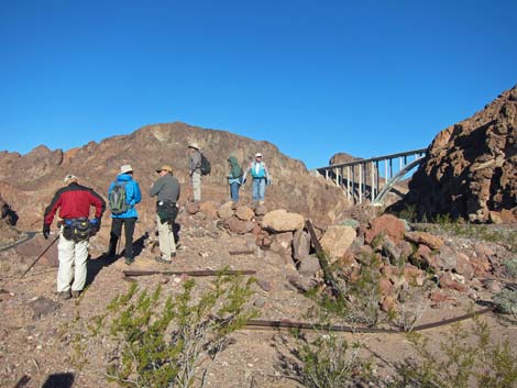
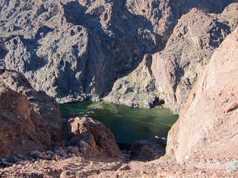
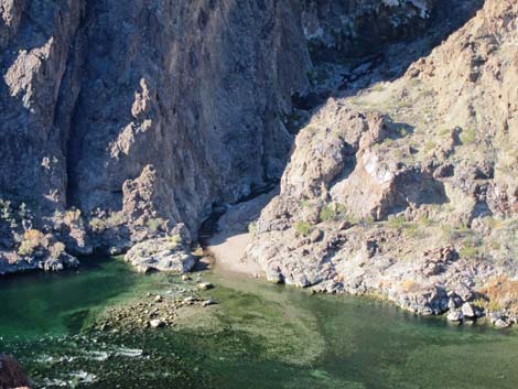
Departing this area, the route runs south atop the dirt pile between crags on the left and the edge of the cliffs on the right. Hikers can follow an old road down the side of the dirt pile to get closer to the river, but river access appears unsafe. As some overlook views fade away, others improve. Hikers can walk out to a rocky promontory (Wpt. 12) to see a bit more of the bridge. This area apparently was also used as a dump, and the burned-out trash heap contains cut pipe, metal junk, and lots of wire. |
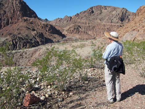
 Hiker at highpoint on old road (view W) |
Leaving the edge of the river, still following the flat areas south, hikers can wrap tightly around the south side of the rocky crags, or they can walk farther out to the edge of the dirt pile. Out on the edge, there are nice view south towards Lone Palm Canyon and the river, and nice view east and back up the route. On the west side of the crags, it is useful to stay a bit left to close the loop (Wpt. 08) rather than trying to hike directly back towards the wash. The route eventually reconnects with the steep, partially paved road (Wpt. 08) and returns back up the washes towards the trailhead. Beyond the narrow canyon and low two pour-overs, be sure to stay right when the wash forks (Wpt. 06), and be sure to turn left onto the old road (Wpt. 05) en route back to the trailhead (Wpt. 01). |
 Old road descends towards wash (view NW) |
 Old road descends towards wash (view NW) |
 Hiker in sandy wash (view NW) |
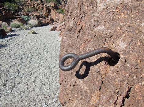 Ringbolt for cable gate (view NW) [more historic junk photos] |
 Sandy wash (view NW) |
 Sandy wash merges with wash from right (view NW) |
 Hiker descending first low pour-over (view NW) |
 View from atop second low pour-over (view W) |
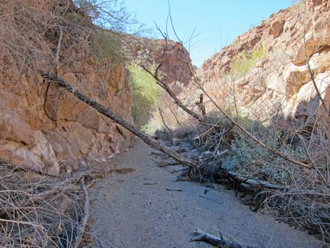 Narrow canyon with flash-flooded trees (view W) |
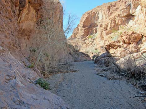 Narrow canyon (view W) |
 Hiker exiting narrow canyon (view W) |
 Hiker leaving wash and starting up old road (view W) |
 Hiker on old road (view W) |
 Hikers approaching the highpoint (view NW) |
 Hikers at low saddle (view NW) |
 Hikers overlooking the North Overlook (view NW) |
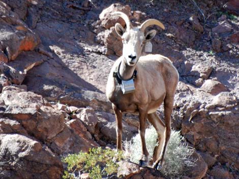 Desert Bighorn Sheep with radio collar |
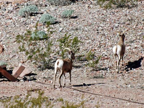 Desert Bighorn Sheep in Overlook area |
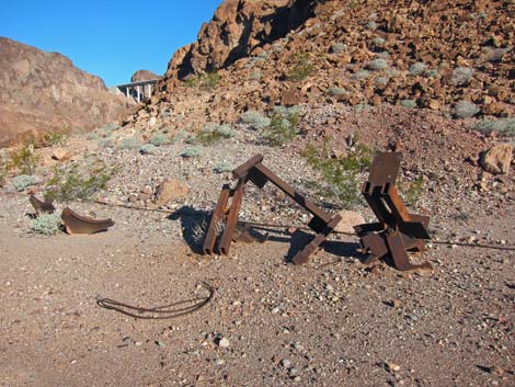 Historic dam-building debris (view N) [more historic junk photos] |
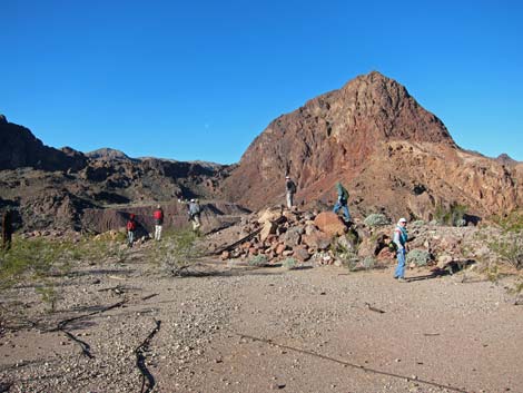 Hikers at North Overlook (view NW) |
 Hikers at North Overlook (view N) |
 North Overlook (view N) [more historic junk photos] |
 North Overlook (view SW) |
 North Overlook (view N) |
 Hikers departing North Overlook area (view S) |
 South Overlook (view S) |
 South Overlook (view N) |
 Debris-filled gully opposite Goldstrike Canyon (view W) |
 Colorado River at Goldstrike Canyon (view W) |
 Historic drill bits stuck in rock wall (view N) |
 Hikers descending partially paved construction road (view E) |
 Hikers approaching the main wash (view E) |
Table 1. Hiking Coordinates Based on GPS Data (NAD27; UTM Zone 11S). Download Hiking GPS Waypoints (*.gpx) file.
| Wpt. | Location | UTM Easting | UTM Northing | Elevation (ft) | Point-to-Point Distance (mi) | Cumulative Distance (mi) | Verified |
|---|---|---|---|---|---|---|---|
| 01 | Trailhead | 705183 | 3986429 | 1,305 | 0.00 | 0.00 | GPS |
| 02 | Bottom of Wash | 705206 | 3986372 | 1,292 | 0.06 | 0.06 | GPS |
| 03 | Old Road Leaves Wash | 705069 | 3986372 | 1,260 | 0.14 | 0.19 | GPS |
| 04 | Highpoint on Old Road | 705026 | 3986356 | 1,280 | 0.02 | 0.21 | GPS |
| 05 | Old Road Ends at Wash | 704735 | 3986346 | 1,119 | 0.21 | 0.42 | GPS |
| 06 | Confluence of Washes | 704461 | 3986540 | 967 | 0.23 | 0.65 | GPS |
| 07 | Old Road Departs Wash | 704179 | 3986460 | 899 | 0.23 | 0.88 | GPS |
| 08 | Highpoint on Old Road | 703884 | 3986532 | 1,019 | 0.23 | 1.11 | GPS |
| 09 | Sugarloaf Overlook | 703712 | 3986686 | 999 | 0.16 | 1.27 | GPS |
| 10 | North Overlook (Upper) | 703703 | 3986764 | 1,044 | 0.05 | 1.32 | GPS |
| 11 | North Overlook (Lower) | 703684 | 3986777 | 1,018 | 0.02 | 1.34 | GPS |
| 12 | South Overlook | 703741 | 3986358 | 1,053 | 0.34 | 1.68 | GPS |
| 08 | Highpoint on Old Road | 703884 | 3986532 | 1,019 | 0.33 | 2.01 | GPS |
| 06 | Confluence of Washes | 704461 | 3986540 | 967 | 0.46 | 2.47 | GPS |
| 05 | Old Road Ends at Wash | 704735 | 3986346 | 1,119 | 0.23 | 2.70 | GPS |
| 01 | Trailhead | 705183 | 3986429 | 1,305 | 0.41 | 3.11 | GPS |
Happy Hiking! All distances, elevations, and other facts are approximate.
![]() ; Last updated 240326
; Last updated 240326
| Hiking Around Lake Mead | Hiking Around Las Vegas | Glossary | Copyright, Conditions, Disclaimer | Home |