Hiking Around Las Vegas, Lake Mead National Recreation Area
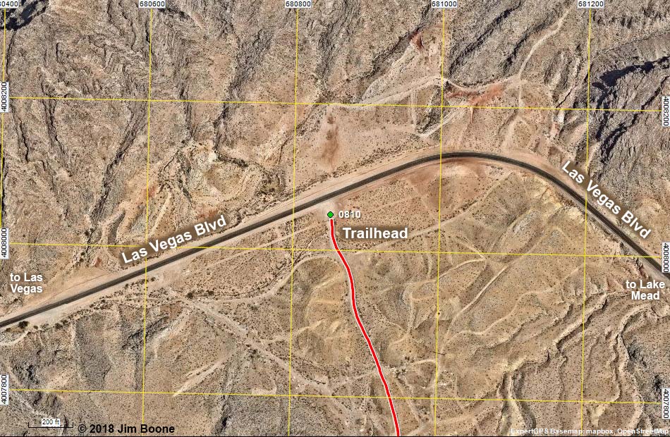
Note: Roads are black (solid = paved; dashed = unpaved). Trails and routes are red (solid = main; dashed = adjacent or alternate). Map based on aerial photograph. North is at the top. Grid is UTM NAD27 CONUS. Download waypoint coordinates from route description page.
Happy Hiking! All distances, elevations, and other facts are approximate.
![]() ; Last updated 181012
; Last updated 181012
| Frenchman Mountain Trailhead | Hiking Around Lake Mead | Glossary | Copyright, Conditions, Disclaimer | Home |