 |
| Home | Wilderness | Hiking | Lake Mead Hikes |
Hiking Around Lake Mead Click Map -- Northshore Area
Hiking Around Las Vegas
Overview Map | Hoover Dam Area | Northshore Area | Las Vegas Wash Area | Lake Mohave Area |
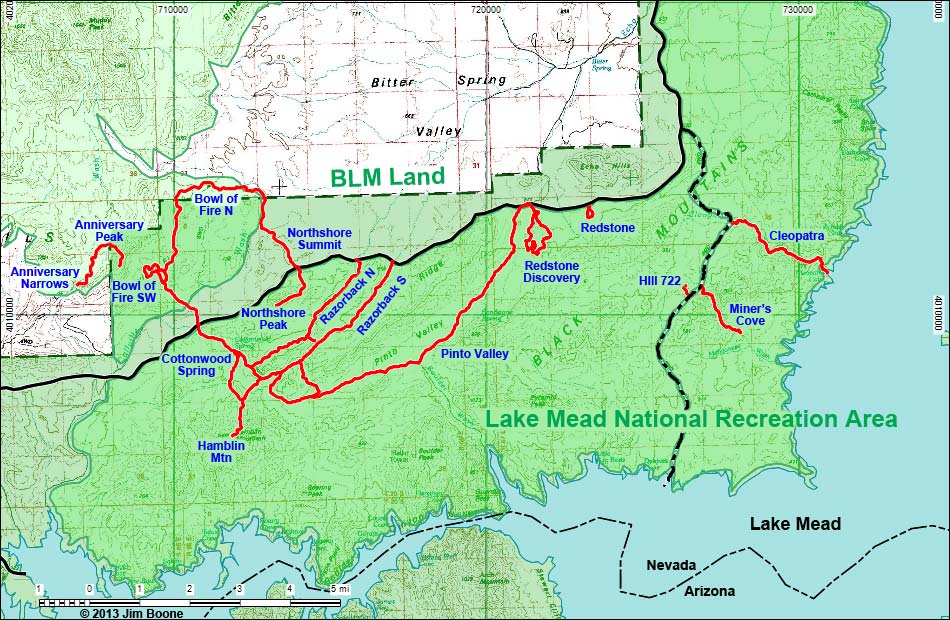 |
| Note: Roads are black (solid = paved; dashed = unpaved). Trails and routes are red (solid = main; dashed = adjacent or alternate). Map based on Open Street Map. North is at the top. Grid is UTM NAD27 CONUS. Wilderness Areas (boundaries solid green, fill dark green) based on BLM data. National Park Areas (boundaries dashed green, fill light green) based on NPS data. Urban Areas (yellow) based on Google Earth (9/2012) image. Water is blue. |
| Key Words: Anniversary Narrows, Anniversary Peak, Bowl of Fire Loop, Bowl of Fire, Southwest, Cleopatra Wash, Cottonwood Spring, Hamblin Mountain, Hill 722, Lovell Wash Narrows, Miner's Cove Overlook, Northshore Peak -East, Northshore Peak - West, Northshore Summit, Pinto Valley Wash, Razorback Wash - North, Razorback Wash - South, Redstone Discovery, Redstone Loop Trail, Redstone Scramble. |
Happy Hiking! All distances, elevations, and other facts are approximate.
 ; Last updated 130127 ; Last updated 130127 |
|