Hiking Around Las Vegas, Mojave National Preserve
 Concrete trail (view W from the edge of the pavement) Concrete trail (view W from the edge of the pavement) |
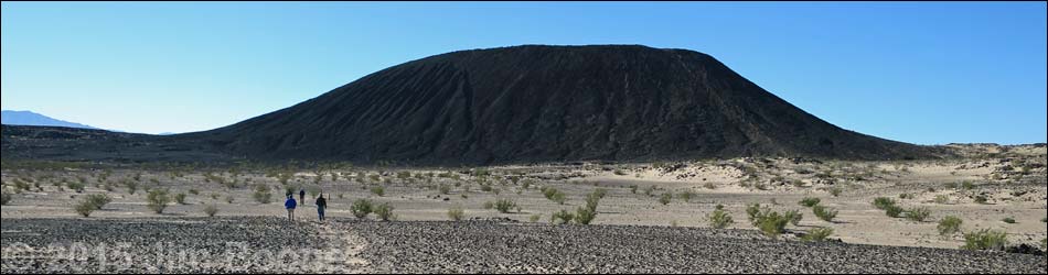
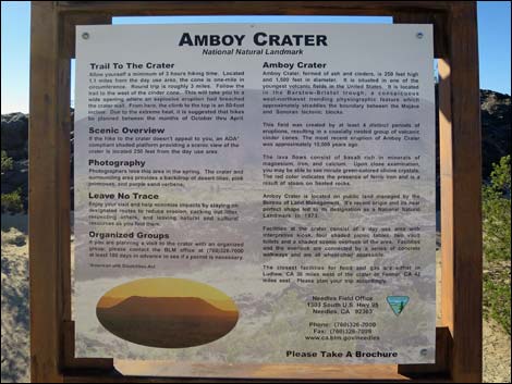
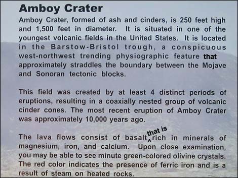
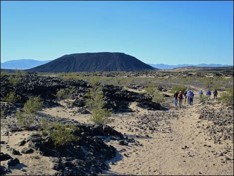
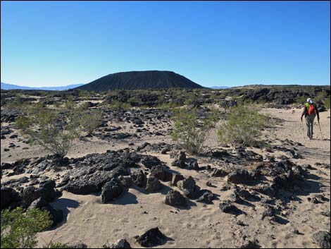
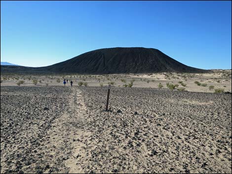
Overview Amboy Crater is a volcano -- a fresh volcano -- that stands some 250 vertical feet above the surrounding terrain, which is a lava field partially covered with windblown sand. The volcano last erupted about 10,000 years ago, so the land looks fresh and raw. The 3-1/4-mile, round trip, trail to the summit leaves the trailhead and winds among ridges of lava, then sets out across open terrain covered with loose sand and a few sand-loving plants and lizards. The trail wraps around the west end of the cone, then climbs into the crater via a lava "waterfall." Inside the crater, several trails lead to the rim from where the 360-degree views are grand. If the marines on the nearby 29 Palms Marine Corps Base are out playing with their big toys, they can add eerie, earth rumbling sounds to the "inside the crater" experience. Link to map. See BLM Amboy Crater brochure (pdf). |
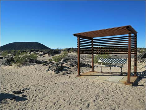
 Information sign beyond the picnic tables (view W) |
Watch Out Other than the standard warnings about hiking in the desert, ...this hike is pretty safe. There are plenty of places to stumble off a steep hillside, but there are no unusual hazards along the trail. There is little shade along the route, so this hike is best done at cooler times of year, but two shade shelters are helpful. On the volcano, hikers follow use-trails that were not well designed or placed, so be careful on steep, loose terrain, and stick to the existing trails and do not start new ones. The corner of the 29 Palms Marine Corps Base lies a mere mile from the volcano, so be careful if unexploded ordinance is found, and don't stray too far southwest from the crater. While hiking, please respect the land and the other people out there, and try to Leave No Trace of your passage. Also, even though this is a short hike, be sure to bring what you need of the 10 Essentials. |
 Information sign (view S) |
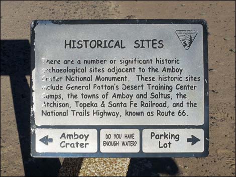
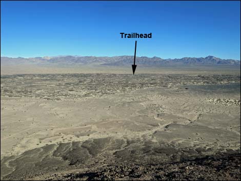
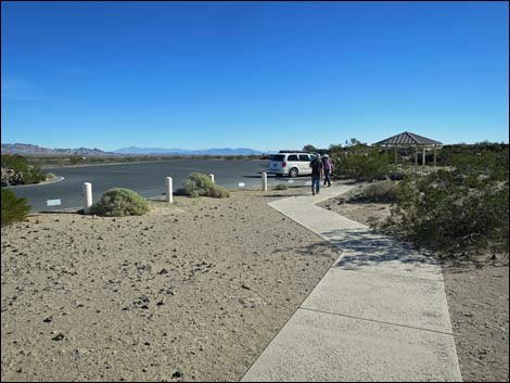
Getting to the Trailhead Amboy Crater is located south of Mojave National Preserve, about 2-1/2 hours south of Las Vegas. From town, drive out to the Mojave National Preserve Visitor Center at Kelso, California. From the Visitor Center, continue south on Kelbaker Road. Drive over the mountains, exit the National Preserve, and continue south under Interstate 40. From the interstate, drive due south 11.5 miles to a T-intersection with National Trails Highway, also known as Historic Route 66. At Route 66, turn right and drive west through the "town" of Amboy and crossing over the railroad tracks. After crossing the railroad tracks, Route 66 passes Amboy Road (to 29 Palms) on the left. In another 1.1 miles, Route 66 arrives at Amboy Crater Road, on the left. Turn left onto Amboy Crater Road and drive 0.5 miles to the end of the road. Park here; this is the trailhead. |
 Some text on the information sign (view S) |
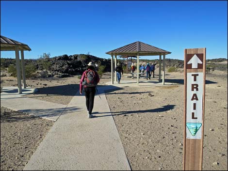
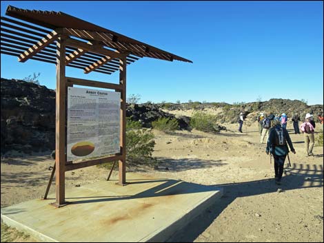
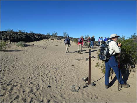
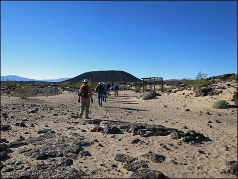
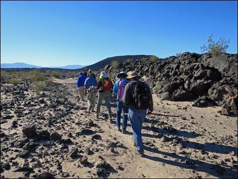
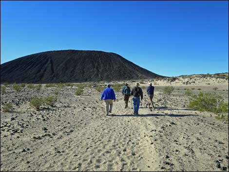
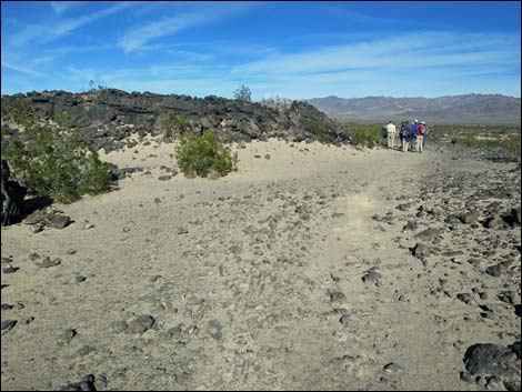
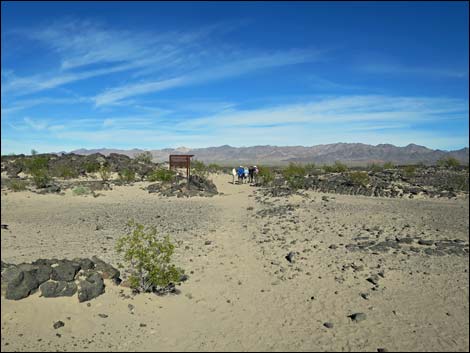
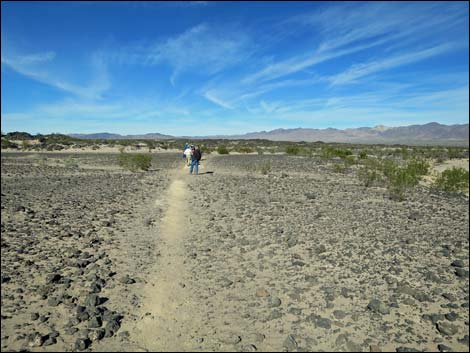
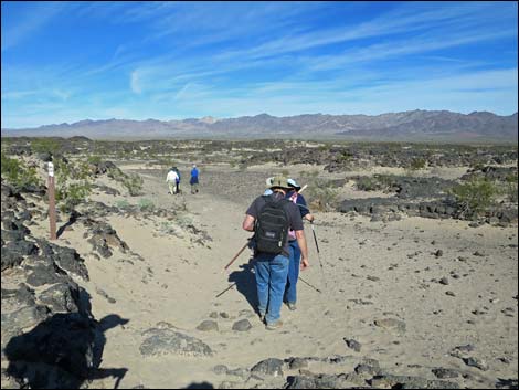
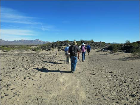
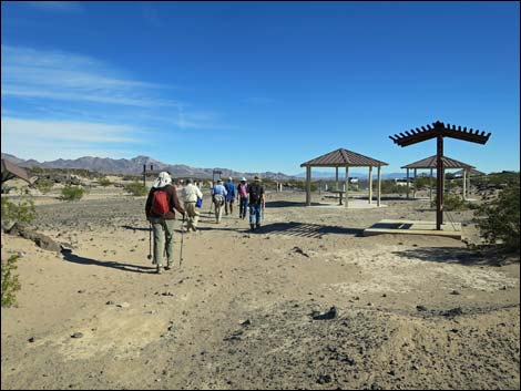
The Hike From the trailhead (Table 1, Waypoint 01) at the southwest end of the parking lot, a cement trail leads west to a large information sign (Wpt. 02) at the far edge of the picnic area. Beyond the information sign, a carsonite sign indicates that the trail runs west along a sandy route, but then in only a few yards, it bends left around a lava flow and runs through S-curves among lava ridges before emerging into a sandy plain. Watch for carsonite signs and concrete monuments that mark the trail. The trail continues southwest across the sand, but watch for trail markers on highpoints in the near distance. Crossing the next lava field, the trail passes the first shade shelter (Wpt. 03) and winds generally south following the sandy path through the lava ridges. |
 Smaller sign near the large information sign (view N) |
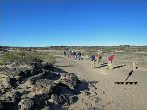
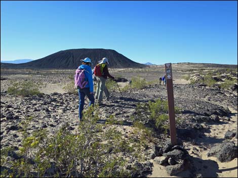
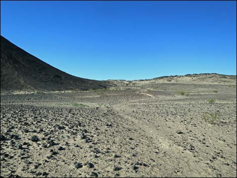
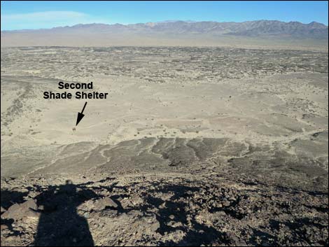
From a highpoint, such as highpoints are on these flat lava flows, the trail runs southwest across a broad sandy plain heading towards the center of the volcano. Near the base of the volcano, the trail bends right and runs up to a cement monument (Wpt. 04) with a shiny metal sign about desert tortoises. The more useful information on the sign is the arrow pointing towards "Amboy Crater." Out in this area, the trail can be hard to follow, and the markers are a bit sparse, but if the trail is lost in the shifting sands, hikers can simply hike towards the west edge of the volcano. Continuing from the tortoise sign, the trail runs west to another shade shelter (Wpt. 05), then continues southwest, but now wrapping around the base of the volcano. |
 Carsonite signs mark the trail (view SW) |
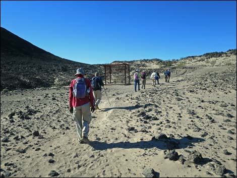
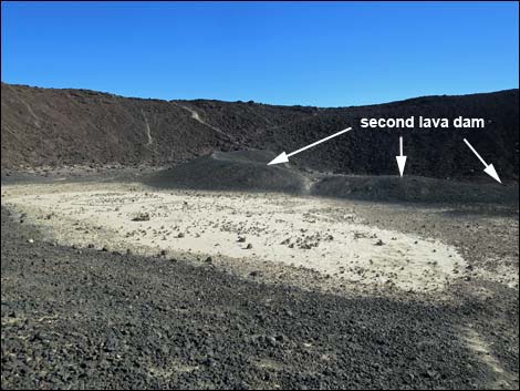
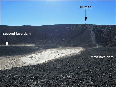
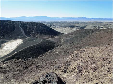
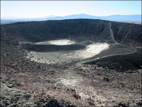
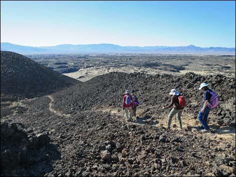
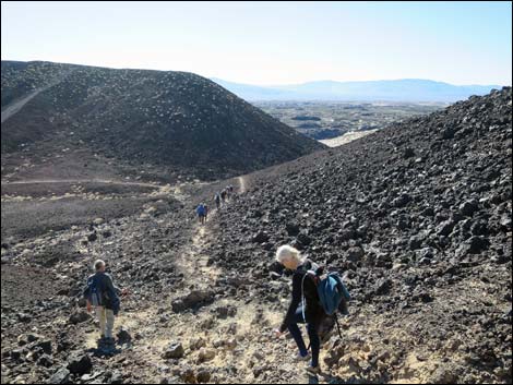
Approaching the west end of the cinder cone, which is not visible from earlier on the trail, it becomes apparent that the west wall of the cinder cone collapsed as lava welled up within the crater. The lava spilled out making a "frozen waterfall" of lava here, and the use-trail runs up along the edge of the lava flow (Wpt 06). The use-trail climbs steeply to the top of the "frozen waterfall" (Wpt 06), which is the level of the base of the crater. Continuing east into the crater, the trail forks (Wpt. 08). The trail left leads to the rim of the crater, but it makes a good way to come down. Still continuing east into the crater, the trail runs up onto a low ridge (Wpt 09), which is one of two inner craters. After the main wall of the crater collapsed and the lava flowed out, this ridge formed a dam that held lava inside the crater. The dirt covered flat area below is part of the second-to-last lake of lava that once filled the crater. Just ahead to the east is another low lava ridge, and it too holds a flat, dirt covered area -- the very last of the lava lake. |
 Concrete monuments mark the trail too (view SW) |
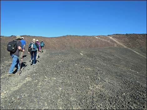
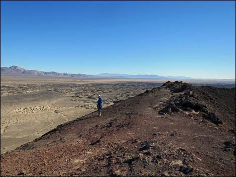
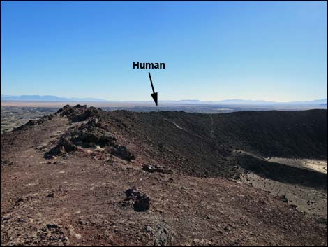
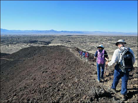
From this point, use-trails lead north, east, and south to the rim of the crater above. It probably makes for the best volcano experience to turn right and hike south, climbing onto the south edge of the rim. From there, hikers can turn left and hike east, circling all the way around the rim of the cinder cone to the north edge (Wpt. 10). After enjoying the grand scenery inside and outside the volcano, the route continues west along the edge of the rim until the use-trail cuts back down steeply inside the crater to the rejoin the main trail (Wpt. 08). Following the main trail back, the route exits the crater (Wpt. 07) to the flats below, then winds around the north side of the volcano and sets out across the sandy flat on the way back to the trailhead (Wpt. 01). |
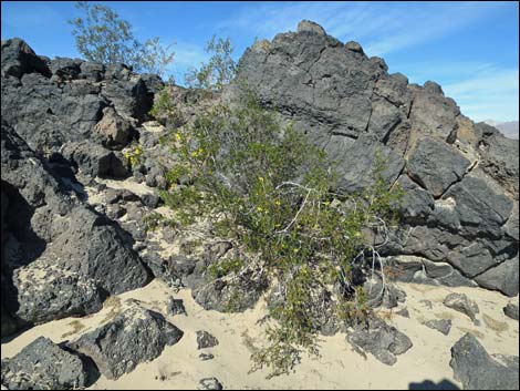 Lava ridge, creosote bush, and sand |
 Carsonite sign on a highpoint (view SW) |
 Concrete monument marks sandy trail (view SW) |
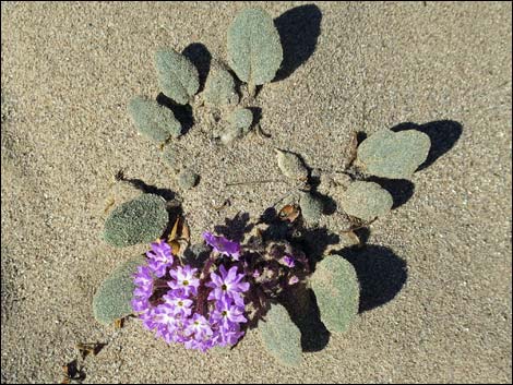 Desert Sand Verbena |
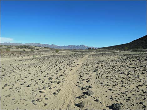
 Sandy trail winds among low lava ridges (view SW) |
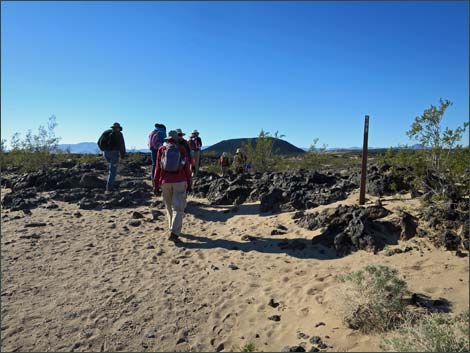
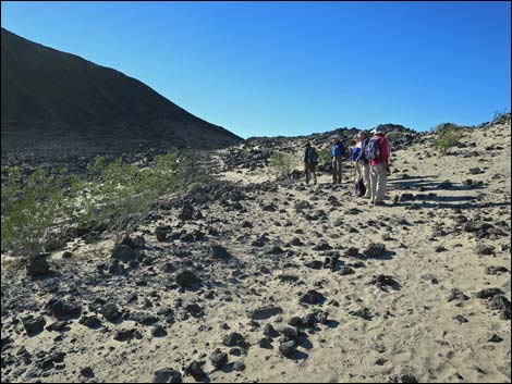
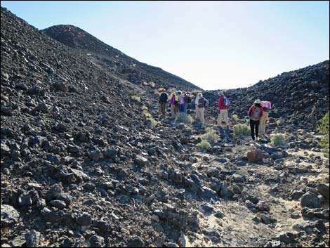
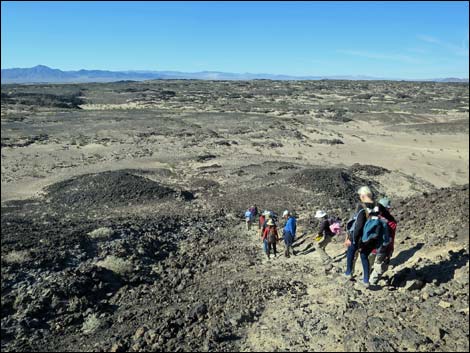
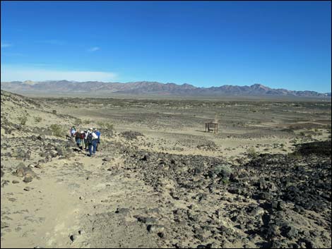
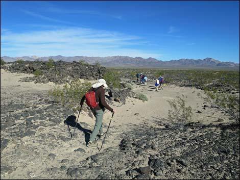
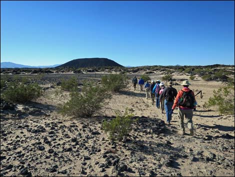 Hikers setting out across sandy plain (view SW) |
 Hikers approaching the first shade shelter (view SW) |
 First shade shelter (view SW) |
 |
 |
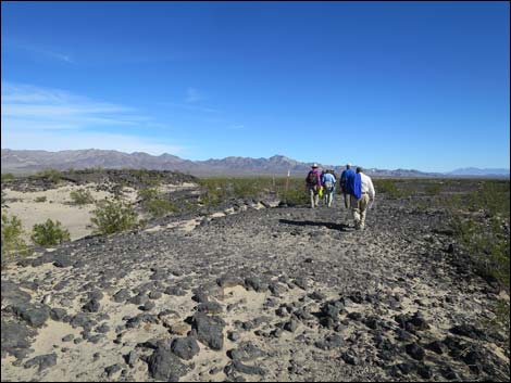
 Highpoint, exiting lava ridges onto sandy flats (view SW) |
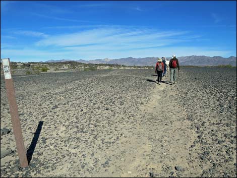
 Carsonite sign on sandy flats (view SW) |
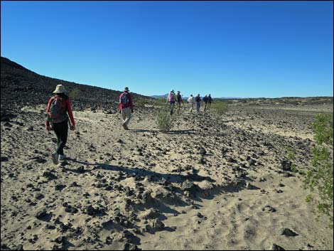
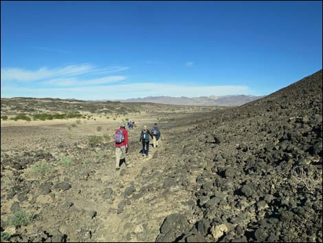
 Hikers on sandy flats (view SW) |
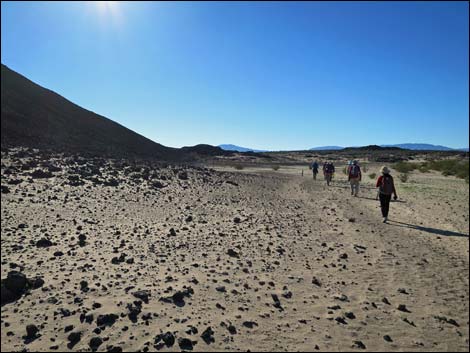
 Sandy flats (view SW) |
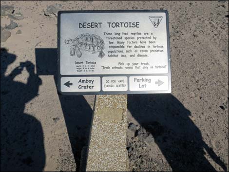 Metal tortoise sign (view N) |
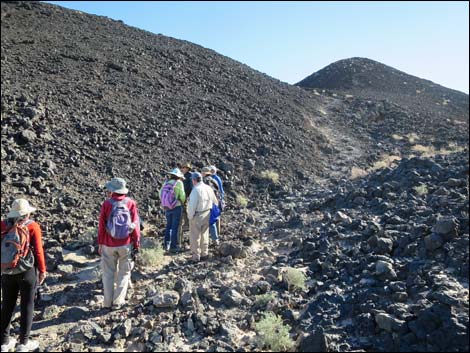
 Hikers approaching the second shade shelter (view SW) |
 Second shade shelter (view SW) |
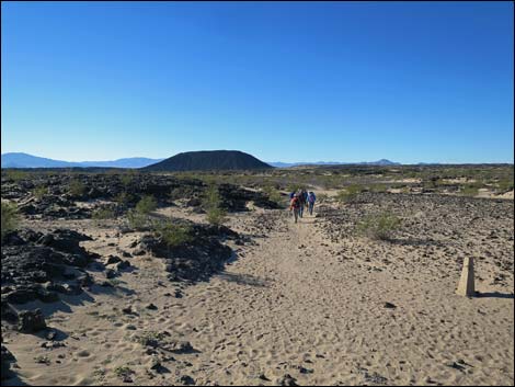
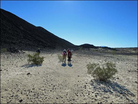
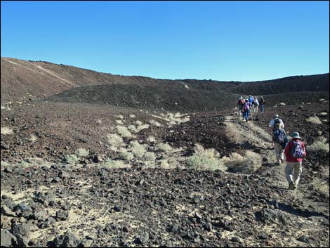
 Sandy hills leading towards west side of cinder cone (view SW) Sandy hills leading towards west side of cinder cone (view SW) |
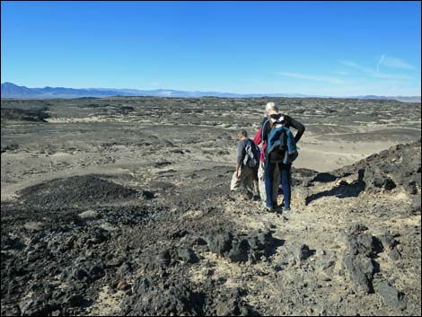
 Sandy flats on northwest side of cinder cone (view S) |
 Sandy flats on northwest side of cinder cone (view S) |
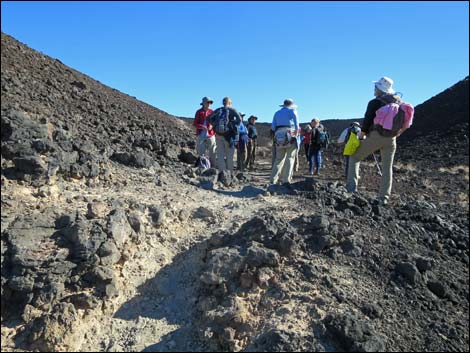
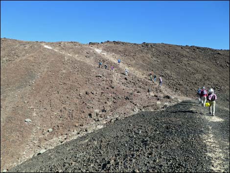
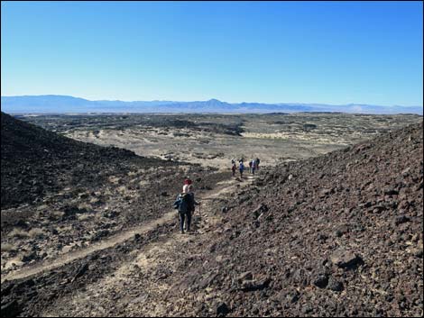
 Hikers approaching the collapsed wall of the volcano (view S) |
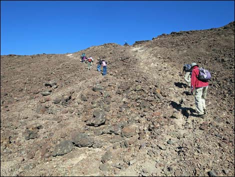
 Hikers starting up along edge of "frozen waterfall" (view SE) |
 Hikers starting up along edge of "frozen waterfall" (view SE) Hikers starting up along edge of "frozen waterfall" (view SE) |
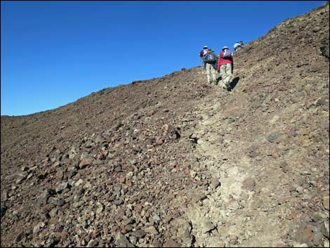
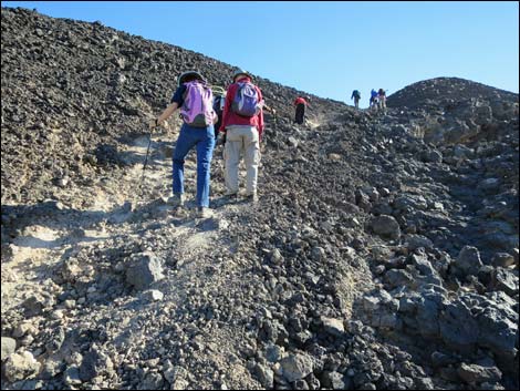 Steep, loose trail along edge of "frozen waterfall" (view SE) |
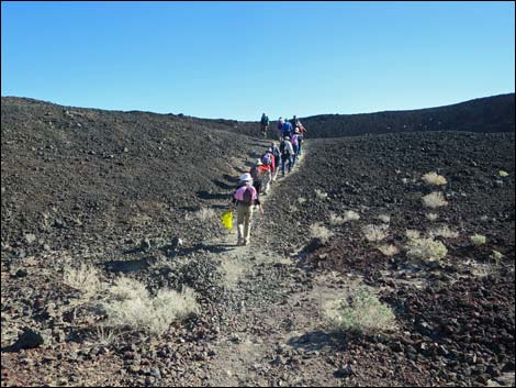
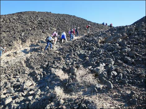 Hikers climbing along edge of "frozen waterfall" (view E) |
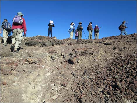
 Hikers at the lip of the crater (view E) |
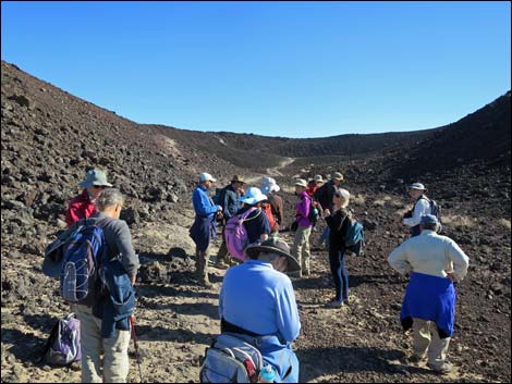 Hikers in the crater (view E) |
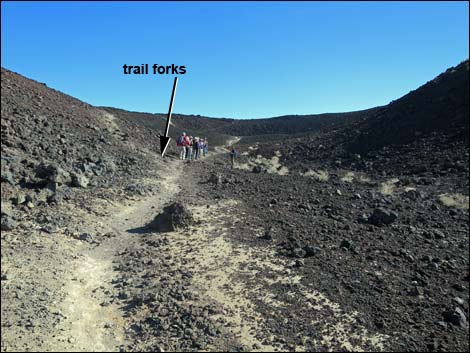 Hikers in the crater, just past fork in the trail (view E) Hikers in the crater, just past fork in the trail (view E) |
 Hikers in the crater (view E) |
 Hikers climbing onto first lava dam (view E) |
 Mud-filled crater bottom (view E from first lava dam) |
 Hikers on first lava dam (view N) |
 Mud-filled crater bottom (view SE from first lava dam) |
 Hikers climbing towards north edge of crater rim (view N) |
 |
 |
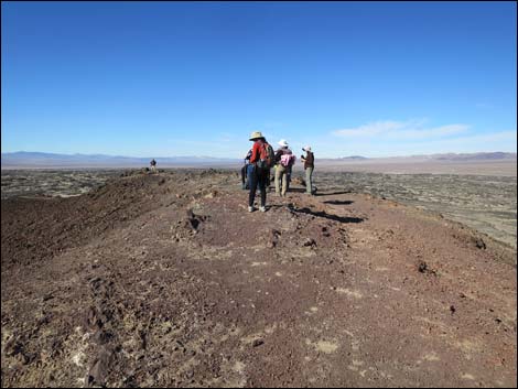
 Hikers arriving at north edge of crater rim (view N) |
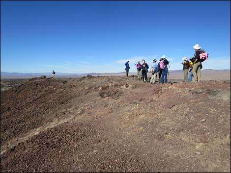 Hikers on north edge of crater rim (view NW) |
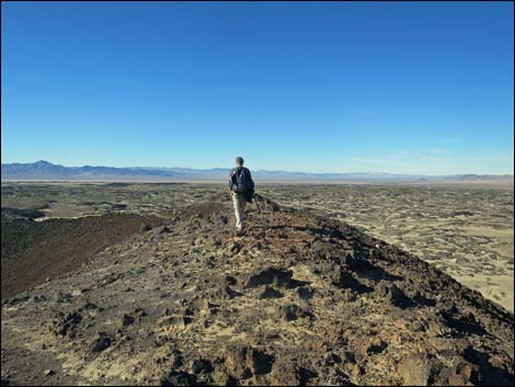
Summit Views
 |
 |
 |
 |
 |
 |
 |
 more to come ... |
Returning to the Trailhead
 Hikers on the north rim (view W) |
 Hikers on the north rim (view W) |
 Hikers departing the north rim (view SW) |
 Hikers descending back into the crater (view SW) |
 Hikers arriving at fork in the trail (view SW) |
 Hikers atop the "frozen waterfall" (view E) |
 Hikers descending from the crater (view NW) Hikers descending from the crater (view NW) |
 Hikers arriving on desert flats (view N) |
 desert flats (view NE) |
 Hikers returning towards second shade shelter (view NE) |
 Hikers crossing sandy flats (view NE) |
 Hikers crossing lava flow (view NE) |
 |
 |
 Hikers at first shade shelter (view NE) |
 Crossing sandy flats (view NE) |
 |
 |
 Hikers returning to the picnic area (view NE) |
 Hikers returning to the trailhead (view NE) |
Table 1. Hiking Coordinates Based on GPS Data (NAD27; UTM Zone 11S). Download Hiking GPS Waypoints (*.gpx) file.
| Wpt. | Location | UTM Easting | UTM Northing | Elevation (ft) | Point-to-Point Distance (mi) | Cumulative Distance (mi) | Verified |
|---|---|---|---|---|---|---|---|
| 01 | Amboy Crater Trailhead | 611884 | 3824395 | 647 | 0.00 | 0.00 | GPS |
| 02 | Amboy Crater Trailhead Info Sign | 611825 | 3824405 | 648 | 0.04 | 0.04 | GPS |
| 03 | First Shade Shelter | 611553 | 3823931 | 670 | 0.41 | 0.45 | GPS |
| 04 | Tortoise Trail Sign | 611200 | 3823396 | 683 | 0.55 | 1.00 | GPS |
| 05 | Second Shade Shelter | 611004 | 3823366 | 708 | 0.14 | 1.14 | GPS |
| 06 | Base of Gully | 610825 | 3823065 | 750 | 0.27 | 1.41 | GPS |
| 07 | Top of Gully | 610899 | 3823028 | 827 | 0.06 | 1.47 | GPS |
| 08 | Trail Forks | 610920 | 3823033 | 832 | 0.01 | 1.48 | GPS |
| 09 | Center of Crater | 611004 | 3823031 | 852 | 0.06 | 1.54 | GPS |
| 10 | North Rim of Crater | 611037 | 3823171 | 947 | 0.11 | 1.65 | GPS |
| 08 | Trail Forks | 610920 | 3823033 | 832 | 0.14 | 1.79 | GPS |
| 07 | Top of Gully | 610899 | 3823028 | 827 | 0.01 | 1.80 | GPS |
| 06 | Base of Gully | 610825 | 3823065 | 750 | 0.06 | 1.86 | GPS |
| 05 | Second Shade Shelter | 611004 | 3823366 | 708 | 0.27 | 2.13 | GPS |
| 04 | Tortoise Trail Sign | 611200 | 3823396 | 683 | 0.14 | 2.27 | GPS |
| 03 | First Shade Shelter | 611553 | 3823931 | 670 | 0.55 | 2.82 | GPS |
| 02 | Amboy Crater Trailhead Info Sign | 611825 | 3824405 | 648 | 0.41 | 3.23 | GPS |
| 01 | Amboy Crater Trailhead | 611884 | 3824395 | 647 | 0.04 | 3.27 | GPS |
Happy Hiking! All distances, elevations, and other facts are approximate.
![]() ; Last updated 240328
; Last updated 240328
| Hiking Around Mojave Preserve | Hiking Around Las Vegas | Glossary | Copyright, Conditions, Disclaimer | Home |