Hiking Around Las Vegas, Mojave National Preserve
Overview | Close-up
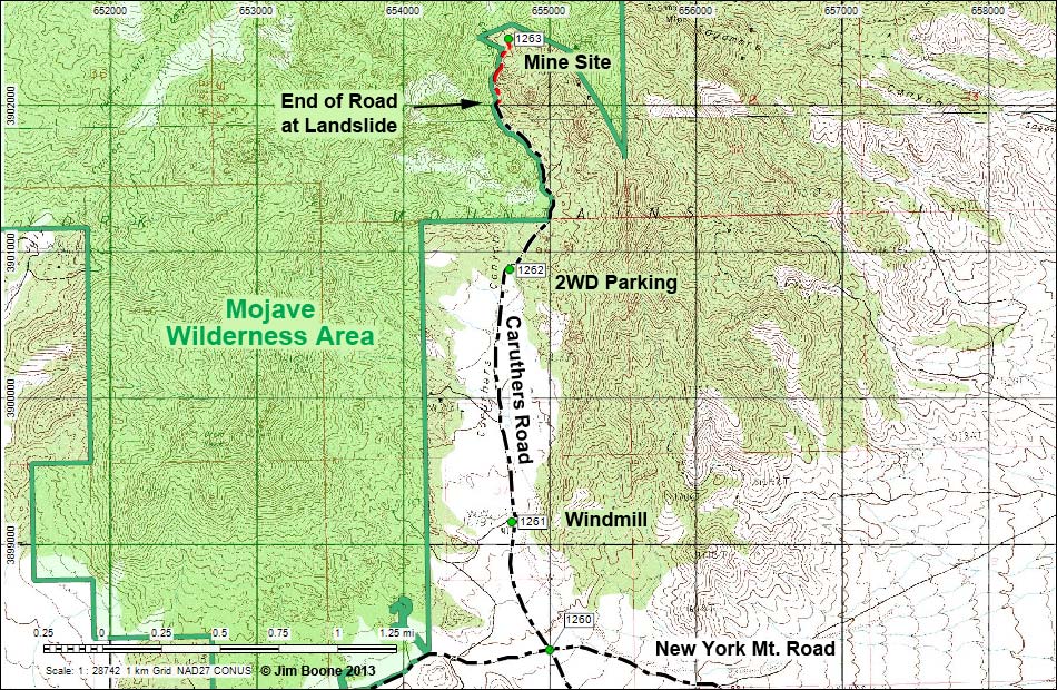
Note: Roads are black (solid = paved; dashed = unpaved). Trails and routes are red (solid = main; dashed = adjacent or alternate). Map based on USGS 7.5-minute topo map. North is at the top. UTM Grid is NAD27 CONUS. Wilderness Area boundaries (solid green) based on BLM data. Roads on this map based on aerial photos, not GPS data.
Note: All distances, elevations, and other facts are approximate.
![]() ; Last updated 130528
; Last updated 130528
| Caruthers Canyon | Hiking Around Mojave Preserve | Glossary | Copyright, Conditions, Disclaimer | Home |