Hiking Around Las Vegas, Mojave National Preserve
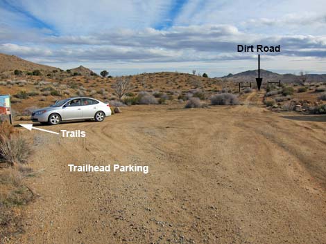
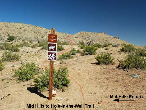
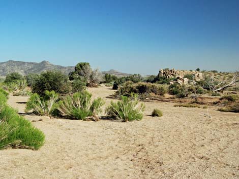
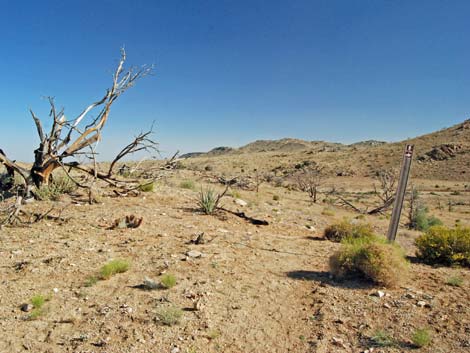
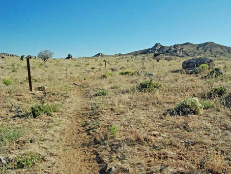
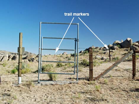
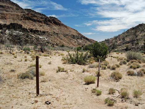
 Mid Hills Trailhead (view SE) Mid Hills Trailhead (view SE) |
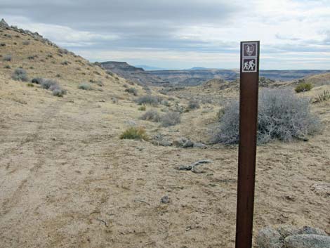
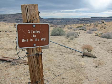
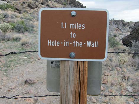
Overview The Mid Hills to Hole-in-the-Wall Trail (MH-HITW Trail) runs for about 8-1/2 miles between the Mid Hills (MH) campground area and Hole-in-the-Wall (HITW) campground area. This long, but fairly easy trail traverses a variety of habitats and vegetation types (burned and unburned), climbs over rocky passes, follows sandy washes, and runs through big open country that gives the feeling of being "way out there." The Park Service says that lots of people get lost on this trail. Careful attention to trail markers and a few landmarks should eliminate this problem. Link to Landmarks. Link to map or download scan of official trail brochure. |
 Mid Hills Trailhead (view SE) |
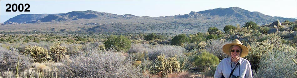
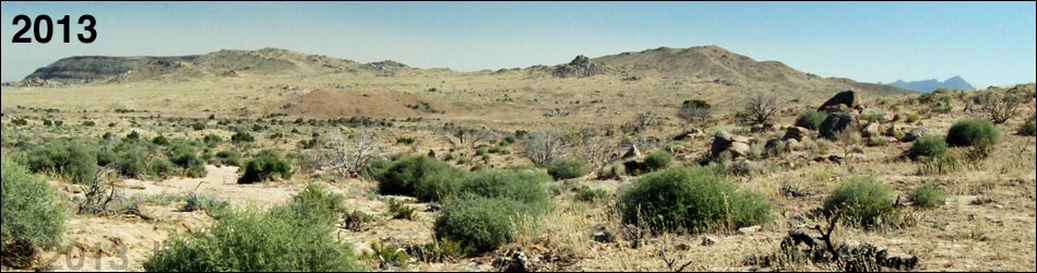
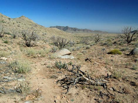
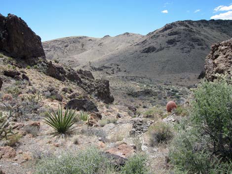
There are various places to start and end this hike, and the trail can be walked in either direction in all or in part, but as described here, the hike starts at the MH Trailhead and runs south to the HW Visitor Center (net loss of about 1,710 feet). As such, the hike requires a vehicle shuttle, and that being the case, there are several dirt roads that could be used to shorten the hike (several exits to Wild Horse Road). Note that the Park Service recommends hiking this trail in this direction. In June 2005, this area burned in the 71,000-acre Hackbury Fire. The south-most mile or so remains unburned, but the rest of the trail runs through the burned area. Although different now, this still is an interesting hike with astounding spring wildflowers and many resprouting shrubs and a few patches that escaped the blaze. It has been interesting to watch the desert vegetation respond to wildfire. |
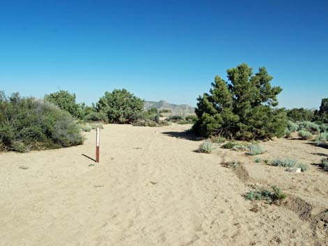
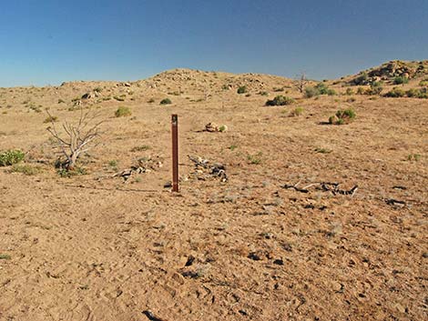
 Mid Hills Trailhead (view S) |
Watch Out Other than the standard warnings about hiking in the desert, ...this is a fairly safe hike. You could stumble into one of the many Banana Yuccas, Buckhorn Cholla, or Woodrat nests along the trail, but these concerns aren't unique to this trail. There is a very dangerous mine shaft a short way off the trail about 1/2 mile past the high saddle. If hikers visit this site, be aware that the collar is formed from loose dirt, and getting too close to the shaft easily could result in the soft dirt giving away. The main danger is that hikers can get too close before realizing the hazard. While hiking, please respect the land and the other people out there, and try to Leave No Trace of your passage. Also, this is a long hike in a remote area, so be sure to bring the 10 Essentials. |
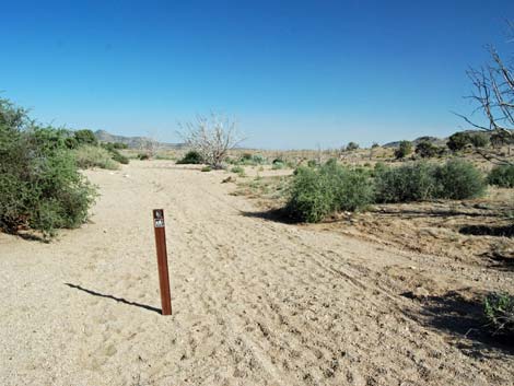
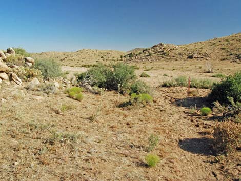
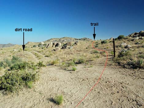
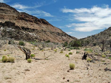
 Option 3: start on the dirt road (view S) |
Getting to the Trailhead
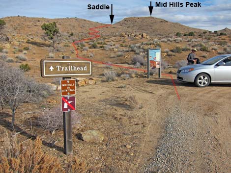
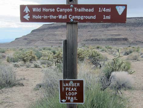
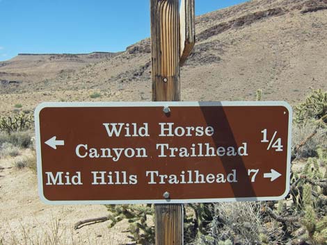
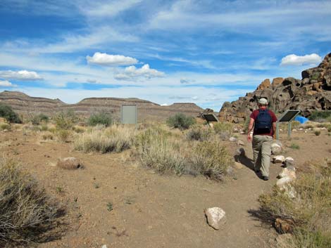
This hike is located in Mojave National Preserve, about 2 hours south of Las Vegas. From town, drive two vehicles out to the Hole-in-the-Wall Visitor Center, which is about 85 miles south of Las Vegas. Continue west on Hole-in-the-Wall Road to the picnic area and the Rings Trailhead at the end of the road. Leave one shuttle vehicle here. Alternatively, from the Visitor Center, continue south on Black Canyon Road to Wild Horse Road. Turn right and drive west about a mile to Wild Horse Trailhead. Leave one shuttle vehicle here. From the southern trailhead, drive north on Black Canyon Road about 7 miles to Wild Horse Road. Watch for signs to Mid Hills Campground. Turn left towards the campground and drive west 2 miles to the campground entrance road. Do not turn into the campground; rather, turn left into the Mid Hills Trailhead parking area (Site 1444). Park here, this is the trailhead. |
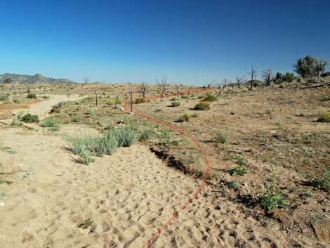
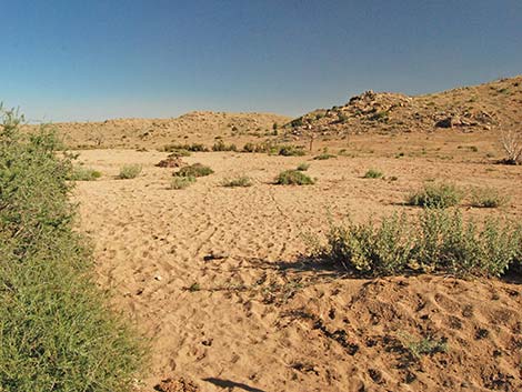
 Options 1 and 2: start on trails (view SE) |
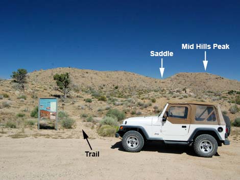
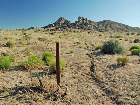
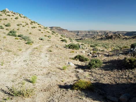
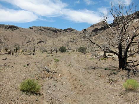
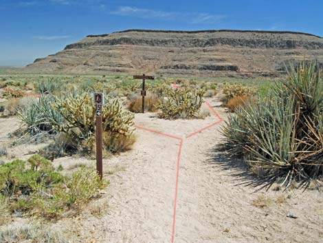
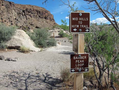
The Hike At the Mid Hills Trailhead (Table 1, Waypoint 35), hikers are immediately presented with three choices: (1) hike the regular trail, (2) hike "backwards" on the Mid Hills Loop, or (3) hike down a dirt road until joining the Mid Hills Loop trail, and then hiking "backwards" on the Mid Hills Loop. Option 1. The regular trail runs southeast to climb over the ridge behind the trailhead. This option is harder because it climbs over the ridge, but it offers nice views out over the desert. This also offers the opportunity to summit Mid Hills Peak with little added effort. |
 Option 1: straight; Option 2: turn right (view SW) |
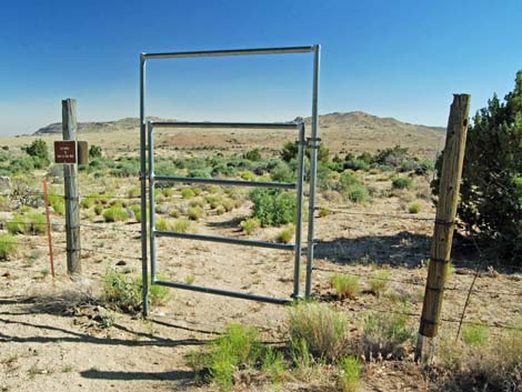
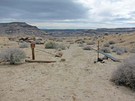
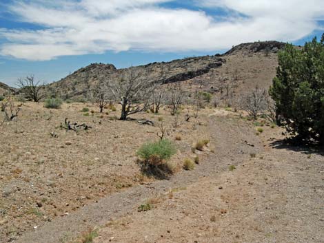
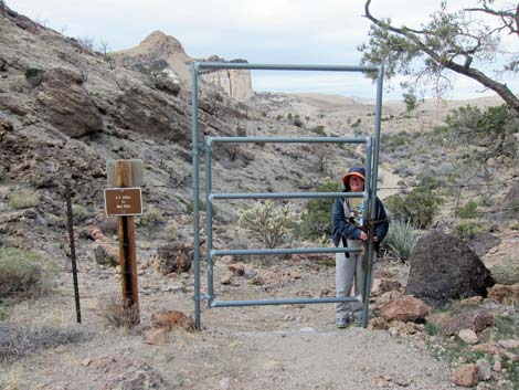
Option 2. Hiking "backwards" on the Mid Hills Loop provides an easier start, but the first 1/2 mile is faint and hard to follow. For this option, follow the main trail through a gate (Wpt. 34) and up to signs on a 4x4 post. Turn right onto what looks like a cow trail and hike south for about 2 miles to the south end of the Mid Hills Loop (Wpt. 29). For details of this hike, see the Mid Hills Loop Trail. Option 3. Hiking the dirt road makes a fine route that is easy and easy to follow, but it starts by climbing over a locked gate (which can be bypassed with some added distance by hiking out the main trail to the man-gate). On the dirt road, hike south for about 0.5 miles to join the Mid Hills Loop, then continue 1.5 miles to the south end of the Mid Hills Loop (Wpt. 29). See the Mid Hills Loop for details. |
 Option 1: straight; Option 2: turn right (view SW) |
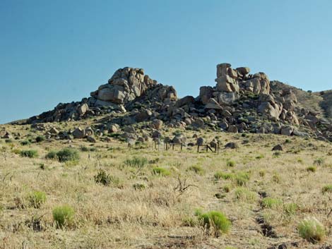
On the main trail, the well-marked trail runs southeast, through a man-gate (Wpt. 34), and up to a saddle (Wpt. 33) on the ridge to the southeast. Views from the saddle are not bad, but those from Mid Hills Peak, just above, are grand. Continuing over the saddle, the trail wraps around the east side of the peak to another saddle, then runs down a sideslope to a third saddle (Wpt. 32), and eventually runs down a canyon and out onto a sandy flood plain (Wpt. 31). Following carsonite signs, cairns, and landmarks, the trail runs through a gate (Wpt. 30) and on down to a trail junction (Wpt. 29) where the Mid Hills Trail loops back to the north and the MH-HITW Trail continues south. See the Mid Hills Loop Trail for details of the trail to this point. |
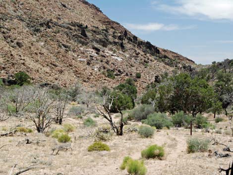
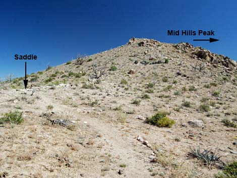 High saddle and Mid Hills Peak (view S) |
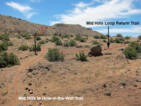
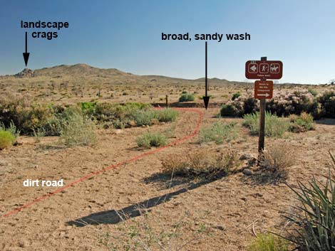
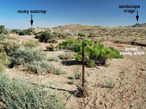
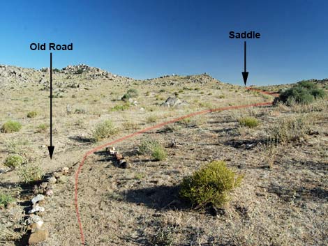
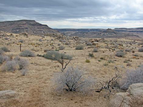
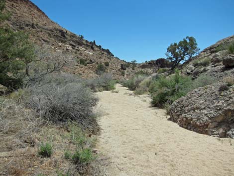
Here, in the broad, sandy wash (Wpt. 28), the three hiking options converge. Before leaving this spot, look south to the high ridge that runs east-west. The trail runs over this ridge at the lowest saddle in the middle of the ridge. Locate an important landmark: the rocky crags just right of the lowest saddle. The MH-HITW Trail continues south from the trail signs in the broad, sandy wash (Wpt. 28). The wash runs southeast past a rocky outcrop, then when the wash seems to spread out, the carsonite trail markers drift off to the right side of the wash, eventually leaving the wash (Wpt. 27) to the right. The trail runs up over a low ridge, then drops to cross another broad, sandy wash (Wpt. 26; Wpt. 25). Continuing south, the well-marked trail begins a long, uphill run. The trail runs up a side canyon, then crosses a low ridge into a small sandy wash (Wpt. 24). |
 |
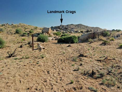
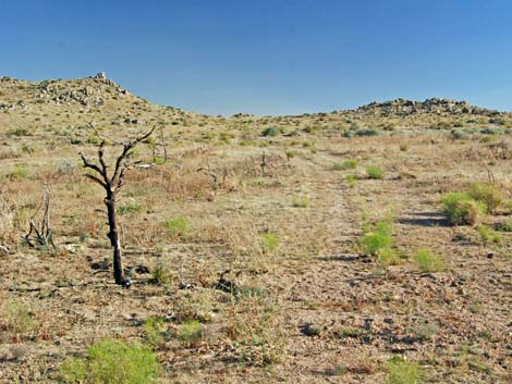
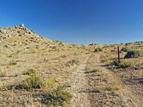
Running southwest up the wash, the trail runs through a landscape well adorned with boulders, including balanced rocks and juniper trees (a bit of shade), aiming for rocky crags on the skyline. Approaching the rocky crags, the trail fades out as cows and humans avoid the washed-out ditch that was the trail, but continuing towards the rocky crags, the trail arrives at a gate (Wpt. 23). Note that these crags are a good landmark that can be seen from miles away. Passing through the gate, a dirt road runs east, angling down and across the hillside; however, the well-marked trail runs up across the hillside to the southeast. Eventually reconnecting with the old road (Wpt. 22), the trail continues onto a high saddle (Wpt. 21). |
 Gate in sandy washes area (view S) |
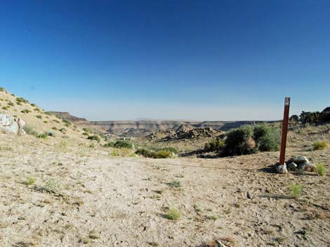
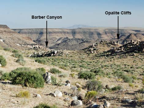
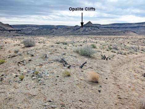
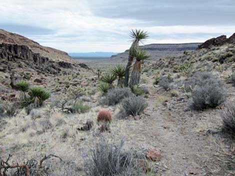
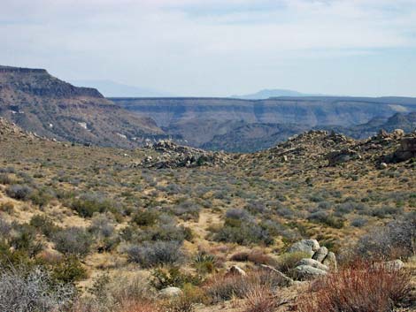
Atop the saddle, take notice of the landscape ahead and locate the landmarks. The entire landscape appears to drain towards a single canyon: this is Barber Canyon where the trail runs around the west edge of Barber Peak. Also, partially obscured by foreground hills, the Opalite Cliffs can be seen. The trail runs below the Opalite Cliffs before turning down Barber Canyon. There is no reason to become disorientated in this area: just walk downhill past the Opalite Cliffs and down Barber Canyon. Continuing south over the saddle (Wpt. 17), the old road runs down the canyon heading generally south as it passes a T-intersection (Wpt. 20; there is a quail guzzler to the east), passes through an historic gate (Wpt. 18) from which the barbed wire has been removed, and crosses another old road (Wpt. 17). |
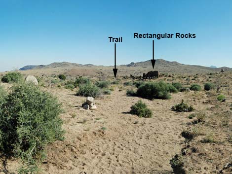 Landmark: rectangular rocks below sandy washes |
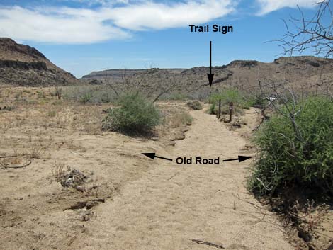
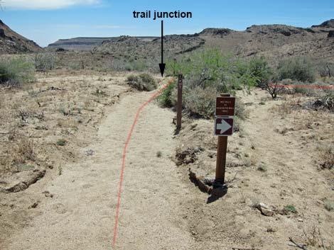
Still running generally south, the trail runs on side hills east of the sandy wash that drains from the saddle. There are cattle trails in this area that can be confusing (Wpt. 16), but the trail continues south. In this area, the trail passes near to the dangerous mine shaft. Hikers who investigate the site need to stay well back from the soft edge. [Personal note: this is the scariest unmarked mine shaft that I have ever seen because I got too close before realizing that the collar was unstable.] At about 1.8 miles south of the saddle, the trail comes off the hillside and enters that sandy wash (Wpt. 15). This wash is followed generally south about 0.2 miles, across one dirt road to a second dirt road with trail signs (Wpt. 14). At the second dirt road, the trail turns right onto the road and runs southwest towards the Opalite Cliffs. |
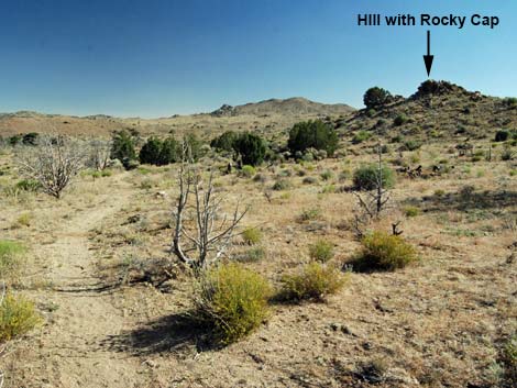 Landmark: hill with rocky cap |
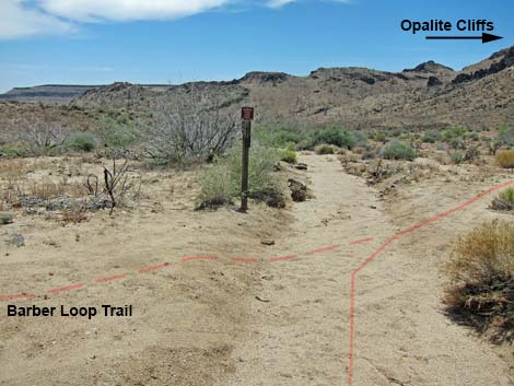
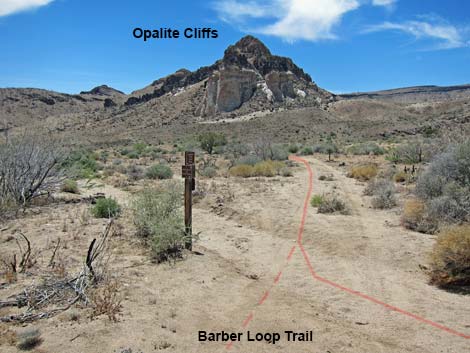
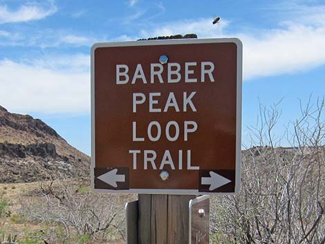
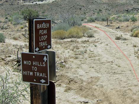
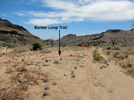
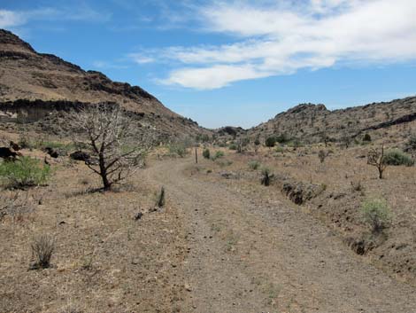
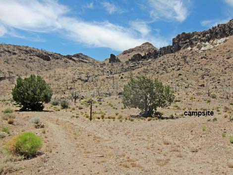
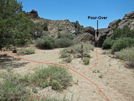
The road merges with another (Wpt. 13) and curves to the southeast heading more directly towards Barber Canyon. Still on the road, the trail passes a campsite directly below the Opalite Cliffs (Wpt. 12). The road eventually ends, and the trail follows the sandy wash downstream into Barber Canyon. Trail signs indicate where the trail cuts up out of the wash to the left, but hikers who miss the signs will, in a few yards, stop atop a high pour-over. Climbing out of the wash, the trail passes a gate (Wpt. 10) and climbs over a highpoint (Wpt. 09). For details of this section, see the Barber Peak Loop Trail. |
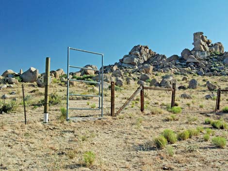
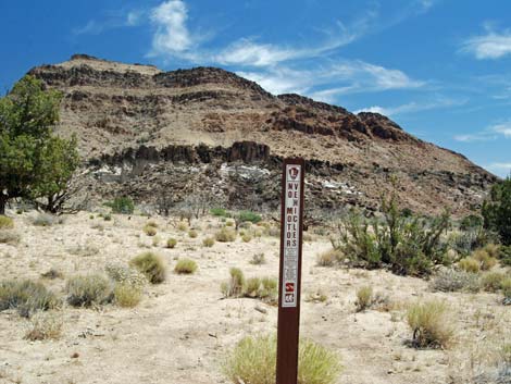
 Sign at south end of Mid Hills Loop (view SW) |
Between the gate and the highpoint, hikers might want to drop off the steep hillside into the wash below and visit the Tallest Yuccas. Continuing down the wash, hikers can cut back up the trail without climbing back up a cliff. Beyond the highpoint (Wpt. 09), the well-defined trail runs south and down a rocky canyon past several quite stout yuccas, and on down to a signed trail junction (Wpt. 07). Here, hikers terminating at the Wild Horse Trailhead continue south another 0.3 miles, while hikers heading for Hole-in-the-Wall turn left and head west another 1.2 miles. For details of this section, see the Barber Peak Loop Trail. |
 HITW trail turns down broad, sandy wash (view S) |
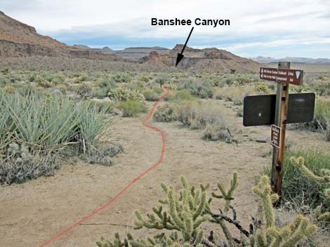
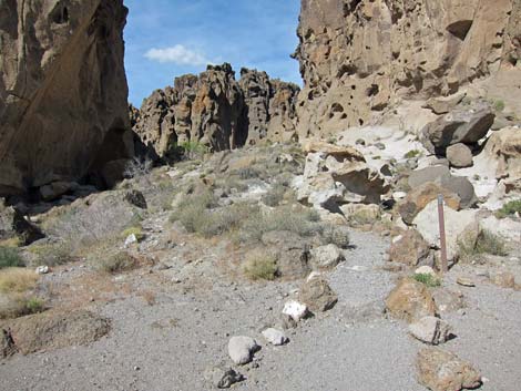
The trail runs across gentle hillsides and down a sandy wash heading for Banshee Canyon. At a junction with the Rings Loop Trail (Wpt. 03), The trail continues straight into Banshee Canyon. Staying left into a cleft, the trail climbs two sets of ringbolts (Rings Trail) and arrives at the Rings Trailhead (Wpt. 02). Following the road east another 1/4-mile, the trail ends at the Hole-in-the-Wall Visitor Center (Wpt. 01). For details of this section, see the Rings Loop Trail. |
 HITW trail turns down broad, sandy wash (view SE) |
 Carsonite trail markers in wash (view SE) |
 Carsonite trail markers trending right in wash (view SE) |
 Well-marked trail exits wash (view SE) |
 Trail climbs over low ridge towards 2nd broad wash (view S) |
 Trail approaches broad wash (view S) |
 Trail entering broad wash - look ahead for carsonite marker (view S) |
 Carsonite marker on south side of broad wash (view S) |
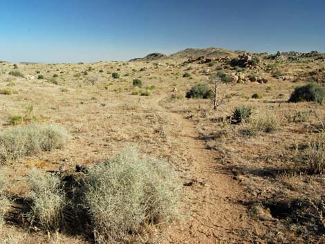
 Trail runs up a side canyon (view S) |
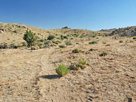
 Trail runs across rolling landscape (view S) |
 Trail enters smaller, sandy wash (view SW) |
 Trail in boulder-strewn area (view SW) |
 Approaching landmark crags, trail becomes faint (view SW) |
 Approaching rocky crags, trail becomes very faint (view SW) |
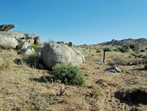
 Approaching gate below landmark rocky crags (view SW) |
 Gate below landmark rocky crags (view SW) |
 Gate below landmark rocky crags (view SE) |
 At gate, trail runs high, not on dirt road (view SE) |
 Faint trail runs across hillside; watch for trail markers (view SE) |
 Faint trail runs across hillside; watch for trail markers (view SE) |
 Faint trail joins old road; high saddle comes into view (view S) |
 Trail follows track of old road towards saddle (view S) |
 Trail follows track of old road towards saddle (view S) |
 High saddle (view S) |
 Atop high saddle, review the landscape ahead (view S) |
 Atop high saddle, locate the landmarks (view S) |
 Trail follows old road below high saddle - watch for trail markers |
 Trail passes through old gate (view S) |
 Sign at old gate (view S) |
 Very faint trail - watch for trail markers (view S) |
 Very faint trail - watch for trail markers (view S) |
 Very faint trail - watch for trail markers (view S) |
 Trail crosses old road (view S) |
 Trail signs at 2nd dirt road (view S) |
 Trail turns right onto dirt road (view S) |
 Trail turns towards Opalite Cliffs landmark (view S) |
 Sign at dirt road (view S) |
 Sign at dirt road (view SW) |
 Dirt roads merge below Opalite Cliffs (view SW) |
 Dirt road runs towards Barber Canyon landmark (view SE) |
 Road runs below Opalite Cliffs (view SE) |
 Road runs past campsite below Opalite Cliffs (view SE) |
 Road runs into Barber Canyon (view SE) |
 Road runs into Barber Canyon (view SE) |
 Road ends before Barber Canyon (view SE) |
 End of the road sign (view SE) |
 Trail continues on closed road (view SE) |
 Trail continues on closed road (view SE) |
 Trail drops into wash (view SE) |
 Before pour-over, trail turns left onto hillside (view S) |
 Trail climbs hillside to gate and highpoint (view E) |
 Looking back at hiker coming through gate (view NW) |
 Sign at gate (view S) |
 Route into top of Tall Yuccas area (view SW) |
 Passing high point and starting down rocky trail (view S) |
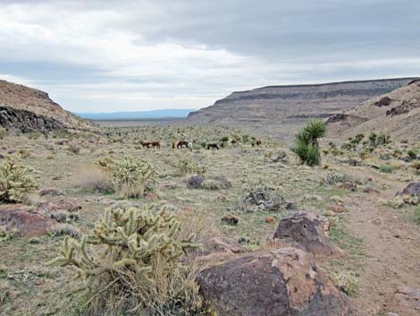 Horses grazing along trail (view S) |
 Trail forks: turn left towards Hole in the Wall (view S) |
 Trail sign (view S) |
 Trail sign (view W) |
 Trail runs into Banshee Canyon (view E) |
 Trail sign at Rings Loop Trail (view S) |
 Trail entering Banshee Canyon (view NE) |
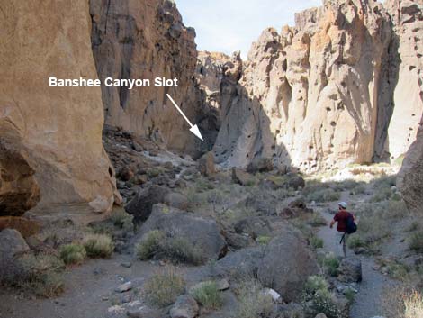 Trail approaching Banshee Canyon Slot (view NE) |
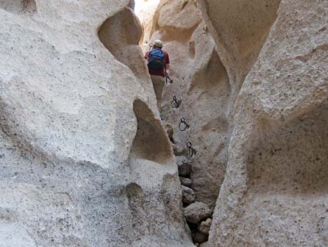 Hikers ascending lower set of ringbolts (view NE) |
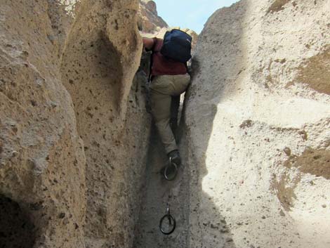 Hikers ascending higher set of ringbolts (view NE) |
 Hikers arriving at Rings Trailhead (view E) |
Historic photos from before the 2005, 71,000-acre Hackbury Fire
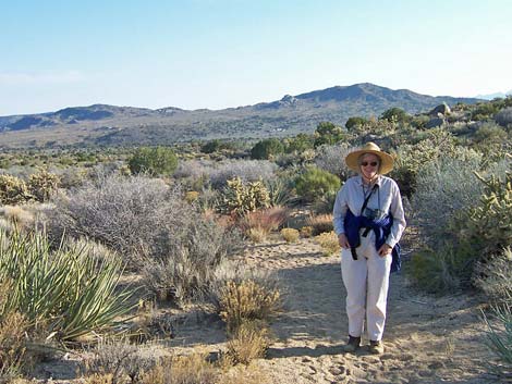
 Hikers departing HW area |
 Hikers approaching the Opalite Cliffs (view NW) |
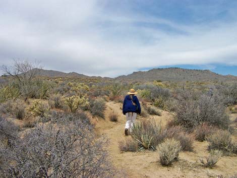 Hiker heading for saddle on the skyline (view N) |
 Looking back towards Barber Peak (on left; view S) |
 Hikers on 4.8-mile saddle (view NE) |
 Hiker approaching the northern mountains (view S) |
Table 1. Trail Coordinates Based on GPS Data (NAD27; UTM Zone 11S). Download Hiking GPS Waypoints (*.gpx) file.
| Wpt. | Location | UTM Easting | UTM Northing | Elevation (ft) | Point-to-Point Distance (mi) | Cumulative Distance (mi) | Verified |
|---|---|---|---|---|---|---|---|
| 01 | HW Visitor Center | 646446 | 3878721 | 4,227 | 0.00 | 0.00 | GPS |
| 02 | Rings Trailhead | 646177 | 3878898 | 4,256 | 0.24 | 0.24 | GPS |
| 03 | Trail Junction | 646020 | 3878753 | 4,163 | 0.20 | 0.44 | GPS |
| 04 | Trail Drops into Wash | 645818 | 3878538 | 4,160 | 0.20 | 0.64 | GPS |
| 05 | Trail turns into Side Wash | 645737 | 3878527 | 4,171 | 0.05 | 0.69 | GPS |
| 06 | Trail Exits Wash | 645525 | 3878425 | 4,194 | 0.18 | 0.87 | GPS |
| 07 | Trail Junction | 645031 | 3878461 | 4,292 | 0.33 | 1.20 | GPS |
| 08 | Detour to Tall Yucca | 644860 | 3878777 | 4,320 | 0.23 | 1.43 | GPS |
| 09 | Highpoint | 644393 | 3879376 | 4,533 | 0.52 | 1.95 | GPS |
| 10 | Gate | 644281 | 3879465 | 4,505 | 0.10 | 2.05 | GPS |
| 11 | Trail Enters Wash | 644230 | 3879498 | 4,458 | 0.04 | 2.09 | GPS |
| 12 | Campsite below Opalite Cliffs | 643779 | 3879801 | 4,541 | 0.38 | 2.47 | GPS |
| 13 | Road Forks | 643704 | 3880001 | 4,577 | 0.17 | 2.64 | GPS |
| 14 | Trail Junction | 643790 | 3880165 | 4,593 | 0.11 | 2.75 | GPS |
| 15 | Trail Exits Wash | 643706 | 3880476 | 4,659 | 0.23 | 2.98 | GPS |
| 16 | Trail Junction | 643729 | 3881560 | 4,943 | 0.73 | 3.71 | GPS |
| 17 | Crossing Old Road | 643599 | 3882076 | 5,084 | 0.39 | 4.10 | GPS |
| 18 | Old Gate | 643597 | 3882180 | 5,103 | 0.07 | 4.17 | GPS |
| 19 | Trail Joins Old Road | 643602 | 3882202 | 5,112 | 0.01 | 4.18 | GPS |
| 20 | Road Forks | 643641 | 3882348 | 5,163 | 0.10 | 4.28 | GPS |
| 21 | Saddle | 643463 | 3883144 | 5,393 | 0.54 | 4.82 | GPS |
| 22 | Trail Departs Road | 643507 | 3883470 | 5,349 | 0.21 | 5.03 | GPS |
| 23 | Gate | 643343 | 3883818 | 5,345 | 0.24 | 5.27 | GPS |
| 24 | Trail Exits Wash | 643996 | 3884582 | 5,149 | 0.66 | 5.93 | GPS |
| 25 | Broad Sandy Wash, South | 643938 | 3884930 | 5,116 | 0.24 | 6.17 | GPS |
| 26 | Broad Sandy Wash, North | 643902 | 3884992 | 5,119 | 0.04 | 6.21 | GPS |
| 27 | Trail Drops into Wash | 643872 | 3885216 | 5,157 | 0.15 | 6.36 | GPS |
| 28 | Trail Joins Dirt Road | 643628 | 3885475 | 5,199 | 0.23 | 6.59 | GPS |
| 29 | Trail Departs Dirt Road | 643644 | 3885492 | 5,199 | 0.02 | 6.61 | GPS |
| 30 | Gate | 643741 | 3886312 | 5,319 | 0.55 | 7.16 | GPS |
| 31 | Trail Leaves Wash | 643628 | 3886744 | 5,443 | 0.31 | 7.47 | GPS |
| 32 | Low Saddle | 643534 | 3886888 | 5,510 | 0.12 | 7.59 | GPS |
| 33 | High Saddle | 643407 | 3887395 | 5,646 | 0.38 | 7.97 | GPS |
| 34 | Gate | 642961 | 3887602 | 5,495 | 0.37 | 8.34 | GPS |
| 35 | Trailhead | 642891 | 3887627 | 5,493 | 0.05 | 8.39 | GPS |
Happy Hiking! All distances, elevations, and other facts are approximate.
![]() ; Last updated 240329
; Last updated 240329
| Hiking Around Mojave Preserve | Hiking Around Las Vegas | Glossary | Copyright, Conditions, Disclaimer | Home |