Hiking Around Las Vegas, Mojave National Preserve
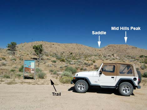 Trailhead Parking (view SE) |
Overview The Mid Hills Peak route provides a fairly easy 0.5-mile hike through high-elevation desert near Mid Hills Campground. The trail, and then a route, lead to the summit of Mid Hills Peak (5,771 ft elevation). The hike is short, and the peak is too low to rate a summit register, but the views are beyond compare for a mere 5,800-ft peak. Link to map. |
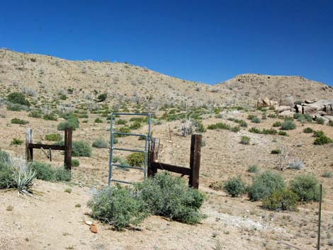 Trail passes through gate in barbed-wire fence |
Watch Out Other than the standard warnings about hiking in the desert, ... this trail is about as safe as it gets with no particular hazards. Part of the hike is off trail, but even that is as safe and easy as off-trail hiking gets. While hiking, please respect the land and the other people out there, and try to Leave No Trace of your passage. Also, even though this hike is short, be sure to bring what you need of the 10 Essentials. |
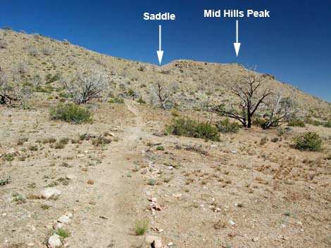 Trail climbs to saddle (view SE) |
Getting to the Trailhead This hike is located in Mojave National Preserve, about 2 hours south of Las Vegas. From town, drive out towards Hole-in-the-Wall Visitor Center. On Black Canyon Road, drive south from Cedar Canyon Road for 2.8 miles to Wild Horse Road (watch for signs to Mid Hills Campground). Turn right onto Wild Horse Road and drive west 2.0 miles to Mid Hills Campground Road. At the campground road, do not right into the campground. Rather, turn left into the Mid Hills Trailhead parking area. Park here, this is the trailhead. |
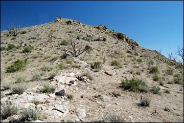
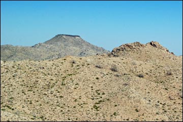
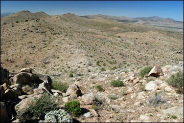
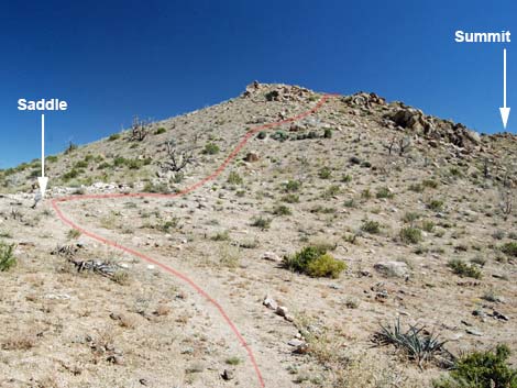 Route departs trail at saddle (view S) |
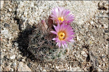
The Hike From the trailhead (Table 2; Waypoint 01), the trail runs past signs to the southeast aiming for a saddle on the horizon just north of the Mid Hills Peak. After passing a gate (Wpt. 02; be sure to close and latch the gate), the trail ascends the gentle bajada until turning and climbing more steeply up the sideslopes of the mountain. The trail makes two switchbacks, then continues fairly steeply up the hillside. This hillside burned severely, but many species are coming back; even a few conifers survived the fire. Common species growing back include Grizzlybear Pricklypear Cactus, Engelmann's Hedgehog Cactus, Mojave Kingcup Cactus, Buckhorn Cholla. Desert Globemallow, Narrowleaf Goldenbush, Cliffrose, Banana Yucca, Turpentinebroom, and lots of desert wildflowers. |
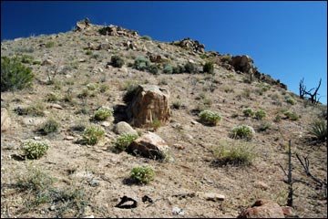
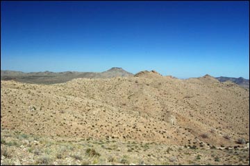
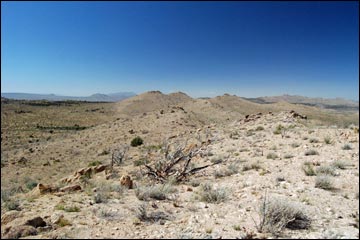
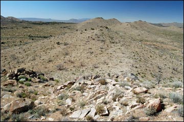
 Route runs up ridge (view S) |
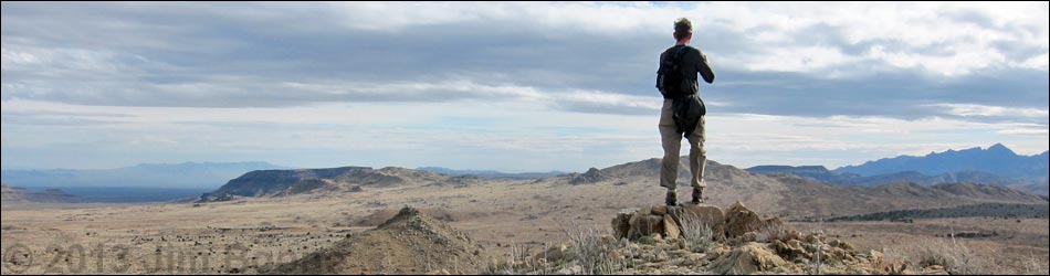
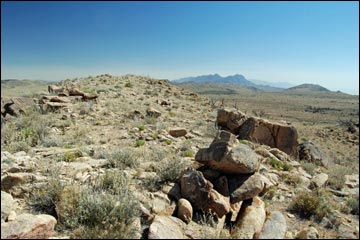
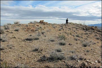
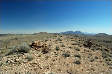
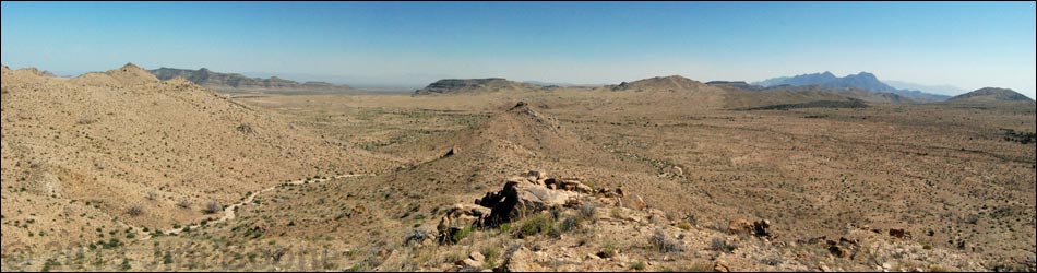
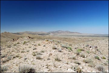
The grade eventually lessens as the trail climbs onto a saddle (Wpt. 03). At the saddle, the route leaves the trail and climbs the ridge to the south. It looks a long way away, but the summit ridge is surprisingly close, and the walk out to the summit (Wpt. 04) is almost level. Views from the summit are surprisingly long. To the east, the New York Mountain and mountains very far into Arizona can be seen (including the Hualapai Mountains 90 miles away south of Kingman). To the west, the views stretch to mountain ranges beyond the horizon (including Mt. San Gorgonio 110 miles away near San Bernardino, CA). |
 |
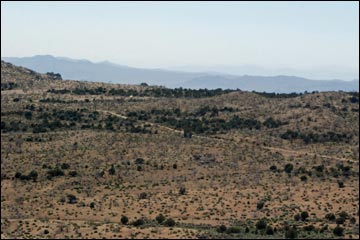
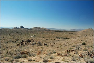
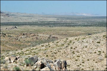
To the south, Barber Peak (above Hole-in-the-Wall Campground) and the Providence Mountains (15 miles) dominate the view, but the Piute and Old Woman Mountains (south of Interstate 10; 40 miles distant SE), Granite Mountains (27 miles SW), and other mountain ranges stretch into the haze. To the north, the Mid Hills (including Eagle Peaks) stretch into the near distance, and Cima Dome (15 miles) can be seen beyond. In the far distance beyond Cima Dome, high peaks of the Kingston Range (52 miles) can be seen 50 miles into the haze. When ready, retrace the route back to the trailhead, or consider finishing the Mid Hill Loop Trail. |
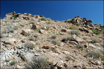 Approaching summit ridge (view S) |
 Trail ornament |
 North end of summit ridge (view S) |
 Hiker on summit ridge approaching peak (view S) |
 Summit: Mid Hills Peak (view S) |
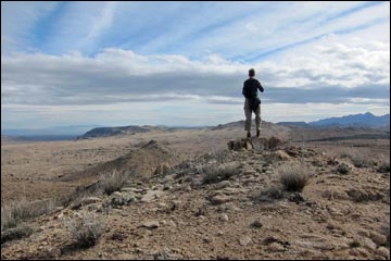 Hiker on Mid Hills Peak (view S) |
Mid Hills Peak Summit Views
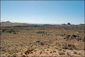
 View South |
 View South - zoom (Providence and Granite Mountains) |
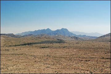
 View West |
 View West - zoom (Old Dad Mountains in the haze) |
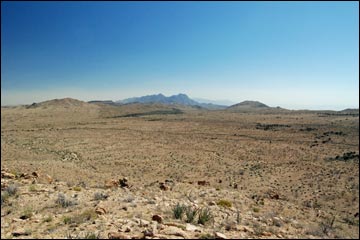
 View North |
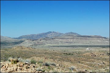 View North - zoom (New York Mountains) |
 View East |
 View East - zoom (Table Top Mountain) |
 View Northwest |
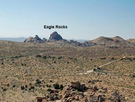 View Northwest - zoom (Eagle Rocks and Trailhead) |
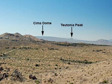 View Northwest - zoom (Cima Dome, Teutonia Peak) |
 View North - zoom (Mid Hills Campground) |
 View Northeast - Castle Peaks |
 View Southeast - Mid Hills to HITW trail |
Going Down
Summit Ridge (view N) |
 Approaching north end of summit ridge (view N) |
 Starting over the edge onto North Ridge (view N) |
 Hiking down North Ridge (view N) |
Table 1. Hiking Coordinates Based on GPS Data (NAD27; UTM Zone 11S). Download Hiking GPS Waypoints (*.gpx) file.
| Wpt. | Location | UTM Easting | UTM Northing | Elevation (ft) | Point-to-Point Distance (mi) | Cumulative Distance (mi) | Verified |
|---|---|---|---|---|---|---|---|
| 01 | Trailhead | 642891 | 3887627 | 5,493 | 0.00 | 0.00 | GPS |
| 02 | Gate | 642961 | 3887602 | 5,495 | 0.05 | 0.05 | GPS |
| 03 | High Saddle | 643407 | 3887395 | 5,646 | 0.36 | 0.41 | GPS |
| 04 | Summit | 643395 | 3887243 | 5,752 | 0.11 | 0.52 | GPS |
| 01 | Trailhead | 642891 | 3887627 | 5,493 | 0.52 | 1.04 | GPS |
Happy Hiking! All distances, elevations, and other facts are approximate.
![]() ; Last updated 240329
; Last updated 240329
| Hiking Around Mojave Preserve | Hiking Around Las Vegas | Glossary | Copyright, Conditions, Disclaimer | Home |