Hiking Around Las Vegas, Mojave National Preserve
 |
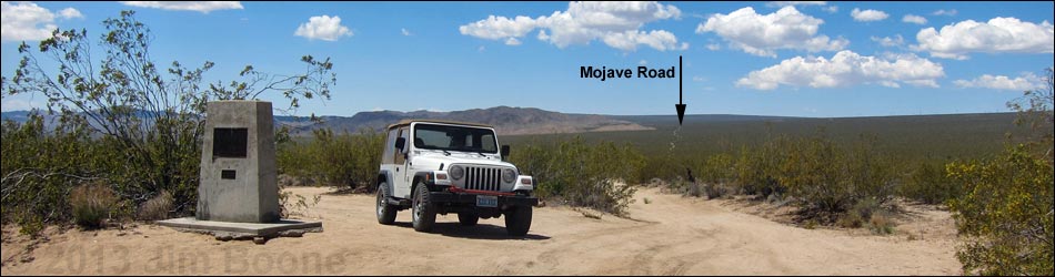
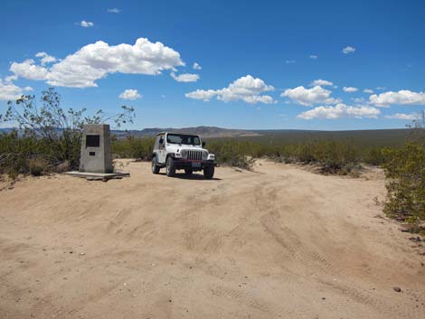
Overview Located in the heart of the Preserve, the Mojave Road Monument stands among tall Creosote Bushes quietly commemorating the history of humans crossing the Mojave Desert. From the beginning of time, native peoples used this route to move goods between the Colorado River and the Pacific Coast. Later Spanish missionaries and American explorers used the route, which was then developed into an army wagon road. Today the road remains a faint track across the desert, used by adventuresome backroad riders in their modern 4WD vehicles. Link to map. |
 |
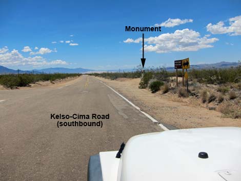
Getting to the Mojave Road Monument The Mojave Road Monument is located in Mojave National Preserve, about 1-1/4 hours south of Las Vegas. From town, drive south on I-15 into California, and then out towards the Kelso Depot Visitor Center. From Cima, continue south on Kelso-Cima Road for 4.4 miles to Cedar Canyon Road (Table 1, Site 0832), on the left. Do not turn onto Cedar Canyon Road. A few yards past the intersection, on the right (west) side of the highway, a dirt road takes off across the desert. This is the historic Mojave Road, and the monument sits a few steps of the pavement. |
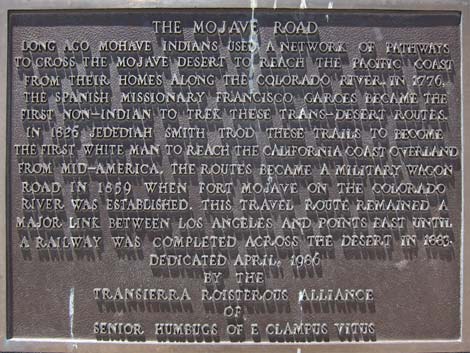 |
Text of the monument: The Mojave Road. Long ago Mohave Indians used a network of pathways to cross the Mojave Desert to reach the Pacific coast from their homes along the Colorado River. In 1776, the Spanish missionary Francisco Garces became the first non-Indian to trek these trans-desert routes. In 1826 Jedediah Smith trod these trails to become the first white man to reach the California coast overland from mid-America. The routes became a military wagonroad in 1859 when Fort Mojave on the Colorado River was established. This travel route remained a major link between Los Angeles and points east until a railroad was completed across the desert in 1883. Dedicated April, 1986 by the Transierra Roisterous Alliance of Senior Humbugs of E Clampus Vitus |
 Kelso-Cima Road at Cedar Canyon Road |
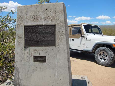 Mojave Road Monument |
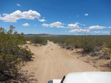 Driving west on the Mojave Road |
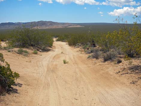 Mojave Road (view W) |
Table 1. Highway Coordinates Based on GPS Data (NAD27; UTM Zone 11S). Download Highway GPS Waypoints (*.gpx) file.
| Site | Location | UTM Easting | UTM Northing | Latitude (N) | Longitude (W) | Elevation (ft) | Verified |
|---|---|---|---|---|---|---|---|
| 0831 | Kelso-Cima Rd at Cima | 636500 | 3900110 | 35.23656 | 115.49990 | 4,176 | Yes |
| 0832 | Cima-Kelso Rd at Cedar Cyn Rd | 635848 | 3893416 | 35.17631 | 115.50817 | 3,727 | Yes |
Happy Hiking! All distances, elevations, and other facts are approximate.
![]() ; Last updated 240329
; Last updated 240329
| Hiking Around Mojave Preserve | Hiking Around Las Vegas | Glossary | Copyright, Conditions, Disclaimer | Home |