Hiking Around Las Vegas, Spring Mountains (Mt. Charleston), Kyle Canyon
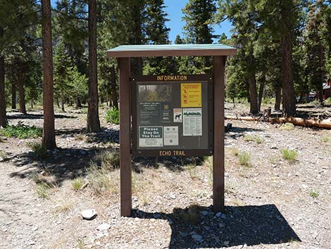 Echo Trailhead sign (view NW) |
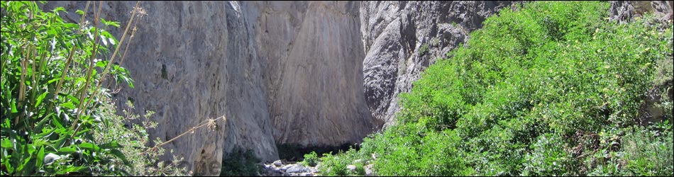
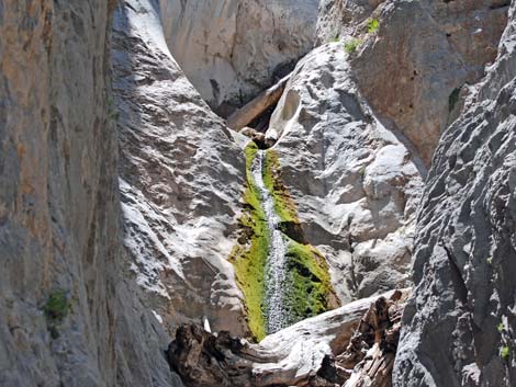
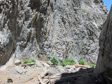
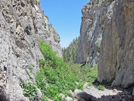
Overview The Little Falls Trail is a short, 0.3-mile one-way spur trail off the Echo Trail, but it takes at least 0.54 miles, one-way, to get there from the nearest trailhead (Echo Trailhead). From Echo Trailhead, the trail runs southeast through a forest of pine and fir trees to the base of an avalanche chute where many logs have been piled up by the snow. Staying in the trees and following the edge of the avalanche chute, the trail climbs towards a cleft in the cliffs above. Near the cliffs, pines and firs are left behind, and only flexible trees (aspen, maple) and forbs that can survive avalanches remain. The trail ends in a narrow limestone box-canyon at the base of the Little Falls waterfall where water pours down several, impassible steps during spring and early summer. Link to map. |
 |
Watch Out Other than the standard warnings about hiking in the desert, ...this trail is more strenuous than it should be, so take it easy at this elevation if you've just come up from the desert (the air is thin up here at nearly 8,000-ft elevation). Other than that, the trail is safe and easy to follow. During much of the year, there is water at the falls, but I'm not sure I would drink it. During winter, watch for ice on the trail and avalanches coming down over the falls. While hiking, please respect the land and the other people out there, and try to Leave No Trace of your passage. Also, even though this hike is short, be sure to bring what you need of the 10 Essentials. The falls sometimes are badly covered with graffiti; please respect this area, don't add graffiti, and report any criminal activity seen. |
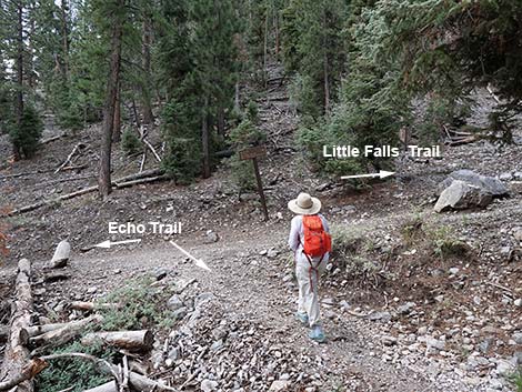
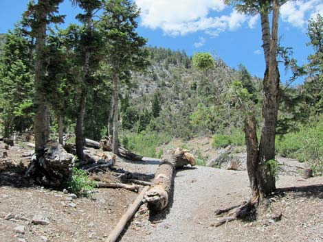
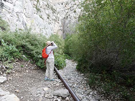
 Hiker at Little Falls Trail -- Echo Trail junction (view SW) |
Getting to the Trailhead This hike is located in Kyle Canyon up in the Spring Mountains National Recreation Area, about 1 hour northwest of Las Vegas. From town, drive out to the Spring Mountains Visitor Center, then continue up Kyle Canyon Road. Just past the fire station, stay right onto Echo Road and continue to the Echo Trailhead. This trail can also be accessed from the Cathedral Rock Trailhead. |
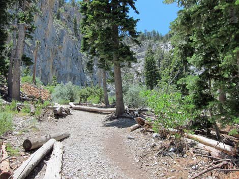
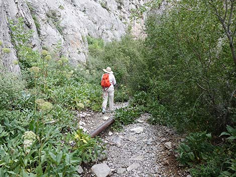
 Approaching avalanche chute (view W) |
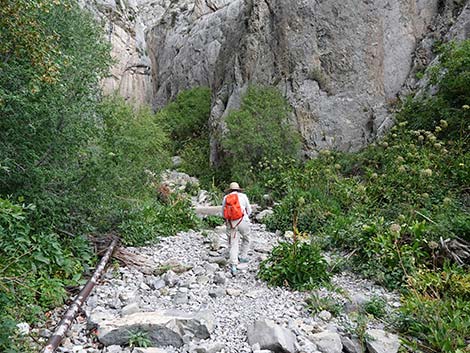
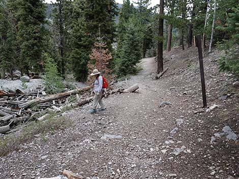
The Hike From the Echo Trailhead (Table 1, Waypoint 01), the trail follows the Echo Trail for about 0.54 miles to the trail junction with the Little Falls Trail (Wpt. 05). This part of the hike runs through a ponderosa pine and white fir forest that provides intermittent shade, and then it runs across the base of an avalanche chute choked with logs. For details of this section, see the Echo Trail. Turning right onto the Little Falls Trail, the trail soon comes alongside a gully full of fallen and tumbled logs. The gully serves as an avalanche chute during winter, and when conditions are just right (just wrong?), huge masses of snow break loose high in the mountains and sweep down the gully knocking down trees and everything else in the way. When the snow comes to rest, the logs and other debris are left behind. The jumble of logs in this gully is a good example of this phenomenon. |
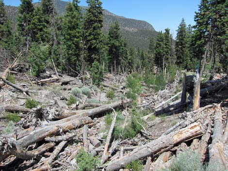 Looking back down at jumbled logs in avalanche chute (view N) |
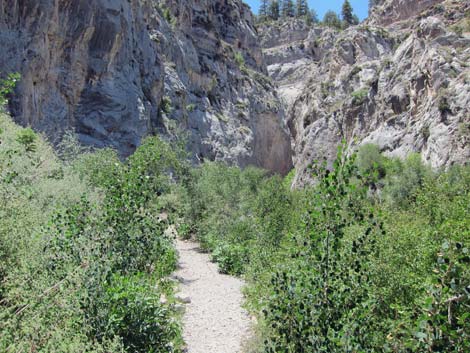
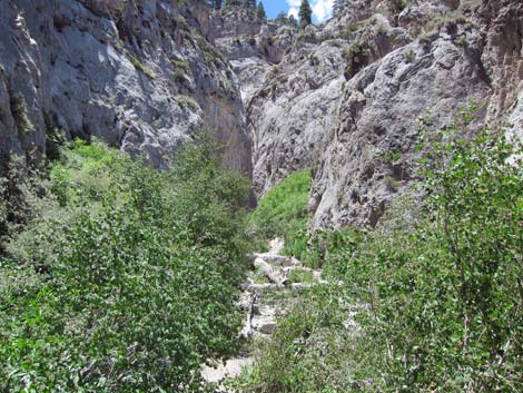
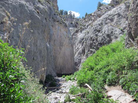
The trail stays in the trees, following along the side of the avalanche chute, as the grade increases. Fortunately, the fallen logs provide many shady places to sit and relax along the way. Eventually, as the trail nears the cliffs, the tall trees give way and only flexible trees (e.g., quaking aspen and rocky mountain maple) and forbs survive the winter snow. The trail finally runs up into a narrow cleft in the limestone cliffs and ends in a narrow box-canyon at the base of the waterfall (Wpt. 06). The bottom of the canyon is littered with broken logs, some of which are quite smooth. This is a nice area to relax in the shade, contemplate the forces of erosion, and maybe watch a broad-tailed hummingbird working the mountain wildflowers. Return to the trailhead by following your footprints back down the trail. Be sure to turn left at the Echo Trail junction (Wpt. 05) on the way back to Echo Trailhead (Wpt. 01). |
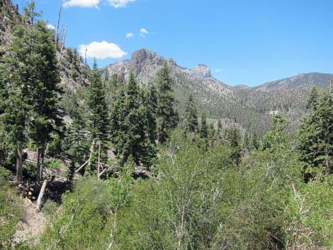 Looking down canyon: grand views and quaking aspen (view N) |
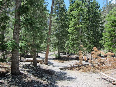 Little Falls Trail in the trees |
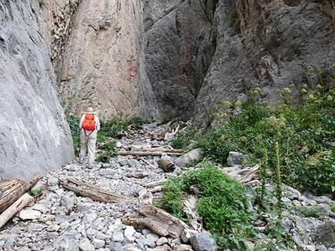
 Little Falls Trail approaching the limestone cliffs |
 Approaching cliffs and Little Falls (view SW) |
 Little Falls Trail in the bottom of the canyon |
 Little Falls Trail entering the narrows |
 Bird watching in Little Falls narrows |
 Hiker on Little Falls Trail |
 Hiker on Little Falls Trail |
 Hiker entering the narrowest section on Little Falls Trail |
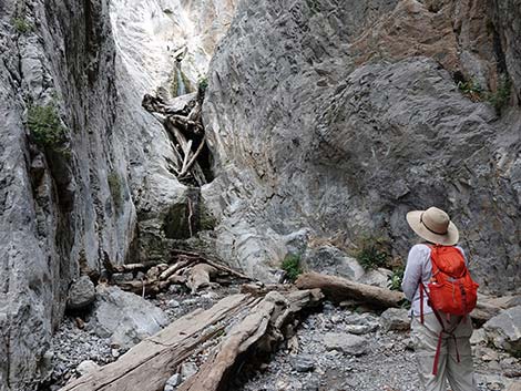 Hiker arriving at Little Falls |
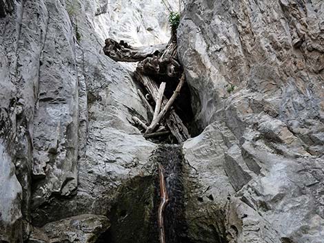
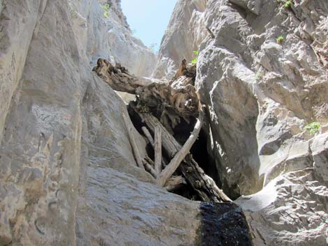
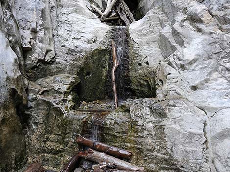
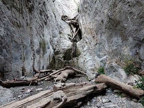 Little Falls |
 Little Falls log jam in narrow cleft (2022) |
 Log jam in narrow cleft in the falls (little change since 2012) |
 Bottom of Little Falls |
 Upper section of Little Falls (view S) |
 Fivepetal Cliffbush |
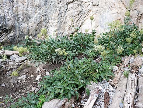 King's Angelica grows in wet canyons |
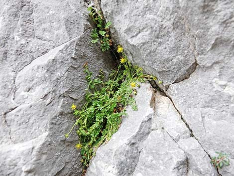 Jaeger's Mousetail grows on the sides of cliffs |
 Looking down-canyon from base of Little Falls |
 Looking down-canyon from the narrows |
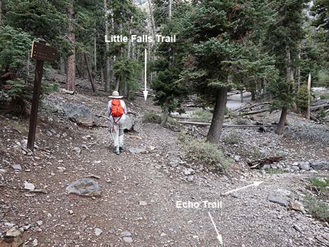
 Hiker turning left at the Echo Trail junction (view NE) |
Table 1. Hiking Coordinates Based on GPS Data (NAD27; UTM Zone 11S). Download GPS Waypoints (*.gpx) file.
| Wpt. | Location | UTM Easting | UTM Northing | Elevation (ft) | Point-to-Point Distance (mi) | Cumulative Distance (mi) | Verified |
|---|---|---|---|---|---|---|---|
| 01 | Echo Trailhead | 620941 | 4013699 | 7,651 | 0.00 | 0.00 | GPS |
| 02 | Old Road Forks, stay right | 621128 | 4013428 | 7,769 | 0.27 | 0.27 | GPS |
| 03 | Old Road Forks, stay left | 621153 | 4013293 | 7,772 | 0.10 | 0.37 | GPS |
| 04 | Trail Leaves Old Road | 621211 | 4013219 | 7,779 | 0.08 | 0.45 | GPS |
| 05 | Echo-Little Falls Trail Junction | 621251 | 4013102 | 7,766 | 0.09 | 0.54 | GPS |
| 06 | Little Falls | 620880 | 4012963 | 7,978 | 0.28 | 0.82 | GPS |
| 01 | Echo Trailhead | 620941 | 4013699 | 7,651 | 0.82 | 1.64 | GPS |
Happy Hiking! All distances, elevations, and other facts are approximate.
![]() ; Last updated 240329
; Last updated 240329
| Hiking Around Mt Charleston | Hiking Around Las Vegas | Glossary | Copyright, Conditions, Disclaimer | Home |