Hiking Around Las Vegas, Red Rock Canyon National Conservation Area
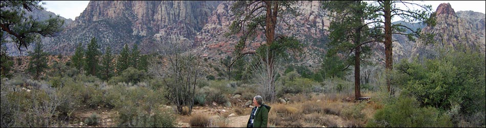
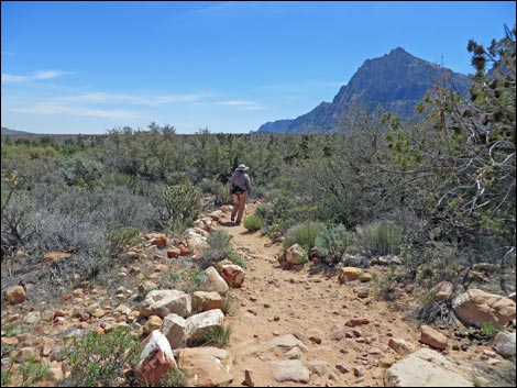
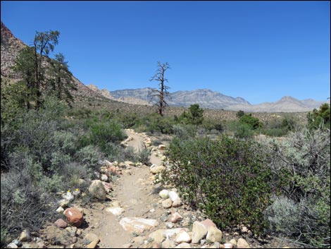
 Pine Creek Trailhead; Fire Ecology in the distance (view SW) |
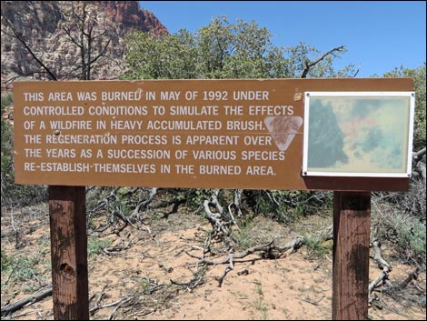
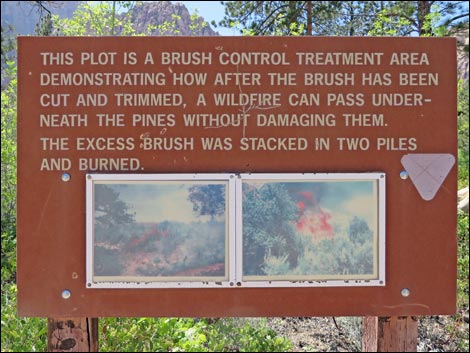
Overview This easy, 0.3-mile loop trail runs from the Pine Creek Trail out into Pine Creek Wash through an area of thick Mojave Desert Scrub vegetation where the BLM set a controlled burn in 1997 to clear brush and reduce the chances of a catastrophic wildfire that might kill the tall ponderosa pines in the wash. Little evidence of the fire remains, but the efforts have been successful. The Fire Ecology Trail starts from the Pine Creek Trail and runs as a figure-8 out to Pine Creek. The first half of the figure-8 is easy to find, but the start of the other half is not clearly marked. To hike the Fire Ecology Trail from the Pine Creek Trailhead, the total distance is about 1.0 miles round trip. Link to map. Link to BLM Georeference PDF map file. |
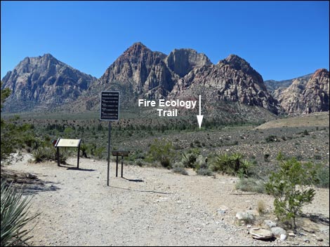
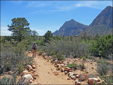
 Pine Creek Trail at Fire Ecology Trail (view W) |
Watch Out Other than the standard warnings about hiking in the desert, ...this is a safe, but rocky trail where you have to watch your step to avoid twisting an ankle. The first (and last) 0.2 miles of the trail is fairly steep, dropping (or climbing) 70 feet in about 0.2 miles, but the rest is essentially flat. While hiking, please respect the land and the other people out there, and try to Leave No Trace of your passage. Also, even though this is a short hike, be sure to bring what you need of the 10 Essentials. Getting to the Trailhead This hike is located along the Scenic Loop Road in Red Rock Canyon National Conservation Area, about 1 hour west of Las Vegas. Drive out to Red Rocks, pay the fee, and then drive about 2/3rds of the way around the Scenic Loop Road to the Pine Creek Canyon Trailhead. Park here; this is the trailhead. |
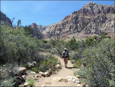
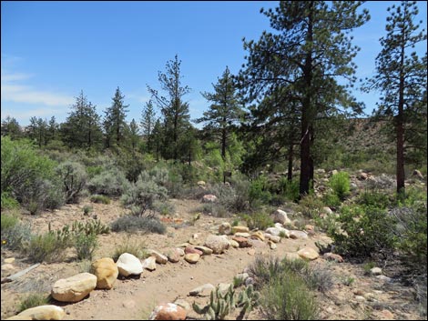
 Start of Fire Ecology Loop Trail (view S) |
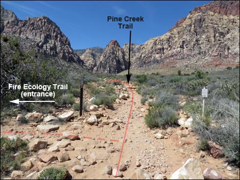
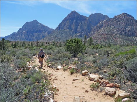
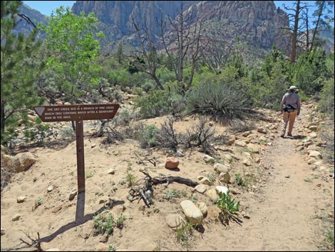
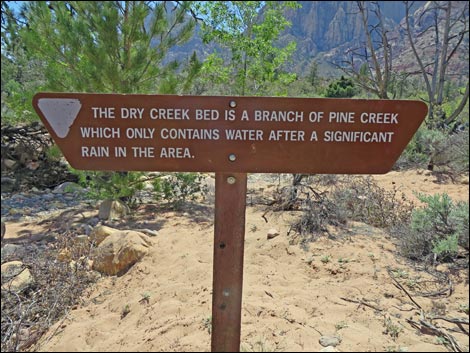
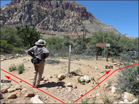
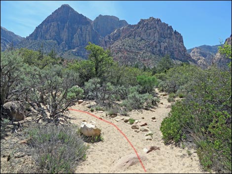
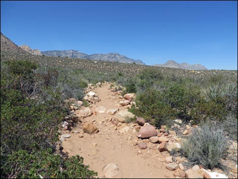
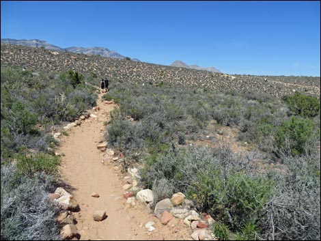
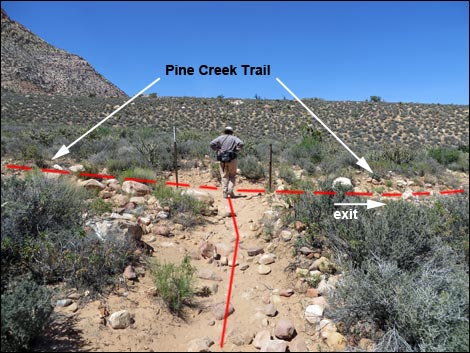
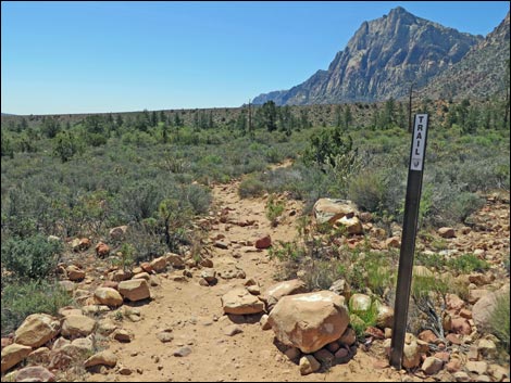
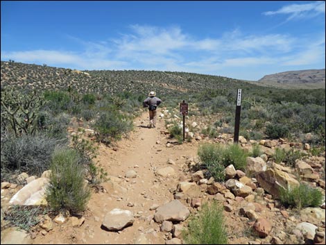
The Hike From the Pine Creek trailhead (Table 1, Waypoint 01), which sits atop a bench overlooking Pine Creek Wash, the well-defined Pine Creek Trail runs south, cutting down and across a steep sidehill. Near the trailhead, the vegetation is fairly sparse and dominated by few species, including blackbrush, Mojave yucca, banana yucca, and Utah juniper. The trail turns west and follows an old road towards the Wilson Cliffs. After another 0.1 miles, the Pine Creek trail intersects the start of the Fire Ecology Trail (Wpt. 03). Before starting down the Fire Ecology Trail, look up the Pine Creek Trail about 45 yards and spot a white post with a sign along the trail; this marks the end of the Fire Ecology loop. The Fire Ecology Trail runs south, descends five concrete stairs, and shortly arrives at the edge of a wash and the first information sign (about the stream). The vegetation here is thick and diverse, and manzanita, yerba santa, and ponderosa pines have joined the species mix. |
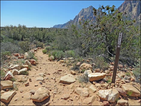
 Hikers starting the Fire Ecology Loop (view S) |
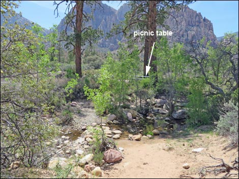
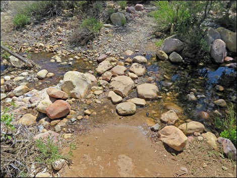
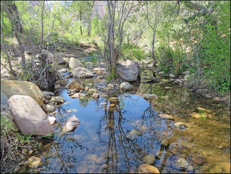
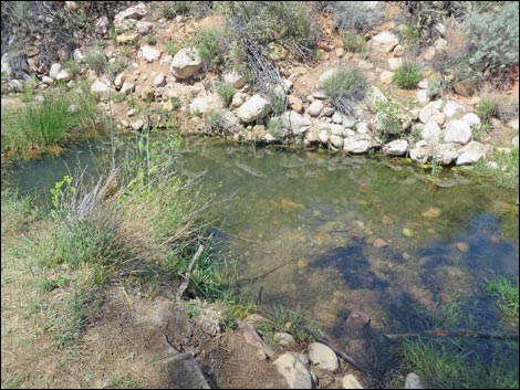
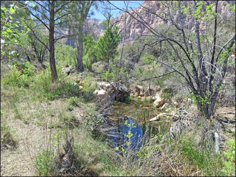
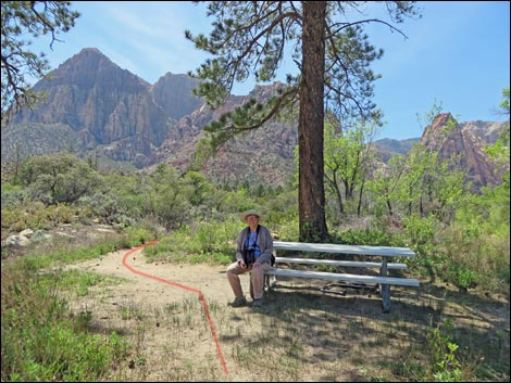
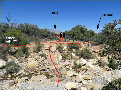
At the edge of the seasonal stream, the trail turns west and runs along the edge of the wash. After walking for another minute or two, the trail arrives at a second information sign about the fire (Wpt. 04). This is the center-point of the figure-8. From this point, hikers can look SW across the wash and see a picnic table by three big ponderosa pines. The trail crosses the wash to the picnic table, then continues southwest, straight past the table. Not quite so obvious, another trail crosses the wash due south from the fire information sign; this is the "exit" from the bottom of the figure-8. Continuing past the picnic table, the trail forks at an unsigned trail junction. Staying left, the trail shortly arrives at the main fork of Pine Creek Wash. Pine Creek flows here seasonally at the end of the loop (Wpt. 05), and two signs explain the controlled burn. Sit in the shade, relax, and listen to the water and the birds. |
 |
Continuing around the loop, the trail quickly returns to cross the first wash (note the picnic table to the left). Crossing the wash, hikers arrive at the fire information sign again. Hiking south, straight past the sign, the rocky trail climbs two concrete stairs and continues north to the end of the Fire Ecology Trail (Wpt. 06) where it intersects with the Pine Creek Trail. At the Pine Creek Trail junction (Wpt. 06), either turn east (right) and walk back 0.3 miles to the trailhead (Wpt. 01), or turn west (left) and wander another 1/2-miles farther up the Pine Creek Trail. From the intersection, it is just a few minutes to the remains of old-man Wilson's homeplace (Wpt. 07), so you might as well wander up there and check it out before heading for home. |
 Hiker on trail (view S) |
 Hiker on trail (view W) |
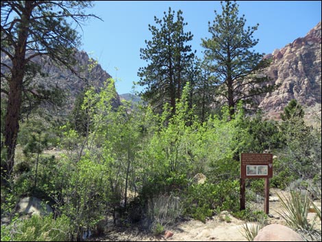
 First information sign (view SW) |
 First information sign (view SW) |
 Second information sign and center of figure-8 (view SW) |
 Second information sign |
 Picnic table across stream under trees (view SW) |
 Trail crosses the stream |
 Pine Creek |
 Pine Creek |
 Pine Creek |
 Hikers at picnic table (view SW) |
 Stay left at unmarked trail junction (view SW) |
 Wandering along (view SE) |
 Approaching the end of the loop (view SE) |
 Fire Ecology Trail (view N) |
 |
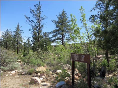 |
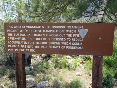 Information sign |
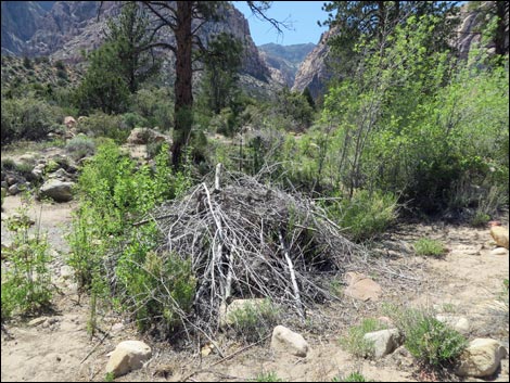 Continuing efforts at fire control: brush pile |
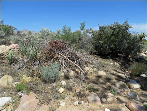 Continuing efforts at fire control: brush pile |
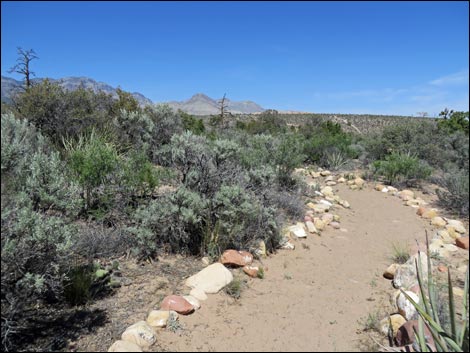 Fire Ecology Trail (view N) |
 Fire Ecology Trail (view N) |
 Returning towards the picnic table (view N) |
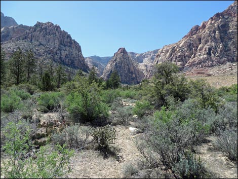 Grand scenery (view W) |
 Crossing the stream to the fire information sign (view N) |
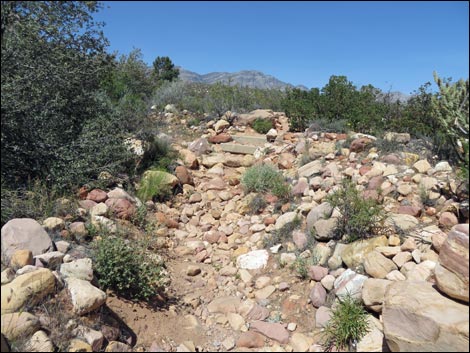 Rocky trail and concrete stairs (view N) |
 Fire Ecology Trail (view N) |
 Fire Ecology Trail (view N) |
 End of the Fire Ecology Trail at Pine Creek Trail (view N) |
 Pine Creek Trail, looking back down Fire Ecology Trail (view S) |
 Hiker returning to trailhead on the Pine Creek Trail (view E) |
Table 1. Hiking Coordinates Based on GPS Data (NAD27; UTM Zone 11S). Download Hiking GPS Waypoints (*.gpx) file.
| Wpt. | Location | Easting | Northing | Elevation (ft) | Point-to-Point Distance (mi) | Cumulative Distance (mi) | Verified |
|---|---|---|---|---|---|---|---|
| 01 | Pine Creek Trailhead | 637417 | 3999122 | 3,988 | 0.00 | 0.00 | GPS |
| 02 | Pine Creek Wash | 637357 | 3998843 | 3,923 | 0.19 | 0.19 | GPS |
| 03 | Start Fire Ecology Trail | 637185 | 3998820 | 3,962 | 0.11 | 0.30 | GPS |
| 04 | Figure-8 Junction Start | 637114 | 3998697 | 3,955 | 0.11 | 0.41 | GPS |
| 05 | End of Loop | 637102 | 3998597 | 3959 | 0.08 | 0.49 | GPS |
| 06 | Picnic Table | 637080 | 3998685 | 3950 | 0.07 | 0.56 | GPS |
| 07 | Figure-8 Junction End | 637108 | 3998696 | 3,976 | 0.02 | 0.58 | GPS |
| 08 | End Fire Ecology Trail | 637139 | 3998808 | 3,988 | 0.17 | 0.66 | GPS |
| 01 | Pine Creek Trailhead | 637417 | 3999122 | 3,988 | 0.33 | 0.99 | GPS |
| 09 | Wilson's Homeplace | 636507 | 3998532 | 4,029 | 0.47 | . | GPS |
Happy Hiking! All distances, elevations, and other facts are approximate.
![]() ; Last updated 240330
; Last updated 240330
| Hiking Around Red Rocks | Hiking Around Las Vegas | Glossary | Copyright, Conditions, Disclaimer | Home |