Hiking Around Las Vegas, Red Rock Canyon National Conservation Area
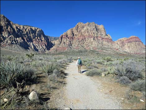
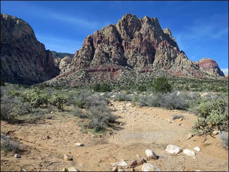
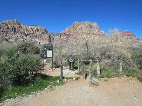 First Creek trailhead (view W) |
Overview The First Creek Canyon Trail starts out as a pleasant 1.3-mile walk across a desert valley beneath towering red-and-white sandstone cliffs. After that, hikers can go as far as they like, but the trail becomes much more aggressive. Hiking a total of 1.8 miles up the canyon brings hikers to a nice place to stop for lunch before returning back down the trail for a total of 3.6 miles round trip. The trail pass a nice little waterfall, First Creek Falls, with cottonwood trees, desert willows, and other trees around a large plunge pool cut into interesting conglomerate rock. Link to map. Link to BLM Georeference PDF map file. |
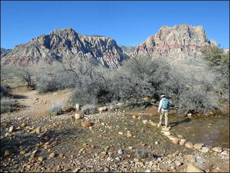
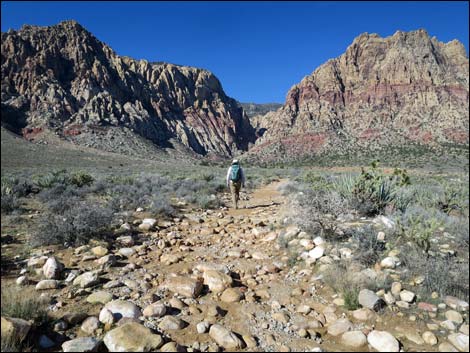
 Approaching Oak Creek Wash (view W with hikers across the water) |
Watch Out Other than the standard warnings about hiking in the desert, ...this is a safe hike, even for kids out to the 1.8-mile mark; after that, the route get much rougher. Watch for slippery rocks along the creek during summer, and watch for ice during winter. In the upper canyon, there are many brushy places where it is hard to see the footing, so be extra careful and watch for rattlesnakes. While hiking, please respect the land and the other people out there, and try to Leave No Trace of your passage. Also, even though this is a short hike, be sure to bring what you need of the 10 Essentials. |
 Hiker crossing Oak Creek Wash during winter (view W) |
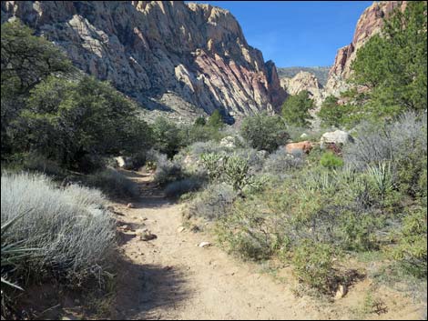
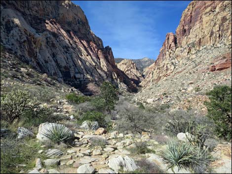
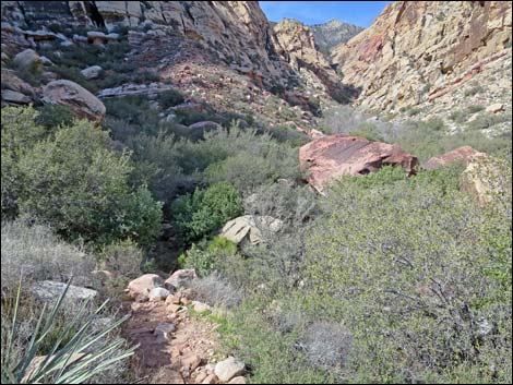
Getting to the Trailhead First Creek Canyon is located in Red Rock Canyon National Conservation Area, about 40 minutes from downtown, but not on the Scenic Loop Road. Drive out West Charleston Blvd, past the exit from the Scenic Loop Road, to the First Creek Trailhead. Park here; this is the trailhead. The Hike From the trailhead (Table 1, Waypoint 1), the trail winds through a gate, then bends southwest and crosses Oak Creek Wash. Water flows in the wash after wet winters, but usually it is dry; a sign advises hikers to stay out of the water during floods. The trail then bends to the west and heads out towards the Wilson (Red Rocks) Cliffs and First Creek Canyon. |
 Staggered cable fencing defines trail in burn area (view W) |
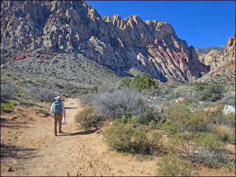
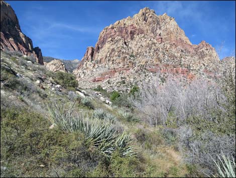
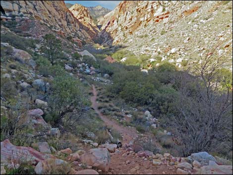
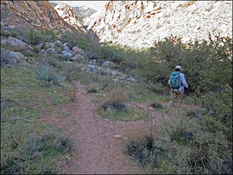
Across the wash, the trail strolls westward across the gently sloping valley. About 130 yards out, the trail enters an area that burned in a 2006 wildfire. Most of the Joshua trees and other shrubby vegetation is gone, but some plants are growing back. To help the land recover, the BLM installed post-and-cable fencing along the trail to encourage people to stay on the trail and avoid trampling the new vegetation. They did a nice job: they put fencing only on one side of the trail at any one point, but alternated the sides of trail so that hikers are guided in the right direction but never feel hemmed in. It will be interesting to watch the vegetation come back over the years. Beyond the fire, the trail wanders among the Joshua trees, Mojave yucca, creosote bush, blackbrush, and a variety of other shrubs. Along this section, hikers can see First Creek Wash a few hundred yards off to the north (right). Through here, the trail generally runs straight towards the mouth of First Creek Canyon while slowly angling closer to the wash. For details of the first 1.0 miles, see First Creek Falls Trail. |
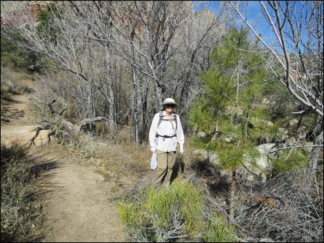
 Hiker in the unburned area (view W) |
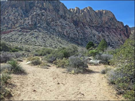
At 1.0 out, just before getting to the first pine tree on the south side of the trail, an unmarked trail (Wpt. 05) angles off to the right (northwest) towards another pine tree about 100 yards out; this the trail to First Creek Falls. Hikers who want to detour to the falls can do so, then continue west to reconnect with the main trail without looping all the way back to this trail junction. For details of getting to the falls, see First Creek Falls Trail. Staying left on the main trail, hikers pass the first pine tree on the left (Wpt. 05) and continue west towards First Creek Canyon. Shortly ahead, hikers pass a side trail (Wpt. 09) merging from the right. This the other end of the trail that runs over to First Creek Falls. The trail continues west into an area with trees and tall shrubs. After passing the first shade on the trail, a hikers arrive at a large sandy area with several tall, ponderosa pines growing along the creek. |
 Hiker exiting S-curves (view W) |
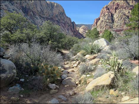
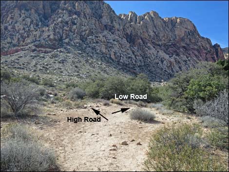
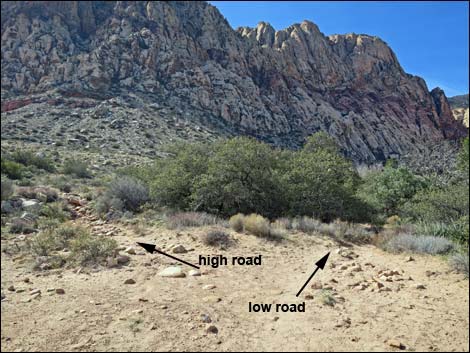
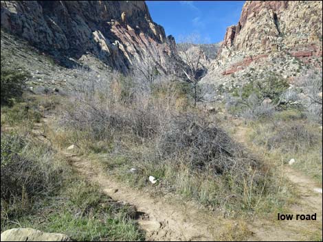
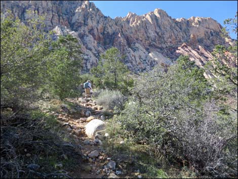
Here the trail begins to split into myriad use-trails. At the far side of the sandy area (Wpt. 10), the trail makes a major fork: the "low road" and the "high road." Hikers might take one uphill and the other on the way back down. Here, the description follows the "low road" up the canyon. Staying right into the trees rather than climbing onto the sunny hillside to the left (Wpt. 10), the "low road" follows along the wash while winding among trees and shrubs. There are plenty of use-trails that fork left away from the wash, but staying along the trees bordering the stream makes for a useful path. Eventually, however, the narrow bottom of the canyon narrows further into dense thickets of trees, and the trails climbs steeply to the left climbing out of the bottom of the wash onto a bench. Atop the steep hillside (Wpt. 12), a trail merges from the left: this is the other end of the "high road." By this point, hikers are now inside the Rainbow Mountain Wilderness Area. |
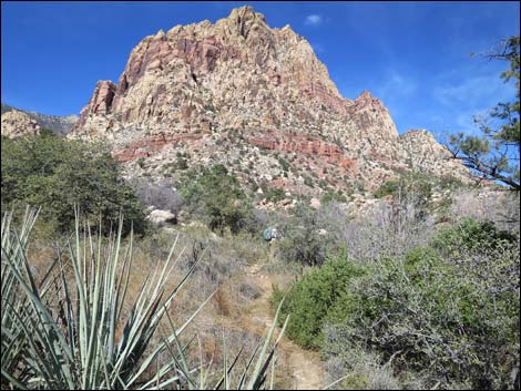
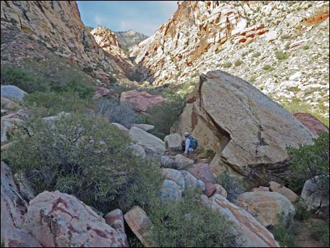
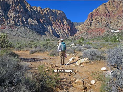 Hiker at trail junction to the falls (view W) |
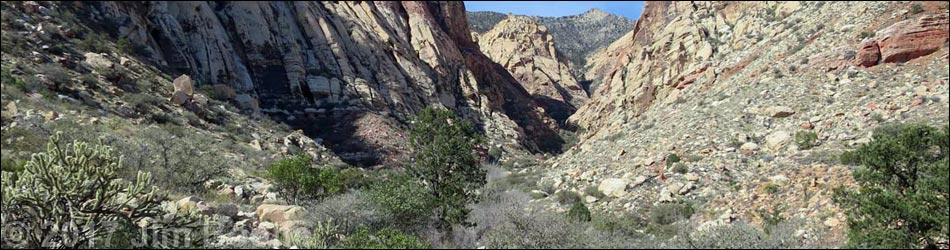
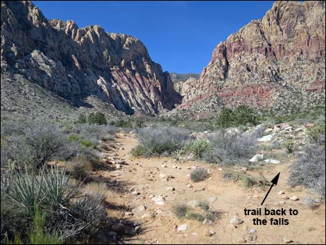
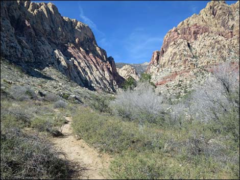
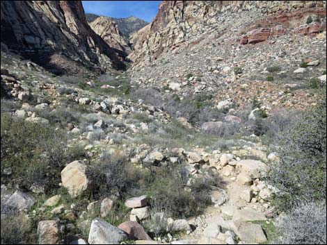
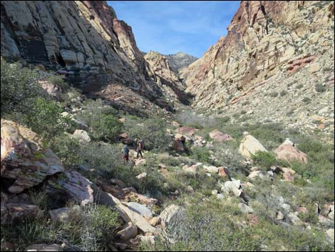
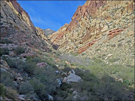
Continuing up the canyon, use-trails fork and merge, but the area available for hiking is now so limited that all trails lead up the canyon. Farther along, there is another major fork leading to a high road and a low road. Taking either trail is fine as they merge in about 100 yards near the sharp edge of a deep side wash (Wpt. 13). Here, overlooking the side wash, the trail drops steeply back towards the bottom of the canyon. The trail continues, but soon becomes lost in that tangle of trees and shrubs packed among enormous boulders in the braided wash. Using aerial photos, an intermittent "trail" can be seen, but it might be just as easy to stop on the big, flat rocks before dropping into the canyon bottom and enjoy a quiet lunch to the sounds of Canyon Wrens and White-throated Swifts with great views up and down the canyon. To get back to the trailhead (Wpt. 01), retrace your steps in the dust back down the canyon. On the way down, consider staying right at the fork (Wpt. 12) and hiking down the "high road" for a different perspective on the canyon. Also, hikers who missed the First Creek Falls on the way up might consider visiting them on the way down. See photos of the return-to-trailhead here. |
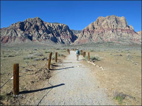
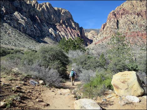
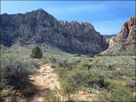 Heading towards the first pine on the left (view W) |
 Continuing up the trail (view W) |
 Passing side-trail back to the falls (view W) |
 Hiker continuing up the trail (view W) |
 Starting into the first shade (view W) |
 Tunnels of shade (view W) |
 Passing a large pancake cactus on the left (view W) |
 Entering the big, sandy area (view SW) |
 Middle of the sandy area; trails split (view SW) |
 Far side of the sandy area; trails split (view SW) |
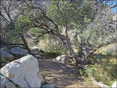 Shade under oak trees (view W) |
 Trails continue to fork left, but stay right (view W) |
 Trail follows the edge of the trees (view W) |
 Shrubby trail follows the edge of the trees (view W) |
 A young ponderosa pine! (view W) |
 Shrubby trail follows the edge of the trees (view NW) |
 The trail suddenly bends left and climbs steeply (view SW) |
 A bit beyond the top of the hill, some easy trail (view W) |
 Trail begins to traverse rocky hillsides (view W) |
 Trail traverses rocky hillsides (view W) |
 Trail traverses rocky hillsides (view W) |
 Another high road vs. low road decision (staying right; view W) |
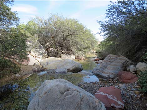
 Along the low road, a short detour to First Creek (view W) |
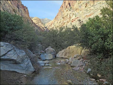 First Creek (view W upstream) |
 First Creek (view E downstream) |
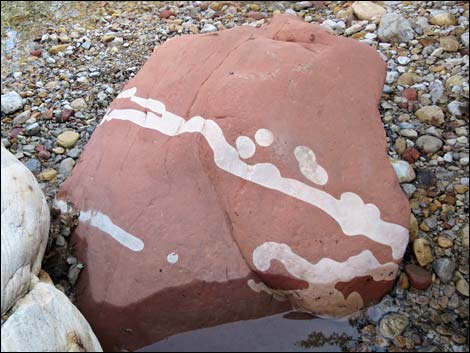 Interesting pattern in the boulders (view down) |
 Rocky trail (view W) |
 Winding among huge boulders (view W) |
 Atop ridge overlooking side wash, trail drops into vegetation (view W) |
 There really is a use-trail up there (view W) |
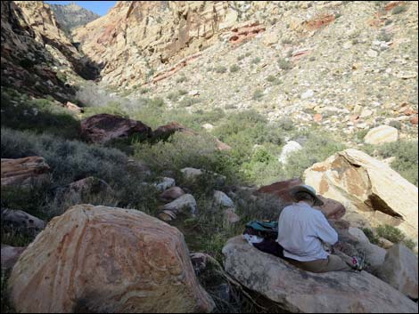 A nice place to stop and have lunch (view W) |
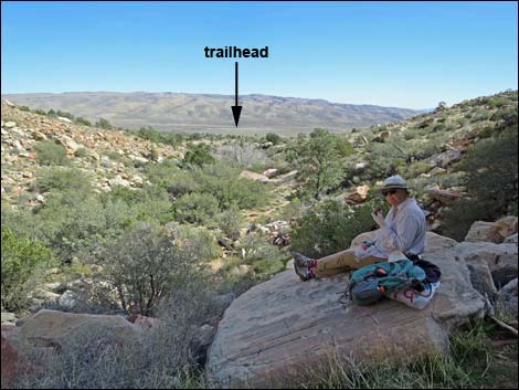 A nice place to stop and have lunch (view E) |
Table 1. Hiking Coordinates Based on GPS Data (NAD27; UTM Zone 11S). Download Hiking GPS Waypoints (*.gpx) file.
| Wpt. | Location | UTM Easting | UTM Northing | Elevation (ft) | Point-to-Point Distance (mi) | Cumulative Distance (mi) |
|---|---|---|---|---|---|---|
| 01 | Trailhead | 639812 | 3993885 | 3,661 | 0.00 | 0.00 |
| 05 | Use-Trail Junction | 638333 | 3993725 | 3,825 | 1.00 | 1.00 |
| 08 | First Pine | 638270 | 3993671 | 3,846 | 0.05 | 1.05 |
| 09 | Trail Junction back to Falls | 638175 | 3993682 | 3,909 | 0.07 | 1.12 |
| 10 | Trail Junction | 637908 | 3993570 | 3,952 | 0.19 | 1.31 |
| 11 | Wilderness Boundary Sign | 637603 | 3993573 | 4,041 | . | . |
| 12 | Trail Junction | 637550 | 3993605 | 4,036 | 0.28 | 1.59 |
| 13 | Trail Junction | 637264 | 3993597 | 4,113 | 0.21 | 1.80 |
| 14 | Lunch Spot | 637258 | 3993589 | 4,114 | . | . |
| 01 | Trailhead | 639812 | 3993885 | 3,661 | 1.80 | 3.60 |
Happy Hiking! All distances, elevations, and other facts are approximate.
![]() ; Last updated 240330
; Last updated 240330
| Hiking Around Red Rocks | Hiking Around Las Vegas | Glossary | Copyright, Conditions, Disclaimer | Home |