Hiking Around Las Vegas, Red Rock Canyon National Conservation Area
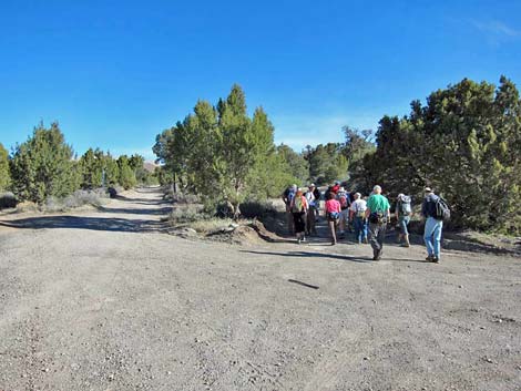 Departing trailhead (view N) |
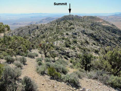
Overview This fairly strenuous, 5.2-mile round-trip hike is located on the west side of the Red Rock Canyon escarpment. Access is from Highway 160 near the town of Mountain Springs. The hike starts near the edge of the Rainbow Mountain Wilderness Area and heads east to the crest of the Spring Mountains Range, entirely within the Pinyon-Juniper Woodland zone. Following the crest south to a highpoint, the route turns east and descends to the top of the sandstone escarpment. After bit of easy 3rd-class scrambling on sandstone, the route climbs to the base of the summit block. Views from the actual summit require a bit of 4th-class climbing, but views from everywhere include the La Madre Range to the north, Las Vegas and every mountain range to the east, to Mt. Potosi in the south. Link to map or elevation profile. |
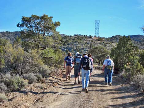 Hiking towards telecom tower (view NE) |
Watch Out Other than the standard warnings about hiking in the desert, ...this hike is fairly safe, but there is a bit of scrambling and falling hazards out on the end of the sandstone (i.e., at the top of the escarpment). Reaching the actual summit is 4th-class with some serious exposure. While hiking, please respect the land and the other people out there, and try to Leave No Trace of your passage. Also, this hike is in a remote area, so be sure to bring the 10 Essentials. This route is in designated Wilderness, so please pay particular attention to respecting the land. |
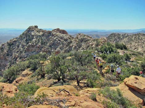
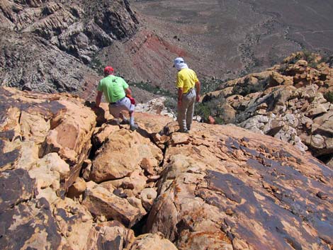
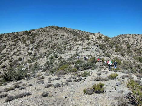 Hikers at saddle (view S) |
Getting to the Trailhead This hike is located in Red Rock Canyon NCA, but over on the west side of the sandstone escarpment. From the Red Rock Visitor Center area, drive west then south on West Charleston Blvd (Hwy 159) past Blue Diamond Town to Highway 160. Turn right onto Highway 160 and drive west 9.5 miles to the Mountain Springs Trailhead, which is just before the town of Mountain Springs. |
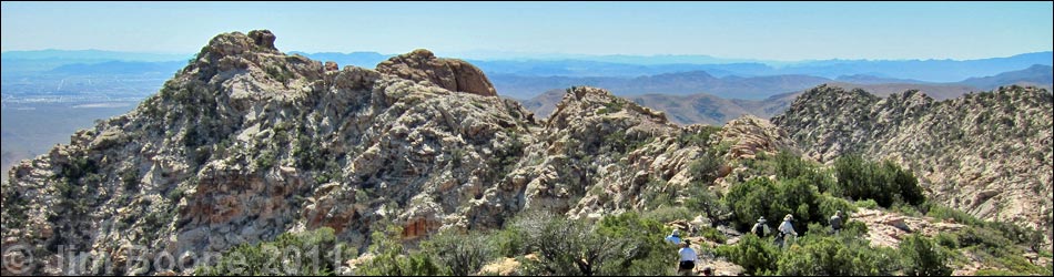
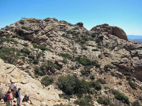
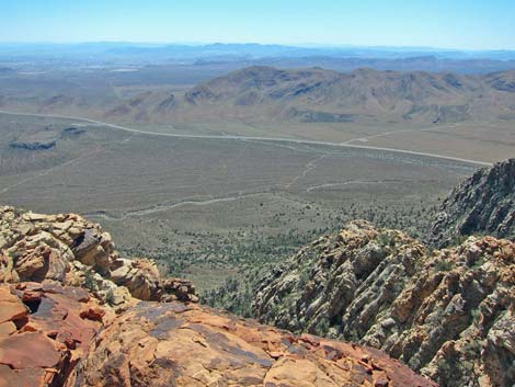
 Long limestone ridge (view SE from highpoint) |
The Hike From the trailhead (Table 2, Waypoint 01), the route runs north following the right of two parallel dirt roads. The dirt road climbs steeply towards a communications tower in the distance, passing one road intersection (Wpt. 02; stay straight) along the way. Just before the communications facility, a gate blocks the road, so technically hikers could drive to this point and park on the side of the road. From the communications facility (Wpt. 03), the route follows the dirt road eastward along the ridgeline. Just past the communications facility, the route enters the Rainbow Mountain Wilderness Area, and people have worked to convert the old road to a trail. |
 |
Vegetation on the west side of the mountains is a fairly dense forest of singleleaf pinyon pine and Utah juniper with a variety of shrub species including blackbrush, banana yucca, mormon tea, sagebrush, turpentinebroom, narrowleaf goldenbush, silver cholla, and Utah agave. The old road, and eventually an obvious use-trail, leads up and east towards the crest of the Spring Mountains Range (Wpt. 04). The use-trail reaches the crest at a flat spot on the ridge, and for the first time, the view east reveals the goal: Windy Peak. When hiking back down to the trailhead, this spot is not obvious, so take a good look at the area and notice the cairn before turning north and continuing along the ridgeline. |
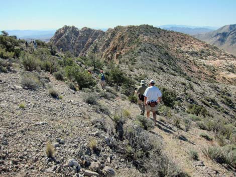 |
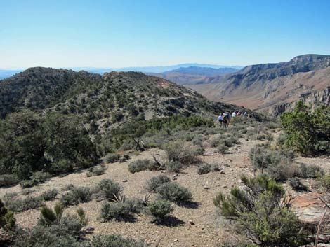
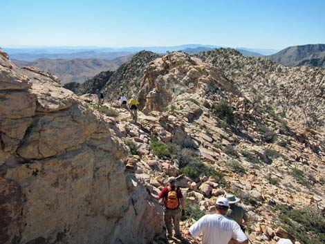
Following the crest of the Spring Mountains south, the route climbs over a highpoint (Wpt. 11) and then runs out the ridgeline to the southeast. Most of the way along the ridge, the use-trail is obvious, but it is faint in places and generally runs on the south side of the ridgeline. The route crosses a saddle (Wpt. 12), then climbs towards the start of the sandstone (Wpt. 13). The use-trail runs out to the edge of the gray limestone and continues onto the yellow and pink sandstone. The point of contact between the two types of rock marks the world famous Keystone Thrust Fault. Geologists come from all over the world to see this classic thrust fault, so enjoy the moment hiking across it (but don't delay too long lest it thrusts again). |
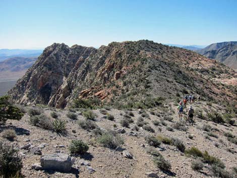 |
On the sandstone, the use-trail can be hard to follow, but the route more or less follows the south side of the ridgeline. The route runs out to a notch on the ridge (Wpt. 14) where at first glance the ridge appears to fork. Staying to the right quickly becomes the obvious route choice. The route continues southeast, then drops down a long gully to a bowl on the south side of the peak. Continuing southeast towards the summit, the route climbs back onto the ridge line and arrives at the base of the summit block. For most hikers, the views are good enough from the ledges around the summit block, but for those willing to do a bit of exposed 4th-class or easy 5th-class climbing, the 360-degree views from the summit are grand. |
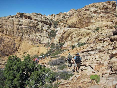
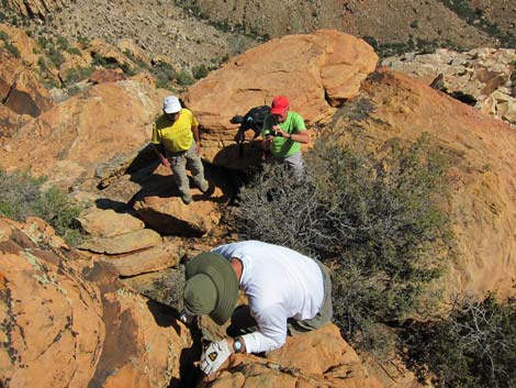
 Off limestone and onto sandstone |
For hikers content with not climbing to the very peak, there is a summit register at the base of the summit block. On the summit, there is another, less well used register. There are also a few boulders that can be used for climbing anchors. In the summit area, vegetation includes singleleaf pinyon pine and Utah juniper on the summit, plus scrub live oak, manzanita, and skunk bush; species usually associated with wetter areas. Rare in the Red Rocks area, there are at least one pancake pricklypear in the summit area, plus grizzlybear pricklypear, and Heermann's buckwheat, blackbrush, and lots of colorful lichens. |
 Ridge forks (view SE) |
 View across bowl towards summit (view E) |
 Looking back, this is the gully to come down (view W) |
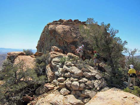 Hikers at base of summit block (view SE) |
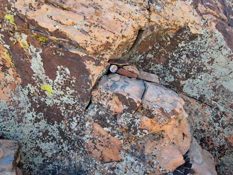 Lower summit register (view SE) |
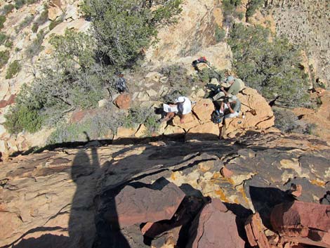
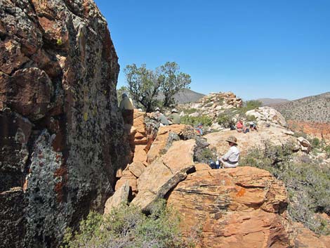 Hikers relaxing below summit block (view NW) |
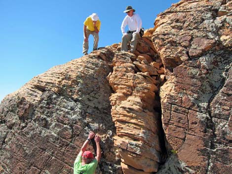
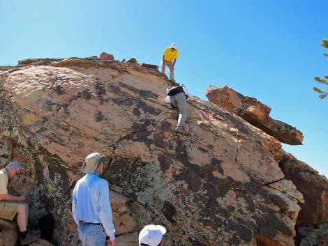 Climbing summit block (view S) |
 Looking back down (view down, N) |
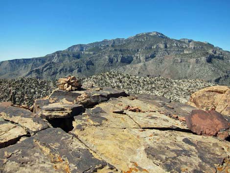 Summit cairn and Mt. Potosi (view S) |
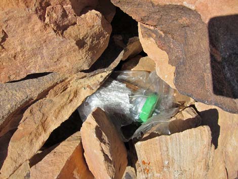 Upper summit register |
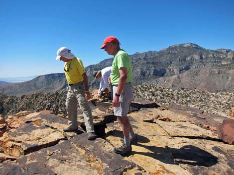 Contemplating the descent |
 Seriously contemplating the descent |
 Starting over the edge |
 The overhang at the bottom is a killer |
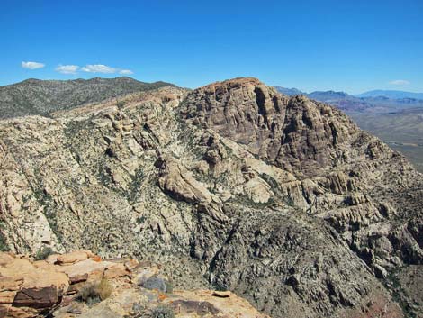 Windy Peak (view N along the escarpment) |
 Cottonwood Valley and Las Vegas (view E) |
Table 2. Hiking Coordinates and Distances based on GPS Data (NAD27; UTM Zone 11S). Download Hiking GPS Waypoints (*.gpx) file.
| Wpt. | Location | UTM Easting | UTM Northing | Elevation (ft) | Point-to-Point Distance (mi) | Cumulative Distance (mi) | Verified |
|---|---|---|---|---|---|---|---|
| 01 | Trailhead | 635267 | 3986363 | 5,470 | 0.00 | 0.00 | Yes |
| 02 | Fork in Road | 635394 | 3986528 | 5,524 | 0.19 | 0.19 | GPS |
| 03 | Communication Tower | 635559 | 3986773 | 5,652 | 0.20 | 0.39 | GPS |
| 04 | Crest of the Range | 636370 | 3986956 | 6,012 | 0.68 | 1.07 | GPS |
| 11 | Highpoint on Ridge | 636449 | 3986788 | 6,128 | 0.13 | 1.20 | GPS |
| 12 | Lowpoint on Ridge | 637179 | 3986159 | 5,849 | 0.65 | 1.85 | GPS |
| 13 | Starting onto Sandstone | 637429 | 3985903 | 5,971 | 0.25 | 2.10 | GPS |
| 14 | Fork in Ridge | 637689 | 3985740 | 5,894 | 0.21 | 2.31 | GPS |
| 15 | Summit | 638028 | 3985794 | 5,971 | 0.28 | 2.59 | GPS |
| 04 | Crest of the Range | 636370 | 3986956 | 6,012 | 1.52 | 4.11 | GPS |
| 01 | Trailhead | 635267 | 3986363 | 5,470 | 1.07 | 5.18 | Yes |
Happy Hiking! All distances, elevations, and other facts are approximate.
![]() ; Last updated 240330
; Last updated 240330
| Hiking Around Red Rocks | Hiking Around Las Vegas | Glossary | Copyright, Conditions, Disclaimer | Home |