Hiking Around Las Vegas, Red Rock Canyon NCA, La Madre Wilderness Area
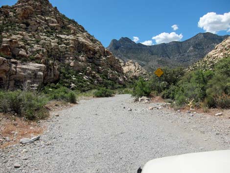
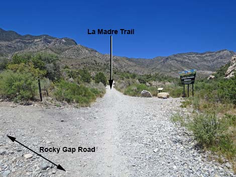
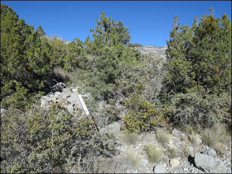
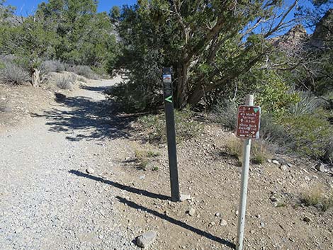
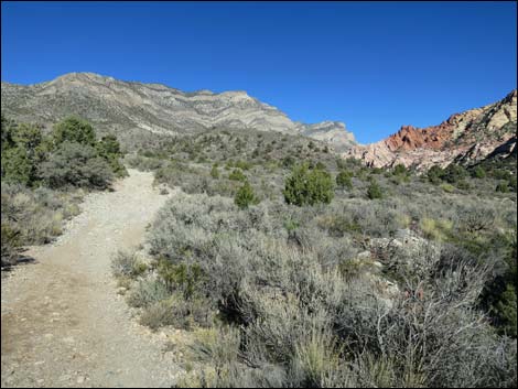
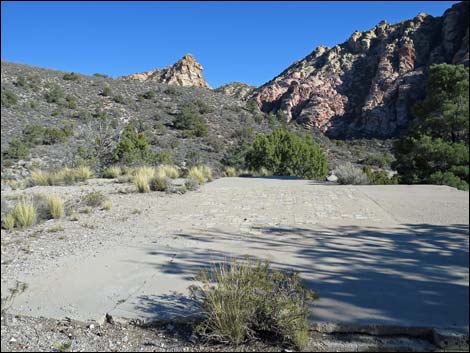
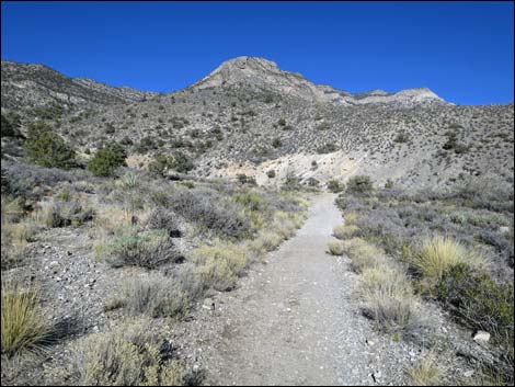
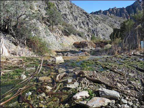
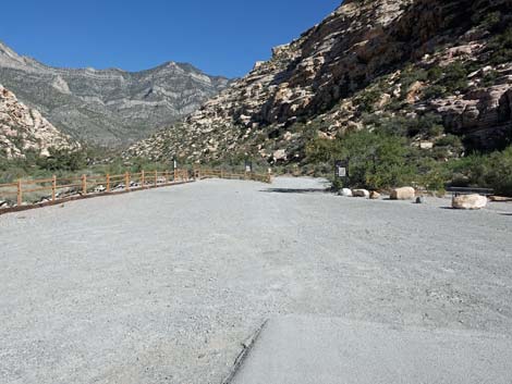 La Madre Spring Trailhead (view NW from end of pavement) |
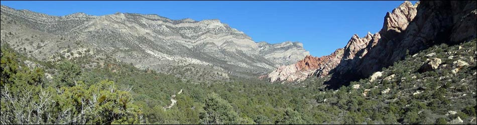
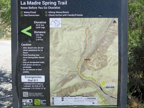
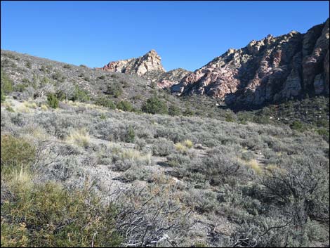
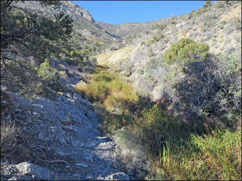
Overview The La Madre Spring Trail follows an old road into the La Madre Wilderness Area as it runs up a canyon with red and white sandstone cliffs on one side and gray limestone mountains on the other. The trail does not actually go to La Madre Spring; rather it ends at what is left of a concrete dam built in the 1960s to store water for cattle and perhaps domestic use. The dam now provides water for wildlife and makes a pleasant contrast with the desert environment. For the Red Rocks area, the shrubby vegetation in the canyon is fairly dense, and the mix of single-leaf pinyon pines, Utah juniper, and shrub live oaks make parts of the trail feel like a forest. Parts of this hike are strenuous, as the trails climbs some 700 ft in only 1.8 miles, for a round-trip distance of 3.64 miles.Link to map. Link to BLM Georeference PDF map file. |
 La Madre Spring Trailhead (view NW) |
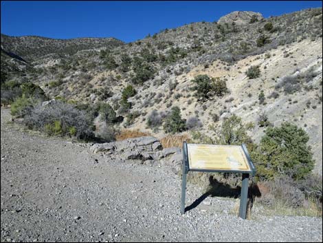
Watch Out Other than the standard warnings about hiking in the desert, ...this is a safe hike, but I wouldn't drink the water. Past the end of the pavement, the 0.5 miles of unmaintained road gets pretty rough. While hiking, please respect the land and the other people out there, and try to Leave No Trace of your passage. Also, even though this is a short hike, it is a remote area, so be sure to bring what you need of the 10 Essentials. The trail runs up into the La Madre Wilderness Area, so be extra careful with the land. |
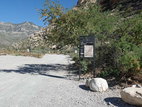
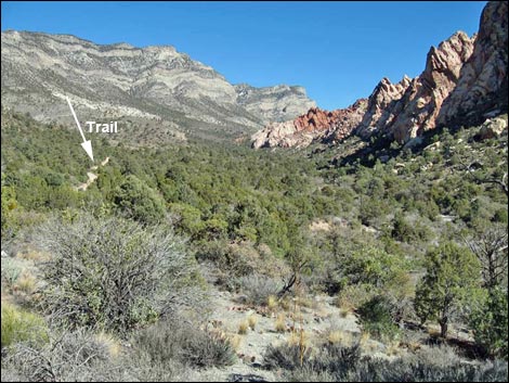
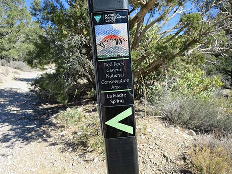
 La Madre Spring Trailhead map (view NW) |
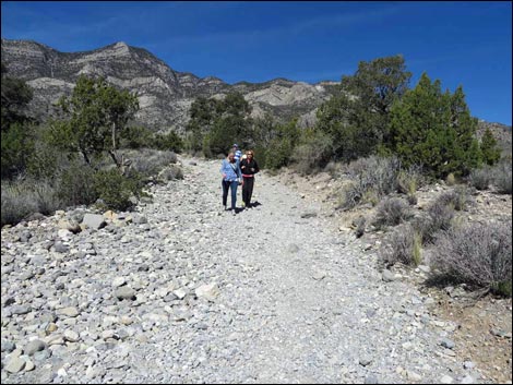
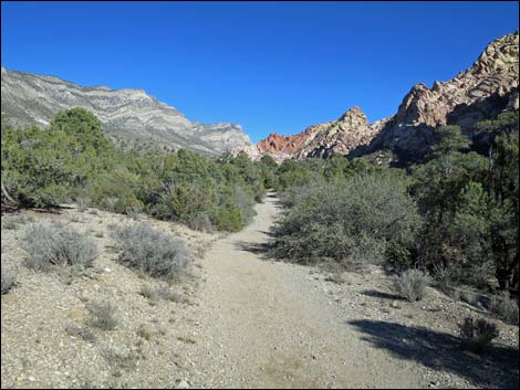
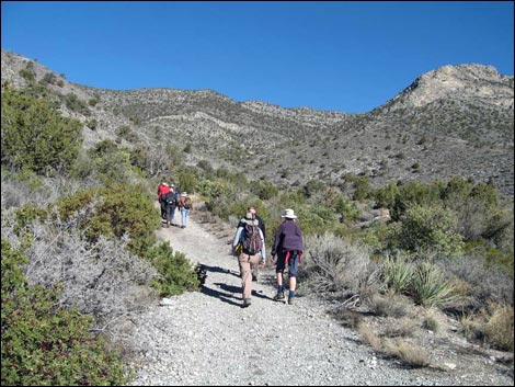
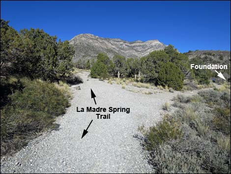
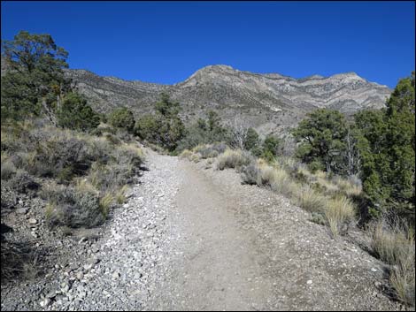
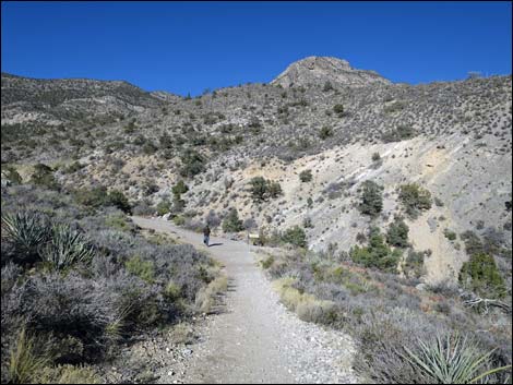
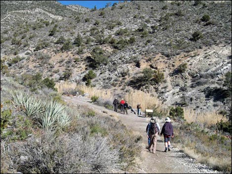
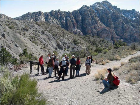
Getting to the Trailhead This hike is located along the Scenic Loop Road in Red Rock Canyon National Conservation Area, about 1 hour west of Las Vegas. Drive out to Red Rocks, pay the fee, and then drive about half-way around the Scenic Loop to Willow Springs Road. Turn right and drive north 0.6 miles to Willow Springs Trailhead. Park here; this is the trailhead. Hikers with high-clearance vehicles can shorten the hike by continuing north on Rocky Gap Road to the La Madre Trailhead. The Hike From the end of the pavement at Willow Springs Picnic Area (Table 1, Waypoint 01), the route runs north and up the rough and rocky Rocky Gap Road, which starts out running up the canyon along the east side of Red Rock Wash. The canyon is floristically diverse, with lots of shrub live oak and other shrubs, making it a good place to listen and watch for birds. This is also a good area to look for bighorn sheep, and because you are walking on a road, it is easier to look around as you walk. |
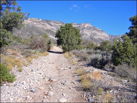
 Rocky Gap Road departing the Willow Springs area (view NW) |
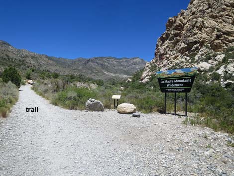
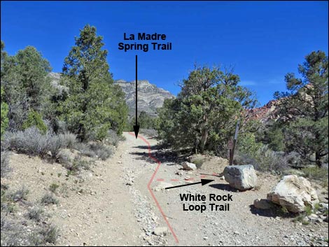
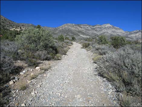
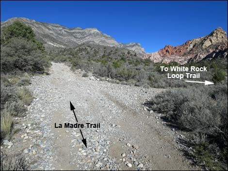
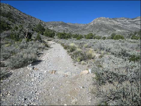
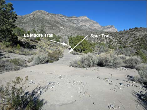
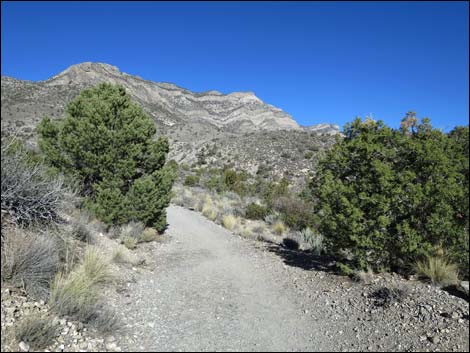
About 0.5 miles out, Rocky Gap Road crosses Red Rock Wash (Wpt. 02), and about 100 yards farther up the road (Wpt. 03), the trail leaves Rocky Gap Road and turns right onto the La Madre Spring-White Rock Loop Trail. Although the first 0.5 miles is a pleasant walk, this point marks the official start of the La Madre Spring Trail and entrance into the La Madre Wilderness Area. The trail follows another rocky, old road up a fairly steep hillside to the north, and then bends to the east (Wpt. 04) and continues up the canyon at more gentle grades. Through here, the vegetation continues to be dense and diverse, with lots of shrubs (e.g., pointleaf manzanita, silk tassel, and narrow-leaf yerba santa), plus pinyon and juniper trees that are thick enough to form a forest. Even big sagebrush grows here, which is unusual at this southern location. |
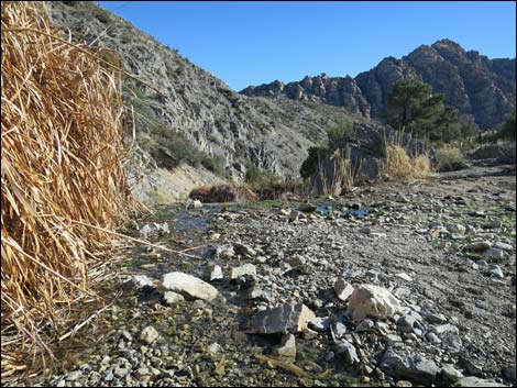
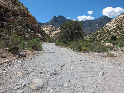 La Madre Spring Trail follows Rocky Gap Road (view NW) |
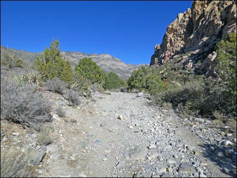
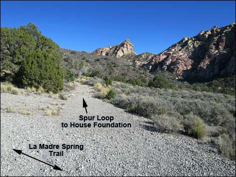
The valley is geologically interesting. It is bordered by 180-million-year-old sandstone cliffs (the White Rock Hills) on the south side and 230-million-year-old limestone mountains (the La Madre Range) on the north side. The geologic story is complex (evidenced by the faulted, tilted, and twisted cliffs), but in essence, the older limestone was thrust up and over the younger sandstone. Some of the limestone has since eroded away, leaving the canyon and the tilted layers of sandstones rock. For details of the local geology, consider hiking the Keystone Trail. Following the old road, the La Madre Trail passes a trail junction (Wpt. 05; 1.1 miles out) where the White Rock Loop Trail branches off to the right and runs south towards the sandstone cliffs (and then turns left). The La Madre Trail stays on the hillside and starts to angle up towards a side canyon on the flanks of La Madre Peak. The La Madre Trail also continues straight past an old road that also forks off to the right and runs south (Wpt. 06; 1.3 miles out), connecting with the White Rock Loop Trail. |
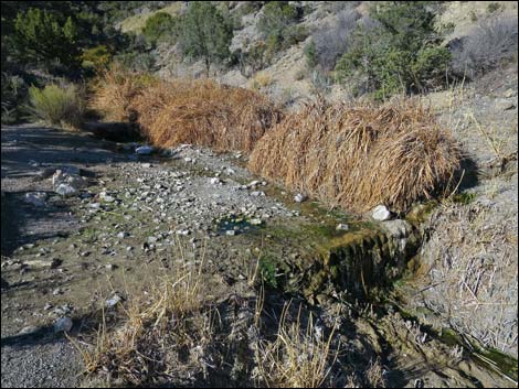
 Rocky Gap Road crossing Red Rock Wash (view NW) |
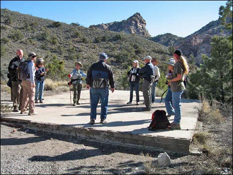
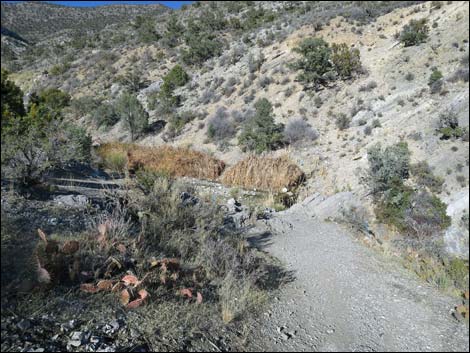
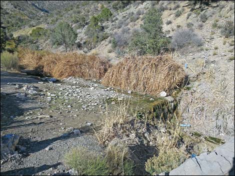
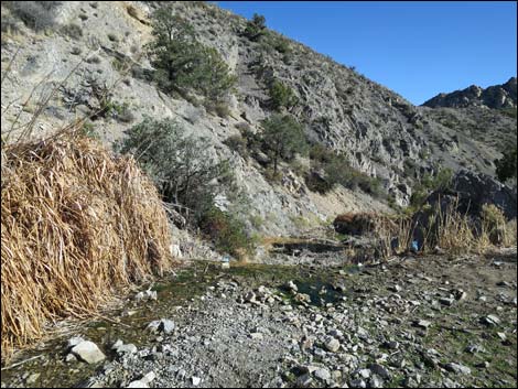
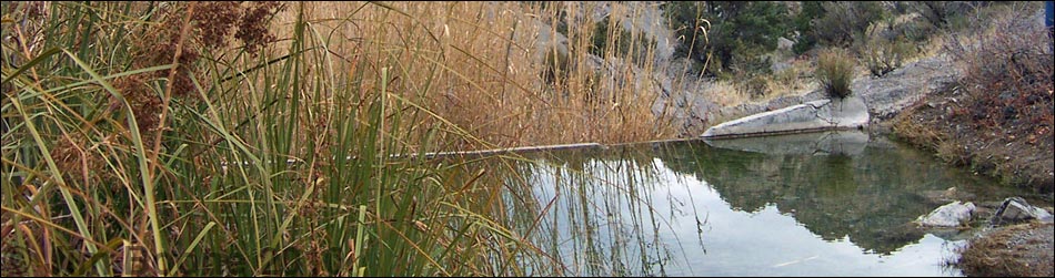
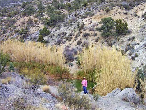
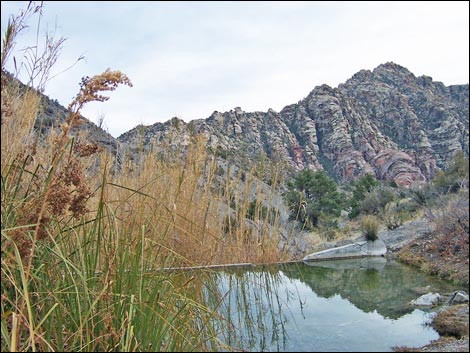
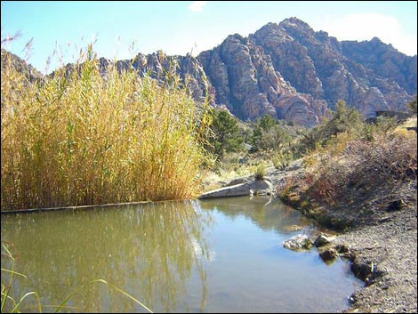
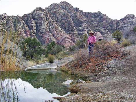
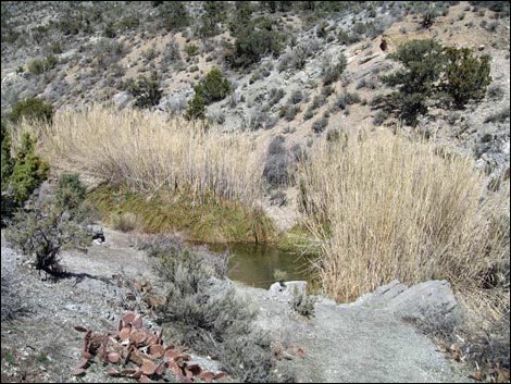
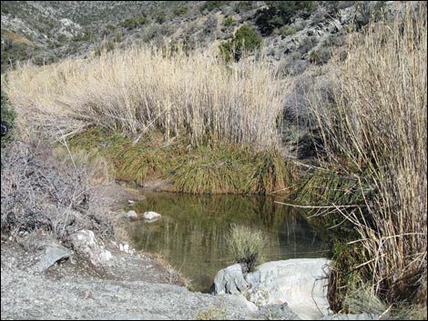
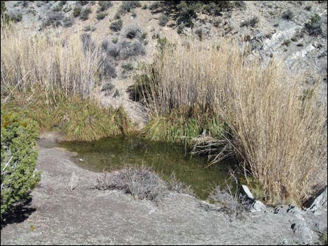
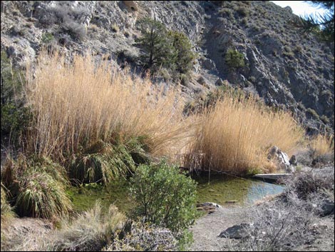
The La Madre Trail runs through an old homestead area where the foundations of two 1960s-era houses and several other building can be seen. As I understand it, brother and sister Couch lived here for a time, then the area was used for an archery range, and later it was acquired by the BLM. The first (Wpt. 07) and second (Wpt. 08) forks to the right are a loop driveway for the first house foundation, and the third spur road to the left (Wpt. 09) runs to a second house foundation. The La Madre Trail continues up and across the hillside, eventually reaching the end of the old road. From there, a short trail leads past an information sign and down to the concrete dam (Wpt 10; 1.8 miles out). What is left of the old dam blocks the stream that comes down from La Madre Spring. We used to have a small pond here, but the low dam is filled in with gravel, so the stream just pours over the top and spills down the canyon. |
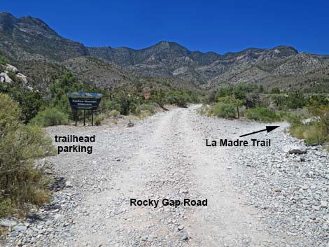 Rocky Gap Road at La Madre Trailhead parking (view NW) |
The dam is the end of the official trail, and this is a good place to stop, relax, eat lunch, and enjoy the wilderness. The water provides habitat for Pacific treefrogs that sing in the spring; water for birds, bighorn sheep, and other wildlife; and it sustains vegetation not often seen in the desert (sedges, wiregrass, cattails, common reed, and other hydrophilic plants). Above the dam, a narrow use-trail runs up the brushy canyon to La Madre Spring, a 15-foot waterfall, an old miner's cabin, and a mine. For details on the route up the canyon, see the description of the La Madre Miner's Cabin route. Relax in the sun, listen to the sound of water and birds in the desert, then when you are ready, retrace your steps back to the trailhead (Wpt. 01). |
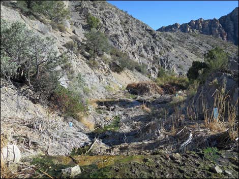
 La Madre Spring Trail (view N from Rocky Gap Road) |
 La Madre Spring Trail passes wilderness boundary sign (view N) |
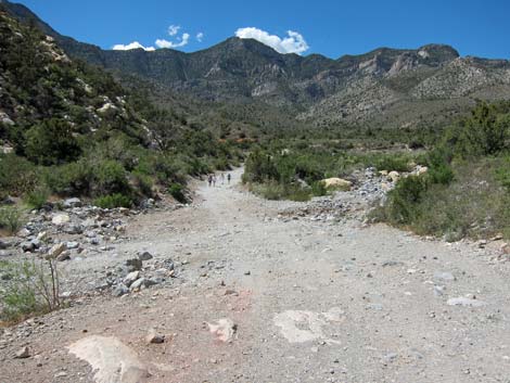
 Hikers on steepest part of the La Madre Spring Trail (view N) |
 Old road begins to level out (view NE) |
 Wilderness boundary sign along the trail (view N) |
 View up Red Rock Canyon (view NE; trail ahead becomes visible) |
 Old road becomes fairly level (view NE) |
 La Madre Trail at White Rock Loop Trail junction (view NE) |
 Signs at trail junction (view NE) |
 Sign at trail junction (view E) |
 Sign at trail junction (view NE) |
 LaMadre Trail continues up the valley (view NE) |
 |
 |
 La Madre Trail at connector trail to White Rock Loop Trail (view NE) |
 La Madre Trail turning north into a side canyon (view NE) |
 Hikers on trail (view N) |
 Grand scenery up the canyon (view E) |
 Approaching first spur road to lower building foundation (view NE) |
 Spur road to lower building foundation (view E) |
 Hikers at lower foundation (view E) |
 Lower foundation (view E) |
 Trail continues; spur to upper foundation at top of hill (view N) |
 Upper foundation (view NE towards La Madre Trail) |
 Trail continues past upper foundation (view N) |
 Approaching highpoint overlooking La Madre Spring (view N) |
 Highpoint overlooking La Madre Spring (view N) |
 Hikers arriving at La Madre Spring (view N) |
 Sign at end of old road overlooking spring pond (view NE) |
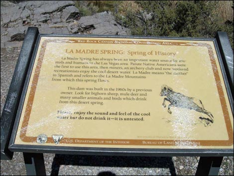 Information sign (view NE) |
 La Madre Spring (view N from info sign) |
 La Madre Dam |
 Pool in the creek just above the dam (view N) |
 Pond is filled with gravel, but water flows over the dam (view S) |
 Pond is filled with gravel, but water flows over the dam (view S) |
 Pond is filled with gravel, but water flows over the dam (view N) |
 |
 |
 Above the dam (view N towards La Madre Spring, proper) |
 Hikers ready to depart spring pond area (view S) |
Historic Photos from before the top of the dam was removed
 La Madre Pond (view N from the trail overlook) |
 La Madre Pond (view S towards White Rock Hills) |
 La Madre Pond (view S towards White Rock Hills) |
 La Madre Pond (view S towards White Rock Hills) |
 La Madre Spring (view NE) |
 La Madre Spring (view NE) |
 La Madre Spring (view NE) |
 La Madre Spring (view SE) |
Table 1. Hiking Coordinates Based on GPS Data (NAD27; UTM Zone 11S). Download Hiking GPS Waypoints (*.gpx) file.
| Wpt. | Location | UTM Easting | UTM Northing | Elevation (ft) | Point-to-Point Distance (mi) | Cumulative Distance (mi) | Verified |
|---|---|---|---|---|---|---|---|
| 01 | End of Pavement | 635112 | 4002653 | 4,568 | 0.00 | 0.00 | GPS |
| 02 | Red Rock Wash | 634408 | 4003038 | 4,701 | 0.53 | 0.53 | GPS |
| 03 | Trail Leaves Road | 634312 | 4003150 | 4,744 | 0.10 | 0.63 | GPS |
| 04 | Crossing a Wash | 634261 | 4003442 | 4,871 | 0.20 | 0.83 | GPS |
| 05 | White Rock Loop Trail junction | 634461 | 4003824 | 4,901 | 0.29 | 1.12 | GPS |
| 06 | White Rock Loop Connector | 634603 | 4004142 | 5,002 | 0.23 | 1.35 | GPS |
| 07 | First Rd to Foundations | 634611 | 4004333 | 5,065 | 0.12 | 1.47 | GPS |
| 08 | Second Rd to Foundations | 634616 | 4004371 | 5,075 | 0.03 | 1.50 | GPS |
| 09 | Third Rd to Foundations | 634584 | 4004423 | 5,107 | 0.03 | 1.53 | GPS |
| 10 | La Madre Dam | 634615 | 4004857 | 5,245 | 0.29 | 1.82 | GPS |
| 01 | End of Pavement | 635112 | 4002653 | 4,568 | 1.82 | 3.64 | GPS |
Happy Hiking! All distances, elevations, and other facts are approximate.
![]() ; Last updated 240330
; Last updated 240330
| Hiking Around Red Rocks | Hiking Around Las Vegas | Glossary | Copyright, Conditions, Disclaimer | Home |